
Sunday, June 5, 12022 HE
My neighbour Pierre and I have been talking about getting out on the water for a paddle for some time. Today we made it happen.
The forecast was not ideal. Easterly winds of 14 knots with gusts up to 20 knots, accompanied by rain. But we had approval from upper management (our wives), so we decided to make the best of it. The wind would be a challenge, particularly for me on a stand up paddleboard (SUP). Pierre was kayaking. The rain, no problem. I am falling in regularly right now as I learn the limits on my new(er) board. Freshwater, saltwater‽ Whatever.
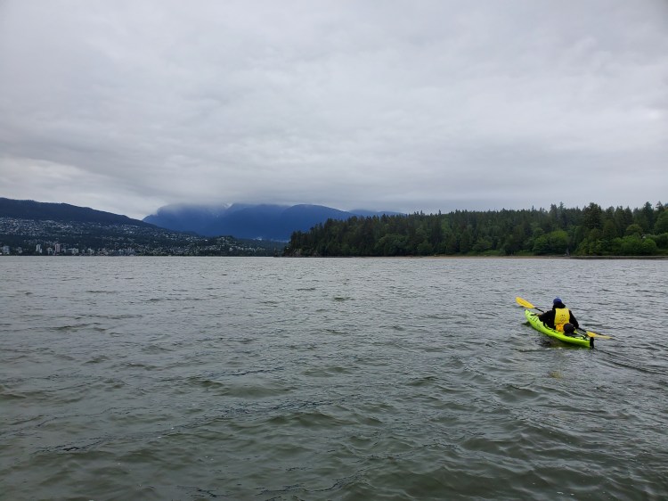
Pierre is in the market for a new kayak, so he rented one from Jericho Beach Kayak. Jericho Beach kayak is part of the Jericho Sailing Centre, so that was our launch point. Today’s paddle was my first for the summer (i.e., meteorological). Today was warmer than recent paddles, which isn’t saying much, given the cooler spring. After we arrived at the parking lot, Pierre went to get his rental in order while I set up my kit. That is when the rain started, just before putting on my semi-drysuit. The rain was light at first, but by the time I was down to the water, it was solid. So too was the wind.
As I set out to launch, two SUPers were landing. They were returning from the east with the wind at their back, well-timed, I thought. While Pierre got his rental in order, I decided to play around in the bay in the wind waves. Once I was out on the water, the winds picked up, and the rain began pelting down. I did a few short upwind/downwind runs, frolicking in the waves and admiring how much more easily the NSP Carolina (2020 edition) picked up small bumps compared to my Blackfin Model XL (2019 edition). And much to my chagrin, my skill sessions seemed to be paying off. I was able to step back turn with relative ease and maintain my balance in the bumpier conditions. At this point, the wind was strong and I was beginning to question the plan we laid out en route of paddling to Slhx̱í7lsh (Standing Man) rock.
On my next run to the shore, Pierre appeared on the beach and signaled to me. The rental staff suggested waiting 10 minutes before launching for the winds to die down. Fine by me. I was having a grand old time in the wind waves.
And sure enough, a few minutes later, the winds died down, and the rain stopped. But not before I managed to take my first dip of the day. I tried to power onto a wave and pulled myself off balance during my stroke. The water was warm.
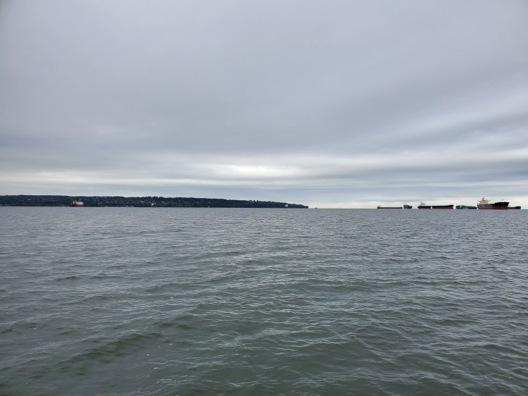
A few moments later, after the requisite rental recounting of the standard safety spiel, we were off. We planned to cut across the bay, provided the winds weren’t too strong for me. Our backup was to contour the shoreline as I figured the easterlies would be milder at the water’s edge. The winds were mild enough to attempt the direct crossing. It was the cross chop coming from my starboard side at the beginning of our adventure that was most challenging. Though further out, the currents seemed to change, and we took advantage of the leeward side of an anchored freighter for some wind shelter. I kept my distance from Pierre as I still have the occasional errant fall on my narrower board. I didn’t want to sprawl out over a kayak, nor did I think Pierre would appreciate me dropping in.
The rain had stopped, and the skies out over the strait carried the promise of better weather. The wind was still an outflow but the clouds seemed to be clearing toward the inland. I took note of this phenomenon absentmindedly at the time. We bantered over the wind as we leisurely paddled toward Prospect Point. Later, upon reflection, I was perplexed as to why the clouds had appeared to be being blown inland when the wind was going in the opposite direction?
Regarding the apparent paradoxical cloud movements, I later came across the video below from the United Kingdom‘s national weather service (the MET Office), which explains how sea breezes work. I was querying into cloud types and searched YouTube for a MET video on clouds. I have found the MET weather education content to be spot-on. I then came across the video below. I already knew about differential heating from previous weather sleuthing. Marine and land air masses heat differently under the same solar radiation. The difference is due to the fact that water has a higher specific heat capacity than land, so the air above water heats up slower. What I didn’t know, but is eloquently explained in the video, is that for a sea breeze to form, it requires a light offshore wind at about 900 metres (3000 feet). This outflow aids in the formation of the sea breeze circulation. And after watching the video, it dawned on me that a similar process must have occurred while we were on the water, albeit in reverse. The surface-level offshore winds we were experiencing were creating a land breeze circulation. For a moment, I thought I was on to something. A new meteorological term! But like most things in the modern world, someone else has long before discovered or considered the idea, despite the personal epiphany you might experience at your personal revelation. A concept that parallels the phenomena of “multiple discoveries.”

Closer to the Downtown/Stanley Park peninsula, the winds were lighter, and the last section leading up to Slhx̱í7lsh (Standing Man) rock was flat and calm.
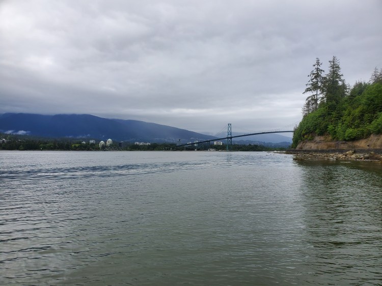
We spotted a pair of eagles circling the treetops of Stanley Park just before reaching the monolith. For more details on Slhx̱í7lsh (Standing Man) and links to the indigenous lore and pronunciation, check out my past post, “Slhx̱í7lsh (Standing Man) Rock 1.0“. The tide was just above three meters, and the waters were calm, so we passed between the seawall and the natural obelisk. We then decided to venture a bit further, offshore from Douk Beach, to view the Lions Gate Bridge from the water.
I knew from a past paddle that you are not allowed to have non-motorised watercraft in the First Narrows. I found this out the hard way in a run-in with a water authority officer during the pandemic in a tale I christened “Lord Stanley and the Case of the Coastguard.” The watercraft restriction wasn’t always the case, as before 12017 HE, there weren’t any limits. It is a bit of a shame as the waters around the peninsula would be interesting to explore. Rather than an all-out ban, I wonder if having signage warning paddlers to stay close to the shore and avoid the active shipping route could be a safe compromise. For an informed waterperson, I think that would bridge the gap between safety and adventure. But, I do concede that the possibility of having uninformed recreational paddlers unsuspectingly venturing out into the way of freighter and cruise ship traffic could pose a problem. There are no brakes on ships, and there is little room for evasive manoeuvres in the narrows. For those that the deterrent of death isn’t motivation enough, perhaps a monetary incentive of an expensive fine would be persuasive. Seemingly, having made the waters off-limits by way of this obscure document from the Port of Vancouver has proved relatively successful. I haven’t heard of any collision events, nor have I seen any paddle craft in the area when I have been near there. To that end, I think a compromise would be a viable option. The map of the restricted area is below, and here is the link to the PDF version, “Safe Boating Guide for Burrard Inlet.”

BUT WAIT …
Perhaps my tirade above is unwarranted. I did a bit more internet sleuthing post-paddle since I am still curious about the Ambleside tidal rip. First, I came across the surfski.wiki site again and its Ambleside page. After a refresher of the content, I did so more searching. The two hits for surf ski courses for the “Road to Ambleside Tide Rip” (Cates Park Paddling Centre and Jericho Beach Kayak), left me wondering how they can be inside the restricted. Maybe the tide rip zone is just along the edge of the “Busy Port Area” from the Safe Boating Guide. But when I compared the GPS Map from the surfski.wiki site with the Safe Boating Guide map they appeared to overlap. It was only when I went through the finer details, re-read the map legend, and compared the current map (2021) with the past map (2019, see the comparison below) that I saw a difference. There appeared to be a subtle change. The area west of the “Burnaby Shoal Light” no longer appears gridded. In the legend in the new guide (see here for the 2021 version), the non-gridded area does not seem to be explicitly stated as off-limits to “paddling.” Rather the “Busy port area” reads, “No anchoring, crabbing, fishing, sailing, rowing, paddling, jet skiing or waterskiing.” The darker shaded blue area is still the “Deep-sea transit route,” which warns to “Stay to the right of the channel, do not cross in front of deep sea [sic] vessels.” At least that was my initial interpretation.
But there is a caveat. When I pulled up the new version of the map on my mobile, it seemed to show the grid again. Confused, I rechecked the maps and found that looking at the map on my computer, the contrast between the blue and the gridlines was less apparent. It reminded me of the blue dress colour craze of 12015 HE. Essential the controversy around the dress was that people saw it as coloured black and blue or white and gold. The difference in interpretation stems from the fact that we don’t really see what we think and that our brains do a lot of guesswork to determine the nature of our reality. In this case, the brain makes assumptions about the light and shadows in the photo (for a summary of how and why check out the BBC‘s The Curious Cases of Rutherford & Fry eponymously titled podcast episode “The Colour Conundrum“). So, I may soon venture around Lord Stanley’s park for future exploration of the east side of the Stanley Park peninsula. But first, I will contact the Port of Vancouver for clarification of the map details, or not. Do I plead ignorance and ask for forgiveness or acknowledge responsibility and ask permission? To paraphrase the quote often ascribed to Rear Admiral Grace Hopper but likely already in circulation before her time.


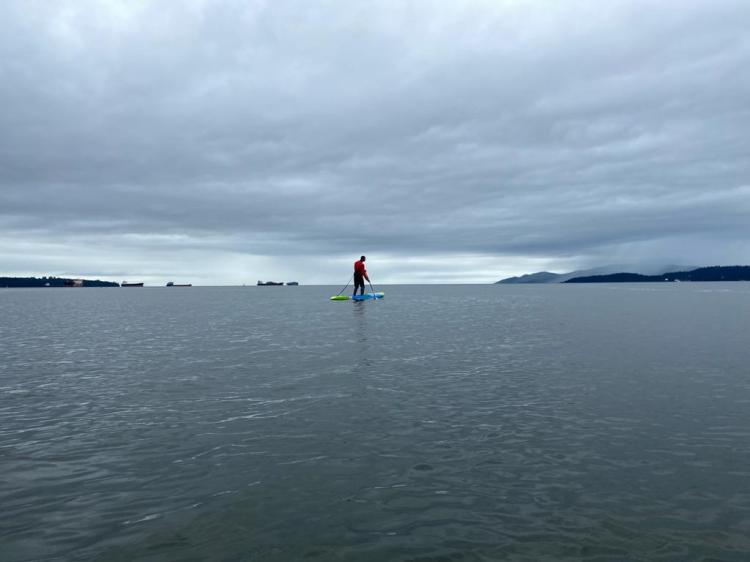
Shortly after taking the photo below, as we drifted slightly further afield, Pierre spotted a seal. Or so he says. I didn’t see. I suspect it was a ploy to throw me off balance. While turning to see the seal, I turned a bit too much, lost my balance, and went for a dip. It was fitting, in hindsight, as we were just offshore from Douk Beach. I looked up the meaning of “douk” post-paddle, and it turns out that one usage is “an instance of dipping, plunging, or bathing”. I did spot the seal later after clambering back onto my board.
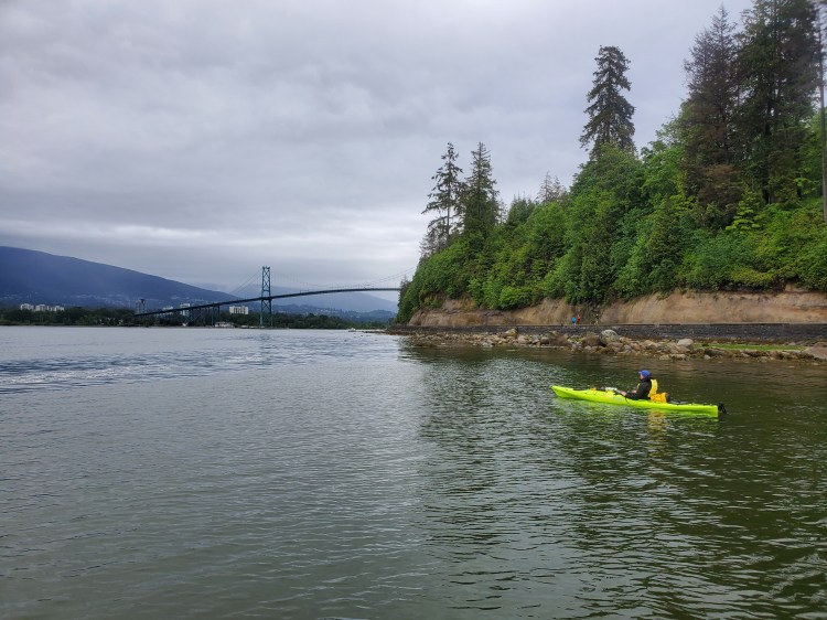
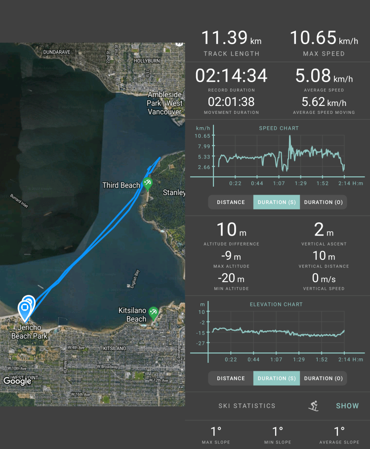
There was a Great Blue Heron on shore at Douk Beach, as well as two Canadian Geese. After a short rest, we turned to return to Jericho. A few rolling waves made their way across the narrows as we departed. I picked up my pace and to my surprise caught one of the waves. There are often rolling waves near the point coming from the northwest, and I have tried to catch them previously on my inflatable SUP (iSUP), but with limited success. On my iSUP, I’ve gotten a boost but never ridden the waves. To my surprise, I found myself catching this wave and accelerating forward. But I was off-balance from the start, and as the rail of the board caught and pushed me starboard-wardly, I couldn’t correct and fell off for my third swim. I quickly remounted and attempted to catch the rest of the set. I rode a few more bumps but not with the same speed as the first. I turned around to make one more pass hoping there would be a few more rollers, but I had missed my window. The waters were flat. Looking through my GPS data post-paddle, I had clocked a new top speed of 10.7 km/h on Geo Tracker (on Relive the top speed was 12.9 km/h). The image below is me searching for the second set when the waters were too smooth.

Catching those waves left me excited for the summer! I look forward to exploring some downwinders in the sound!
As we broke away from the shoreline came across two more Great Blue Herons heading toward Stanley Park. I mistook them for geese from a distance, but as they approached, I found myself wondering, wow Canadian Geese have really wide wingspans. Then I realized they were herons.
The wind remained easterly, so it was at our back for the return. Before launching, the rental representative from Jericho Beach Kayak had told us that the forecast was for a shift to westerly winds later in the day. But she wasn’t giving it much credence. She told us the morning forecast was for southeasterly winds, but the actual conditions were easterly winds, if not northeasterly. I was leery of the change in wind direction since last week I had witnessed just that phenomenon play out for two other SUPers. Today, I was more confident that cloud cover would consistently continue, but not certain. However, consistent clouds turned out to be the case.
As a short side note, it turns out that it is incredibly challenging to accurately predict the weather. Check out this video from Veritasium, “Chaos: The Science of the Butterfly Effect,” on how tiny differences can take massive effect over time. And for a more historical perspective, give this podcast from ABC‘s Rear Vision, “Predicting the weather—a history of the forecast,” a listen.
We traversed back in choppy conditions but with the wind at our back. I made a few more attempts to catch some rolling waves in the chaotic soup. But it was too much of a mess to get any clear runs. We arrived back at Jericho Beach under the faintest of drizzles.
Here are the map and statistics of my paddle recorded with Geo Tracker.
Below is the recap of our route created on Relive. As mentioned above, Relive gives slightly different stats, which I suspect is due to differences in data sampling rates between the applications. If the video below doesn’t work, here is a link to the video on Relive’s site.
