Saturday, June 13, 2020
I made it out for a morning paddling at Burnaby Lake today. I launched from Still Creek near the Clubhouse parking lot at the northeast side of the lake. I then paddled up Still Creek towards the lake and then came across the Cariboo Dam at the headwaters of the Brunette River. Foolishly, I was not aware of the dam. Fortunately, it is well marked with signage to keep your distance since the dam can open without notice to drain. This was news to me that I relayed to my brother as he and I had previously attempted to paddle up the Brunette River from Sapperton Landing to Burnaby Lake. Fortunately, we didn’t make it due to lower water levels and more challenging currents higher up. But in our planning, we failed to realize that the Cariboo Dam stood in our way. Our plan stemmed from our previous adventure paddling down Still Creek a few days before.
Today’s paddle was much less adventurous but highly informative.
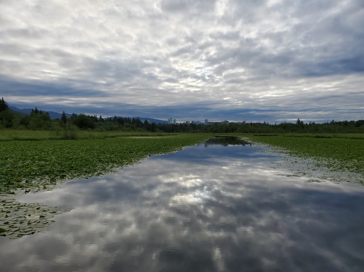
Below is the view westward back towards Vancouver from the east end of the lake.
And below was the view northeastward toward Coquitlam from the east end of the lake.

And there were plenty of beaver dams that I spotted throughout the headwaters leading to Brunette River.

As well as plenty of beavers too! Like this one that I was able to capture while keeping myself high side of my board.
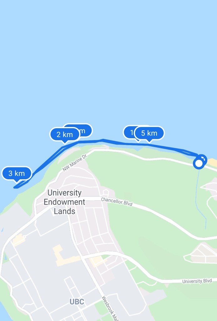
Below is my paddle route with a bit of a GPS smudge at the western tip.

And then to end the day I was able to squeeze in another sunset evening paddle from Spanish Banks out towards Point Grey. It is like I was back in university doing two-a-day practices. Below is the westward view of the setting sun. The elephant-looking structure walking along the water horizon is the wave energy testing station that is located off of the point.

And here is the view back towards the city.

The route for Paddle 2.0 is below.