Saturday, July 4, 2020
I grew up in Squamish and have driven the Sea to Sky Highway innumerable times, so it is surprising to me that I have only recently started to pay attention to what lies within the Howe Sound.
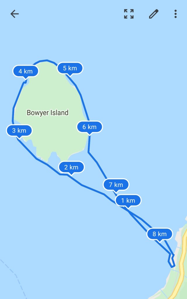
I am not sure exactly how I came up with the idea of paddling around Bowyer Island. It probably was after looking at a map of the various local bodies of water with interesting and accessible geography. Anvil Island seemed too big for my first circumnavigation within the sound so Bowyer Island was the natural default.
Finding a launch point/route plan proved to be an interesting endeavour. If you Google “Bowyer Island paddling” the results are predominantly about Bowen Island. This was not necessarily a bad thing as it gave me a few resources for my plans to circumnavigate Bowen Island, but it did not help for the plan at hand.
I used Google Maps to plot out the route distances for some different options of routes. I also consulted a marine chart of the area that was available on the Government of Canada website.
In the end, it came down to a toss-up between leaving from Sunset Marina or Ansell Point (another option is to leave out of Lions Bay area which we left out of consideration since it was a further drive and longer paddle). Paddling from Ansell Island would add an extra 1-2 km depending on if you hugged the shoreline or cut across the channel. To leave from Sunset Marina you need to pay a daily parking rate of $20. I had read online that sometimes they’ll only charge qajaqers half of the rate if you do a half-day paddle, but we were not so lucky or skilled/motivated in the art of bartering.

We aimed for an early departure as the forecast did call for some wind. When we arrived we were pleased to find the conditions quite calm. Since we were parked at the north end of the parking lot and the dock is at the south end, we opted to clamber over the parking barricades and launch from the rocks (score one for inflatable boards!). I couldn’t be bothered to carry my board to the other side of the lot when it would be much lighter on the water.

Based on the wind and tide we decided to aim for the southern tip of the island. With a northerly wind, we would have a slightly more challenging paddle north along the west coast of the island but then we would have an easier paddle coming back down the east coast at the tail-end of our paddle.
We paddled across to the small peninsula at the southern tip of the island, then cut across the bay to start up the western shoreline. A client who is an experienced qajaqer had warned me about ferry wakes in the Howe Sound. So when I peeked over my left shoulder and saw the Langdale Ferry quickly approaching I had a few palpitations. Fortunately, we were far enough from the ferry’s route that we were outside of its reach.
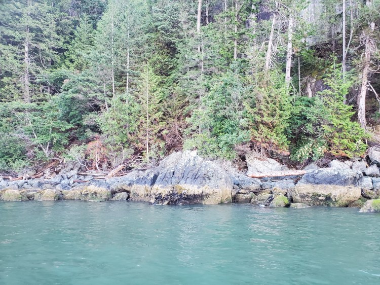
It was choppier heading north up the west side of the island into the wind. At the northern tip, we spotted an eagle perched in a tree in a small cove. I took a photo but it was shaky as I stood on my board and from a distance as I did not want to get too close and disturb it. In the end, it took flight despite me trying to give it some space, so see if you can spot it in the photograph below.
Just after taking the photograph, there was a loud sploosh of water. I caught the glimpse of what I thought was the tail of a fish out of the corner of my eye.
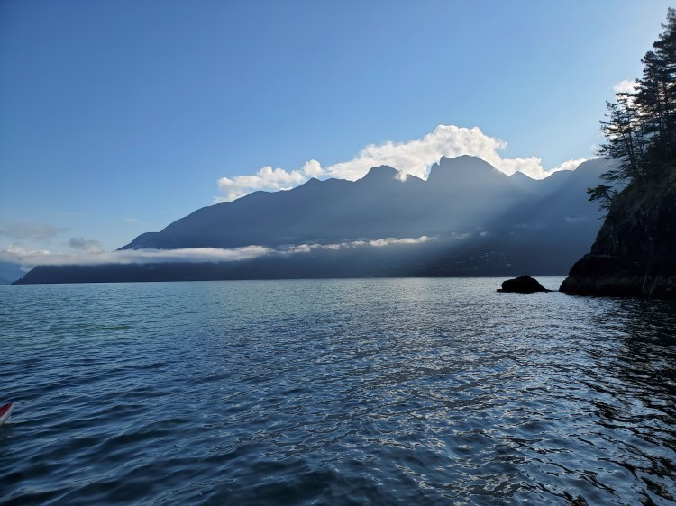
As we rounded the northern tip of the island we emerged back into the breaking sunlight. It was a moment in which you appreciate the marvelous magnificence of the mundane. The sun does this every day it is just that we are not there to bear witness.

A little while later we happened upon a bob of seals (yes that is one of many technical terms for a group of seals). The funny part was that when you thought that they had swum away if you turned around there would be an array of heads poking out from the water of the rest of the bob curiously hanging out behind you. There was another sploosh and then I realized that the sploosh that we had heard earlier when watching the eagle was also a seal.
Just after the six-kilometer point of our journey, we spotted another paddleboarder approaching from the northeast. We slowed down slightly so that our paths would cross. He was an older gentleman who lives in Lion’s Bay. He told us that a few times per week he paddles over with a croissant in his PFD pocket and heads over to a beach on the southwestern shore to enjoy his breakfast and the tranquility. Not a bad retirement set up if you ask me.
The waters were still calm on the paddle back to Sunset Marina. We decided to paddle to the dock to exit the waters rather than brave the rocky shore. This is a paddle I will do again in the future, but next time I would like to leave from Ansell Point to check out a slightly different view of the shoreline.
Our Route