
Saturday, August 15, 2020
While away in Parksville (we were staying near Rathtrevor Beach Provincial Park) I used the paddling.com app to search for local launch sites for different areas to explore. The launch site near Brickyard Community Park looked promising with a few islands nearby off of the shoreline.
As I did more research I found out that these were the Winchelsea Islands, a subgroup of the larger Ballenas-Winchelsea Archipelago. Checking out a few other websites from a Google search gave me a bit more information. The most important point is that the northernmost Winchelsea Island is a torpedo test site for the Canadian Forces. In fact, the Canadian Forces Maritime Experimental and Test Ranges facility is located in Nanoose Bay.
It turns out that while I did visit the Ballenas-Winchelsea Archipelago I did not make it to the Winchelsea Islands. Rather I only ended up paddling to the Ada Islands another sub-group of the archipelago that is closer to Vancouver Island. Here is a more descriptive map of the area with more labelling than what is available on Google Maps.
My father-in-law who is an avid sailor was well aware of the Canadian Forces testing sight too. He informed me that there are times where the straight is off-limits to boaters when tests are occurring. From what I could gather online, I would be okay paddling around the southern islands. It even seemed that you could paddle around the northern island provided you didn’t land. I wasn’t about to test my luck with that.
When I arrived at Brickyard Community Park I did a quick reconnaissance run down to the water’s edge sans paddleboard. I just wanted to confirm that there was a good launch point. There was, and fortunately, it was just a short distance from the trailhead. I got my kit in order and then was off.
Below is the view into a small little cove that is just north of Nanoose Bay. The line of trees running out on the point (Wallis Point) that is the northern edge of Nanoose Bay.

Brickyard Cove was shallow as it was low tide and I had to steer clear of some low rocks as I rounded the point. There are a few small unnamed islands between Vancouver Island and Southey Island (see map here). As I approached one of them the sun was rising over Southey Island.
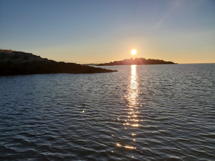
The wind was mild to start but present. The waters were relatively calm. Below is the view a bit closer to Southey Island. I decided to pass on the northern side of the island.

I was expecting to encounter some seals as I rounded Southey Island. But if there were any there they heard me coming and made themselves scarce.
Next, I made the longer crossing what I thought was the southwestern Winchelsea Island, but would prove to be one of the Ada Islands. I paddled towards the small cove here and then paddled out in between the two islands to get around to the northeastern side. The wind was stronger as I entered further into the part of the Ballenas Channel that separated the islands. And the current was pushing me southeast down the channel.
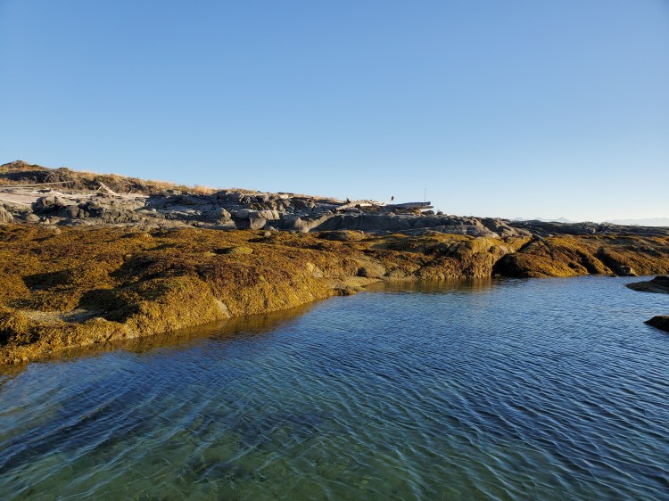
I followed the wind and current down the northeastern shore of the southern Ada Island. I then took a small channel through to the western shore before circling back around the southern tip to head back across the channel to the northern island. I paddled around through the shallow waters on the southwestern shoreline. The photograph below is looking south towards Maude Island with Vancouver Island in the background.

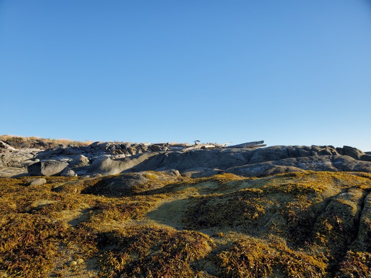
In the shallow waters at the southern tip of the northern Ada Island, I spotted an eagle perched on some beached driftwood.
The eagle took flight as I approached the shore in an attempt to get a closer picture. We had just been to the North Island Wildlife Recovery Centre several days before so it was amazing to see this eagle free and healthy.
The winds were stronger on my return paddle and the channel was choppier. Fortunately and unfortunately it was mostly a crosswind so it didn’t help or hinder me too much.
My Route
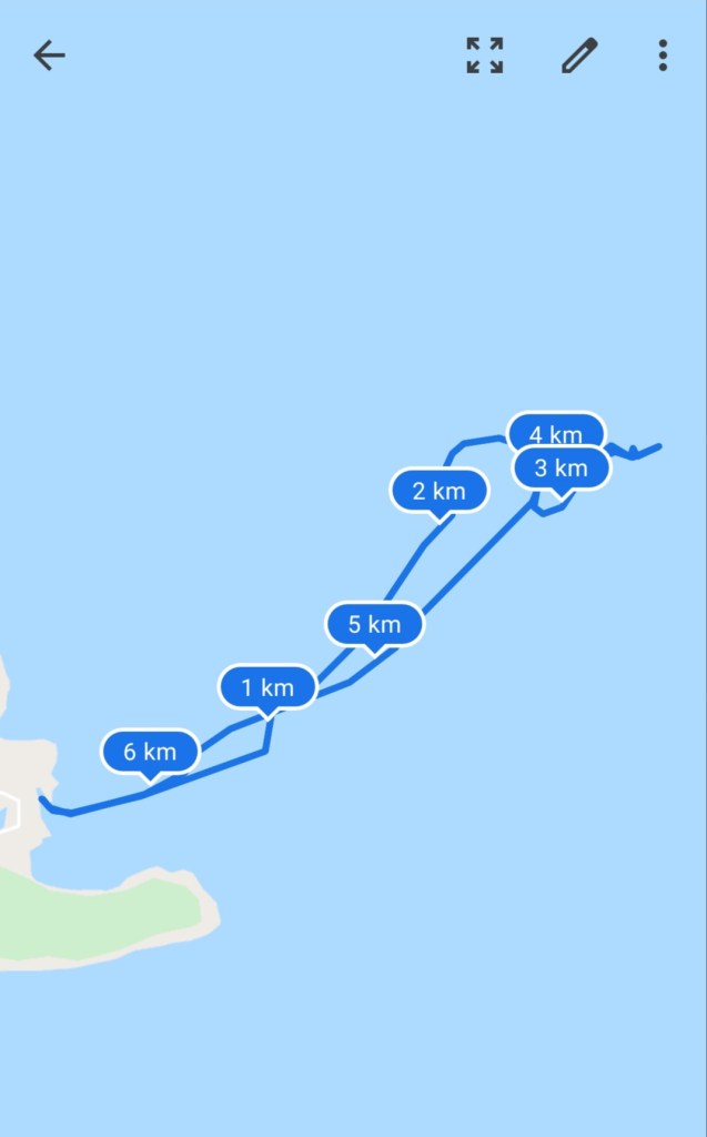
Funnily Google Maps in map view does not show any of the Winchelsea or Ada Islands from the archipelago. So above it looks like I am paddling around in open water. They are visible in the satellite view and now I can attest to them being there in real life as well.
