
Monday, August 17, 2020
The map above is a strange situation in Google Maps where the satellite view of Ballenas Islands shows empty space. So it looks like I went out and circled nothing. Yet in Google Maps map view the Ballenas Islands are depicted.
My paddle to the Ballenas Islands was a sequel to my explorations (Denman Island Crossing, Winchelsea Islands?) of places to paddle nearby while visiting Parksville from the paddling.com app. After enjoying my trip to what I thought was a Winchelsea Island but turned out to be the Ada Islands, I decided to explore more of the Ballenas-Winchelsea Archipelago. Here is a quick resource for information on paddling there from BC Magazine.
The paddling.com app showed a launch point from Moorecroft Regional Park. I considered trying to leave from Dorcas Point but the difference in distance was negligible and I did want to risk not finding an accessible launch point versus using one listed on paddling.com. I parked at the end of Stewart Road in a gravel lot and then it is a short walk down to the beach (approximately 250 metres) where I launched from, which I later determined was Arab Cove.

Below is the view from my launch site in Arab Cove in Moorecroft Regional Park. The point that goes out to the right of the picture is Cook’s Point and the one in the centre, almost closing off the cove, is Vesper Point. It was a glorious morning. It was generally a rocky beach, as you can see from the picture, but if you are here at low tide know that the bay is soft and muddy further out!

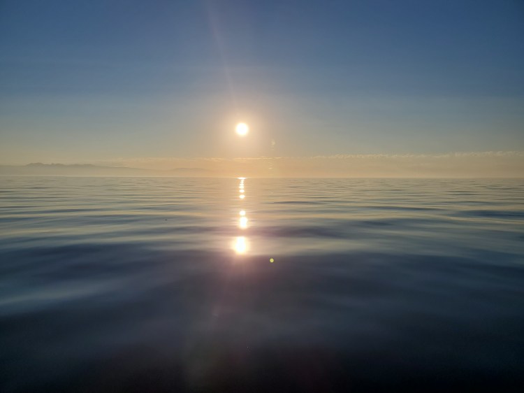
I started towards Gerald Island. The sunrise from Arab Cove was a spectacular sight.

I passed Gerald Island on the northwestern coast. From there it was a pretty uneventful paddle through the Ballenas Channel. I aimed for the southern point of the southern island. If you think of the island as a face, the southern point is the chin. From there I crossed the small cove that would be the mouth and then headed to the point that is the nose. At the eastern tip, I paddled through the small channel that is just off the brow of the face.
From there I crossed across the larger bay at the northern coast of the island. I was feeling some fatigue from the long paddle out to the islands so I decided to conserve my energy and take the shorter route, not exploring the entire perimeter. I cut straight across to the northwest most point.
After a good paddle with the sun now out I stopped for a quick swim on my way back in the Ballenas Channel just south of the island. It was refreshing!
The picture below is looking east over the water of the Ballenas Channel.
When I arrived back at Arab Cove the tide was out and the landscape was a bit different. I tried to take this photo from the same spot as the one from when I launched. I went from memory and was quite a bit higher up the shore. I had to trudge through some deep mud to get out of the bay. Hence the warning above.

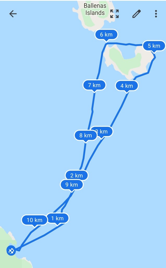
My route below shows my path around the island rather than just an ocean circle.
My Route
On this vacation to Vancouver Island, there was much left to explore! I hope to get back to the area and explore more soon. I think I will try to check out the Yeo Islands for one.
