Saturday, October 3, 2020
This paddle has been on my radar for a while. And with the winter approaching, I was starting to think that it might be a paddle for 2021. Fortunately, the weather cooperated, and Mike was keen to paddle the fall waters of the Átl’ka7tsem (Howe Sound)!
The full disclosure is that some of the inspiration for this route came from Norm Hann’s website. When searching about paddling in the Vancouver area, I came across his site. His company conducts organised SUP tours. One tour is a coffee run from Squamish to Britannia Beach. So to give credit where credit is due, check out his site if you have not previously.
Another paddle on my to-do “Potential Paddle Plan” list is Porteau Cove to Britannia Beach. I attempted it previously but came up short.
Initially, the weather forecast looked like we would have a solid tailwind, but the night before and on the morning of, the forecast was only for 1-2 knots. An early departure ensured that we would have an outflow wind (see my post on the 4 Ws: weather, wind, water, and waves). The afternoon changes to inflow with the land surface temperature rising more than the water surface temperature. So for the owls amongst us, completing the trip in reverse would be better (though this is very seasonal).
Mike and I sorted out the final details the night before (meeting place/time, kit, etc.).
Paddle Plan
DATE: Oct. 3, 2020
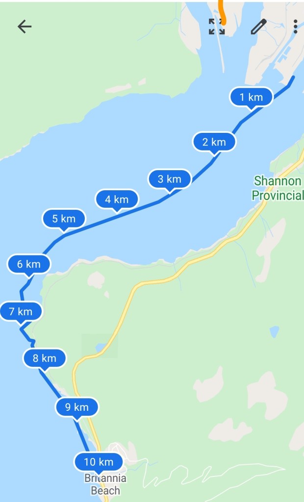
ROUTE: Newport Beach, Squamish to Chatterbox Cafe, Britannia Beach (one-way trip)
EST. DEP.: 0700
EST. ARR.: 0900
Details:
Sunrise
•0705
Nautical Twilight
•0650
Tides
•Low @ 0113, 1.9 m
•High @ 0722, 4.1 m
•Low @ 1315, 2.3 m
Wind
•Marine forecast (https://weather.gc.ca/marine/forecast_e.html?mapID=03&siteID=06400)
•Windy.com: Northeasterly 1-2 kt (7-9 kt wind gusts)
Paddle Distance ~12 km
Paddle Time ~2-2.5 hrs
Drive time:
•Vancouver to Chatterbox: 50 min
•Chatterbox to Newport Beach: 15 min
*Chatterbox Cafe Opens @ 0900
Personal Info
•TRAVELLERS: 2 (Mon Jef Peeters, Mike Tan)
•VEHICLE: [Colour] [Year] [Make] [Model] [License Plate]
•PHONE: [xxx-xxx-xxxx]
Itemized Itinerary
•0530 🚗 Departure
•0620 🚗 Drop at Chatterbox
•0645 🚗 Arrival at Newport Beach (1)
•0705 🛶 Departure Newport Beach
•0900 (0930) 🛶 Arrival Chatterbox
•1000 (1030) 🚗 Departure Chatterbox (2)
•1015 (1045) 🚗 Arrival Newport Beach (2)
•1030 (1100) 🚗 Departure Newport Beach
•1200 (1230) 🚗 Arrival Home
I arrived at Britannia Beach a bit earlier. I decided to check out the shoreline to confirm our landing options. I had surveyed them on Google Maps satellite view, but experience has shown me that looks can be deceiving (especially when using map view). Google Maps satellite view gave an accurate representation, and we would be able to land at the marina docks/boat ramp.
When Mike arrived, we moved our kit between cars, geared up in our paddle wear. And then we departed for Newport Beach. The excitement was brewing!
We surveyed the peninsula for the best spot to launch and, in the end, settled on the northeast corner. We were not the only ones out for a paddle. There was another group setting up to launch. I suspect it may have been a Norm Hann Expedition en route to tour Átl’ka7tsem (Howe Sound)?

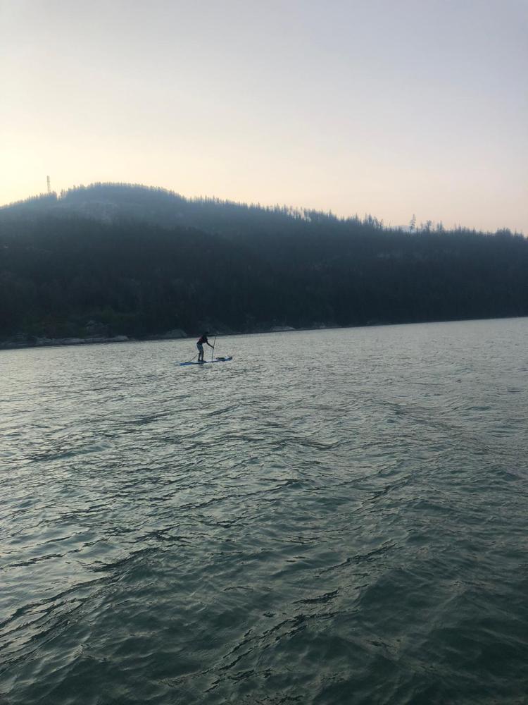
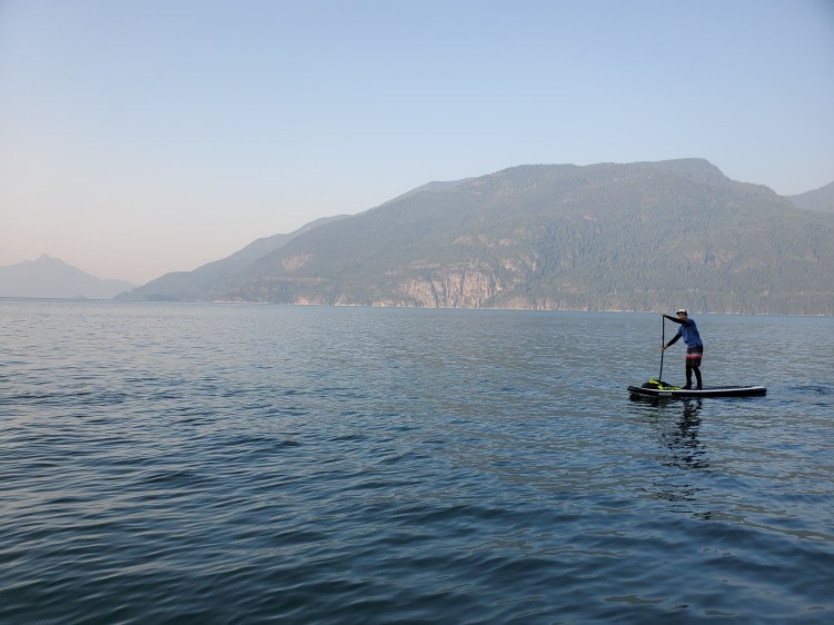
The water was relatively calm as we set out. We stuck more to the centre of the sound, though, in hindsight, it would have been much more interesting to explore the shoreline more. Perhaps next time.
We took the opportunity to slow down and take a few pictures around Watts Point.


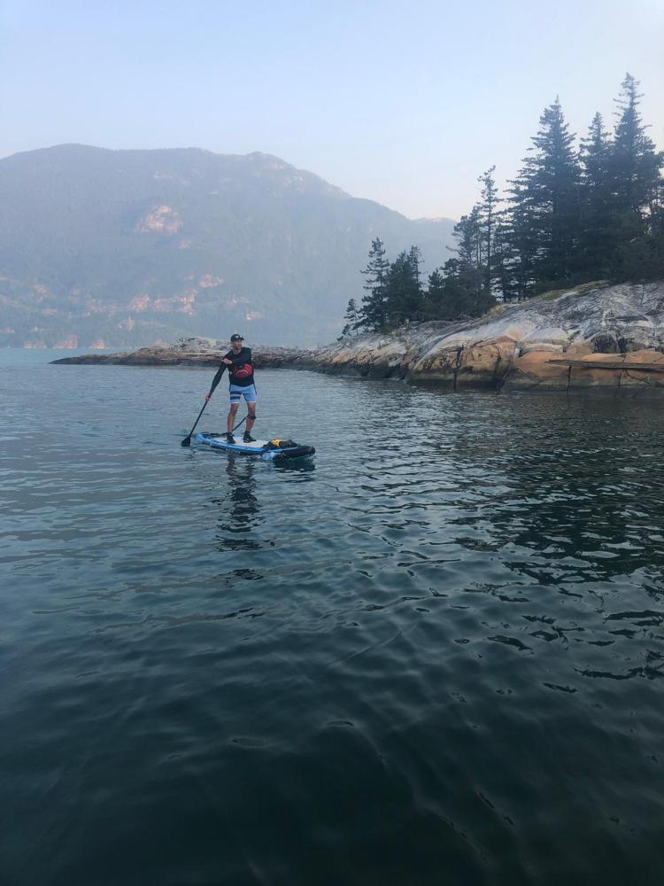
We cut in closer to the eastern shoreline after passing Watts Point. Here we found an intriguing crevice and waterfall to explore.
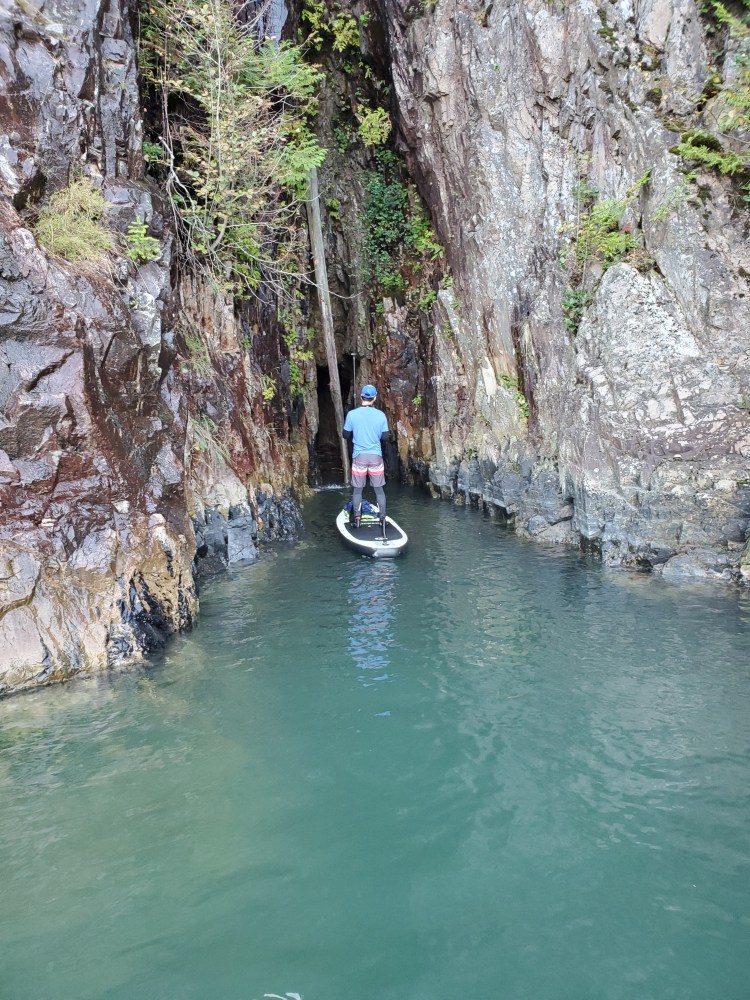
Here is the view a bit more up close and personal.

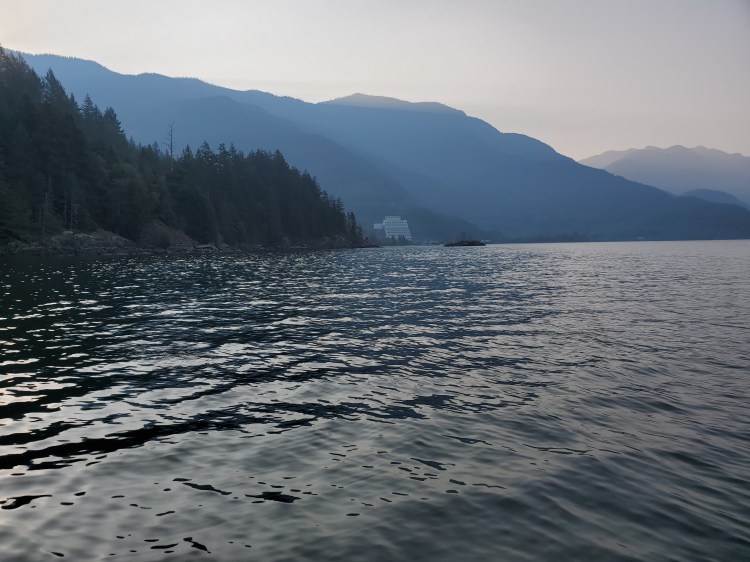
Soon we could see the Britannia Mine Museum in the distance. It appeared much closer than it was. With the end in sight, I thought the paddle was almost over. It turns out I am not the best at predicting paddle times or distances visually.
We did not spy any of the First Nations pictographs visible from the water. We will have to go back with a keener eye to spot them.
We did cross paths with some mountain climbers. I believe it was Seal Cove where we passed them, from what I can determine from this website.
As we approached Britannia Beach, the tide was going out, so the shoreline was exposed. Much of the granite shoreline had an array of colours to it. It was quite beautiful though the rust coloured stains are a by-product of the mines polluting history.

We made it in just under two hours. So despite not being able to sight distances by time on the water, my paddle plan time estimate was on point. We docked at the boat launch at Britannia Beach. While we were getting out of the water, a kite-surfer was getting ready to get. He appeared to be launching with a jet-ski for support/travel.

We carted our boards up to the highway and then across the Sea to Sky to the Chatterbox Cafe for some post-paddle perk (coffee and baked goods). It is a nice spot to cross as there is a traffic light with a pedestrian crossing.
Our Route