
Saturday, October 17, 2020
This was my third adventure from the Surrey Blueways trio of waterways (see paddle plan here). The other two waterways are the Nicomekl River and the Serpentine River. The Blueways Master Plan states that “The Fraser River Challenge provides a route for experienced paddlers from Surrey Bend to Brownsville Bar, as a part of a regional blueway paddling system throughout the Fraser Valley”. I tried to find more information on first-hand accounts of people who had done the challenge but all the sites that I found simply reiterated the description from the City of Surrey site. After my dead-end adventure on the Serpentine River Circuit I was reluctant to trust the description that was on the City of Surrey’s website, but I was still curious. I decided that I just needed to taper my expectations as the Surrey Blueways are a proposal and more of a work in progress. Yet, from previous paddles on other sections of the Fraser River, I knew that there was potential for this to be an interesting adventure.
Here is a link to the Surrey Blueways Map PDF.
I had trouble securing a paddling partner so as the weekend approached I realized that it would be a solo paddle. I needed someone to pick me up as this is a one-way trip (here are some good reads on the pros and cons of solo paddling: paddling.com, fitfunsup.com, and islesurfandsup.com). You travel west downriver and depending on what the tides are doing you could have a pretty strong current that you would be battling to go back against to do a round-trip. Luckily I was able to ask my father-in-law to meet me at the end of the trip for a pint and pick-up.
There were a few details that I wanted to confirm in regards to the safety and feasibility of the trip. First and foremost, I searched for evidence of other people paddling down the Fraser River in this section. I found this post that referenced being careful paddling west of the Patullo Bridge due to the high amount of tugboat traffic. I figured I would be okay since I was paddling on a weekend and my exit point was essentially the Patullo Bridge. I also had read a post by the Urban Oarsman on rowing the Sapperton Channel so I knew there was not any restriction for non-motorized boats underneath the bridges (see here for my past error on this topic). I also needed to find out my launch and landing sites. I used the Google Maps satellite view to look at two potential spots, one just north of the Barnston Island Ferry departure point at Port Kells and another slightly more north in Surrey Bend Regional Park. I learned my lesson not to trust the Google Maps map view after my Serpentine River Circuit debacle. Since the Port Kells launch site was closer to the ferry parking lot I decided to start there and then default to the Surrey Bend Park site if it proved inaccessible. As luck would have it the Port Kells site worked well as there was an old concrete boat launch slab just north of the ferry dock that was easily accessible at high tide (at low low tide it is still accessible but on the day of my trip I encountered an interesting find…stay tuned for details). The launch site is now uploaded to the paddling.com site/app so you can find directions and details there. But most importantly, I needed to confirm that the Brownsville Pub would be open for my post-paddle beer. It appeared that it would be so it was go time.
I have been looking into getting a dry suit or semi-dry suit for paddling through the winter. But I have not pulled the trigger yet on a purchase, so I went with a thin base layer (UNIQLO HEATTECH for my bottoms and Under Armour for my top) with board shorts and a t-shirt over top. I packed a MEC dry bag with a change of dry clothes, snacks, and a Swell water bottle loaded with tea in case I was cold. This all proved to be useful as I took a very early spill, but was able to stay warm despite gloomy weather and paddling the whole route wet.
At the same time that I was ready to depart the Barnston Island Ferry was about to leave too. Initially, I waited on the riverbank as I didn’t want to be in the wake of the ferry. But, after assessing the situation I assumed that I was sheltered enough, that the ferry was going at such a slow pace that the wake would be negligible and that the ferry would do a linear point to point so that the cars onboard could easily drive off. Oh, how I was wrong! Only now do I know that after drifting away from the dock with the river current the ferry takes off in reverse! This created a massive eddy current that swirled towards me just moments after I had stood up on my board and started to drift along with the current too. Before I could get my footing the starboard side of my board was sucked down into the eddy. I tilted hard to the right and the next thing I know I was jumping (okay fine falling) off my board into the muddy waters of the Fraser! In hindsight, I wonder if I had been more prepared for the eddy if I could have braced myself, but I suspect that I am just trying to protect my ego with such a presumption. Below is a video of the ferry departing taken by my father-in-law when we came back to pick up my vehicle. Listen to my commentary explaining how I was unwittingly sucked in (sorry that I don’t have live spill for your entertainment but if you can contact a youth cycling group that was on the Barnston Island Ferry the morning of October 17, 2020, I am sure they can give you an amusing account). Make sure you watch the video to the end so that you can witness my look of disbelief and then read on to see what the heck I am looking at!
So at this point my ego has been severely battered, my confidence shaken, and I am questioning whether this paddle is a good idea. I take a moment and collect myself and conclude that anyone could have gotten sucked in like that. How was I supposed to know that the ferry boat goes in reverse rather than straight!? I consider going back to change into my dry gear, but then I consider I still have the tugboats to deal with. I decide to continue on. If I fall in again at least I will have a dry change for the pub.
The current is pushing me less than I anticipated as I start up the southwest channel around Barnston Island. As I pass Robert Point, the northwest tip of the island, the current feels a bit stronger and there is also a slight headwind (so much for that tailwind that was forecasted). I pass by some fishermen as I near Douglas Island. They ask me how far I am travelling and applaud me for my bravery. I was pleasantly amused by their compliment, but simultaneously trepidatious. Gulp, what do I need to be brave for?
The current feels like it is changing slightly beneath my board. In hindsight, this was probably the merging of the Pitt River to the Fraser River waters. I get the rich scent of the cut logs that line the southern riverbank. They smell like cedars to me. I tried to take in the mix of natural beauty mixed with industrial sights. There are several floatplanes in the distance.
It is at this point that I encounter my first of three tugboats. Despite the tug travelling towards me at a slow pace, the wake it is producing looks substantial. I consider maintaining my course but the wake actually looks enormous as it approaches. I quickly turn the nose of my board into the wake and thankfully so. They are probably the biggest wakes I have encountered to date. I squat lower and brace and am able to ride them relatively easily. I try to relax my tensed muscles but I think I am shaking slightly. More difficult than the wake itself are the rebounding waves coming off of the log booms. The relatively calm waters are now choppy for the foreseeable future. I continue on.
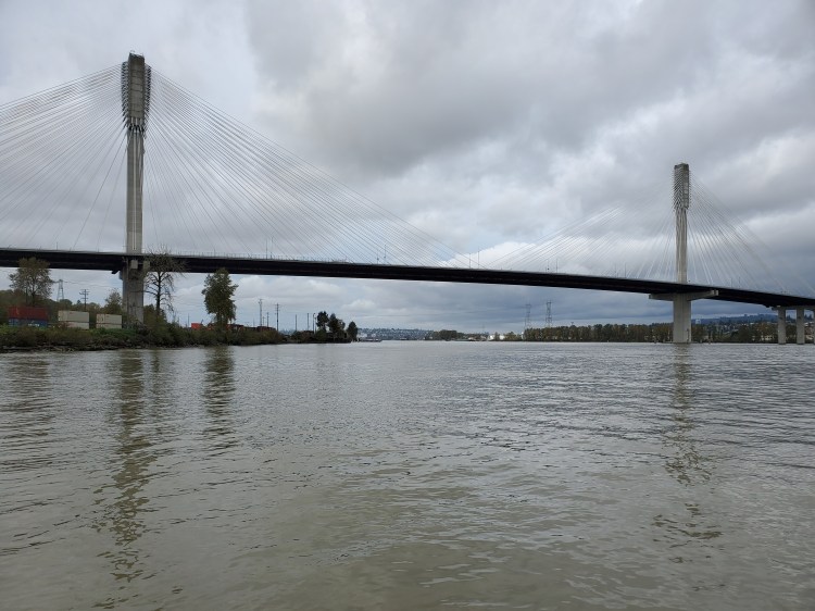
I can see the Port Mann Bridge in the distance now. Its massive mammary-like cable stays scintillating in the light like lace-like dressings as the sun battles with the cloud cover.
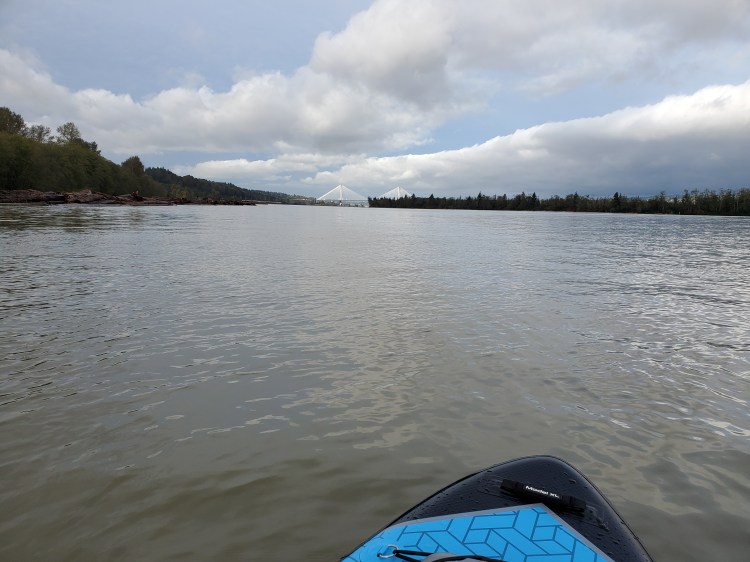
The waters are now calm again and I find myself relaxing into the calming repetitiveness of the paddle stroke. My mind wanders and it is at this point that I decide I should write a blog. I also muse over the idea of doing urban paddle tours. I wonder if others would find intrigue in paddling through historic waters that are now prey to industrial pollution but still rich with life and history. I paddle dot cee eh. That has a nice ring to it. Inflatable paddleboard? I am paddling? My mind continues to wonder. I reach the bridge and pass under.
I encounter tug number two on the other side of the Port Mann Bridge. Again it is coming towards me. The wake is big but not as big as the first one. The Fraser River is wider here and I am thankful as there is another boat of fisherman and I do not think my ego would handle another spectated unplanned water entry. Their boat rocks through the wake and as I call out to see if they have caught anything one of them calls back and shows me that his line is active. I do not stick around to see what he brings up.
I can see Burnaby Mountain and the Simon Fraser University campus off in the distance. The riverbank becomes more and more industrial at this point. I pass several recycling centres ranging from cars to plastics to wood products.

As I approach the Patullo Bridge I notice a tugboat pulling a barge approaching me from behind. I worry his wake is going to be difficult to navigate from behind. There are moored ships on the south bank and I consider trying to navigate behind them for shelter. But I worry about how secure they are and if I will truly be more sheltered on the riverbank side of the ships. I decide to stay close to the pilings on my port side and keep a watchful eye for the tugboat. When it finally reaches me the wake is minimal and I realize this is because it is following the tidal current rather than opposing it.
I pass under the bridge and I am momentarily confused as to whether I was to pass under the Skytrain SkyBridge too or not. A man is waving encouragingly to me from the riverbank. That is nice of him, I think to myself. Oh wait, I know him! It is my father-in-law. I steer in towards the beach that he is flagging me towards.
Made it!
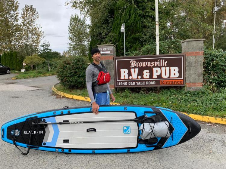
As we walk up to the car park of the pub I briefly recount my adventure. I am relatively dry at this point. I change in the parking lot and we head in for a well-deserved beer and some brunch. Between children and the pandemic, it has been a long time since I have had a restaurant brunch. This one is good and for $5.49 (plus an extra $0.10 for the rye bread) you can’t go wrong. My tea in my Swell water bottle is still piping hot. Next time I will need to let it cool a bit beforehand.
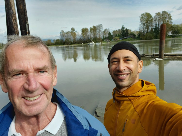
We enjoy beverages, breakfast, and a blather then settle up and head off to pick up my vehicle. When we get to the ferry dock my father-in-law wants to investigate. I show him my launch site. I snap a selfie.
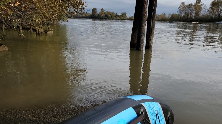
And then as luck would have it there is a ferry leaving right then. He records the departure and I recount my eddy experience as seen above. The tide is lower now and if you watch the video until the end you can notice my dumbfounded expression at the end. It is this, in the image below, that catches my eye and I step out of the camera view to investigate.

See if you can figure out what that is!? And yuck that is damn close to where I was dunked by the ferry eddy!!
Paddle Plan
DATE: Saturday, October 17, 2020
ROUTE: Barnston Island Ferry – Port Kells to Brownsville Bar Park (one-way trip)
EST. DEP.: 0900
EST. ARR.: 1100
DETAILS:
Tides (Point Atkinson)
- 0726 High 2.6 m
- 1341 Low 1.2 m
Wind
- Forecast: see Windy App
- Westerly 2-3 kt (6-8 kt wind gusts)
Current
- 0.6 m/s (2.2 km/hr or 1.2 kt) Outflow
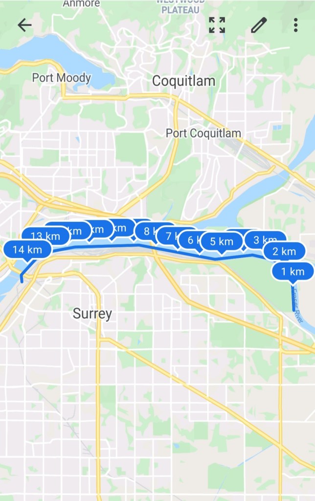
Paddle Distance: ~14 km
Paddle Time: ~1.75-2.25 hrs
Drive times:
- Vancouver to Brownsville Bar Park: ~35 min
- Brownsville Bar Park to Barnston Island Ferry – Port Kells: ~15 min
*n.b. Brownville Bar Opens @ 1100
Personal Info
- TRAVELLERS: 1 (Mon Jef Peeters)
- VEHICLE: [Colour] [Year] [Make] [Model] [License Plate]
- PHONE: [xxx-xxx-xxxx]
Itemized Itinerary
- 0755 🚗 Departure
- 0830 🚗 Car Drop at Brownsville Bar Park
- 0845 🚗 Arrival at Barnston Island Ferry – Port Kells
- 0905 🛶 Departure from Barnston Island Ferry – Port Kells
- 1050 (1120) 🛶 Arrival at Brownsville Bar Park
- [1700 BEER TIME]
- 1230 (1300) 🚗 Departure from Brownsville Bar Park
- 1245 (1315) 🚗 Arrival at Barnston Island Ferry – Port Kells (2)
- 1330 (1400) 🚗 Departure from Barnston Island Ferry – Port Kells (2)
- 1405 (1435) 🚗 Arrival at Home
My Route

6 thoughts on “The Fraser River Challenge”