
Monday, July 27, 2020
This was my first adventure from the Surrey Blueways trio of waterways. The other two waterways are the Serpentine River and the Fraser River Challenge. The Blueways Master Plan states that “The Surrey Floating Nature Trail provides an interpretation-based and controlled paddling experience on the lower Nicomekl River, with enhancements to separate paddlers and other boaters from sensitive waterfowl areas and seasons.”
Here is a link to the Surrey Blueways Map PDF.
The Blueways Master Plan divides the development of the Nicomekl River portion into three phases. I decided to start with Phase I and paddle from the Sea Dam at Elgin Road near Nicomekl Portage Park out to Blackie Spit at Crescent Beach.
Paddle Plan
DATE: Monday Jul. 27, 2020
ROUTE: Nicomekl Portage Park to Blackie Spit (round trip)
EST. DEP.: 06:00
EST. ARR.: 08:15
Details:
Tides (White Rock)
- 0606 Low 1.7 m
- 1204 High 3.0 m
Wind
- Forecast: see windy.com app
Paddle Distance ~12 km
Paddle Time ~2-2.5 hrs
Drive time:
- Vancouver to Nicomekl Portage Park: ~30 min
Personal Info
- TRAVELLERS: 1 (Mon Jef Peeters)
- VEHICLE: [Colour] [Year] [Make] [Model] [License Plate]
- PHONE: [xxx-xxx-xxxx]
I was up bright and early at 05:15 excited to get out for a paddle! Plus the earlier I go the sooner I am home and the less time my wife, Annie, is left running zone coverage on our two kids. I had breakfast on the run so that I could maximize my time.
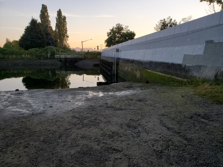
When I arrived I took a quick peek on the upriver side of the sea dam as that is Phase II of the Nicomekl and it is a paddle for a future date. The tide was low and I almost took a header walking down to the water over the super slippery mud.
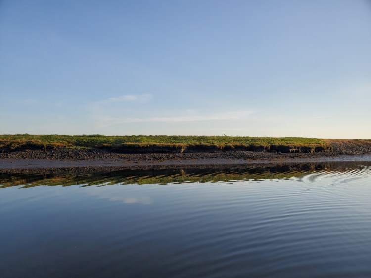
The waters were calm and there was essentially no current. The paddling was calm and easy. I had read a few reviews of people who had paddled parts of the Surrey Blueways and one major con was that there were some significant odors. You are paddling through farmland. Maybe it was that I was paddling in cooler temperatures or the city has been working on cleaning up the waterways as part of the blueways project or maybe I was just expecting more smell from what I had read. In any case, the odors were not that bad, but yes they were there, it was in the middle of farmland.
I was unsure if I would run into any boat traffic so I stuck to the northern riverbank. At the bend next to Elgin Heritage Park, the waters on the south bank were very shallow. So I hugged the north bank even more. And slowed to a cautious pace scanning for any signs of objects that I might catch a fin on. I did not want to take a dip because the water did not look very pristine and I was wildly unsure of the depth.
I made it to Ward’s Marina and was hoping there would be some large signage there. Disco ball, flashing lights, neon sign. Ward is the name of one of my father-in-law’s good friends so I thought it would be a funny picture. To my dismay, there were not any notable markings.
A little further past Ward’s Marina I spotted a coyote (or fox?) on the riverbank. By the time I was ready to take a photograph he was upon the grass line of the dike. You can see it just right of centre in the photograph below.
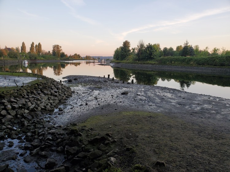
A little way later on I made it to the train bridge which essentially marks the end of the river as it enters Boundary Bay. There was an eagle perched on the fencing taking in the morning sights.

There was a bit more wind picking up now as the sun started to work its magic on the air. The water was still quite shallow and as I entered Boundary Bay I worried that I was going to bottom out. I had to select my route wisely but eventually found where the deeper waters were.
A fishing boat that passed by created a massive wake in the shallow waters which caught me slightly off guard and almost gave me a morning swim. I pushed on a bit further to round the Crescent Beach Point as I wanted to make it to Blackie Spit. But when I checked the time it was getting late and I needed to start heading back.


The tide was now coming in but not as much as I had hoped. It was still more of a slack tide. But I was more familiar with the depth of the river so I was able to pick up my pace on my return route.
On the northern riverbank near Elgin Heritage Park, there was a beached boat. I was not sure if that was by intent or miscalculation of the tides. In any case, I thought my boys would find the photograph interesting.

On my return, I passed one sailboat, another fishing boat, and two qajaqers who all seemed to be departing from Ward’s Marina. All in all, it was a very peaceful and relatively secluded paddle on a Monday morning. I wonder if a weekend paddle would be the same.
My Route

To read about my adventure on the second phase of the Nicomekl River click here.

Cool. Did you manage to ever try the Surrey segment North of 99 or the City of Langley Nicomeckl neighborhood greenway?
LikeLike
I did do Phase II which is from the Sea Dam at Elgin Road to the bridge at 40th Ave.
I still have plans to do Phase III (40th Avenue to 184 Street) in the future. But I got more into touring lakes and doing ocean paddles in the interim. I’ll use your comment as inspiration to finish off the Blueways soon!
—
Phase III on Google Earth
https://earth.google.com/web/data=Mj8KPQo7CiExMW8wdmNfRFdWN0tadm02cjNDdGVwcWlDRUZMQmxIcVISFgoUMDM1MDY3NTRCQzE3OEEwMEFERUY
LikeLike
Will stay tuned. In case you were not aware that the Nicomekl has much early BC History: https://moreupon.wordpress.com/2022/07/07/how-to-commemorate-the-upcoming-bicentennials-of-an-early-contacts-settlement-site-in-southwest-bc/
LikeLike
Thank you. I perused your post. Fascinating! I was not explicitly aware of the history, but upon reflection, it makes complete sense that there would be a ‘pre’ history before the colonial accounts. And even more so now giving the evidence seems to suggest hominids colonised the Americas much early than the old estimate of the ‘Bering Land Bridge’ theory of ~12,000 years ago.
https://www.cbc.ca/listen/live-radio/1-23-ideas/clip/15888973-the-old-stone-age-western-hemisphere
LikeLike