
Sunday, December 20, 2020
Back to back paddle days! What could be better?
Slightly better conditions for day two and a rest day in between? But no complaints here. I was a little bit bummed out that I missed paddling a crazy windy day on Friday, with winds ranging from 20-24 knots and gusts of 30-44 knots! But the conditions today were a lot more reasonable and 30-44 knots is unchartered territory and possible insanity. The plan for today was to do a diagonal crossing from Boundary Bay on the Tsawwassen peninsula to Mud Bay.
Paddle Plan
DATE: Sunday Dec. 20, 2020
ROUTE: Boundary Bay: 1a Ave. Boundary Bay (near Centennial Beach) to the Dyke Trail @ 96th St. Delta (one-way trip)
EST. DEP.: 0800
EST. ARR.: 0900
Details:
Tides (White Rock)
- 0244 Low 1.1 m
- 1043 High 4.3 m
- 1747 Low 2.8 m
(Tsawwassen)
- 0247 Low 1.3 m
- 1034 High 4.5 m
Current (White Rock)
- 0543 Flood 1.7 kt
- 1019 Slack
- 1304 Ebb -0.8 kt
Wind
- Forecast: see Windy App
- Southwesterly (SW, SSW) 9-12 kt (17-19 kt wind gusts)
Sunrise
- 0759
Sunset
- 1617
Paddle Distance ~9 km
Paddle Time ~1.25-1.5 hrs
Drive time:
- Vancouver to 96th St. (BB Dyke): ~28 min
- BB Dyke to 1st Ave: ~22 min
Personal Info
- TRAVELLERS: 2 (Mon Jef Peeters, Trevor Mazurek)
- VEHICLE: [Colour][Year][Make][Model][License Plate]
- PHONE: [xxx-xxx-xxxx]
Itemized Itinerary
- 0700 🚗 Departure
- 0730 🚗 Arrival at 🚗 Drop
- 0745 🚗 Departure 🚗 Drop
- 0805 🚗 Arrival at 🛶 Departure
- 0815 🛶 Departure from 1a Ave.
- 0930 (0945) 🛶 Arrival at 96th St.
- 1000 (1015) 🚗 Departure from 96th St.
- 1025 (1040) 🚗 Arrival at 1a Ave. (2)
- 1035 (1050) 🚗 Departure from 1a Ave. (2)
- 1115 (1130) 🚗 Arrival at Home
Some online searches revealed that we may have some troubles with depth, as several kiteboarding posts were discussing waist-deep water. But we decided to take the risk. The worst-case scenario would be a muddy beach trek to end our paddle. Now that I write this it sounds direr than what I had considered. In hindsight the mud of Mud Bay was serious and that was just at the water’s edge at high tide!
Our exit point was slightly questionable as it was uncharted territory for us and from Google satellite view it was unclear if there would be an easy exit point. The upside of doing a one-way downwinder was that we would be able to check out our exit point first. We decide to go with 96th Street from the images, but mostly because it matched the wind forecast trajectory the best. As backup options, we figured we could check out 88th or 104th Street if 96th proved to be a bad option.
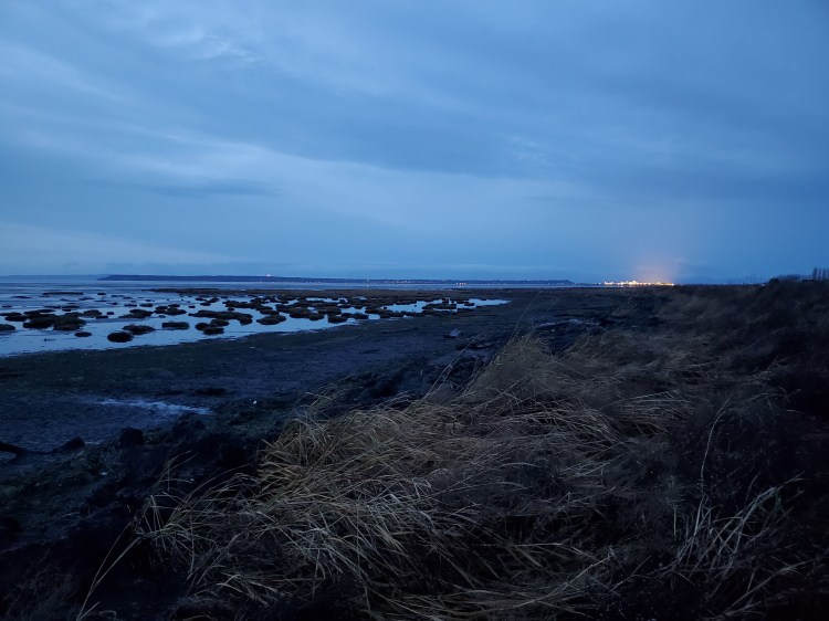
On arrival, the shoreline at 96th Street did not look too bad assuming the tide would be high enough on our arrival. Though you could see why it is called “Mud Bay”.


We changed gear and set up our post-paddle “dry” car. We assumed that our vehicle would be okay to be on the shoulder of the dike past the gate at the end of 96th Street, despite signage saying no motorized vehicles on the dike. I took the warning to mean no farm vehicles as the graphic on the sign was a tractor and the Google satellite image of the site shows a vehicle parked exactly where we parked. We masked up and then started the drive to 1a Avenue Delta. Parking is restricted at the end of 1a Avenue but there is 3-hour parking on 1a Avenue between Centennial Parkway and 67a Street.

I still had the Insta360 One X camera that a client had lent me so below is the video of the launch and first part of the paddle. Not knowing how choppy the conditions would be I decided that my MacGyver selfie stick set up needed to be secured with an additional safety lanyard. So, you can see the blue lanyard cord hanging from the waterproof Venture camera case. Though it appears to be hanging from space, since the camera software makes the case and selfie stick invisible. The wind was not very strong when we set out. Maybe it was being blocked by the Tsawwassen peninsula. The wind was more southeasterly, not the forecasted southwesterly so we decided to “tack” across the bay towards the east so that we could then turn north and travel with the wind.
As we travelled further out into the bay the wind picked up. But the direction of the waves was more towards the north (north-northwest to be exact). We decided it was time to try and ride some waves. If the waves brought us too far to the west we could always tack east to correct.
The sun rising in the east trying to shine through the clouds was a delightful sight (forgive me for the etymological wordplay). Below is the second bit of crudely edited video from the paddle.

The waves and wind were not super strong but they were enough to catch and gain some speed. At one point during our crossing, an eagle soared overhead which was a herald for our landing at Mud Bay. Unfortunately, it happened just after I had turned off the camera to conserve the battery. A lesson learned from my previous 360-degree camera adventure in the Squamish River Estuary. Below is the third section of the video from the paddle. Be sure to use the scrolling feature and check out the view from all directions. You can see that I do a bit of submarining, i.e. the nose of the board submerges into the water as the board is accelerating and lifted from behind by the oncoming wave. The track playing, “The 1919 Influenza Blues“, does not quite fit the activity but I chose it for the times.
Here is the last sequence of the video before I lose power. I asked Trevor what track he had bumping in his head through our paddle and he replied Nice Rec. “No Script” by Mars Jackson was the first track that came up on Spotify when I searched for Nice Rec.
We ended up too far west at 88th Street and we were worried that Trevor’s vehicle was missing from the dike. When we realized we were off course we made our way east towards 96th Street through the shallow waters and were pleased to spot Trevor’s vehicle where we had left it. The wind was strong here as we were at the end of the fetch and we made our way to the shoreline. The tide was high, but as expected the exit was not pleasant. There is a reason it is called “Mud Bay”. I made my way to the shoreline only to find a very thick line of floating seagrass that I would need to cross. Not wanting to have to pluck all of the grass off after exiting the water I decided to dismount early and wade through the grass on foot. When I touched down to the seafloor my foot just kept going. I sunk into almost a foot of mud. I could feel it roll over the top of my booties and sink in. Oh well! I waded through with my board held high and then clambered up to the dike embankment.

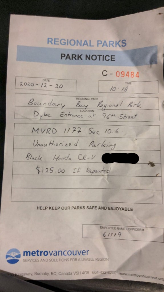
Unfortunately, when we got to the car we noticed what we thought was a ticket on the windshield. Fortunately, it was a warning notice and not a ticket. Lesson learned and in the future, we will need to park down on the street if we are to repeat this paddle.
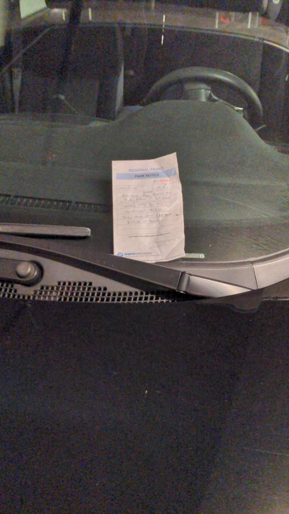
We both saw the $125 price point initially and were super sullen but then elated to see that it was just a warning. Message heard and Metro Vancouver and thank you Officer 61119 for warning/leniency.
While packing up on the dike we had several eagles fly overhead. At one point down on the water, one of the eagles was dragging what looked to be a seagull through the water dropping it and then fetching it?! Unfortunately, I missed the opportunity to capture it so you will just have to picture it in your head. I did get a few shots of some eagles flying overhead and perched on the house at the end of the street.
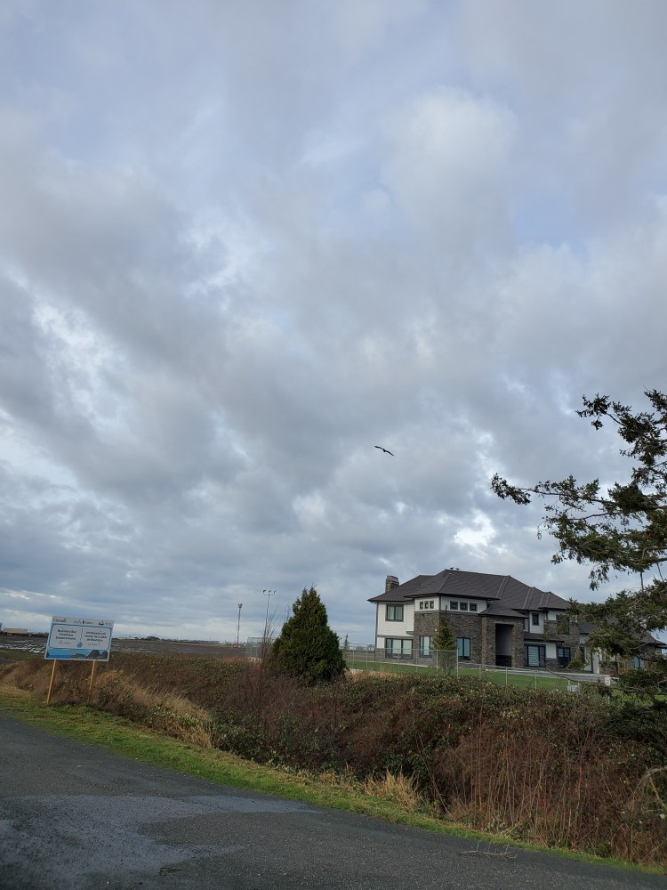
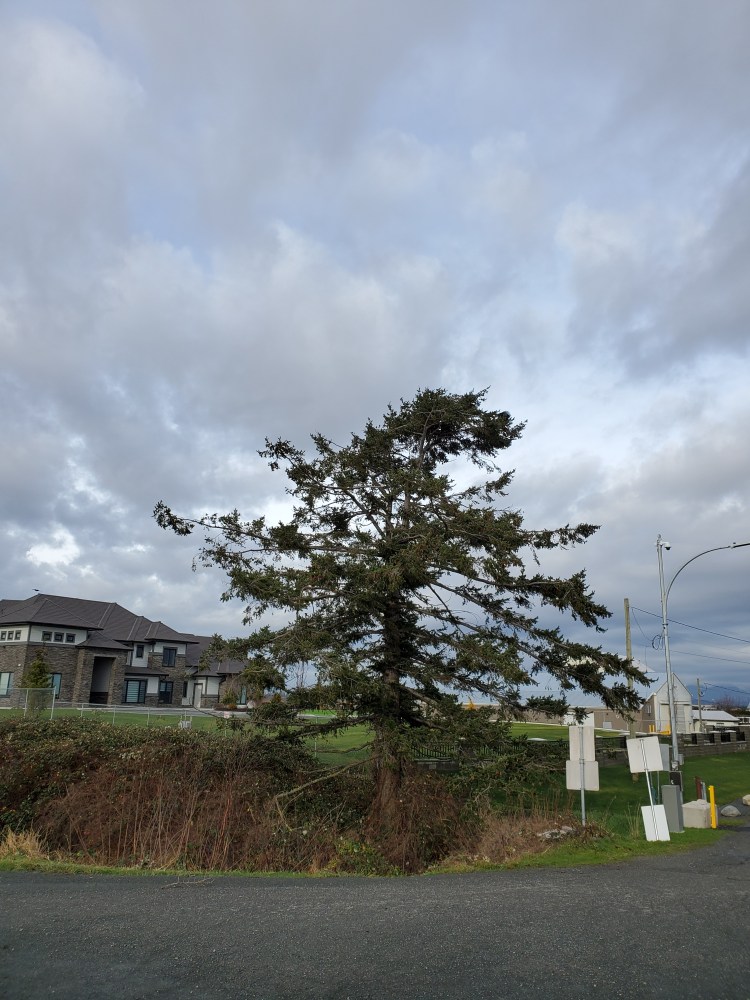
And then two young eagles (they did not have the characteristic white head) came and landed in the tree at the end of the road!
On Saturday night we did take out from Modern Burger at their new (to me) Broadway location. Their previous location was destroyed by a fire a few years ago. I had ordered one turkey burger, my attempt to reduce my carbon footprint by avoiding beef, but had wished I had two. So, when I got home from my paddle it was Modern Burger for lunch. Along with a post-paddle pint!

Our Route

Our Stats


One thought on “Boundary Bay: Downwinder”