Sunday, March 12, 12023 Human Era (HE)
Paddle Preamble
After coming across this article in the Richmond News, I have wanted to check out the Sto:lo (Fraser River) Middle Arm. The article from 12015 HE is nearly eight years old, so I was curious both to what had and hadn’t changed since it was written. From what I could tell, the Middle Arm of the Sto:lo had not progressed to a public access non-motorized, recreational boating hotspot. I was hard-pressed to find much additional information online about how to access the Middle Arm easily. I had previously come across this article, “My own private island,” in The Globe and Mail about a retired physician adopting the island as the island’s caretaker/steward. So I knew paddling around the island was a possibility. What the article in the Richmond News provided was a more proximal put-in. Previously, I had paddled the eastern section of the Middle Arm after launching from Fraser River Park. But to reach my goal of circumnavigating Swishwash Island at the mouth of the Sto:lo, a northern arm launch would likely be a long and arduous paddle, probably against currents and winds.
When searching for a suitable launch site, I did consider the John M.S. Lecky UBC Boathouse. But from what I could tell from online searches, it was not accessible to the public. I did consult with a colleague’s son, who rows from UBC, regarding some of the safety parameters for the river. Mainly, how strong were the winds and where was best to navigate in order to avoid the float planes. He informed me that the winds were generally not a problem for them and that they rowed down the river on the southern bank of the Sto:lo and then could return on the northern shore of Swishwash Island provided they stayed clear of the floating plane landing area east of the island on the northern bank of the river. Armed with this intel, I decided to attempt the river. Thankfully, Trevor was keen to paddle with me.
After surveying Google Maps and Earth, I decided that the best launch spot to attempt would be the Dinsmore Bridge (as per the “Exploring Fraser River’s middle arm by canoe” article). The Go Paddling App and the BC Marine Trails Field Map App didn’t have any listed launch spots in the locale. From the satellite view, it looked like we might have some success from an area just west of the bridge. Assuming the blackberry brambles seen on some of the satellite imagery were passable.
I was expecting overcast skies and some sprinkles, so when the skies looked to be clearing in the east, I was happily optimistic about our sunrise paddle. Clear skies would be a nice reward for sacrificing a potential sleep-in since we had lost an hour of sleep with the change to daylight savings time.

DST and Me
In my youth, I don’t think I gave too much thought to daylight savings time. In high school, like most people, I rejoiced in the idea of getting an extra hour of sleep. While simultaneously lamenting the loss of sleep a third of a year later. Though my classmates and I would joke that we would show up an hour late to school on Monday morning and plead ignorance of the time change as the cause. A practice that would be hard to pull off in today’s modern automatically changing clock world.
It was in parenthood that I grew to detest the practice. As parents, our familial schedule was very routine. So in our first year of parenthood, when November rolled around and we were supposed to get an extra hour of sleep, our five-month-old had different plans. His circadian rhythm could give two-shits about the mythological concept of the clock-time change and biological reality ruled the day. Four months later, he was ready to party into the wee hours of the late evening past his clock-time-based bedtime on the first full day of daylight savings time.
I had heard various reasons for the transition to daylight savings from energy savings in the post-war era to, if memory serves me correctly, more daylight for agricultural practices. It seems that the idea is older than the war, but that the German state was the first nation to adopt the practice.
I can’t recall if I was already aware of some of the concerns around time changes at the time. Specifically, there are reports of a higher incidence of heart attack and traffic accidents associated with the loss of sleep. If I wasn’t, it became ammunition against the practice of time change. So pre-pandemic when there were rumblings of the west coast dropping the time change and adopting daylight savings time permanently I had high hopes. I am not sure if it would have gone ahead sans the pandemic, but for the pandemic-haters out there it is one more reason for grieving.
At present, it still seems that my kids can’t deal with the difference in daylight savings. And my biological clock seems to have a few day delay on the change. Needless to say, I am still a proponent of ditching the dual-daylight distinctions. Or perhaps trying to implement a more gradual type of change that would more closely resemble cosmology and biology rather than the abrupt one-hour change. Could we not conceivably create a computer code that could cautiously and continuously acclimate our collective clocks?
Considering that we are no longer at war (globally) and that the energy savings of the practice are questionable, my vote is to veto the vestigial practice.
Planning and Prep
Weather and Water Levels
As alluded to, the forecast from the night before was calling for overcast skies with the threat of rain. According to Windy.com (all of the models), the winds were light but predicted to be easterly which would make for a harder return upriver. Something for sure to consider on a downriver round-trip route like this.
The mouth of the Sto:lo (Fraser River) is tidal, so the river currents can be sped up or stalled by the ebbing or flooding tide. Previously, I used the My Tide Times Pro app for tides and currents, but more recently I have switched to the Government of Canada’s Water Levels App. Unfortunately, the Water Levels App doesn’t provide current data. A quick and nearly fruitless internet search for specific speeds revealed the estimated flow rates for sections of the Sto:lo from the sandheads to the Port Mann Bridge (I used the South Arm selection as there wasn’t a Middle Arm option – though looking at the map now the North Arm would have been wiser). The values were in metres per second which converts to about two knots. I did a rough estimate of the speeds from the first few kilometres, but mainly settled on using the tides as a proxy measure for the current. The high high-tide was predicted at 3.6 metres at 0852 hours and the low low-tide was going to be 0.8 metres at 1620 hours. That wasn’t ideal as the best option for minimizing the tidal effects on the current was a late night/early morning paddle. But with an early-ish departure, we would be able to catch the slack tide transition in the Middle Arm mid-morning marked by the 0852-hour maximum.
Float Plan
I made a quick float plan. Mainly because it was an unchartered waterway for me and, if I’m completely candid, I was cautiously concerned about the currents and wind. The conditions were manageable, but ideally, this paddle would have happened in the window of a flooding tide for the return leg. Today was a bit of force, but one that I was confident could be conquered.
Typically I use the float plans for safety, reassurance/insurance for loved ones, and a planning tool to get a general sense of the timeline. The brief one I prepared for this paddle is below.
SUP Float Plan
DATE: Sunday, Mar. 12, 2023
ROUTE: Fraser River Dinsmore Bridge around Swishwash Island (round trip)
VESSEL(S): green/blue/white/orange NSP Carolina SUP; white Think Kayak SUP
EST. DEP.: 0730
EST. ARR.: 0945
Details:
Sunrise
•0732
Tides (Steveston)
•0317 Low 2.1 m
•0852 High 3.6 m
•1620 Low 0.8 m
Current (Sandheads to Port Mann)
•~0.4 to 0.8 knots
Wind
•Easterly (E, ESE) 4-8 kt (6-16 kt wind gusts)
Paddle Distance ~10 km (round-trip)
Paddle Time ~2 hrs
Personal Info
TRAVELLER(S): 2 [first & last name]
VEHICLE: [colour][year][make][model][ABC 123]
PHONE: [xxx-xxx-xxxx]
Launch Site
After a quick detour to the conveniently located McDonald’s for the breakfast of champions (all that Olympic sponsorship), we pulled up to our launch site to survey the situation. Aside from a lack of parking, everything in the surrounding area was reserved, but the launch site was suitable. We had a clear path down the water. There were only the faint remnants of blackberry bushes that might block a summertime saunter to the shore. As we set up our kit, the stratocumulus(?) cloud cover seemed to be cracking.


There is a solid slope down the embankment, but we were able to use an old concrete barrier for more secure footing. We launched to relatively calm waters under hospitable skies.
Parking
The parking stalls closest to the river were reserved for 24 hours. Since it was a Sunday morning, we considered leaving my vehicle along the shoulder of the lot, but then recalled a previous paddle where my parking preference resulted in a near penalty. We decided that the McDonald’s lot would be safest, especially considering the lot belonged to a shipping logistics company, and there may be large trucks needing access to the loading bays. As I started my way over toward McDonald’s, I noticed that the further stalls were actually 3-hour limits. So I parked there.
(P)log
My Kit
Clothing
Since I was expecting rain with cooler temperatures, I was dressed in my Kokatat Endurance semi-dry suit. Underneath, I was wearing Icebreaker merino wool leggings and an Icebreaker top, Darn Tough wool socks, and SAXX underwear. As we got into our kit, we joked that it would be a warm paddle with the Sun burgeoning on breaking the cloud cover.
Paddle. Board.
I brought my BlackProject Adjustable Lava paddle. It is much lighter than the stock paddles that came with my inflatable boards. For my board, I was keen to ride my NSP Carolina (12020 HE model) after its previous river debut on the Alouette River. The sleeker (0.65 m (26-inch) width) speedier shape would help for our return route against wind and current, compared to my wider (0.86 metre, 34-inch), slower, but more stable Blackfin Model XL inflatable SUP (12020 HE).
Accessories
For safety, I wore my Onyx inflatable belt pack PFD and packed my cell phone attached to a floating lanyard, along with electricians and duct tape (for emergency repairs) in a ziplock bag inside a Seal Line Seal Pak® Hip Pack. I wore my NRS Freestyle Wetshoes and my NRS Hydroskin gloves. My hands were already cold from the crisp morning air kit assembly, pre-paddle. I paddled with my coiled leash connected to my hip pack belt to keep it out of the water and free from snagging.
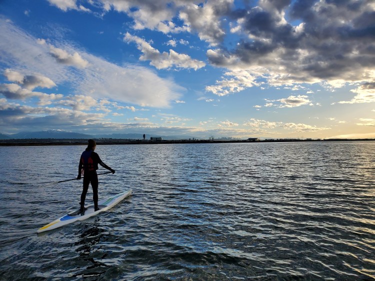
On the River
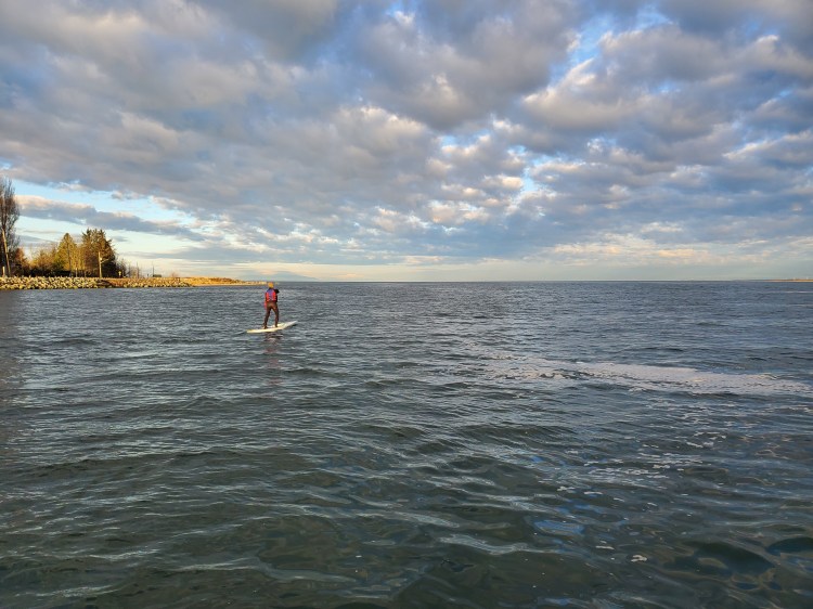
Setting out, we set our sites on crossing to the southern shoreline. It was just before 0745 hours. We crossed under the No. 2 Road Bridge passing between the massive box-girder structures. There didn’t seem to be any wind. Experience told me that meant the wind was at our backs. In spite of the tailwind, we weren’t speeding down the river. The current still seemed to be flooding, slowing our progress downriver. Hopefully, the flooding currents would stay that way a little longer for our return. I was banking on the rule of thirds. If true, we had until about 0945 hours before there was a significant build in the ebbing current by way of the receding tide.
Big Silver Birds in the Sky
West of the No. 2 Road Bridge we spotted our first oversized steel bird. We joked, ‘So… I guess the float planes do fly on Sundays.’ Thankfully, we were far enough east that for this plane’s landing, we would have a good view but not be at risk of being on the runway.
Behind us, we spotted some of the rowers from the boathouse making their way down the river. Apparently, we weren’t as far from the float plane runway as we seemed to think as the coach came up to us in his power boat to ensure that we knew about ‘the big steel birds in the sky.’ He was jovial about the warning, but the message was clear, the big birds don’t give a fuck about you down below so stay the fuck out of the way. Point taken. He suggested hugging the southern shore for our westbound leg to avoid any potential mishaps. I confirmed that it would be okay if we came back eastbound on the north side of Swishwash Island, provided we cut to the south side of the mainstream of the Middle Arm once we were clear of the eastern tip of Swishwash. He concurred given our conversed caveats.
I also asked if the UBC Boathouse was available to the public as a launch site. He confirmed what I had suspected, that it is not open to the public. So, as far as we could tell, the City of Richmond’s plan to make a public paddling paradise in the Sto:lo Middle Arm hasn’t progressed much.
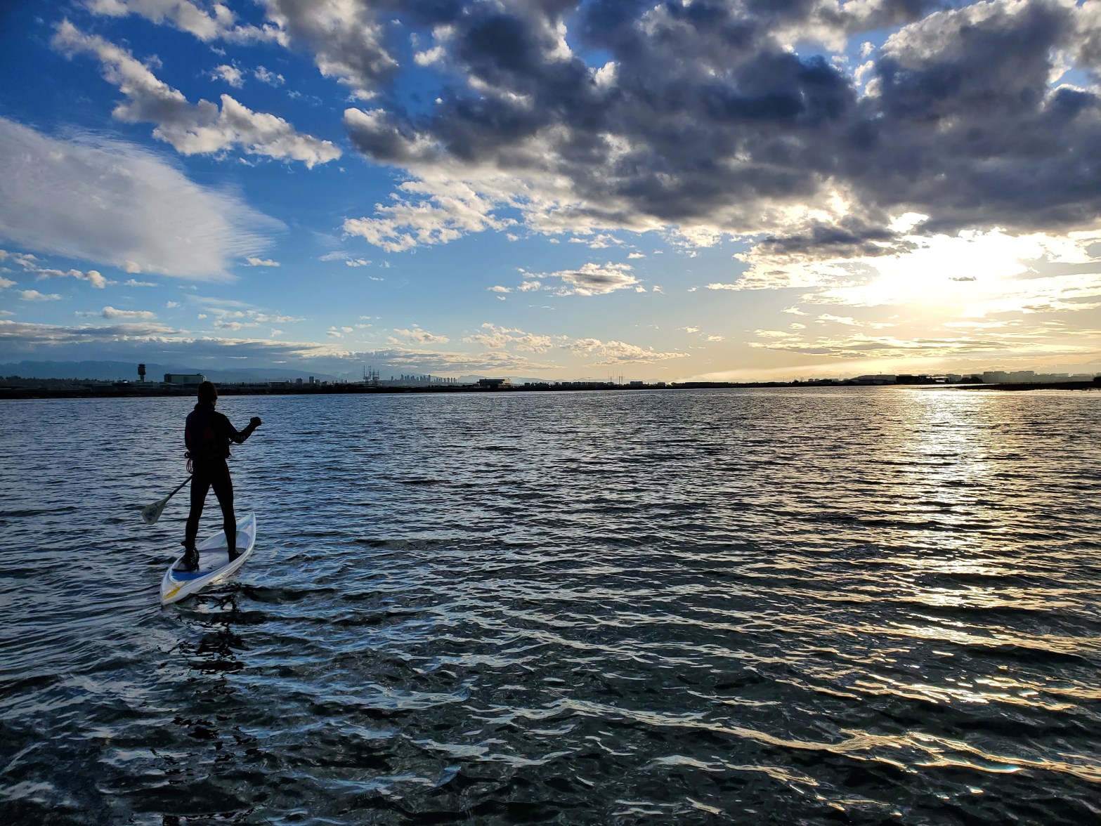
The image below is Swishwash Island, situated in the centre of the Middle Arm.

Podcast Playlist
The water started to get a bit more textured as we made it further downriver. Looking to the north, we could see the North Shore mountains far in the distance rising up over the Vancouver International Airport. The planes were all heading eastward for the take-offs, a confirmation of headwinds for our upriver return. The aroma of jet fuel from the planes taking off assaulted our olfactory senses. “I love the smell of jet fuel in the morning,” Trevor joked. The CBC‘s Ideas program did an excellent three-part series on Hollywood’s unofficial role in pandering to public perception as the propaganda arm of the American war machine. The first episode was titled “Myths on Screen: Hollywood at War, Part One,” and the series is well worth a listen. Ideas also released a more recent episode, “Picturing the Past: History Movies,” on the pros and cons of historic films. The famous napalm line from “Apocalypse Now” is sampled in the episode, which is why I referenced it.

It was a shame that we were paddling west since the sunrise behind us was a spectacular sight.
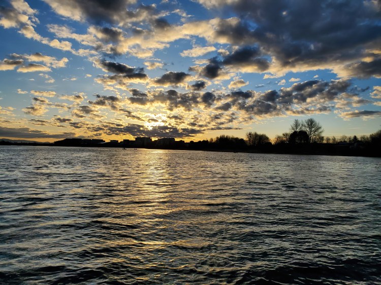
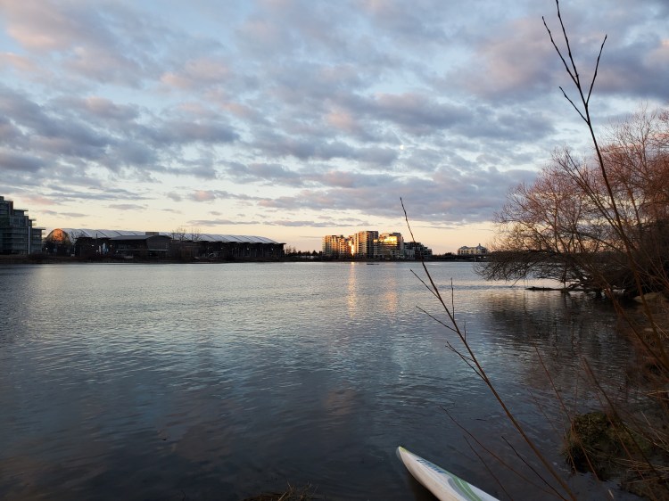
The view to the northeast was slightly less breathtaking. But still dramatic and marvellous in its own right.

History Can(go)Awry
Closer to the west end of the island and clear of any divebombing harbour birds we cut in toward Swishwash Island. There were pilings several metres offshore, and I wondered if they were remnant artifacts or structural security. I vaguely knew from my preliminary paddle research that the island was the home to a cannery at the end of the 119th century HE. And that later in the 120th century HE, sand from the dredging of the Sto:lo (Fraser River) was piled up around the sandbar/marshlands. In my mind, at the time, I wondered if the pilings helped to hold some of the sand at bay. After re-reading the history of the island post-paddle, I concluded that the pilings were remnants of the failed cannery.
The Return Leg
The west end of the island continues out quite a ways. I had anticipated this and even the possibility of running aground from the Richmond News article. Thankfully, the waters remained deep enough that we didn’t run aground. Though the depths did descend to around 70 centimetres at the shallowest points that we navigated. Once on the other side of the island, we started our upwind upriver return.

The winds were manageable, and the rule of thirds seemed to be holding up for the current. We advanced up the northern shore of Swishwash Island with our biggest obstacles being the blinding reflection of the sun (we both had forgotten sunnies) and the threat of catching a fin on a submerged piling. A threat made all the more real with the sunlight screening the subsurface submergings.
From the north shore of the island, the break/channel that splits the island was much more apparent. We contemplated testing the channel to see if it was a thoroughfare but decided against it after considering how shallow the west end of the island was. It looked passable, and I suspect that with a higher high-tide, it would be navigable.
At the east end of Swishwash Island, we cut across to the south side of the Middle Arm. There weren’t any big silver birds buzzing overhead, but we wanted to be on the safe side (literally and figuratively, to use the terms in their classic sense).
The rest of the paddle was relatively uneventful. We passed a few more rowers heading downriver. The tide and current did not seem to be an issue for their multipowered motors or sleek sculling shells.
We noticed this unique building on our return which we had missed travelling west. We figured it was a pump station of sorts, but I made a note to look it up post-paddle. It turns out it is a pump station, an award-winning one at that.
After a successful trip, we decided to reward ourselves with a second breakfast of champions. We felt we deserved Olympic-level sponsorship food after our olympian efforts.

Final Thoughts
If you ensure that you consider the safety parameters for this paddle (weather, wind, water, and waves), the Sto:lo (Fraser River) Middle Arm can be a fun local quick paddle. Taking into consideration the history of the waterway, geologic, pre-historic, and historic, makes paddling this transit route a much richer experience. The sights offer the potential of a juxtaposed scene, urban sprawl tainted by the industry of air travel, all backed by serene skies, the vastness of the Salish Sea, and (in our case) snowcapped mountains. Unfortunately, access to the waterway is less than ideal. But for the industrious urban adventurer an endeavour worth the effort.
Happy paddling people.

One thought on “Middle Arm Swishwash”