
Sunday, March 5, 12023 Human Era (HE)
Paddle Preamble
My son’s friend was having a birthday party at Jungle Jac’s Play Centre in Port Coquitlam. When I looked up the location to get a sense of the driving time I realized that there might be some paddling nearby. Both our boys were invited, so as long as upper management was in agreement, perhaps I could skirt away while the boys were at play.
A quick search of the area on Google Maps revealed a few options for surrounding waterways. I checked on the Go Paddling App to see if any launch spots were listed. Debroville Slough came up as the closest and was only a five-minute drive away. Across the Pitt River Bridge was the Alouette River, a ten-minute drive to the put-in site. There was also the option of paddling the Pitt River itself (a tentative plan that I have had in the works for a downriver paddle from Grant Narrows to the Gillnetter’s Pub). Remembering that I now had the BC Marine Trails Field Map App on my phone I decided to cross-reference. The Alouette River launch site came up in duplicate. I find the BC Marine Trails Field Map App is a much better resource for ocean sites, whereas the Go Paddling App tends to have many inland options.
Tentatively, my mind was already running through some options. Perhaps I could get dropped off pre-party at the headwaters of Debroville Slough and paddle down to the Pitt River then across into the Alouette River for a pick-up post-party? A tall order for sure. Or maybe I could swing a round-trip. When I crunched the numbers, the round-trip proved to be too long. A one-way drop-off and pick-option would have been cancelled faster than J. K. Rowling would be if she stepped into a Men’s restroom. For the record, I am in favour of “woke”-ness, with the caveat that I am a proponent of its original form. Not the new-age appropriated form that all sides of the civic spectrum seem to have co-opted for their use as was predicted in 11962 HE. For an in-depth account of how it all unfolded, check out this article, “A history of “wokeness” by Aja Romano from Vox.
Lofty Ideas
With a round-trip as my remaining option, I started to search the interweb for others’ accounts. I couldn’t find much information on Debroville Slough. And to be honest, the thought of paddling through a slough always sort of gives me the heebie-jeebies, despite having paddled many a still creek. There was more information on paddling the Alouette River. So, when I re-stumbled across this post, “Paddling Alouette River,” by Billy on his site, Outdoor Family, I took it as a sign from the sea (water?) gods for two reasons.
First, last weekend, I completed the third and final section of the Nicomekl River, a sort of bucke… wait… to-do list type of item. In the realm of paddle lists, Pitt and Alouette Lake are the next items on my currently outstanding venture, “Project Paddle: Lower Mainland Lakes.” In my mind’s eye, Alouette Lake had risen to the first place spot on the docket since I think I can complete the circumnavigation in less than a circadian cycle under favourable conditions. So it seemed serendipitous that the sea gods were sending suggestions of a subsequent schedule to score with Alouette River as a subtle reminder of my spring scroll.
Weather Intel
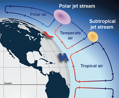
Second, at the end of Billy’s post, there was a link to a new post that I had not read already. It turns out he had just done a winter paddle on the North Arm of Alouette River on February 26th, in true winter conditions. Billy and his paddling partners (one human and one feline) encountered slush and ice along their journey as the Lower Mainland was in the midst of a Polar Vortex arctic outflow. Essentially, the polar jet stream, which acts as a bit of a barrier between the cold polar air and warmer temperate air, buckles allowing the colder air to migrate southward. This may be the new norm as anthropogenic climate change will warm the polar regions of the globe faster than the temperate zones reducing the temperature difference between these areas. It is hypothesized that the reduction in temperature gradient will slow down the jet stream allowing it to bend and buckle (see the video below for a more in-depth explanation). Thankfully, the temperature had climbed back up to more seasonal norms for my voyage and I was more worried about rain than ice and slush.
Armed with some up-to-date intel, I planned to launch from just east of the Harris Road Bridge.
On the drive out we passed the Gillnetter Pub, and I was re-inspired and reminded to plan for a paddle and pub pint with pals for approaching picnic days.
Weather Intel
Weather and Water Levels
In my haste to prepare I had not made a float plan. But I had surveyed the water levels. Well sort of. The Real-Time Hydrometric Data measurement site for the Alouette River is near Haney, which I suspect must be near 216th Street, but I am not sure. In any case, the water levels looked good. As for the weather, the forecast on Windy.com had some light rain/snow, mild temperatures, and light northeasterly winds. I typically find that Windy.com overpredicts snow here, in the Pacific Northwest, so I was doubtful that the flurries would come to fruition. Though now that I think about it, that might be a by-product of using the European Centre for Medium-Range Weather Forecasts (ECMWF) model rather than the more domestic National Oceanic and Atmospheric Administration‘s (NOAA) models (e.g., GFS, HRRR, or NAM).
💡!
I will have to look into this further to see if the more locally generated forecasts are better. Early on in my Windy.com use, I found the ECMWF model was more accurate. But perhaps that assumption is worth a revisit. I’ll see what the NOAA has to offer.
Thus, my float plan consisted of knowledge of the weather, water levels, and wind along with a verbal description of my intended paddle route and an estimated time of return to my partner. I had a pick-up curfew of 1130 hours.
Parking
After dropping everyone off at Jungle Jac’s, I set off quickly to the Trail Pavillion parking lot. At 0945 hours on a socked-in Sunday, I was able to get a VIP spot right next to the gravel ramp leading down to the water. But I could see the possibility of parking presenting as a premium in peak season. There were plenty of dyke and dog walkers preparing to disembark, as well as two vehicles with empty kayak racks on top.
It was my first time at the Trail Pavillion lot. But from what I could tell from the online posts that I had read and the freshness of landscape forms, they seem to have done some upgrades to the west side of the facilities. There was fresh grass surrounding the picnic tables on either side of the ramp to the river, and the gravel leading down to the water look freshly laid. I didn’t use the lavatory facilities at the east side of the lot, but from a distance, they appeared to not have been a part of the recent upgrades.
French, History Lesson
The French word “alouette” translates to “lark” in English. Interestingly, according to Wikipedia, only one species of lark lives in North America, the horned lark. This makes the lake and river name choice of “Alouette” all the more mysterious. It turns out that the lake and river underwent a name change in 11914 HE. Originally named Lillooet River and Lake (the links are to the currently named geological formations), respectively, the name was changed to avoid confusion with the larger river and lake going by the same name. “Alouette” was chosen as it harmonizes with the original name “Lillooet”. That explains the lack of local larks in relation to the lake and its linkage’s label.
Lillooet, the municipality, lake, and river all derive their names from the Lil’wat (and St̓át̓imc Tmicw (St’at’imc)) indigenous peoples. In 11860 HE, the area previously known as the “Cayoosh Flat” was renamed “Lillooet” after the Lil’wat people. According to the history page from the Alouette River Management Society website, the earliest known inhabitants in the Alouette watershed were the Douglas-Lillooet and Katzie Nations. From what I could find the Douglas-Lillooet First Nation is a subgroup of the St’at’imc. My guess is that either a historic interlinking of nations or lost in communication meant that the Lil’wat peoples were or were assumed to be inhabitants of the Alouette watershed. Or someone goofed on the names of the lakes or rivers after the fact leading to the duplication of Lillooets. In any case, their histories are intertwined just as all waterways ultimately are.
Enter the oddity of the French children’s song/nursery rhyme “Alouette.” Maybe something is lost in the French-to-English translation of the lyrics. But the song in English becomes a plucking of the various body parts of the bird. As a child I always assumed “plumerai” to be more like “brush,” rather than “pluck” or “will feather.” But with plucking or defeathering as the verb the song becomes a slightly sadistic venture in pseudo-pterotillomania, beginning with the head, then verse-by-verse venturing to the beak, eyes, neck, wings, legs, tail, and back. I put the song as the audio for my Relive video of my paddle only for the childhood familiarity, not the feather-plucking freakiness. Check out the video below for a preview of my route and a fun, yet freaky, musical interlude.
Musical Interlude
(P)log
Launch Site
The launch spot was easy as I was able to walk into the water and set off. There was a pair of large shallow rocks to mind for fins but they were visible and easy to avoid. I set out to flat waters under stratus cloud cover to the northeast and lighter skies to the southeast.
My Kit
Clothing
Since I was expecting rain with cooler temperatures I was dressed in my Kokatat Endurance semi-dry suit. Underneath I was wearing Icebreaker merino wool leggings and an Icebreaker top, Smart Wool merino wool ski socks, and SAXX underwear. Given that things looked to be relatively dry I would likely run hot. But I was happy to be too hot rather than too cold.
Paddle and Board
I brought my BlackProject Adjustable Lava paddle. It is much lighter than the stock paddles that came with my inflatable boards. For my board, I debated between my Blackfin Model XL inflatable SUP (12020 HE model) and my NSP Carolina (12020 model too). Not knowing the river conditions I thought the inflatable board would be the safer option. It is a tank and can go over and into almost anything. But along with its triple-layer PVC construction and 0.86 metre (34-inch) width comes its sluggish speed. The other side of me wanted to sample the sleeker (0.65 m (26-inch) width) speedier shape of my hardboard in flatwater conditions. Though the elegance and performance of the hardboard come along with greater fragility.
After reading route reviews and looking at Google satellite images I decided to go with the hardboard.
Accessories
For safety, I wore my Onyx inflatable belt pack PFD and packed my cell phone attached to a floating lanyard, along with electricians and duct tape (for emergency repairs) in a ziplock bag inside a Seal Line Seal Pak® Hip Pack. I wore my NRS Freestyle Wetshoes. And also packed my NRS Hydroskin gloves in case my hands got cold. I paddled with my coiled-leash connected to my hip pack belt to keep it out of the water and free from snagging anything despite the slow moving speed of the waterway. In faster moving water, it is also safe practice to have a quick release to your leash.
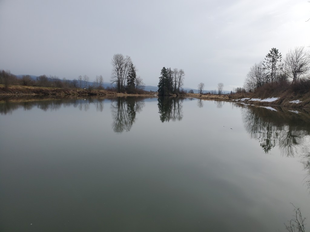
On the River
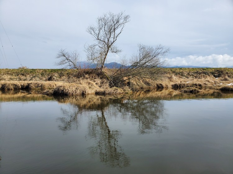
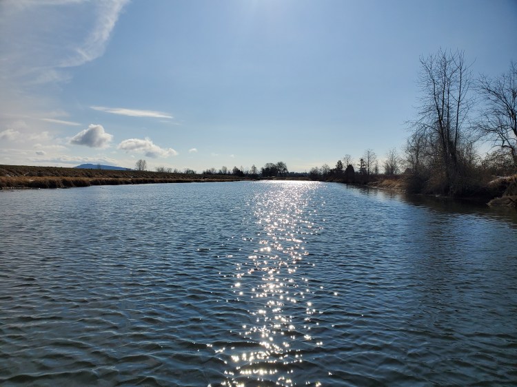
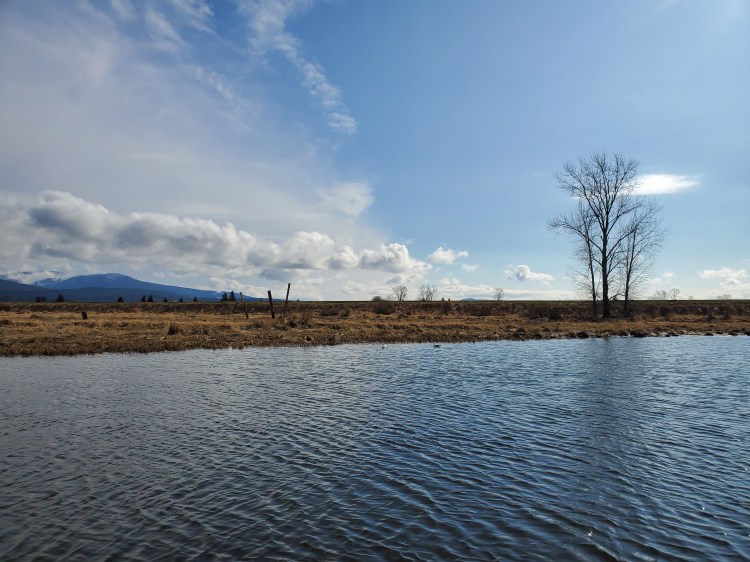
Unfortunately, with the socked-in starting conditions, the view of Golden Ears was obscured. In the distance, I could see the start of the snow-speckled sierras before they slipped away in the sheet of stratus sky screen.
As I approached the fork leading to the North Alouette River the cloud cover commenced cracking. Blue skies to the southeast welcomed the rest of my journey. Over the distant mountains was now a mixture of cirrostratus and altocumulus clouds.
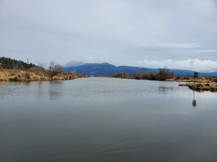
I could see quite a few pilings to the west of the island in the centre of the (main) Alouette River. I tried to keep a watchful eye for any that might be submerged while I took in the sights of the breaking weather.

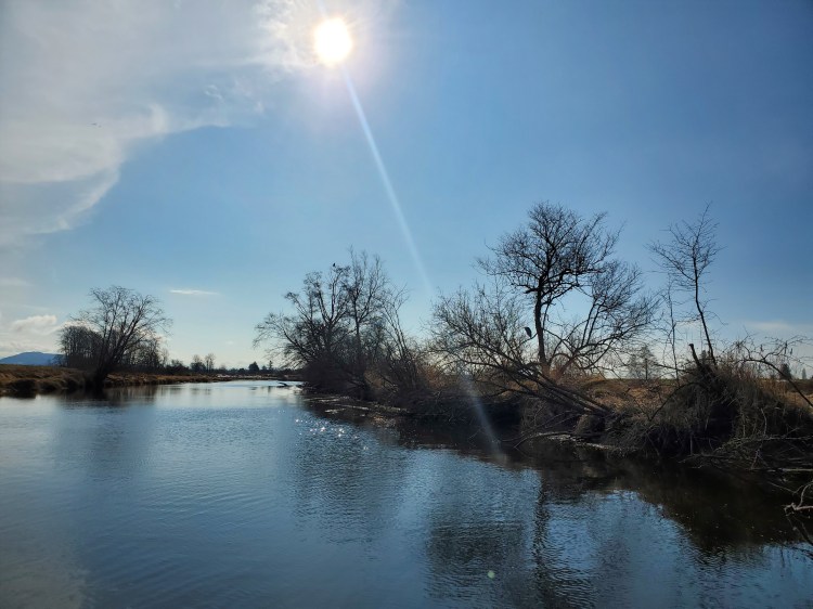
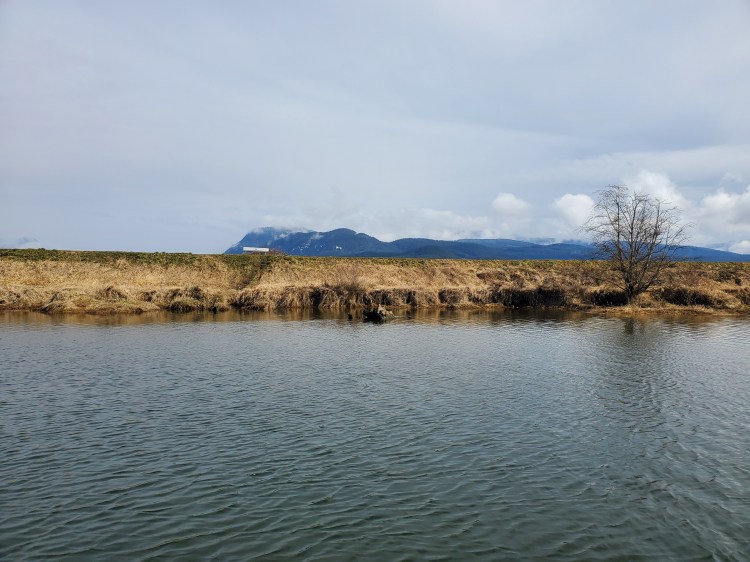
Coming down the northern branch of the waterway was a cool katabatic wind descending through the valley formed by the inland fjord of Pitt Lake and Pitt-Addington Marsh. Looking up the North Alouette River, I could see the cat paw traces of the wind disrupting the calmer waters of the Alouette River proper. Two kayakers were off in the distance and I contemplated following suit since the breaking weather might mean more magnificent mountain views. But I reconsidered given I was tight on time and would lose ground battling the headwind. Though there would be a chance to make it up if the winds remained favourable for my return leg. If the winds remained favourable.
I took the channel on the north side of the river island and happened across what I think was a beaver dam. Well at least a beaver home, it didn’t really seem to be damming any particular waterway.
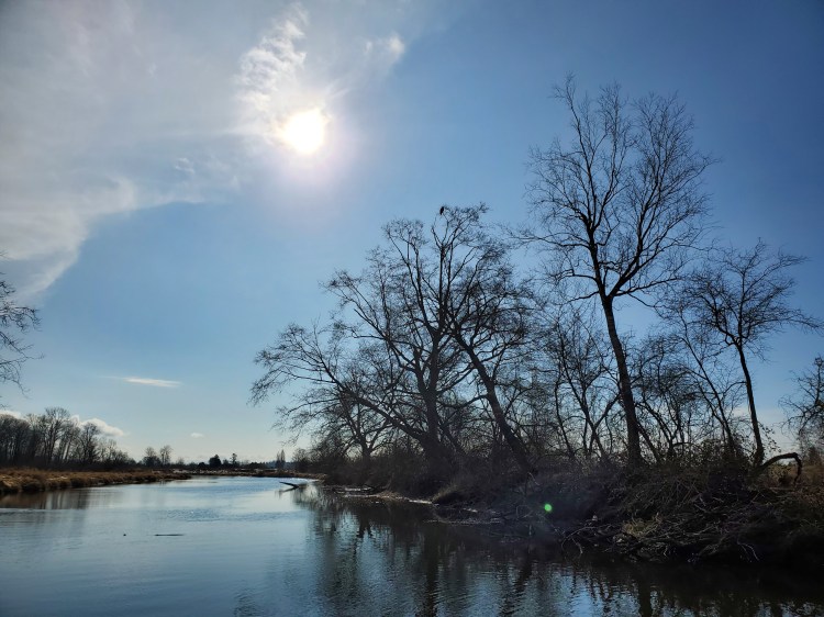
On the island, I spotted a great blue heron in wait. Perhaps it was looking for a mid-morning snack from its tree-branch vantage point. And just beyond the heron, higher up in a tree perched a bald eagle, perhaps equally in wait.
Again I need to remain mindful of the riverbank and water depth as I approached the raptor at rest. My paddle did make contact with an invisible stump beneath the copper-toned canal.
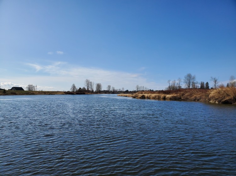
As I SUPed my way into a southeasterly section of the river the winds were at my back giving me an extra boost. The winds rippled the oncoming waters.
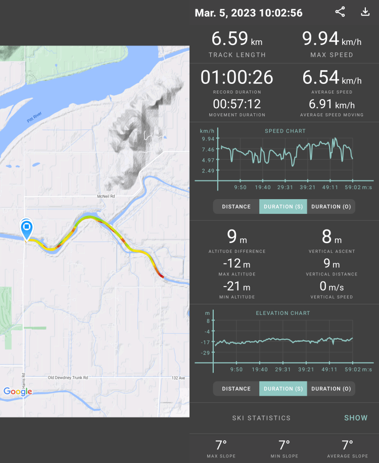
My goal was to get to the Neaves Road Bridge, but in the interest of not being late for my birthday party pick-up, I had set a 30-minute alarm when I set out at 1000 hours. My launch was a little bit later than my anticipated 0945-hour estimate, so when my alarm went off I was still a ways away from the bridge. I paddled on until the next bend before taking a few photos for my final upriver finish.

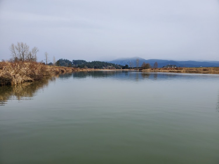
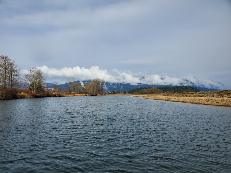
Then I turned around for the return leg. The skies to the northwest were again more ominous, with altostratus clouds covering a combination of stratocumulus to cumulus clouds surrounding the peaks of Pinecone Burke Provincial Park.
The same eagle was still on watchful wait on my return. Funnily, as is often the case, it felt as if the winds had shifted and were now more westerly in their longitudinal aim. Headwinds in all directions.
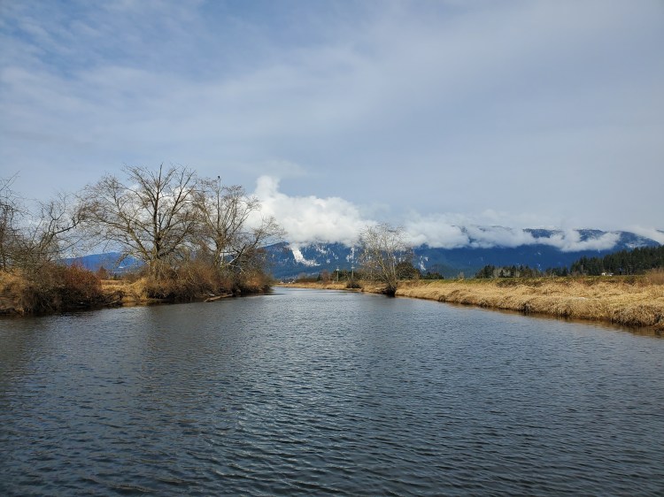
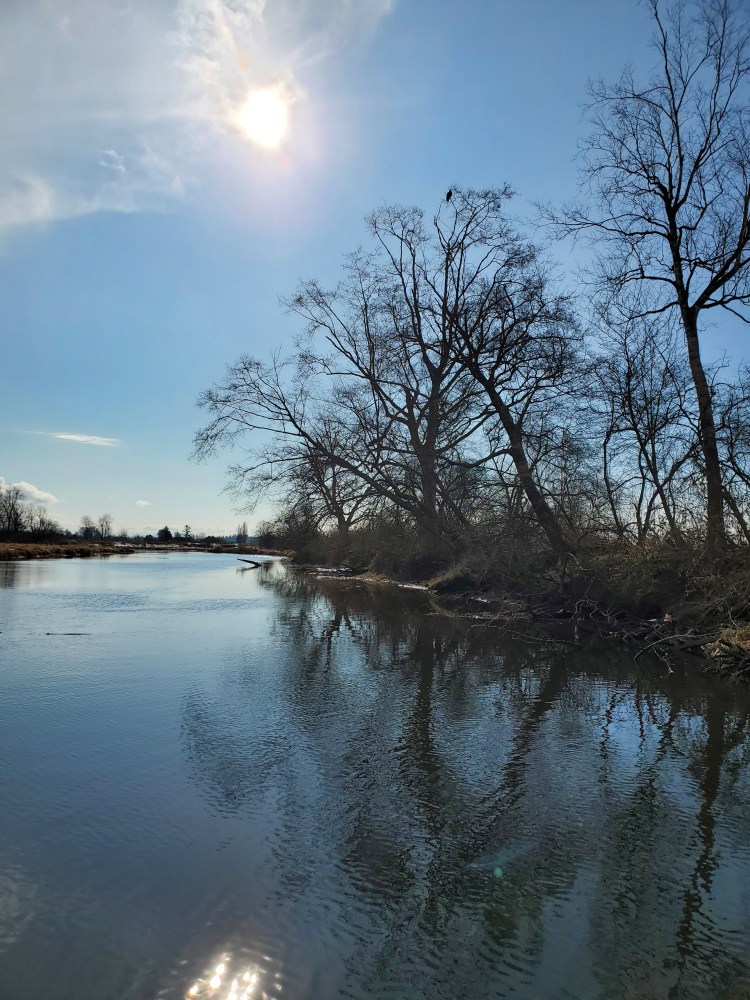
As I neared from where I first appeared the southerly skies still spoke of sunshine in the subsequent schedule.
Though the skies to the distant southwest told of more moisture in the atmosphere. But they seemed low enough to not be an eminent presentiment of precipitant.
When I arrived back at the parking lot there was a couple getting ready to set out in kayaks. We chatted briefly. They communicated that they were newer to kayaking after converting from canoeing. The Alouette River seemed to be close by for them and was their new curious exploration. They were planning to paddle up the North Alouette River and explained that you could go quite far when I queried how far upriver the waters were navigable. Perhaps an adventure for a future date with more time to spare. I wished them well as a rushed to pack up my kit and make my rendezvous time. I arrived right at 1130 hours, just as planned.
Final Thoughts
For a relatively impromptu paddle, the Alouette River was a pleasant surprise. It was a cleaner and more scenic route than my most recent adventure on the Nicomekl River. There was more traffic compared to my Nicomekl adventures, both pedestrian and aquatic, a testament to the true beauty of the area. Despite this, it still felt secluded and I would imagine the North Alouette River only more so for both beauty and solitude. I plan to revisit the river(s) with more time to do a proper exploration.
Happy paddling people.

Thanks for the shoutout, and nice paddle report as usual! I’d be down to join you on your Pitt River paddle/Alouette Lake circumnavigation, or Pitt Lake exploration if you wouldn’t mind a slower (but competent I promise!) paddler 🙂
LikeLike
Thanks for the post! Yeah I’m keen to do a pub run in better weather from Grant Narrows down the Pitt River. Send me an email and let’s look to connect for that or Alouette Lake. I want to circumnavigate Pitt Lake too at some point.
LikeLike