Sunday, January 17, 12021 HE
The forecast for the weekend looked like there would be a bit of onshore wind in Burrard Inlet. I sent some feelers out to my paddling chat group, which is now on Signal. Previously our group was on WhatsApp. I am super stoked on Signal as I am not a fan of giving up my data to Facebook. But I was already committed to WhatsApp when Facebook purchased them in 2014 that I stuck with it despite my reservations. Here is a BBC article on the migration of users between the rival apps that is occurring.
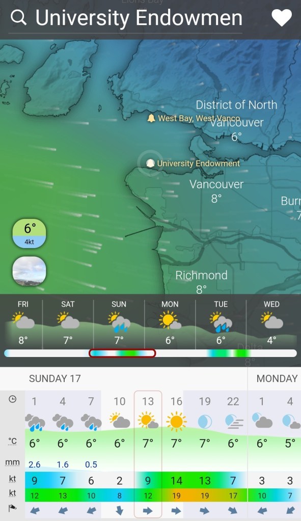
Below is the forecast leading into the weekend a few days beforehand. Sunday looks promising with a westerly wind for a west to east paddle around Spanish Banks.
Trevor was interested. I looked into a few possibilities and somewhere in the process came up with the idea of paddling from Fraser River Park to Spanish Banks. Trevor was intrigued. He was able to get the necessary time commitment greenlight and after his managerial approval, I was able to obtain mine shortly thereafter.
We planned to leave in the afternoon and take advantage of the westerly winds to get some downwinding after we made it around Point Grey. The trouble is that we would be battling a headwind down the North Arm of the Fraser River. I hoped that we could catch the tail end of the ebbing current and then link that to the westerly winds around Point Grey. I was a bit too hopeful.
Below is the swell forecast from Windy.com for 1300.

With a departure from Fraser River Park around 1430, we hoped that the swell would be behind us by the time we rounded the point. Below is the swell forecast from Windy for 1600.

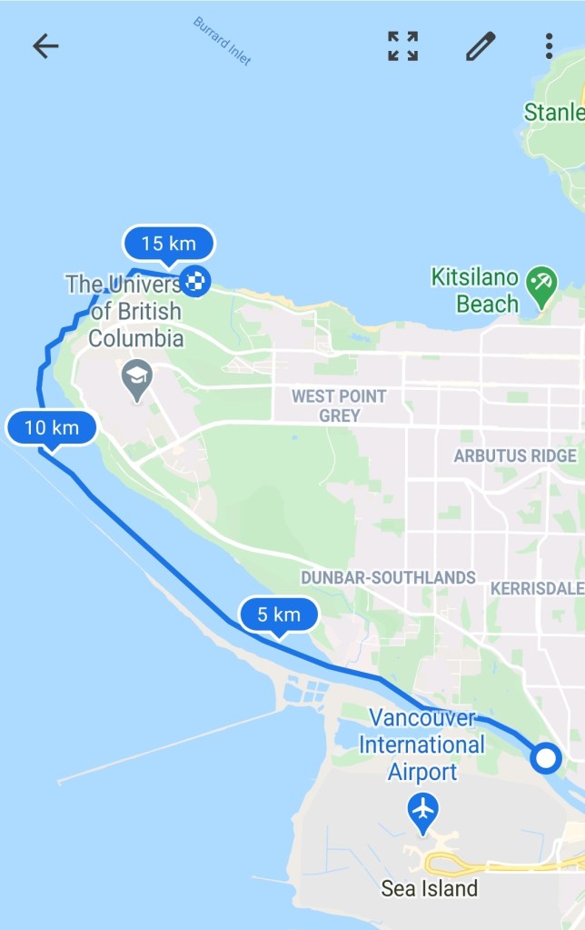
Our Paddle Plan
DATE: Sunday Jan. 17, 2021
ROUTE: Fraser River Park to Spanish Banks Off Leash (one-way trip)
EST. DEP.: 1415
EST. ARR.: 1615
Details:
Sunset
- 1645
Tides (Vancouver)
- 0841 High 4.9 m
- 1440 Low 3.1 m
- 1909 High 3.9 m
Current (Steveston)
- 1230 Ebb -0.6 kt
- 1530 Slack
- 1806 Flood 0.5 kt
Wind
- Windy.com
- Westerly (WNW) 8-11 kt (11-15 kt wind gusts)
Paddle Distance ~15 km
Paddle Time ~1.75-2 hrs
Drive times:
- Vancouver to Spanish Banks: 30 min
- Spanish Banks to Fraser River Park: 25 min
Personal Info
- TRAVELLERS: 2 (Mon Jef Peeters, Trevor Mazurek)
- VEHICLE: [Colour][Year][Make][Model][License Plate]
- PHONE: [xxx-xxx-xxxx]
Itemized Itinerary
- 1315 🚗 Departure
- 1345 🚗 Arrival Spanish Banks 🚗 Drop
- 1400 🚗 Departure 🚗 Drop
- 1425 🚗 Arrival Fraser River Park
- 1440 🛶 Departure Fraser River Park
- 1625 (1640) 🛶 Arrival Spanish Banks
- 1640 (1655) 🚗 Departure Spanish Banks
- 1705 (1720) 🚗 Arrival Fraser River Park 2
- 1715 (1730) 🚗 Departure Fraser River Park
- 1745 (1800) 🚗 Arrival Home
We planned to do a one-way voyage so we met at the Spanish Banks Off Leash Dog Area parking lot to drop off our dry-gear post-paddle car. Then it was off to Fraser River Park. Trevor had the astute eye to notice that the parking lot at Fraser River Park has a two-hour time limit so we parked on the street. We did not want to have a parking issue like our last paddle in Boundary Bay.

There were plenty of people out walking along the riverbanks. This is a lovely pandemic past-time that I hope will remain. Though I am still slightly curious as to what these people were doing pre-pandemic in their leisure time.
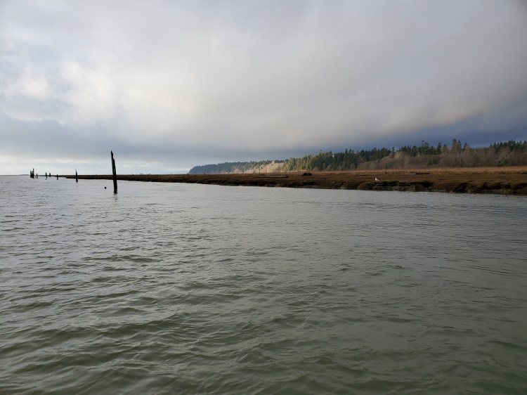
Initially, the headwind was strong and the ebbing current felt non-existent. It was not until we passed by a log-boom that we could feel the current pulling us along. But that feeling was short-lived and the headwind proved to be the stronger of the two forces.
As we passed McDonald Beach Park the sun started to break through the altocumulus clouds. It was a nice saving grace to what was going to be an initial long upwind slog.

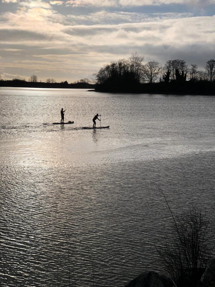
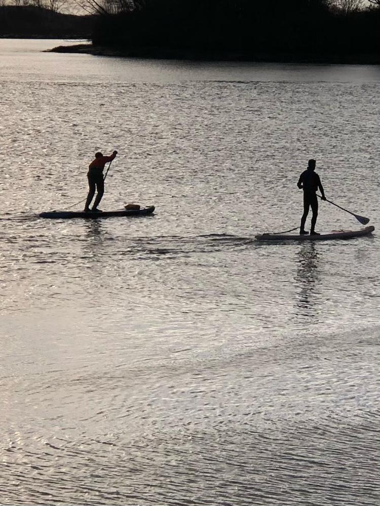
It turns out that we were spotted from the riverbank. My friend and colleague, Behnad, was one of those people out enjoying the beauty along the embankment and after hearing my (loud) voice took a few pictures. Trevor and I had no idea until he shared them with us two days later.
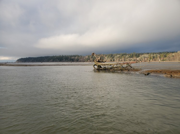
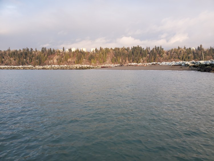
The view more northerly over the floodplain near the Musqueam First Nation Reserve was a little more somber but still beautifully sunlit.

As we pushed on through I hoped that my interpretation of the forecast for Burrard Inlet was going to be better than the Fraser River. The half a knot of ebbing current I had hoped to ride was all slack at this point. All we could feel was the headwind. And the thought that kept running through my head was that maybe we should have done the paddle in the reverse direction.
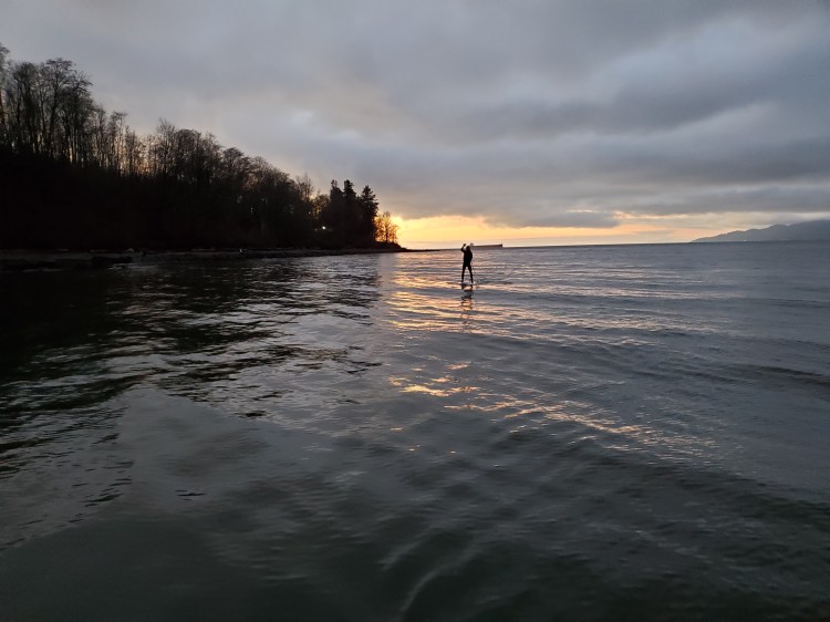
We knew that we would be pushing daylight and possibly entering the twilight at the end of our paddle so we had packed lights. With the headwind, it felt like it was going to be a race against the sunset to get to Spanish Banks in time as the sun began to lower to our port side.
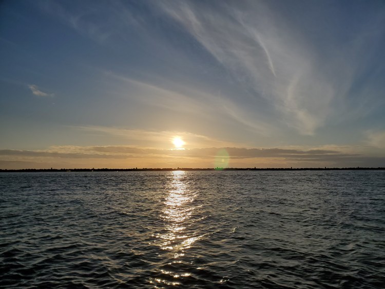
Not quite there yet, but we can see the end of the Fraser and the jetty from Wreck Beach to Secret Beach in the distance. The sun was out and it was gorgeous. And the hope for a little surf at the end of the paddle was a great motivator at this point in our trip.
As we passed Secret Beach and changed course towards the north the conditions were looking more and more promising for some light surf/downwinding.
We were passed by the Canadian Coast Guard Hovercraft. I had just put my phone away and was going to skip taking a video but I figured my boys would love to see the hovercraft. Too bad it was so far off in the distance.
But first, we had to get through the crosswind and swell.
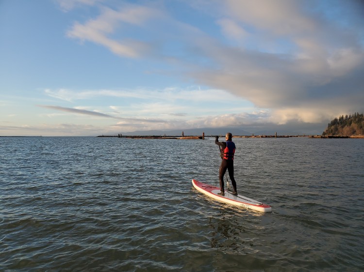
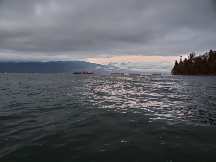
Thankfully, as we rounded the point we did get into a bit of the swell. We ended up SUP surfing into shore before tacking out to zigzag around the point to Spanish Banks. Check out the end of our paddle route here. And below is a picture of some of the majestic North Shore Mountains, albeit slightly obscured by the cloud cover.
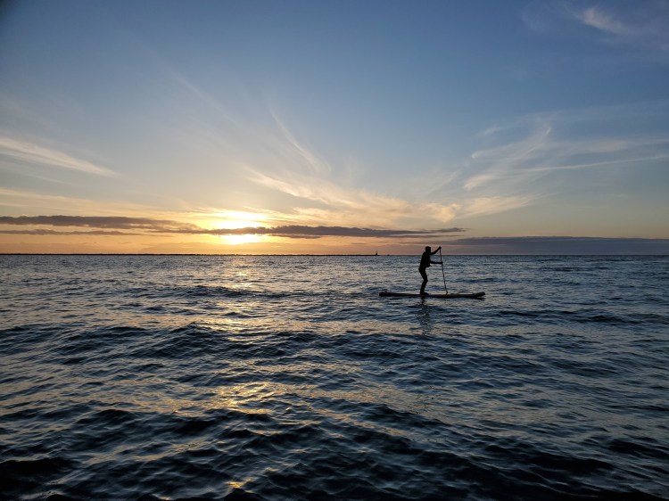
As we approached our exit point the swell died down and it was quite calm. We arrived just as twilight was setting in.
Our Route