Monday, January 11, 12021 HE
There is a storm approaching and the wind was looking like it may work out for a downwind paddle in Boundary Bay. The winds were southeasterly so I planned to cross from Kwomais Point through Mud Bay to Delta. This is essentially the reverse direction that Trevor and I paddled through Boundary Bay on December 20th.
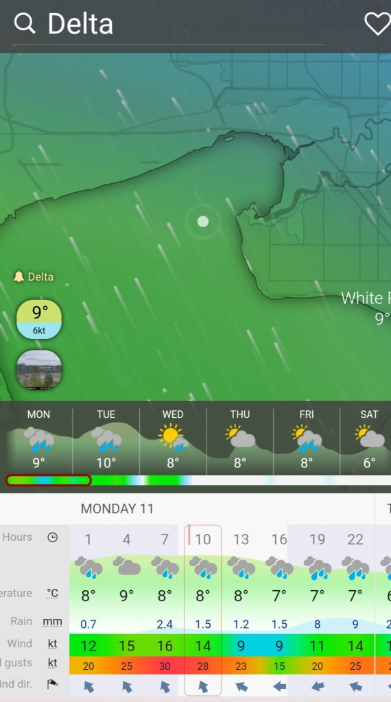
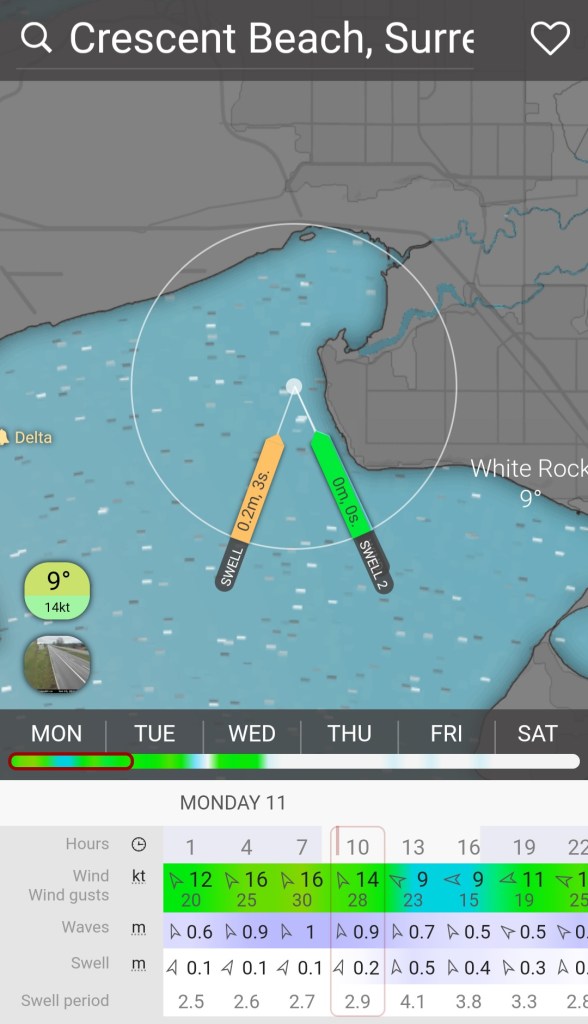
Below are the forecasts for the wind and waves from Windy.com. Not perfect, but enough to have me wanting to test out the adventure!
The problem was that I did not have a paddling partner which makes downwinding challenging to say the least. Given that I thought the wind conditions would be good but not too intense I decided to look into some solo-paddling options. My dad was car-less as he had loaned his vehicle to my brother to help with kid drop-offs and pick-ups. Fortunately, my father-in-law was free and willing. After sending him my paddle plan we solidified the details for our rendezvous pick-up in the morning.
My Paddle Plan
DATE: Monday, Jan. 11, 2021
ROUTE: Boundary Bay: Kwomais Point to Dyke Trail @ 96th Street Delta (one-way trip)
EST. DEP.: 0800
EST. ARR.: 0900
Details:
Tides (White Rock)
•0529 High 4.1 m
•0950 Low 3.6 m
•1421 High 4.1m
Current (White Rock)
•0752 Ebb -0.6 kt
•1223 Slack
Wind
•Forecast: see Windy App
•South-Southeasterly (SSE) 14-20 kt (20-33 kt wind gusts)
Sunrise
•0800
Sunset
•1638
Paddleboard Carry ~200 m
Paddle Distance ~8 km
Paddle Time ~1.25-1.5 hrs
Drive time:
•Vancouver to Kwomais Point Park: ~45 min
•Vancouver to 96th Street (BB Dyke): 32 min
•96th Street to Kwomais Point: 26 min
Personal Info
•TRAVELLERS: 1 (Mon Jef Peeters)
•VEHICLE: [Colour][Year][Make][Model][License Plate]
•PHONE: [xxx-xxx-xxxx]
Itemized Itinerary
•0930 🚗 Departure
•1015 🚗 Arrival at 🛶 Departure
•1045 🛶 Departure from Kwomais Point
•1200 (1215) 🛶 Arrival at 96th St.
•1245 (1300) 🚗 Departure from 96th St.
•1310 (1325) 🚗 Arrival at Kwomais Point (2)
•1325 (1340) 🚗 Departure from Kwomais Point (2)
•1410 (1425) 🚗 Arrival at Home
Enter the coronavirus conundrum. Is it a violation of the current pandemic restrictions to engage in such behaviours? I came down on the side of “no” given that I elected to do the paddle. My justification was that we took precautions (masks, ventilation, and non-symptomatic) to mitigate risks. My personal view on the pandemic is that we should do as much as possible to reasonably limit the spread of the disease. The potential for undue spread to lead to a more virulent and deadly virus mutation is my ultimate rationale as to why this is necessary. Every person infected amounts to millions of replications of the virus, each with the potential to create a mutant strain (albeit the potential is low given that the virus is reported to have high replication fidelity). Obviously, trying to limit death and disease are worthy, more proximal goals, too. But we cannot limit all the risks of disease (nor death) in life. Considering the risk at hand, I felt I was able to make a calculated assessment that was relatively low for us both.
From some internet searches, it seemed I could access the water from Kwomais Point. I found a photo that was taken from the tracks near the water at Kwomais Point on Google Maps which I presumed meant that the water was accessible from the park. More on this later. The other two options that I had considered were 1001 Steps and Crescent Beach as launch sites. But I hoped to have a longer paddle route, so the extra two kilometers that launching from Kwomais Point afforded was too enticing.
My wife needed our vehicle which meant that I would need to rent an Evo Car Share. Such a great service, I was able to reserve one within a block of my house.
I arrived at Kwomais Point Park and while setting up my kit in the parking lot I was approached by a man who asked me if I was planning to paddle and if so where. Lucky for me he was an avid paddler himself and informed me that there was no way to access the water that he knew of from Kwomais Point. He suggested Crescent Beach as an alternative. When I asked about 1001 Steps he said it was an option but that it was currently closed with the fence gate locked and that the stairs would be prohibitively difficult.
I listened to what he said but then respectfully explained that I was still going to have a look around Kwomais Point. The upside was that left my paddleboard behind for some light recon rather than pack it along.
A little way into the park I ran into a woman walking her dog and decided to ask about access to the water. She had the same opinion that there was no easy way down to the water and that 1001 Steps would be the closest option if it was open. And that otherwise Crescent Beach was the best option.
I semi-deflated my board, packed it into the Evo, and then was off to Crescent Beach. At the same time, I called my father-in-law to update him on the change in plans. Though I figured my ETA would remain the same after the delayed departure yet shorter route.
As a note to self (and others), in the future not only will I look at the satellite view in Google Maps, a lesson learned from a previous paddle, but also the terrain view.
I managed to get a parking spot close to the water despite all the construction and workers’ vehicles in the Crescent Beach area. From the shoreline, the wind looked a lot less than forecasted. I was going to need to motor as my deadline for getting home was 1430 hours.
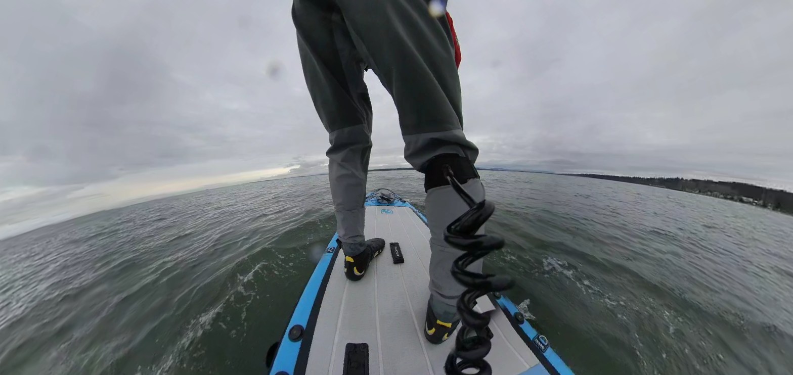
I still had the Insta360 One X camera on loan. This time I went with a different setup from my previous MacGyver PFD design. I had an extra 3/8 inch bolt that I used to attach the camera via the selfie stick to my board. Unfortunately, the only 3/8 inch bolt holes on the deck were right behind me. They are normally for a fishing rack attachment. It does not make for the most elegant shot, especially while I am fumbling for my leash, but it does give a different vantage point on the water (with the camera setup I was not able to mount my board the way I normally would, hence the bumbling leash setup video below). Depending on your software/viewing device you should be able to toggle the view of the camera in case you want to look at the terrestrial surroundings rather than my derrière.
There was not much wind but as I left the shoreline there was a bit of swell to help move me along.
I paddled northward following the waves but knew that I would need to veer westward at some point.
I came across one boat that came from the direction of the Crescent Beach Marina but then did a U-turn to head back. Maybe they forgot something? They gave me a bit of wake to contend with.
The wind was more easterly than forecast so I ended up dealing with a cross swell coming from the east rather than the west. Though in hindsight this was likely just the tail end of the forecasted ebbing current. The crosswind/current along with the lighter tailwind made me worry that I was going to be too slow and late.
On my drive out to Kwomais Point I heard some Tragically Hip on the radio so I thought it was fitting to include it for the video below.
I also heard this track by James Arthur on my drive out and it caught my ear. Not totally fitting for the paddle but a great track nonetheless.
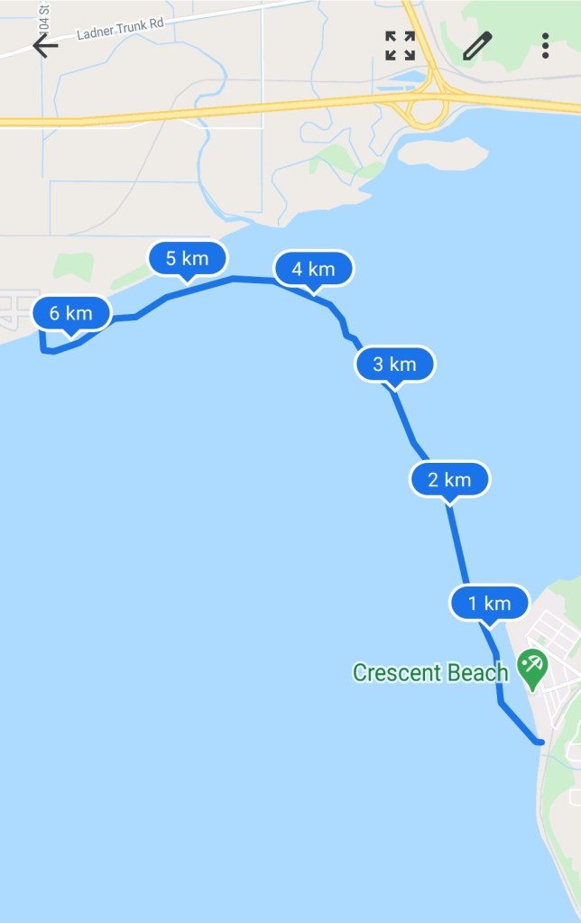
Despite knowing that I needed to be heading west I still managed to be way off the mark by the time I approached the northern end of the bay (unfortunately this seems to be a trend for me in Boundary Bay). I knew I was off the mark I just did not know how far. Slightly confused and unable to find a familiar landmark I checked my GPS coordinates. In my defence part of the reason I was off-course was that I was following the waves rather than aiming for a true bearing. In any case, I was way too far east compared to my destination/rendezvous point of 96th Street. I was not even in line with the Delta Heritage Airpark at this point. Check out my route below to see the drastic arc of direction change over the last two kilometers.
I was now in water just slightly deeper than my paddle blade with minimal wind to push me along and the tide only pushing me inland. I decided it would be best to call my father-in-law and see if he could meet me further east. He thankfully obliged.
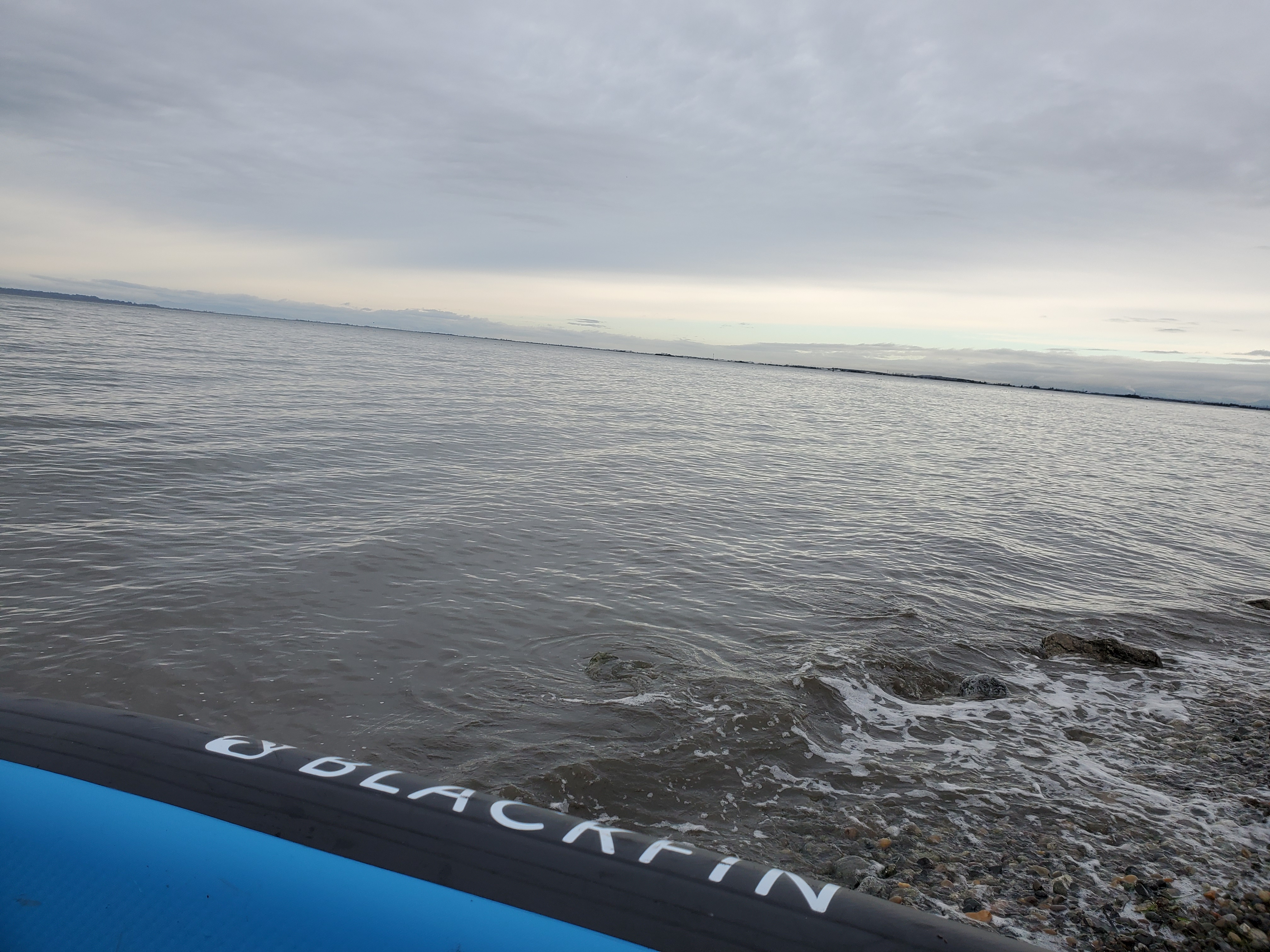
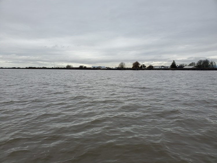
We changed our rendezvous point to the Delta Heritage Airpark. The photo below is the view from the water.
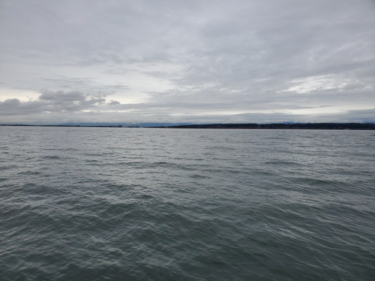
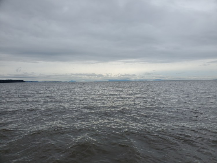
And below is the view back out over the Boundary Bay towards the Semiahmoo Bay and the Strait of Georgia with Kwomais Point on the left in the foreground and Birch Point in the left background.
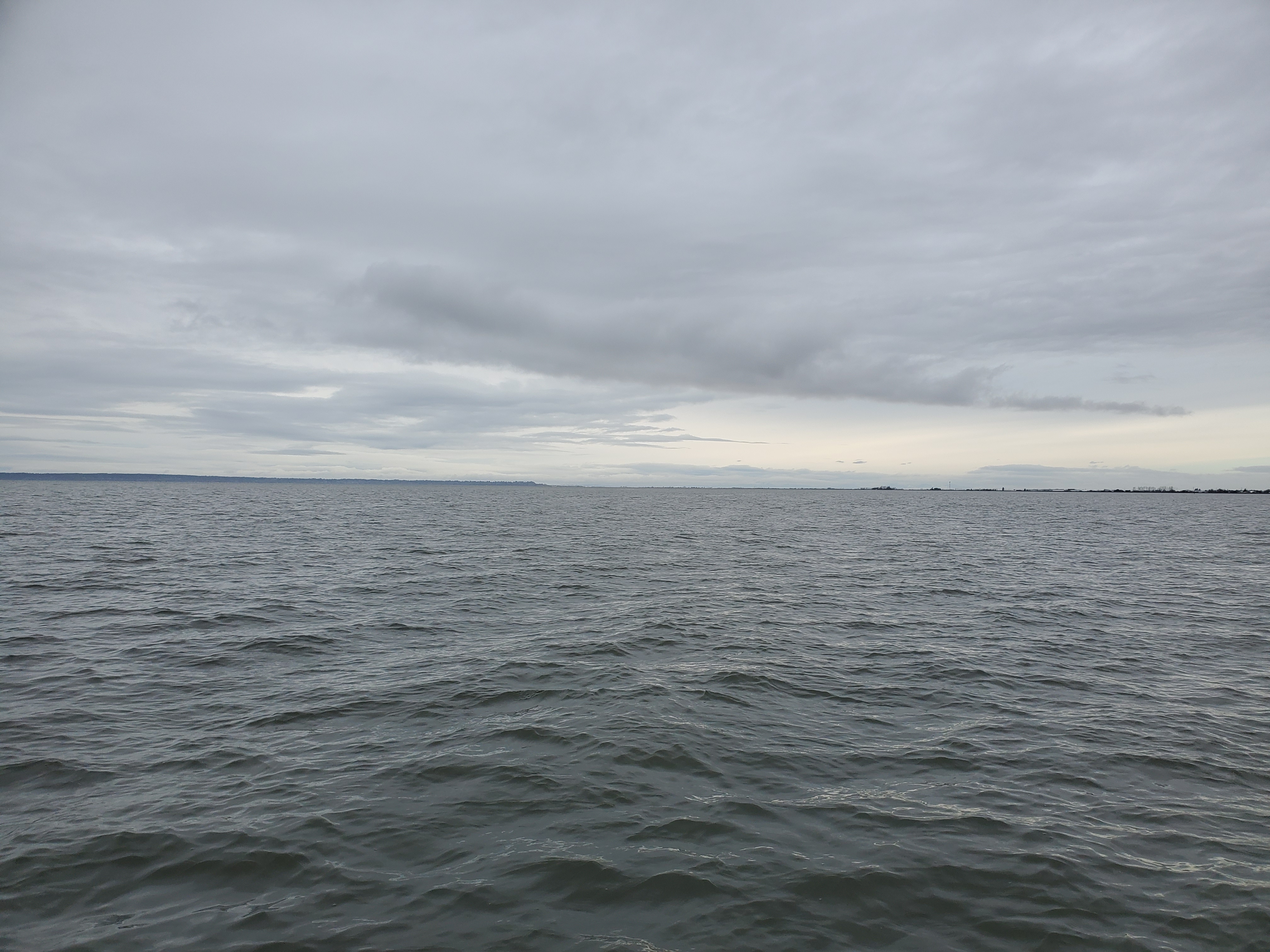
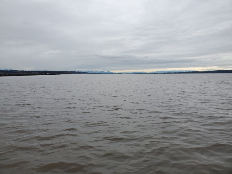
And the view east towards the Cascade Mountain range. The photo does not do the true beauty justice.
I was able to find a rocky spot on the shore to dock. I was happy to avoid another mud bay docking experience and it was relatively free of seagrass.
All in all, it was a fun adventure. Next time though I need to plan my launch site better and get the right forecast.
I made it home in time. When I arrived my wife’s Peloton bike had arrived but with the pandemic, the installers would only assemble the bike outside. We were on our own to bring it up to our second floor. A nice lift to finish my paddle with. But hey, no complaints here, I am very fortunate to get the opportunities to paddle. It is not the most time-efficient activity.
My Route

Extremely curious how long the actual paddle time was to cross the bay. Can you let me know?
Also, would you ever do it again?
LikeLike
The paddle was just under 1h15m.
I would do it again if the conditions were right. Preferably I wanted stronger winds. And then you do need to make sure the tide is high or you’ll have a muddy landing.
LikeLike
Have you, or have you heard anybody, tried to paddle from Muddy Bay to Serpentine river?
LikeLike
I haven’t, but imagine you could. You definitely would want a high tide or to do in the spring or early summer. My experience on the Serpentine was it was shallow in areas, but that was in September. Mud Bay lives up to its name at low tide, too!
LikeLike
This is my experience with the Serpentine River Circuit – https://isupexplore.ca/2020/09/13/serpentine-river-circuit/
LikeLike