Saturday, November 13, 12021 HE
We were in North Vancouver visiting my in-laws today. So, I was able to take advantage of being on the north shore and get on the Səl̓ilw̓ət (Burrard Inlet and Indian Arm) waters. It has been some time since I have paddled there. In the summer, I was there frequently completing the virtual Tuesday Night Race‘s (vTNR) put on by Coast Outdoors through Deep Cove Kayak. See this post for details. But as of late, I have been paddling closer to home, still in Səl̓ilw̓ət (Burrard Inlet).
I decided to recreate one of the paddle routes from the vTNR series, vTNR#6. This time, I would be able to check out the scenery at a much more comfortable and leisurely pace. Although, the weather was going to be quite different from my previous paddle through the area.
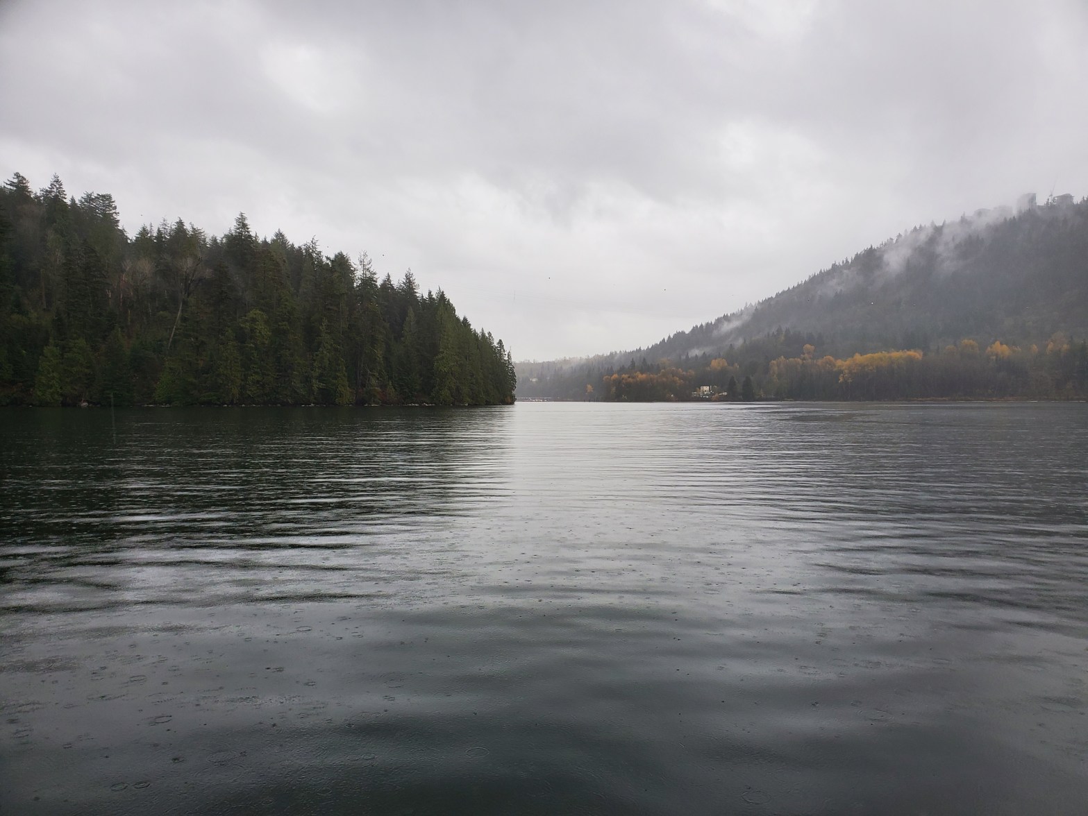
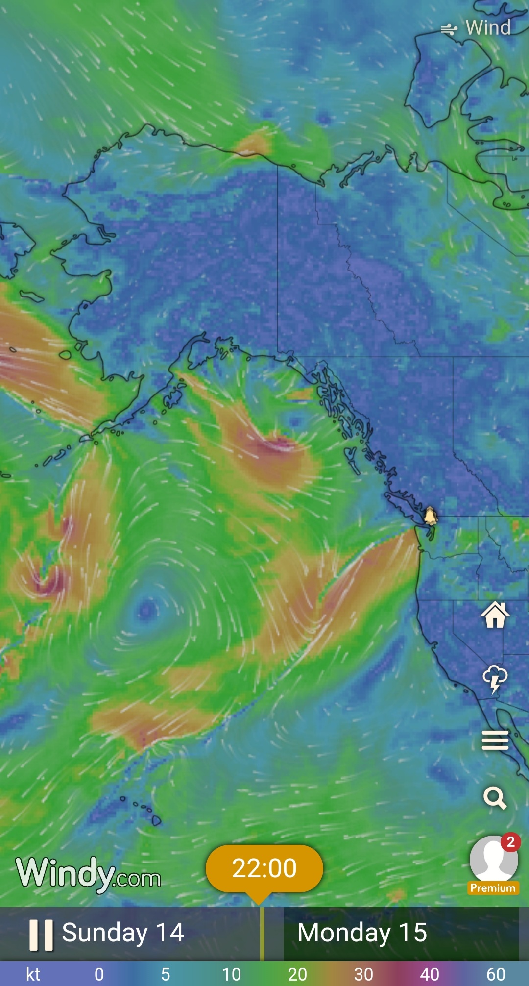
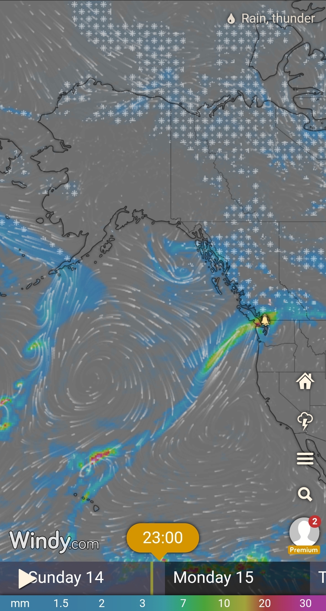
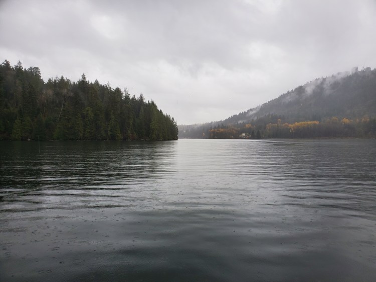
I left from what is now my regular Səl̓ilw̓ət (Indian Arm) launching point at Lowry Waterfront Park. The view across to Belcarra was ominous with socked-in skies but beautiful in that Pacific Northwest temperate rainforest perspective nonetheless. I was setting out on the front end of the arrival of another atmospheric river slated to arrive later in the evening. The atmospheric rivers are sometimes referred to as a Pineapple Express when they arise from the waters around the Hawaiian Islands. Though, this term is not to be confused with the 2008 film by the same name. The images below are from Windy.com on Sunday, and they show the line of the atmospheric river from Hawaii to Vancouver. The wind pattern is colourful image on the left and the rain is the image to the right when you scroll between the two.
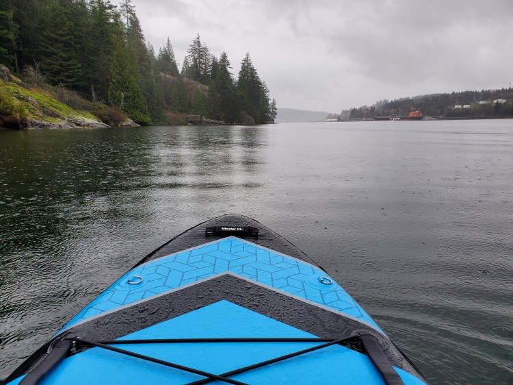
Since this wasn’t a race and there was no official starting line, there was no need to head over to Boulder Island, where the starting line for the vTNR series was. I aimed straight for Burns Point. Though, I have to admit that I confused Burns Point with Admiralty Point in my mind’s eye. The confusion was purely a nomenclature issue, as the two points are side by side and only separated by a small bay. Below is the view toward the point with the Burnaby Mountain Park area in the background on the right.
As I made my way over to Burns Point, I took advantage of the calmer waters in Səl̓ilw̓ət (Indian Arm) to work on some one-foot paddling. In my mind’s eye, I was picturing my newfound SUP crush, Yehor Tarasko, and trying to emulate his one-foot paddling prowess. The video below shows his skill at the task. Sadly, I don’t think my attempt was anywhere near a carbon copy. It is a skill that I have been trying to improve lately, after getting the idea and then being re-inspired by the SUPBoarder Challenges.
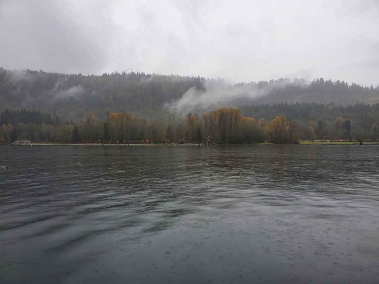
The image below is the view across the inlet toward Burnaby.
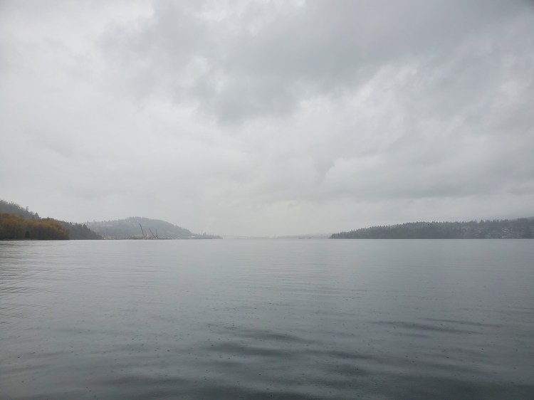
And behind me toward the west, somewhere in the fog, was the Iron Workers Memorial Bridge.
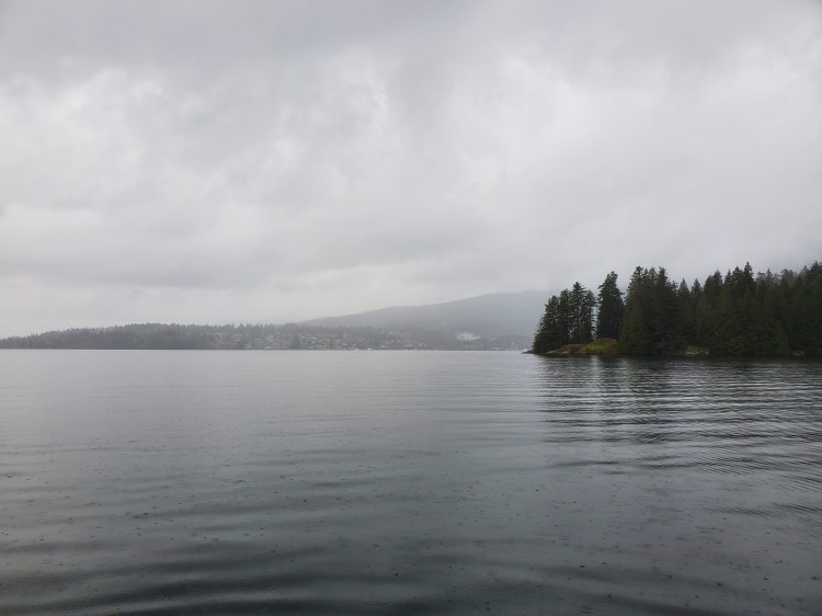
The image below is Admiralty Point on the right, viewed from near Burns Point, looking northwest toward Dollarton.
The rain was light crossing Səl̓ilw̓ət (Indian Arm), but as I rounded Burns Point, it started to pick up. I tried to get an artistic image of the pitter-patter of the rain on the surface of the water. That image is below.
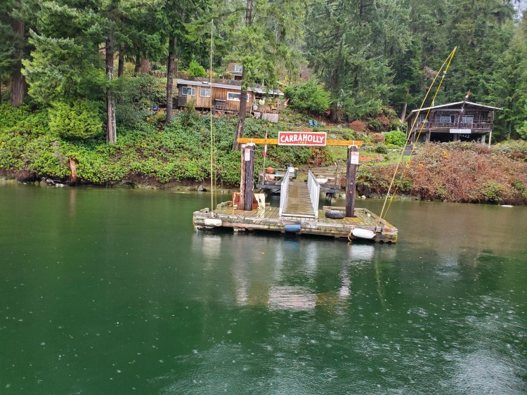
I passed by Carraholly en route to the lighthouse at Caraholly Point. The lighthouse was the turning point for the vTNR#6 route. The tide was much higher this time, and there was no need to check my speed to pay heed to the rocks below.
As I started back on my return, I took advantage of the even calmer waters and did more one-foot paddling. And finally, things began to click. I achieved a PB of 12 strokes while standing on my right foot and paddling on my right side. My left needs a bit more work with my record at eight strokes. The trick that helped me the most was abducting (or side-bending) at my hip on my stance leg so that my torso would counter the requisite weight shift to stand on one leg on a SUP. At the same time, I realized that reaching out with my other leg helped as a counter-balance.
I am curious to see how well my newfound single-leg success will translate to more active water conditions.
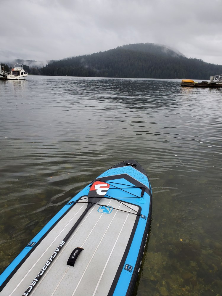
As I passed by the docks at Carraholly, I decided to take a photo. It is such an interesting spot, and I am curious about the history there. A quick internet search revealed hardly anything on the matter.
After arriving back at Lowry Waterfront Park, I worked on some pivot turns near the shoreline. In the calm water, I was able to get my nose quite high as well as complete several nose side 360° turns with my fins fully out of the water.
It was a wet paddle by the end of it, but this time it was from staying on the highside of my board, not the salty, low side.
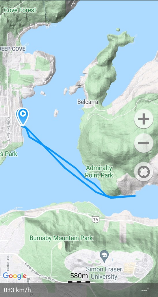
Below is the route that I took recorded with Geo Tracker.
I also came across this cool GPS application, Relive. It allows you to create a 3D video of your route. Below is a recap of the route that I took. If you are unable to view it below here is a link to the video on Relive’s site.
