Saturday, November 20, 12021 HE
This post is a long one. Feel free to gloss over the text and only peruse the images. I won’t mind.
gam·bier
https://languages.oup.com/google-dictionary-en/
/ˈɡamˌbir/
Learn to pronounce
noun
an astringent extract of a tropical Asiatic plant, used in tanning.
https://languages.oup.com/google-dictionary-en/
gam·bit
/ˈɡambət/
Learn to pronounce
noun
a device, action, or opening remark, typically one entailing a degree of risk, that is calculated to gain an advantage.
A whole lot of thought went into this one. As I wrote in my Hutt Island/Nex̱wlélex̱m (Bowen Island) Circumnavigation post, I had planned to make this trip in the spring. The weather was looking good, my kit was in order, and I had a green light from my wife. But as circumstances would have it, my plans changed from trying to paddle to Chá7elkwnech (Gambier Island, see here for pronunciation) to eventually a paddle around Nex̱wlélex̱m (Bowen Island) with an overnight stay on Little Flower Islet. It was an amazing experience, and now I was hooked on the idea of SUP touring and camping. The only problem was summertime was running out.
My friend Trevor and I attempted one last big(er) trip as the summer wound to an end. A multi-day trip up Átl’ḵa7tsem (Howe Sound) from Horseshoe Bay to Squamish and back again. Unfortunately, due to the strong anabatic outflow winds, we came up short. But we did manage to end up on Chá7elkwnech (Gambier Island) and spent the night at the Ramillies Channel Marine Recreation Site (ínaḵa Lhaxwm). With a view from the site toward the Islet View Marine Recreation Site (Lhemlhemḵwús), the seed for a future exploration was already burgeoning.
Enter the fall and the approaching dog days of winter.
Daylight was quickly evaporating, and after the time change, the evening light was almost non-existent. Trevor and I had made tentative plans to attempt to circumnavigate Chá7elkwnech (Gambier Island). He was the only one brave (or foolish) enough to entertain the idea with me. Pick your adjective. But our schedules were not in sync. And if this trip was going to happen before the winter, it was starting to seem like I may have to do it solo. Now, have to is liberal usage of the term. When it comes to pastimes, there are no needs here. Only wants. I did not need to paddle around Chá7elkwnech before the winter or ever, for that matter. But I sure did want to. And greed is a beguiling emotion.
Much has been said about the ill nature of avarice throughout human history. Think of the Greek myth of King Midas and the golden touch. King Midas’ foolishness and greed are the moral lessons within the story. So, it was not without woe that I considered my desire and the risk it could pose to me and my loved ones. In this case, my goal was to be greedy but not foolish.
As the idea of doing a solo SUP around Chá7elkwnech (Gambier Island) percolated, I started to wonder if it was too foolish. I surveyed friends. The majority thought it was crazy. Not so much the fall paddle around the island, though for many, that was crazy enough. But the solo aspect of it. What if something should go wrong? That is a fair comment. For example, if I became incapacitated, someone else there could call for help, provided we were not both incapacitated by this catastrophic event. But, at the same time, I couldn’t help but wonder that in such a remote area, if I was incapacitated to the degree that I couldn’t call for help on my own accord, how likely would that help be to me if someone else was able to call? As in, things would need to be quite dire for me not to be able to signal for help.
Now, there are scenarios in which a partner calling for help would be life-saving. But in my opinion, this comes down to the likelihood of unlikely probabilities. And in my assessment, it would be much more likely that I would not have something go catastrophically wrong that would render me incapable of calling for help on my own.
And so hedonism wins the day. And I don’t mean so much the modern interpretation of it, that tends to carry a negative connotation. Instead, I mean the historical, philosophical sense, where “pleasure (in the sense of the satisfaction of desires) is the highest good and proper aim of human life“.
I decided that the likelihood that the pleasure I would experience on this trip outweighed the unlikelihood that I, or my loved ones, would experience extreme duress. That was my gambit.
So with the acknowledgment of the risk established, I set out to plan accordingly to manage my risk. Had other people completed this trip? If so, when? What time of year and under what conditions? What would be the water temperature? The ambient temperature? How much daylight would I have? How far would I need to travel? Were there any backup sites that I could stop at if I was to run into bad weather or run the risk of running out of daylight? And how could I control as many of these variables as possible?
Initially, I had wanted to do a two-night trip. But after discussing it with my wife, Annie, we agreed that a one-night trip would be the safer option.
I was comfortable with the paddling portion. The uncomfortable aspects for me were how cold it would be and whether I would have enough daylight?
To minimize the immediate risks, I planned a float plan. I would wear my non-inflatable PFD while on the water at all times. When I am close to shore or in more populated areas, I will wear a waist-bag style Inflatable PFD as it is cooler, lighter, and more comfortable. I would wear my leash too, which I always do when SUPing. Your board is your best floatation device, but it does you no good if you are separated from it. I would also wear my semi-drysuit in case I fell in or there was a lot of rain. That would keep me dry and warm in either case. I would bring various forms of communication since cellphone reception in the area is spotty at best (Telus cellphone reception area). So along with my cellphone, I would pack my VHF radio and my Garmin inReach Mini satellite communicator.
Other pieces of safety equipment that I would pack were lights and extra battery and charge sources, my VSSL First Aid kit, extra warm clothes, a sleeping shelter, and fire-starting equipment.
After surveying the weather patterns, I decided that doing a clockwise path around Chá7elkwnech (Gambier Island) would likely be best. I would depart from Horseshoe Bay and make my way toward Halkett Point before heading westward toward the Grace Islands. I hoped there would be a northwesterly wind to help me along and minimal northerly wind coming down Thornbrough Channel. Though if the weather on the day was different, I was open to the possibility of doing the route counter-clockwise. My other hope was that after the record-breaking rainfall we had experienced the weekend before, the taps would be dry for my trip. I also considered the strain on the province in terms of emergency relief workers post-flooding. I did not want to be an additional burden to any emergency rescue services. As such, I was confident in my ability to complete this paddle and only saw a minimal possibility of needing a rescue. Along the same odds of any freak accident.
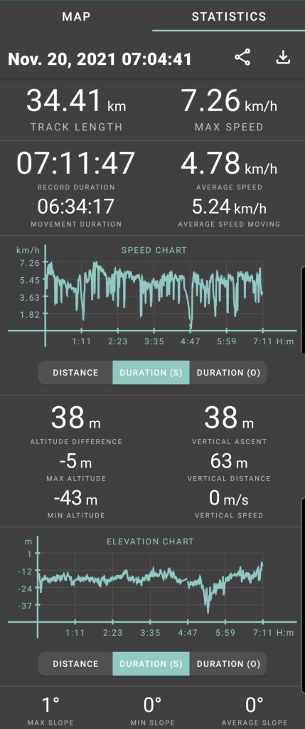
Below is the float plan that I created. It was both a safety tool from the standpoint of should something go wrong, then my general whereabouts would be known. And, it was an exercise in planning for me to know how much distance I would need to cover and how much time I needed. According to timeanddate, I would have just under nine hours of daylight (8 hours and 53 minutes). My goal was to make it to the txwnaḿ Chá7elkwnech (Thornbrough Channel) marine recreation site. But if I ran out of time, my default would be the Smenmántm Ḵ’í ḵp’ikw (Bain Creek) site, which was approximately four to five kilometres closer. That is why there are duplicate times in the itinerary below.
SUP FLOAT PLAN: Horseshoe Bay to Gambier Island (Round-trip)
DATE: Saturday, November 20, 2021, to Sunday, November 21, 2021
ROUTE: Horseshoe Bay to Gambier Island
VESSEL: Teal Blackfin Model XL iSUP
Day 1
EST. DEP. From Horseshoe Bay: 07:00
EST. ARR. @ : 14:30 (15:15)
Day 2
EST. DEP. From Bain Creek (or Thornborough Point): 07:30
EST. ARR. @ Horseshoe Bay: 14:20
Details:
Tides (Gibsons)
November 20
•07:08 High 4.7 m
•12:15 Low 3.6 m
•16:41 High 4.2 m
November 21
•00:04 Low 0.8 m
•07:48 High 4.7 m
•13:01 Low 3.7 m
•17:03 High 4.1 m
Wind
•Forecast: see Windy App for up-to-date
November 20
Morning (Horseshoe Bay)
•Easterly (E, ESE) 1-3 kt (6-8 kt wind gusts)
Afternoon (Howe Sound south of Gambier Island)
•Northeasterly/Southwesterly (NE, SW) 0-1 kt (10 kt wind gusts)
Evening (Thornbrough Channel)
•Northeasterly(NE) 0-1 kt (9 kt wind gusts)
Temperature
November 20
•Low 1°C
•High 3°C
November 21
•Low 3°C
•High 5°C
Water Temperature
•~9°C
Daylight (Nov. 20): 07:31 – 16:24
Civil Twilight: 06:55 – 07:31, 16:24 – 17:00
Nautical Twilight: 06:16 – 06:55, 17:00 – 17:39
Paddle Distance: ~63-72 km
Paddle Time: ~12-15 hrs
Personal Info
TRAVELLERS: 1 (Mon Jef Peeters)
VEHICLE: n/a
PHONE: xxx-xxx-xxxx
Distances (approx. from Horseshoe Bay)
•Finisterre 6 km
•Hope Point 11 km
•Grace Is. 16 km
•New Brighton 19 km
•Woodridge Is. 27 km
•Bain Creek 32 km
•Thornborough Point 36 km
•Christie Islet 43 km
•Pam Rocks 45 km
•Horseshoe Bay round-trip 60 km
Itemized Itinerary
November 20, 2021 (Day 1)
05:50 🚗 ↗️ Home
06:00 👥 ↔️ 🚗
06:05 🚗 ↗️ Beach Tower
06:30 🚗 ↘️ Horseshoe Bay
07:00 🏄🏽♂️ ↗️ Horseshoe Bay (6 km)
08:00 🏄🏽♂️ ↔️ Finisterre Island (5 km)
09:00 🏄🏽♂️ ↔️ Hope Point (5 km)
10:00 🏄🏽♂️ ↔️ Grace Island (2.5 km)
10:30 🏄🏽♂️ ↔️ New Brighton (4 km)
11:15 🏄🏽♂️ ↘️ Andys Bay
11:20 🥘 ⏸ Andys Bay
12:30 🏄🏽♂️ ↗️ Andys Bay (3 km)
13:15 🏄🏽♂️ ↔️ Woolridge Island ((7) or 12 km)
(14:30) 15:15 🏄🏽♂️ ↘️ (Bain Creek) or Thornborough Point
(14:45) 15:30 ⛺ ⏸ (Bain Creek) or Thornborough Point
17:00 🥘 ⏸ (Bain Creek) or Thornborough Point
(~32.5 or 37.5 km)
November 21, 2021 (Day 2)
07:30 🏄🏽♂️ ↗️ (Bain Creek) or Thornborough Point ((9) or 6 km)
(09:00) 08:30 🏄🏽♂️ ↔️ Ramillies Channel (9 km)
(10:30) 10:00 🏄🏽♂️ ↔️ Christie Islet (1 km)
(10:45) 10:15 🏄🏽♂️ ↔️ Pam Rocks (9 km)
(12:15) 11:45 🏄🏽♂️ ↘️ Cates Bay
(12:20) 11:50 🥘 ⏸ Cates Bay
(13:20) 12:50 🏄🏽♂️ ↗️ Cates Bay (6 km)
(14:20) 13:50 🏄🏽♂️ ↘️ Horseshoe Bay
(14:40) 14:10 👥 ↔️ Horseshoe Bay
(14:50) 14:20 🚗 ↗️ Horseshoe Bay
(15:35) 15:05 🚗 ↘️ Home
(~34 or ~31 km)
With a general paddle plan in place, the only other major detail remaining was how to get to my launch site. In my original three-day, two-night trip, I would have left from Spanish Banks. This way would allow me to use an Evo Car and leave our single-family car for my family. But Horseshoe Bay is outside of the Evo home area. And I didn’t want to be renting a car that I wasn’t really using. I had tried to ask my dad, but he wasn’t keen on me doing the solo trip, and my brother had already asked to borrow his vehicle for the weekend to help with shuttling his children to multiple sporting events. Public transit was an option, but I wasn’t super keen on the logistics of carting all my gear over a multi-bus route from Vancouver to West Vancouver.
Thankfully, while discussing weekend plans, my friend and work colleague, Sara, offered to give me a ride! Not wanting to put her out, I emphasized that it would be an early morning event. She didn’t balk, stating that she enjoyed early mornings. I wasn’t going to argue and was grateful for the offer.
I asked my father-in-law, Michael, to help with a pick-up on Sunday. Which he kindly obliged, asking quote, “Any idea what time the remains of your freezing carcass will show up…???!!!”. He’s British if it wasn’t evident from the humour.
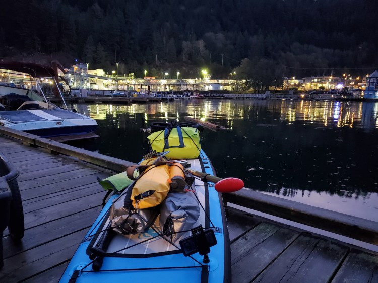
I packed up my gear Friday night after getting our kids to sleep. It was helpful that this wasn’t my first time. I have packed for an overnight SUP trip a few times now, and I have a checklist of packing items. You can see it here. The image below is my gear ready to go, with the exclusion of my board, paddle, spare paddle, PFD, semi-drysuit, booties, and waist-pack. But it still gives you a sense of what needed to get onto my board.

As expected, I was up early in anticipation of my departure. After reserving an Evo and loading up my gear, I was off to rendezvous with Sara. Then off to Horseshoe Bay. The morning air was brisk under cloud cover, but the weather looked dry for the day.
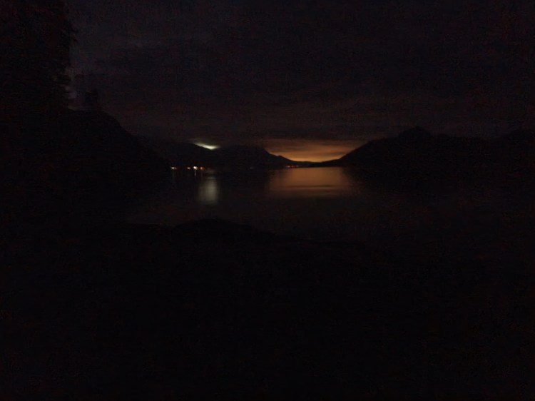
Once at the Horseshoe Bay Public Dock, I was surprised, to a degree, at how dark it was. Though I always am this time of year in the morning. But I planned to be on the water just before sunrise during the civil twilight, equipped with a headlamp for safety and legality.
With my kit in order, I bid farewell to Sara. I did my last-minute checks before setting out on the water. It was 07:05.
Here is a timelapse video of the launching conditions and my paddle out of the bay toward Tyee Point.
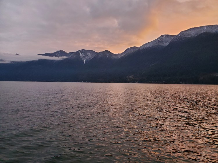
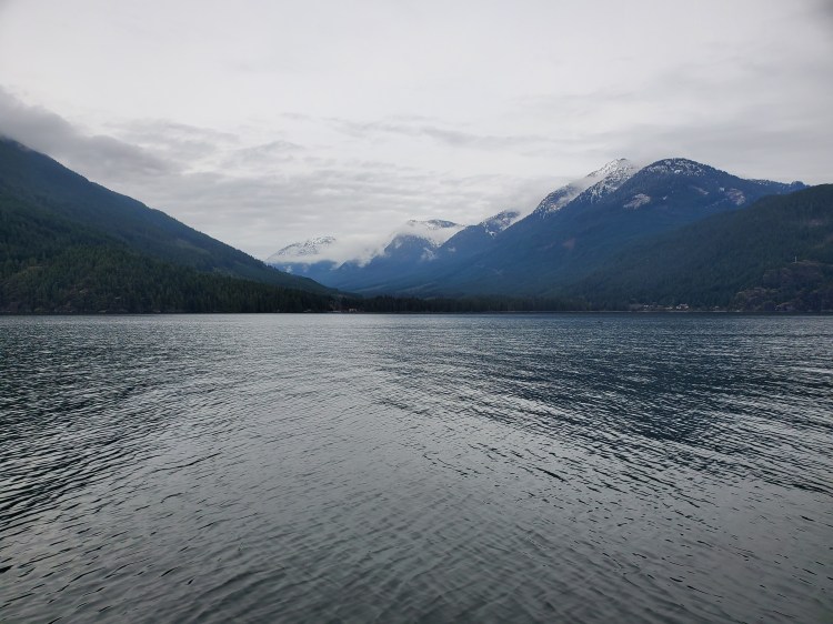
The water was relatively flat. When I reached Tyee Point, there was an open window to cross the ferry lanes. I picked up my paddling pace to make it into the gap between the ferry routes, aiming toward Finisterre Island. In the image below, Nex̱wlélex̱m (Bowen Island) is leftmost, with Finisterre Island at the rightmost tip. Chá7elkwnech (Gambier Island) is behind that, with Lhaxwm (Anvil Island, see here for pronunciation) to the right and Lhákw’tich (Bowyer Island, see here for pronunciation) is leftmost in the image. The mountain peak in the background is Mount Wrottesley on the Sunshine Coast. I eyed the gap between Chá7elkwnech (Gambier Island) and Lhaxwm (Anvil Island) on the Sunshine Coast, as that was my target destination for the day after I paddled around most of Chá7elkwnech first.

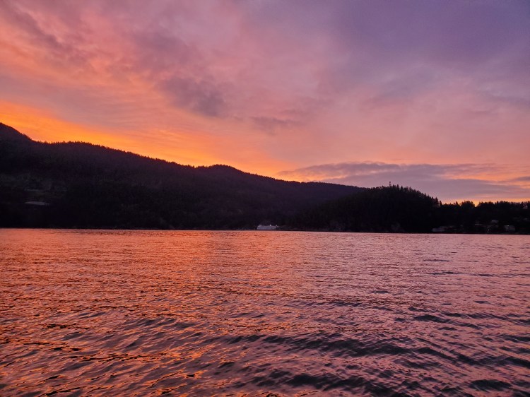
The sunrise gave way to some gorgeous colours in the eastward morning sky. It’s not called Beautiful British Columbia for nothing!


As I approached Finisterre Island, it appeared that the morning high tide was enough to have the tombolo submerged. Every other time that I have been to Finisterre Island, the tombolo has been above water. I wondered if I would be able to pass between the islands. There was only one way to find out.

I made my way into Cates Bay and was pleasantly relieved to find that the water was just deep enough to pass. I cautiously paddle through the channel into Montevista Bay.

As I emerged from Montevista Bay, there was a light northwesterly wind. I could stick to my plan of doing the route around Chá7elkwnech (Gambier Island) clockwise. In the distance, I could see the Langdale ferry, so I started to make my way out toward Halkett Point.
I wondered whether I should go directly north across to Halkett Point or start to hedge my way northwest toward Hope Point. For a true circumnavigation of Chá7elkwnech (Gambier Island), then I needed to head north. But, with lack of daylight looming in the back of my mind, I decided to go with the latter option. I wouldn’t get full credits for a tight and true circumnavigation, but I would have less worry about running out of daylight. I veered northwest aiming toward Hope Point, while at the same time remaining cognizant that I still needed to clear the Langdale ferry lane for safety.
After clearing the ferry lane, I took a moment to take a 360-degree view of the sound. The video starts facing westward with the Langdale ferry visible. I then turn to the right to see Chá7elkwnech (Gambier Island) with a good view of Halkett Point. You can see the tip of Lhaxwm (Anvil Island) and up into Átl’ḵa7tsem (Howe Sound) before the video pans to Bowyer Island and then Finisterre Island and Hood Point on Nex̱wlélex̱m (Bowen Island).
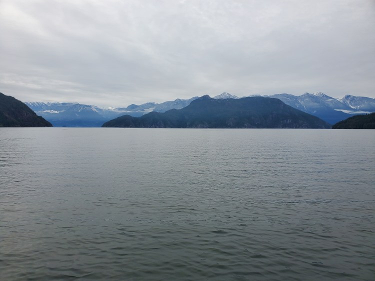
A little while later, Hutt Island and Little Flower Islet came into view. I reminisced on my paddle and camp there in the summer. In the image below, Hutt Island is visible in the centre with Nex̱wlélex̱m (Bowen Island) on the left and Lheḵ’tínes (Keats Island) on the right.
Near Hope Point, I spotted this seal having a snooze on this dock. A little while later, I thought I spotted a fox on a dock, but it turned out to be a look-alike poster. It fooled me and seemed to be fooling the birds and marine life, given there was none on that dock.

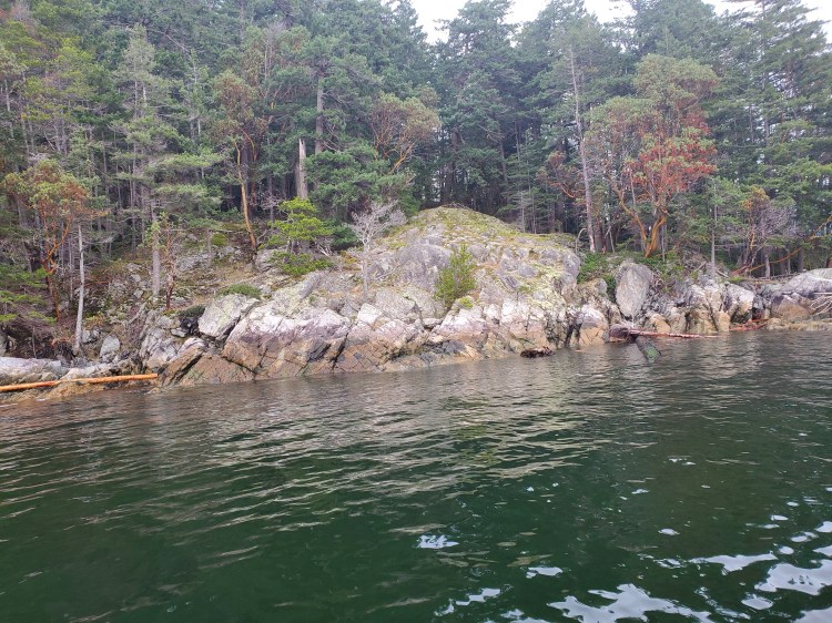
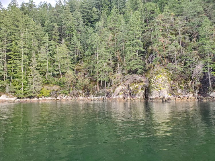
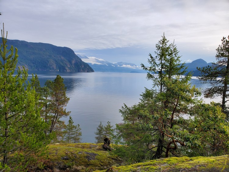
The coastline of Chá7elkwnech (Gambier Island) is Westcoast rugged. Granite cliffs, covered with temperate coniferous forests, are scattered by the occasional Arbutus tree adding some vibrant colour to the muted fall tones. The picture below gives you a sense of the surroundings.
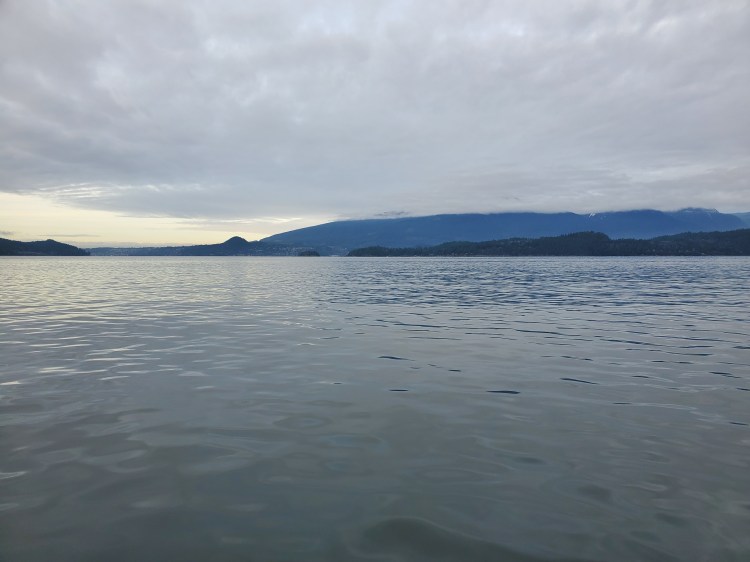
To me, the outline of Chá7elkwnech (Gambier Island) resembles a ghost from Pac-Man. With the southern points (Hope Point, Gambier Point, Carmelo Point, and Gambier Harbour) making up the legs of the ghost. The water in the larger bay between Hope Point and Gambier Harbour was calm as I crossed. The images below are taken from there and show the views in various directions.


The next stop was the Grace Islands which are at the southern tip of the Gambier Harbour peninsula. As I passed by them on the inside of Chá7elkwnech (Gambier Island), the Langdale ferry passed by on the outside. In the photo below, the ferry is obscured by the northwestern island.

As I rounded the point and made my way past Avalon Bay, the northerly headwind coming down Thornbrough Channel made its presence felt. The wind wasn’t too strong, probably about eight knots, but the change from no wind to a headwind was noticeable. In the distance, I could see Port Mellon and the Howe Sound Pulp & Paper Corporation mill. The white plumes of smoke billowing out of the smokestacks looked like low-lying vertical clouds. And despite my distance, the acrid smell of the mill was heavy in the air. It was a familiar smell. Having grown up in Squamish, I was familiar with the odor from the old Woodfibre paper mill. And more recently, I can recall the same aroma when visiting my dad in Prince George from the Canfor pulp mill there. The site of the smoke was a stark juxtaposition between the surrounding natural beauty and the mark of industrial era.

The wind picked up more as I made my way further into the channel toward New Brighton. I began to worry that my progress forward would be too slow. It was 10:20, but I still had lots of distance to cover. And at some point, I would need to stop to eat.

The image below was more striking in real-life. While I was paddling toward the point past Thornbrough Bay, one of the rock formations on the shore appeared to have an all-seeing eye on it. I guess your mind can wander on a long solo paddle and needs to do things to keep you entertained. If you scroll to the right on the slideshow below, you can see the same image zoomed in to what I’ve christened, The Eye of Gambier.


Further ahead, the waters looked flatter. I paddled on and eventually reached the calmer waters around Mariners Rest. Below are the views from the area surrounding the point at Mariners Rest.


In the heart of Thornbrough Channel, the waters were completely flat, aside from the occasional tugboat passing by.
After passing Mariners Rest, I was hungry and in search of my lunch stop, St’áp’as (Andys Bay). To my dismay, I didn’t see a suitable landing spot after passing the point.

All I could see were the docks and log booms, and I started to worry that I would have to push on to Woolridge Island or further to find a suitable stop. I considered stopping at the work docks for lunch, but I wasn’t comfortable or even sure it was allowed. I worried that the more rugged north coast of Chá7elkwnech (Gambier Island) would have even fewer options. Eventually, in the distance, I spied the rocky beach shoreline I had seen on Google Maps‘ satellite view of St’áp’as (Andys Bay). I paddled into shore.

I landed next to the creek and quickly set up my water to boil.

Packing for this trip, I had put all my foodstuff in one dry bag along with my burner and cookware. This way, all I needed to grab was that bag and some freshwater off of my board to bring onshore. On my previous trips, I had packed my foodstuff separate from my cooking wares. I then needed to grab two bags along with water. My new packing method was much more efficient, and I was pleased.
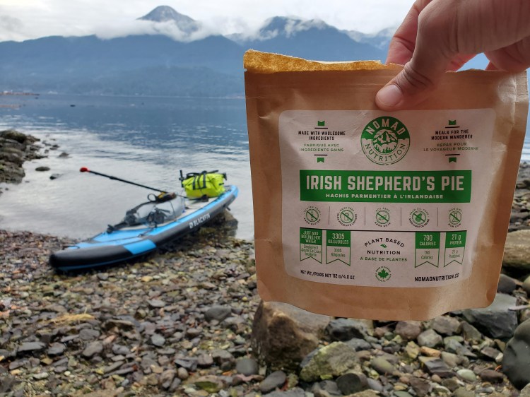
After quickly relieving myself while my water boiled, the first practical use of the waist zipper on my semi-drysuit, I was ready to rehydrate my meal. Lunch would be Irish Shepherd’s Pie by Nomad Nutrition.
While waiting for my food to rehydrate, I made a video greeting for my boys and Annie. I let them know where I was and that I was okay. I also shot some footage of the surroundings. I figured the boys would love seeing the smokestacks from the mill in the background.
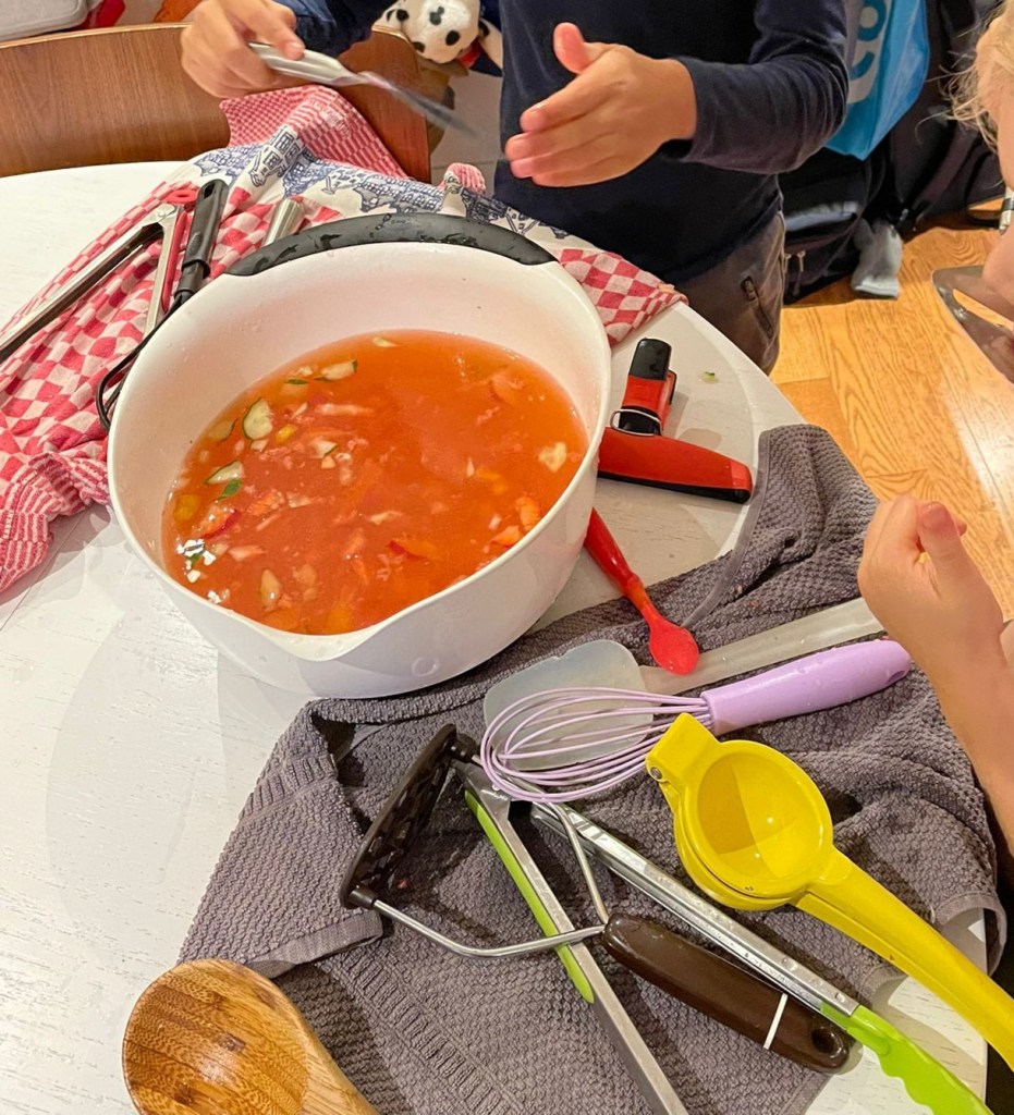
Back at home they were busy making me a “hydration soup” for my return!
Thankfully the smell of the mill had lessened the closer I got to it. So I enjoyed my pie in peace without the pungency of paper pulp production.
Then it was back onto the still waters of the channel with Woolridge Island as my next landmark to pass.

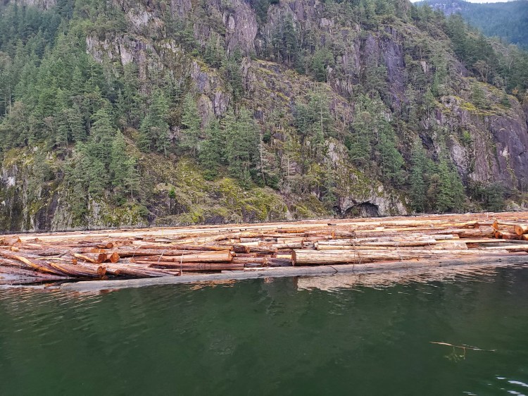
En route, I passed more log booms. They were riddled with seals taking refuge on top of the logs. The seals would raise their heads as they heard me approaching, and then after one of them decided to head for the water, they all would en masse.
Again, I found the contrast between nature and industry jarring to my senses and sentiments. But even when there was not the visible site of lumber on the water, that rocky coastline of Chá7elkwnech (Gambier Island) was riddled with cables and ties. Signs of a long history of modern human industrial presence in the area. I found my mind wandering about the prehistory of the area. For example, how did it form? When was it first inhabited by humans? How did they use the natural resources of the area?
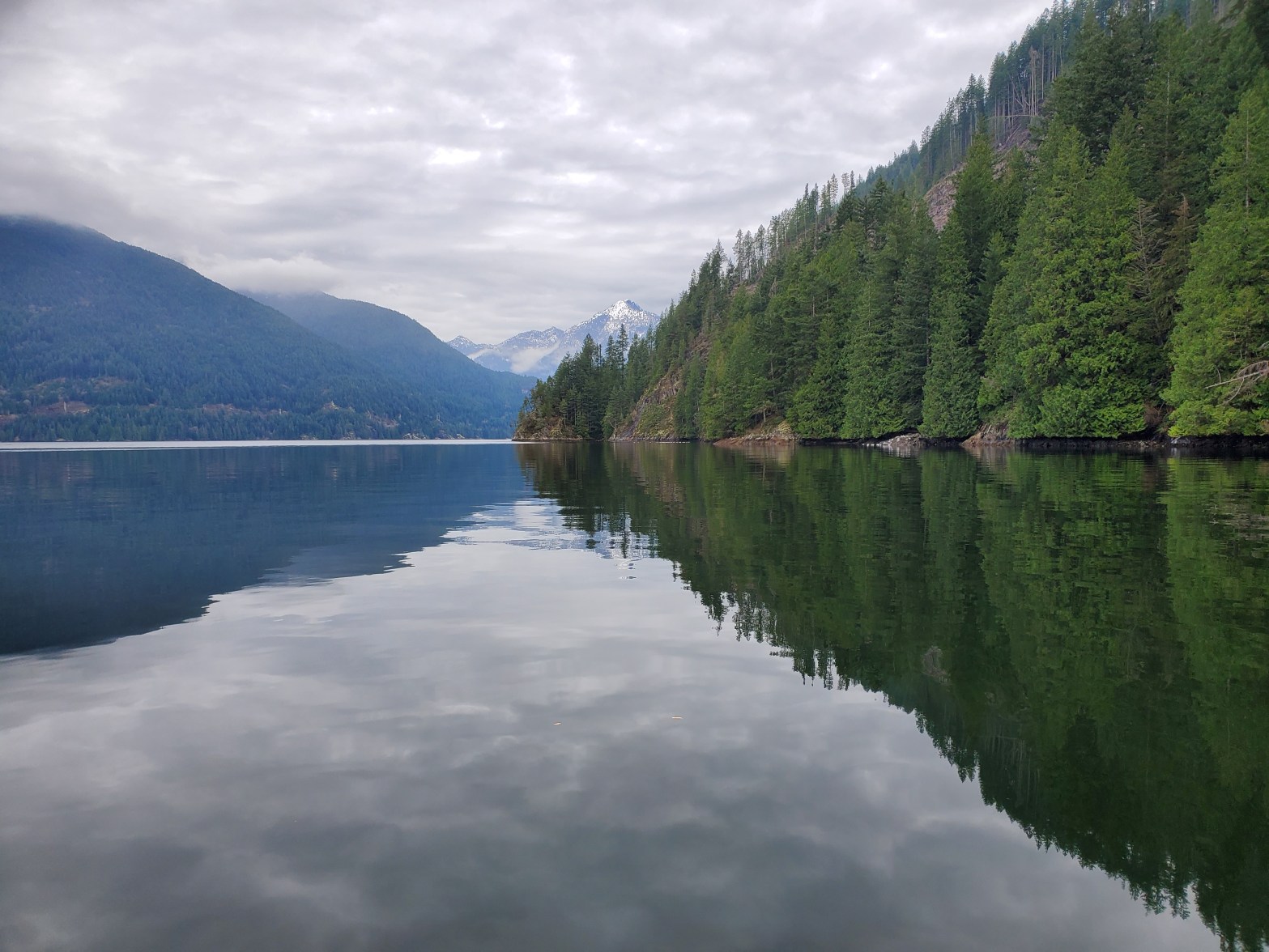
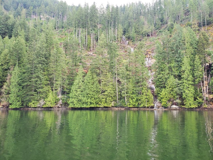
As I approached Woolridge Island and entered Latona Passage, the scenery was spectacular. Slanting coniferous greens on the right reaching down to mirroring glassy waterways flanked by socked-in bulbous mounds to the left with snowcap peaks topping it off.

Not only was it visually stunning to be in Latona Passage, but it was auditorily awing as well. The serene silence of seclusion was accompanied by the soothing sounds of waterfalls. Unfortunately, my camera fidgeting doesn’t do the moment justice, and in fact, it almost sounds like some flatulence. Though I can attest to not letting one rip on camera for fun.
I decided to take a closer look at the waterfalls. As I approached, I wondered how much of the waterfall was due to the incredible amount of rain we had the weekend before and what their normal run-off would be.
And the view from slightly closer. I tried to catch a seal on camera that crept up behind me, but it ducked underwater before I could.
There were many waterfalls along the northern coast of Chá7elkwnech (Gambier Island). I wondered what it would look like in the summer. Perhaps this is a trip to explore next summer?
Here is one more view of things in Latona Passage from the water level.
And then my campsites came into view. I had to decide whether to cross to Smenmántm Ḵ’í ḵp’ikw (Bain Creek) or continue to find txwnaḿ Chá7elkwnech (Thornbrough Channel). It was approaching 13:30, so I felt I had enough daylight to make it to txwnaḿ Chá7elkwnech (Thornbrough Channel). I would push on! Though I did want to go and check out the Smenmántm Ḵ’í ḵp’ikw (Bain Creek) site, I decided not to push my luck.

I wasn’t able to spot the Smenmántm Ḵ’í ḵp’ikw (Bain Creek) site from the water. In the panoramic photo below, I think it is slightly to the left of the valley formed by the two peaks.

Having not seen any boat traffic in the northern part of the channel, I decided to head straight across to where I assumed the campsite to be. Midway across the waterway, the view of the McNab Creek estuary came into view. Again this is an area that deserves a dedicated future exploration.
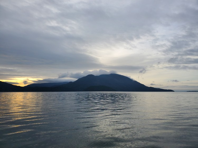
Here is another 360-degree view from my board close to the txwnaḿ Chá7elkwnech (Thornbrough Channel) site. The view starts with Thornbrough Point and Lhaxwm (Anvil Island) before panning to Chá7elkwnech (Gambier Island) and then focusing on the sun over the top of Chá7elkwnech with the mill in the background.
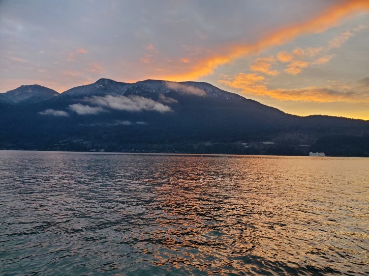
The Coast Mountains over the top of Lhaxwm (Anvil Island) were a spectacular sight. Thankfully pausing to appreciate them allowed me to check my GPS location on my map, and I realized that I was very close to the txwnaḿ Chá7elkwnech (Thornbrough Channel) site.
The view below is from the water in-line with the campsite. Lhaxwm (Anvil Island) is on the left, with Chá7elkwnech (Gambier Island) on the right. Far in the distance, you can see Bowyer Island right of the centre. And to the left of the centre, you can vaguely see Christie Islet and Pam Rock.

I then spotted a lone picnic table on the bluffs. It had to be the site. Closer than I had anticipated. I started to make my way into shore, searching for the signage.
Here is a quick look back over the top of Chá7elkwnech (Gambier Island) as I paddle into the small cove at txwnaḿ Chá7elkwnech (Thornbrough Channel). Fortunately, I would have plenty of daylight to set up camp.

And then I arrived at txwnaḿ Chá7elkwnech (Thornbrough Channel). The site is more challenging to spot approaching from the west, so I was happy I checked my phone’s GPS earlier and spotted the picnic table on the bluff.
I figured a victory selfie was in order. Plus, I could send it back to my family to let them know that I had arrived safely. It was almost 14:40, so I had made it in about seven and a half hours of travel and seven hours of paddling.

Once on land with my gear secure, I did a quick check on the campsite surroundings. Immediately after getting off the beach and into the tree foliage, there’s a tent pad, along with the bear cache below it, followed by another tent pad a little further on. The trail then forks with one path leading up to the outhouse facility. If you continue along the lower trail, you will cross over two creeks by bridges. Then the trail heads up to the bluffs. On top of the bluffs, there’s one large wooden tent pad with a spectacular view out over Átl’ḵa7tsem (Howe Sound). There is also room for other tents to be erected on the mossy area of the bluffs.
A bit higher up on the bluffs sits a lovely picnic table with a view. It would be dining al fresco, and more in the literal Italian meaning of “in the chill.”

There was stronger cellphone reception on the bluff, and I tried to check the weather on Windy.com. Before departing, the forecast called for some light rain overnight. I wanted to confirm if that was still the case. But I wasn’t able to get a consistent signal to load Windy.com.
Assuming it would rain overnight, I figured setting up camp on one of the forested pads would be better. I would get some rain coverage from the forest canopy, plus I could string up a tarp. There was nowhere to attach my tarp to on the exposed bluff. If it rained in the morning, the tarp would be a key asset to break camp. Though sleeping on the tent pad with the view on the bluff would have been nice, it will have to wait for a clear summer day with long daylight hours.
I decided to use the first campsite. It was smaller, but my tent would just fit, and then I didn’t have to move my gear far from the shore. Below is what Camp Peeters ended up looking like.

After setting up camp, which was slightly challenging solo with the tarp, I decided to sign the campsite guestbook. It was only then that I read from the previous entry that the first campsite was prone to flooding in the rain! A slight panic washed over me momentarily, not knowing how much rain was forecasted. I tried to get a signal again, but there was no reception. The entry was from November 14. I wondered how equipped the camper was? Did they use a tarp? How much rain did they have? How much rain was I going to get? Should I move sites? Do I have enough daylight to do so?
In the end, I thought it would be too much effort to change my campsite and decided to run the risk of the rain.
Later on, when communicating with my family and in-laws about the flood warning entry, my concerns were alleviated. I had considered that maybe the flooding was due to the torrential amount of rain we had received in the past week. And after sharing the date of entry with my father-in-law, he sent a link that the atmospheric river from the week before that confirmed my suspicion. The deluge of rain had been on November 14.
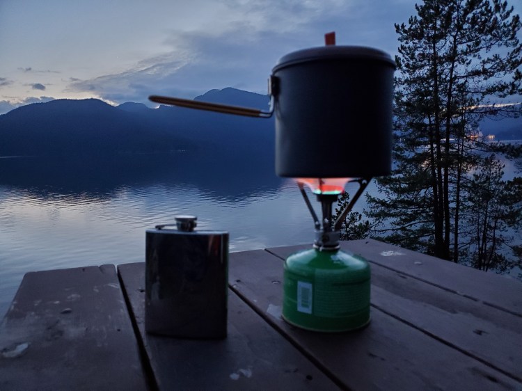
I made my way back up to the picnic table, this time with foodstuff and cookware in tow. The sun was setting as I started my dinner preparations.
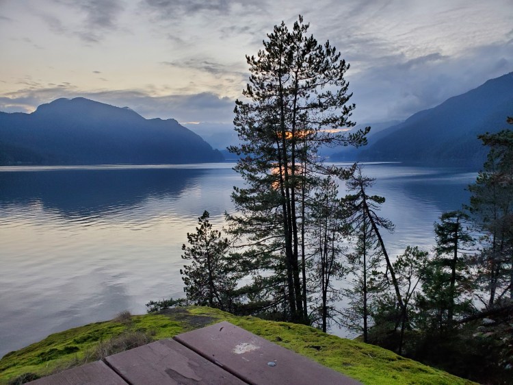
Dinner tonight was going to be Spicy Sausage Bolognese by AlpineAire. And the view from my kitchen was not half bad as I slaved away with my mealtime preparations. On this trip, I remembered to bring a celebratory Scotch. I couldn’t remember what was in my flask, and I was expecting a Teeling Single Malt. However, I was pleasantly surprised when it was a Laphroaig Càirdeas (though this one was a Càirdeas Fino from 2018, I believe). It was in my flask from my summer attempt to SUP the Sound when I forgot to pack it with me. In any case, it was a fine moment to sip on a wee dram on the bluffs by the sea.


After a hearty meal and several more sips of single malt, I was ready to head back down to my sleeping quarters. I made a pit stop at the beach to take in the night sky. Then it was off to bed for some reading and an early night’s rest. I had another big day of paddling ahead of me in the morning…