
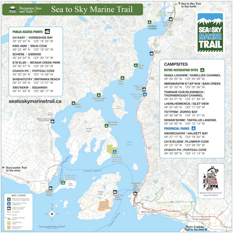
Sunday, September 5, 12021 HE
The Sea to Sky Marine Trail
- The Sea to Sky Marine Trail
- Preamble and Day One
- Day Two
- Shoreline Shenanigans
- New Itinerary
- Lounging Lessons
- Potty Talk
- Late Leisurely Launch
- More Ferry Tales
- Landing Time
- Clean Up Time
Preamble and Day One
To see the details for day one and the preamble to this trip see this post. Otherwise, continue on into the vicarious adventure.
Day Two
I woke to the pitter-patter of rain after a broken night of sleep. That’s my typical sleep pattern when camping, interrupted. There was a moment earlier when I woke and the rain had stopped. But now it was coming down. Hardly any motivation to get up and get out of the tent. I turned to my book, Peter Frankopan‘s The Silk Roads. I was reading about Christopher Colón, better known as Christopher Columbus, and how his motivation to sail to India was to secure riches to help finance a campaign to liberate Jerusalem before the impending Armageddon.
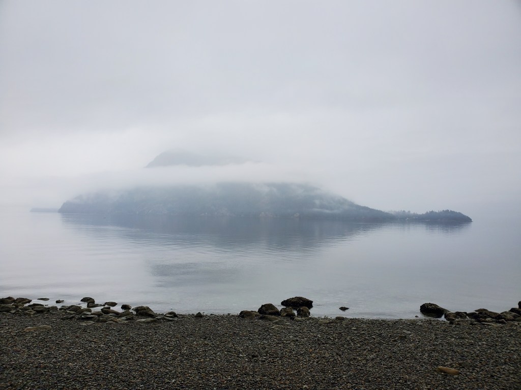
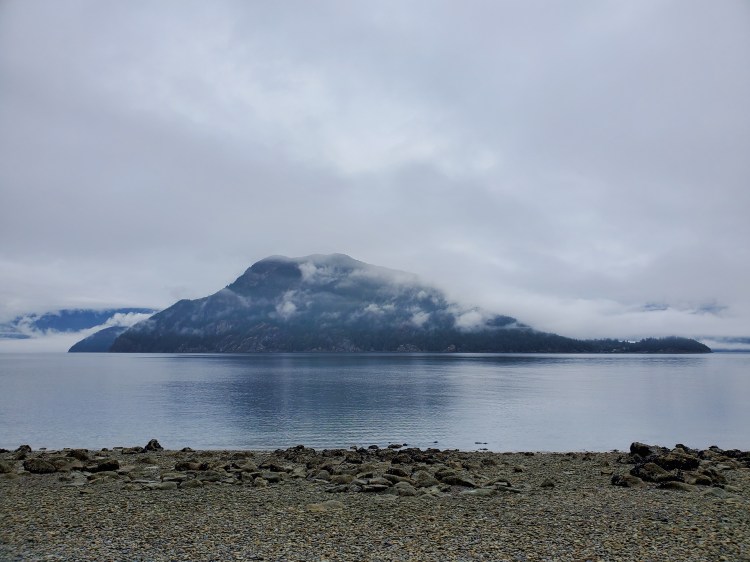
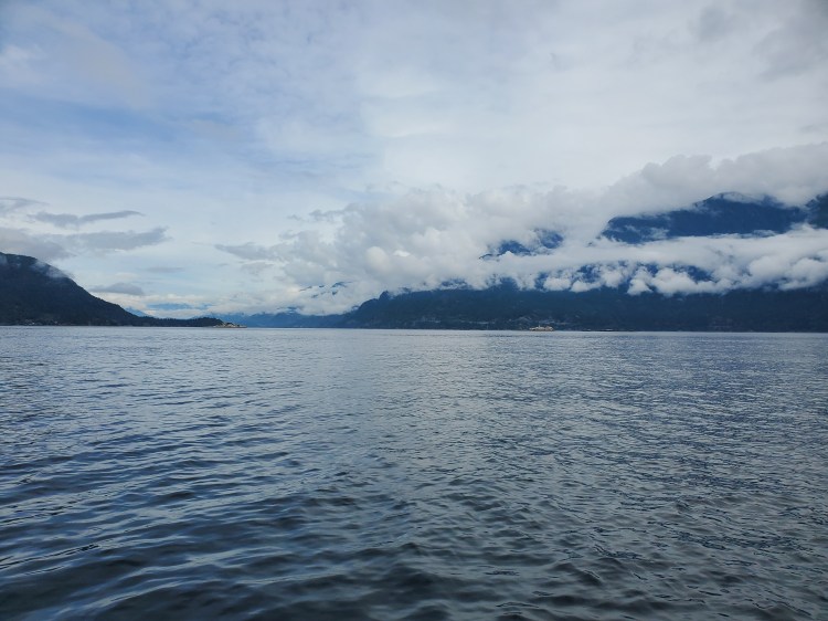
The rain eventually died down and we made our way out into the material world. The clouds were sitting low and the air was thick with moisture. The photo below shows how socked-in Anvil Island (Lhaxwm) still was.
Shoreline Shenanigans
With the neap tide approaching on Monday, we explored the low tide beach and immediately noticed how many flat rocks there were. It was rock skipping paradise. We loaded up our hands and made our way down to the water’s edge for a morning rock skipping session. As these things typically go, the best moments happen off-camera. But the video below captures a few good skips by Trevor. As we slung our side-arm stones we took in the weather forecast on my VHF Marine Radio. The weather sounded more promising for the afternoon.
It was a lazy morning. We had already concluded the night before that our hopes to make it to Squamish had ended. Even with the winds in our favour to head south, we figured it would be too difficult to make the return trip in the time we had remaining. We had considered the possibility of trying to circumnavigate Gambier Island (Cha7élkwnech) but, after our disappointment with not meeting our target destination, we were both lacking motivation to take on a new mammoth paddle. Another option was to change campsites and head to Halkett Bay (Xwáŵchayay) and spend the night at the Marine Provincial Park. Or we could stay at Ramillies Channel (ínaḵa Lhaxwm) and do a day tour out around Christie Islet and Pam Rocks. However, with the cooler weather, neither of us was keen on that option. We decided that our best option would be to come home a day early. This option had the advantage of earning us some brownie points on the home front, and we’d be able to get the burger and beer we had hoped to get in Squamish the day before.
Essentially our paddle plan for the day was what we had planned to do on the third day of our trip. Here is a link to the original itemized itinerary. And, below is what would become the paddle for today, albeit a little bit later in the day.
New Itinerary
September 6 5, 2021 (Day 3 Day 2)0700 🏄🏽♂️ ↗️ Ramillies Channel (7.5 km)0815 🏄🏽♂️ ↔️ Halkett Point (3 km)0845 🏄🏽♂️ ↔️ Finisterre Island (6 km)1000 🏄🏽♂️ ↘️ Horseshoe Bay1045 🚗 ↗️ Horseshoe Bay1105 🚗 ↔️ 🚐1125 🚐 ↗️ Home1155 🚐 ↘️ Home
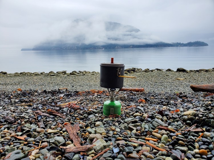
With a plan in place, we set our efforts toward preparing breakfast. I also got the idea of bringing my boys a souvenir from our voyage. Fortunately, the rock selection along the beach was right up the alley of my boys’ current interest. As we boiled water for our oatmeal, Trevor and I probed the shoreline for special rocks. The photo below is our morning kitchen.
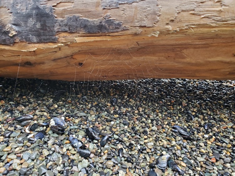
After securing some special stones, we started on our breakfast, Quaker Instant Oatmeal. Then we found a nice piece of driftwood to sit on and enjoy the serene settings. We spotted the spider web in the image below on the backside of our morning log (no, not that morning log…the one below).
Lounging Lessons
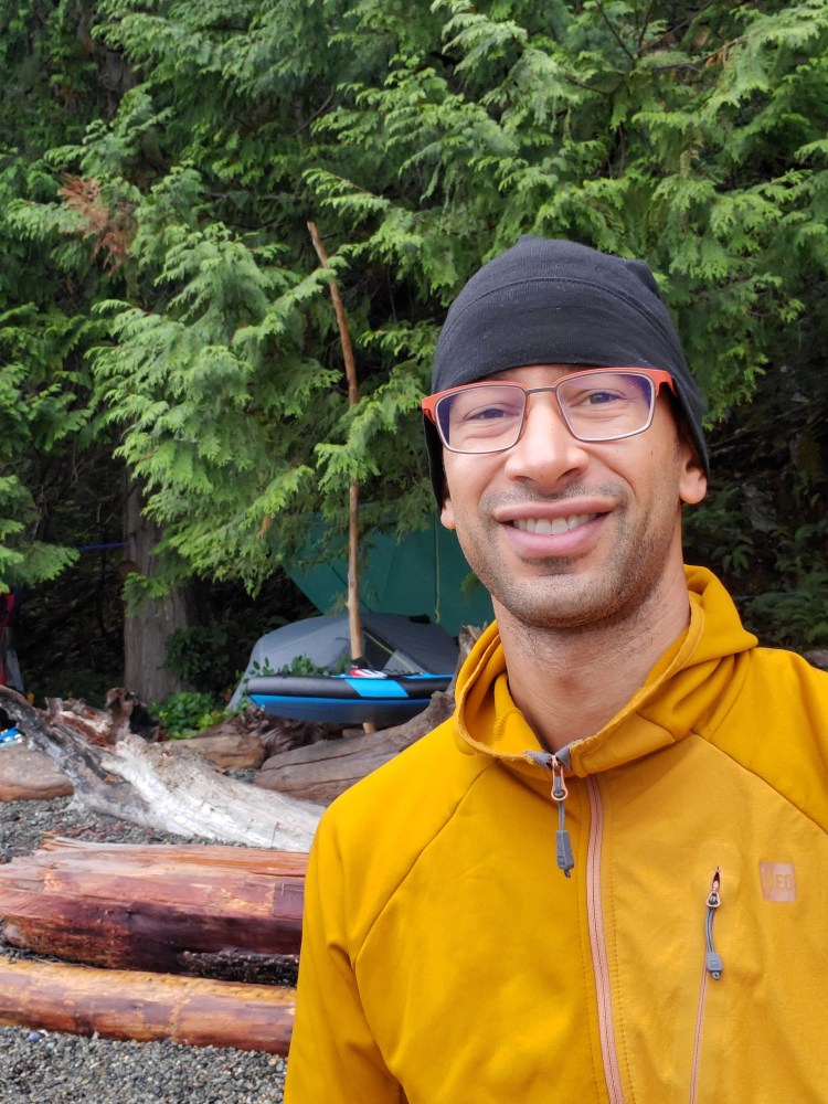
One take-home from my Bowen Island (Nex̱wlélex̱m) circumnavigation paddling experience was that a seat cushion would have been a luxury to have brought. After being on your feet for most of the day on a stand up paddleboard, I thought it would have been nice to have a comfortable place to sit. So, for this trip, I packed two Karrimor folding seat mats that my brother-in-law, Alex, had given to us years ago. They were perfect for having a seat on some of the driftwood and enjoy our breakfast. As we sat enjoying breakfast, it dawned on me that aside from lying down to sleep for the night, we had been on our feet for the majority of the past 24 hours. We ate both lunch and dinner standing. And now, it felt so good to sit. And that was without a backrest! The photo below was a morning selfie I sent to my family to say good morning. My shit-eating grin tells the story of how satisfied I am with our morning setup.
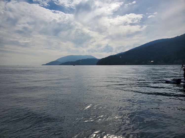
Shortly after sitting down, it started to drizzle slightly. We took cover in our tree canopy dining room from the night before. Luckily, the rain was short-lived, and we were soon back out on the beach enjoying the scenery. The clouds were low on the water, and we marvelled at just how close they appeared on the water in the distance. Initially, I assumed we were looking out of the boundary of Ramillies Channel toward Porteau Cove. But after looking at a map, I realized that we were looking toward the Sunshine Coast, nearby the Islet View Maine Recreation Site (Lhemlhemḵwús). Islet View was our scheduled lunch spot had day one of our voyage gone according to plan.

Potty Talk
As we sat enjoying the scenery, I heard nature’s call. The Ramillies Channel site has a composting toilet listed in the camp comments on the BC Marine Trails website. As much as I hate outhouses, I was slightly curious about the setup for the compostable toilet.
I was pleasantly surprised by the inner workings of the outhouse. For starters, there was no odor. On top of that, it was clean. Upon entering, it struck me that there were two toilet bowls inside the facility, one on either side of the outhouse. It reminded me of a friend’s cabin from my youth, where the outhouse had a double-barrel set up too. At my friend’s place, however, the seats were side-by-side so that you could do your business in tandem if you so chose, but facing away from each other. Here the bowls were face-to-face, which I initially thought was a strange setup. I’m not sure how I feel about stare–dueling while duking. However, the toilet on the right side had wooden slats running over the top of it, preventing it from being used. Why the slats were there became evident after I read the signage in the facility, which is below to satisfy your curiosity.

And here is the operator’s manual.

With the morning business out of the way, it was back to enjoying the sights and sounds of Ramillies Channel. The cloud cover was lifting, and after enjoying some morning tea and more rock skipping, we set our sights on breaking camp. Thankfully, our gear wasn’t soaking wet as the rain had not been heavy since the early morning. Trevor’s tarp game was on point!
I failed to consume any of the Talisker 10-year-old Scotch whisky Trevor had packed the night before. Too pooped from paddling. My flask, faithfully filled with Laphroaig Càirdeas, was sitting at home in my liquor cabinet. I had forgotten to pack it, as well as beer. I made a mental note to update my SUP camping packing list to include libations. While we made our final paddling pack preparations, we had some belated celebratory sips of some fine single malt. Okay, fine, truthfully, we emptied the flask…but we did it sip by sip.
Late Leisurely Launch
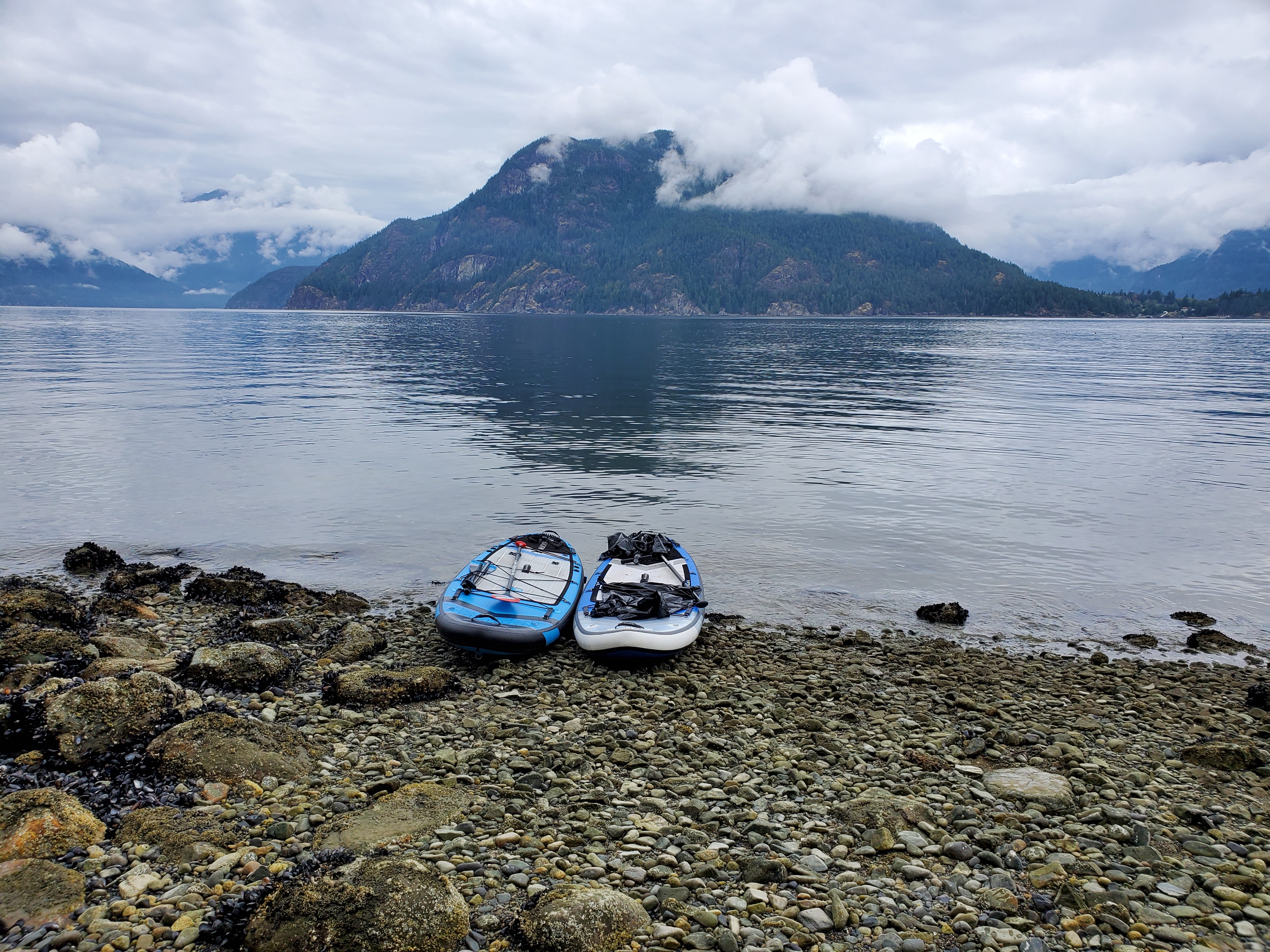
The image below is our boards at the next-to-neap tide, just before loading them up for our departure.
And here we are again loaded up and ready to paddle.

One last selfie. A friend told me that I should post more selfies on the site. It’s not really my thing, but I’m open to suggestions. So this post has a couple. We decided to dress lighter than Saturday’s attire as the forecast was calling for sunny afternoon skies. We had contemplated wearing shells but decided against it.

Funnily, as we set out on the water, it felt like the winds picked up ever so slightly. The morning had been relatively calm until this point. I started to worry that we could be in for a similar day to yesterday, with high winds halting progress. In the original float plan, we had scheduled to be on the water by 07:00. With our relaxed and leisurely morning, we were setting out at just after 13:00. In the photo below, the skies in the path ahead look ominous.

We decided to hug the shoreline next to Gambier Island (Cha7élkwnech) rather than venture out toward Christie Islet and Pam Rocks. At this point, the exploration side of the paddle had waned, and our sights were on getting back to Horseshoe Bay. As we made our way further down Ramillies Channel, the clouds began to thin, thankfully. It was getting warmer, and we were both happy with our paddling apparel decisions. And so far, the winds were mild.

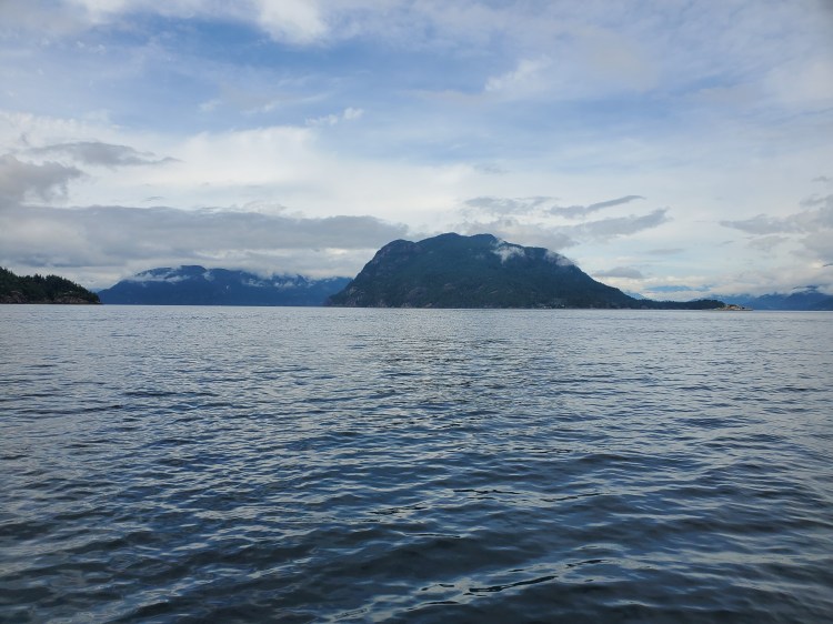
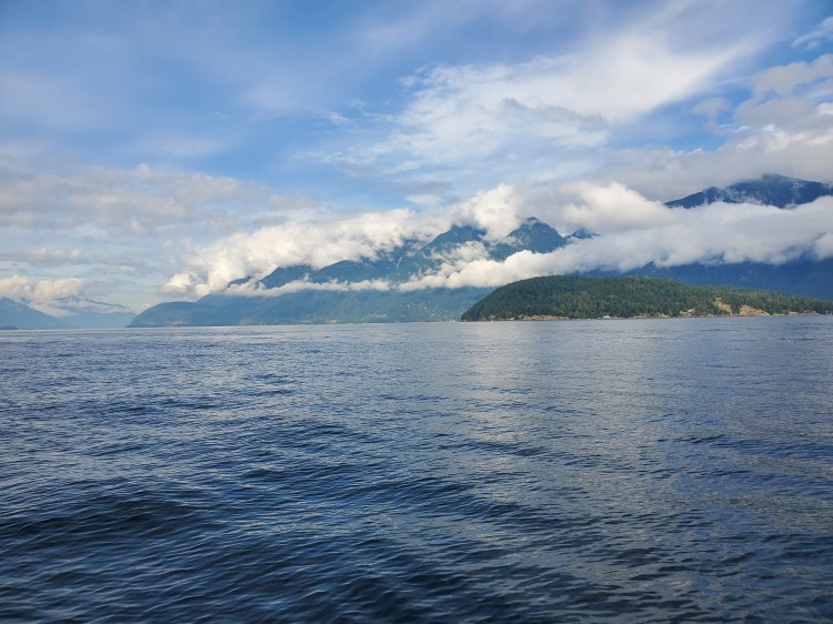
Looking back toward Anvil Island (Lhaxwm), the cloud cover was starting to break apart. You can see Christie Islet at the right of the photograph below. And the landmass north of Brigade Bay on the left.
And below is a similar view with Pam Rocks now insight on the right. My exploration of the islets would have to wait for another trip through the sound.
We made our way up toward Halkett Point before stopping for a snack and contacting Michael by phone. We had texted earlier, and it seemed he would be able to pick us up. So we wanted to give him a better sense of our ETA and confirm a pick-up point. Horseshoe Bay was the obvious choice, but we wondered if Whytecliff Park would be easier and safer. It would be a beach landing rather than a dock which would be easier to unload our boards. Plus, we would have the option of crossing ferry lanes one at a time. Though, it would add on a bit more distance.
In the end, we decided on Horseshoe Bay. Most likely, this was for my subconscious desire to complete a round-trip. We planned to paddle to Halkett Point before crossing to Finisterre Island. From there, we would plan our route according to where the ferries were.
As we approached Halkett Point, there was a sailboat idling in the waters between Gambier (Cha7élkwnech) and Bowen Island (Nex̱wlélex̱m). I tried to get a sense of how strong the wind would be from their sail. The wind was coming from the west but, I couldn’t tell how strong it was. Fortunately, as we made it out past the point, the wind was mild. At this point, the would-be sailors had lowered their sail. They now appeared to be patrons of a public house rather than watermen. They joked with us about what we were doing and if we were out for a walk. They weren’t wrong concerning our rough speed of transportation, but I wish at the moment I had been witty enough to ask them what they were doing? Out for a sail? They sure weren’t sailing when we passed by.
More Ferry Tales
As luck would have it, we could see the Langdale ferry approaching, and the timing would work in our favour. We could continue to paddle and cross the ferry lane in the wake of the ferry without having to wait or accelerate. In the distance, we could see the Snug Cove ferry crossing from Horseshoe Bay. And the Nanaimo ferry appeared to be docked at Horseshoe Bay. Our timing was looking good. Perhaps we could slip in-between the two remaining ferry lanes that we had to cross.
After reaching Finisterre Island, we decided to shoot straight in between the ferry lanes toward Horseshoe Bay. The Snug Cove ferry would be leaving Snug Cove, and the Nanaimo Ferry would soon depart Horseshoe Bay. Ideally, we could paddle through after those two ferries crossed our path. The unknown was when was the Nanaimo ferry coming. As I confirmed our location between the converging ferry lanes and assessed the marine traffic on my Marine Radar app, I also took a moment to capture some photos.
The photo below shows the view, looking toward Snug Cove. We both had a keen eye on guard for the ferry traffic crossing and coming into the Queen Charlotte Channel. The high peak in the background is the Bowen Island Ecological Reserve. In front of that is Dorman Point and in front of that is Miller’s Landing. Between those two landmasses is the Snug Cove Terminal. And Eaglecliff is the land area in the foreground of the photograph.
And the view northeastward toward Bowyer Island and the Britannia Range of the Sea to Sky Highway.
As we paddled toward Horseshoe Bay, the Snug Cove ferry emerged from Snug Cove. We started to quicken the pace as I hoped to be close behind the ferry. That way, we could cross if the opportunity presented. As we frantically struggled to make up the distance, the Nanaimo ferry departed. We quickened the pace more as we were still far off from both of the vessel’s paths. There was no sign of the ferry returning from Nanaimo anywhere in the Queen Charlotte Channel, though the visibility was hazier in the distance. We paddled harder.
As we watched the departing Nanaimo ferry travel further off into the distance, we were confident that we would see the arriving ferry in time. Though, we weren’t about to let up on our paddling. To our port side, the Langdale ferry was now returning to Horseshoe Bay, but we were a comfortable distance out of its path.
Finally, we were close enough to Tyee Point that we were both comfortable enough to let up on our paddling. We made our way through the small islets at the point and then toward the docks. We had made it! Assuming we could navigate around the docks and moored ferries in the image below.

Landing Time
The area of the public dock that we had launched from was busy. So, we decided to land on the beach. It would also be easier to get our gear-loaded boards out of the water this way. We just carried them up the stairs, fully loaded one at a time.
Michael was by shortly after we landed to shuttle us back to Ferdinand. From there, Trevor and I were on a mission to find a burger and beer. After getting some intel, we set our sights on the Alibi Room. We were able to get a patio seat shortly before the dinner rush and enjoyed a well-deserved burger and brew!
Clean Up Time
The nice thing about shortening our trip was that I still had the holiday Monday to clean up my gear. The image below is the unglamorous side of SUP touring. A backyard turned into a makeshift laundromat. The weather was beautiful, and I had just spent two marvellous days out on the water. It was well worth the clean-up.

In the end, we paddled approximately 16 kilometres on the second day. So, overall it was nearly 50 kilometers over the two days.
Below is a virtual recreation of the route we took on day two of our trip, created using Google Maps, Google Earth Studio, and OpenShot Video Editor.
And here is the Google Map version of our paddle route for day two.

One thought on “SUP’in the Sound: Day 2”