Tantalus Landing to Ramillies Channel
Sunday, September 4, 12022 HE
This post is the account of Day Two of my three-day two-night stand up paddleboard (SUP) tour through Átl’ḵa7tsem (Howe Sound, click here for pronunciation), from Locarno Beach to Sxwan’shnm (Tantalus Landing Marine Recreation Site). Day Two was the start of my return from Tantalus Landing to ínaḵa Lhaxwm (Ramillies Channel Marine Recreation Site). For Day One’s adventure, see this post, “SUP’in the Sound 2.0: Day One.”
I had set an alarm the night before for 0430 hours. Hardly necessary since I was in bed by 2030 hours, but I didn’t want to take any chances of missing my wind window. I was quite certain I would be up, but I wasn’t going to leave it to chance. Generally, I sleep lightly when camping, with the lack of comforts and the extra sounds of nature. My biological clock was on point, rousing me from Hypnos‘ grasp just after 0400 hours. I lay in bed for a few moments playfully musing the happenstance of reading about sleep patterns in hunter-gatherers the night before in Daniel Lieberman‘s book Exercised: Why Something We Never Evolved to Do Is Healthy and Rewarding. The parallels between interrupted sleep and conditions lacking our modern plush bedding comforts were so salient. Camping is a return to a simpler more primal state and it is why I enjoy it.
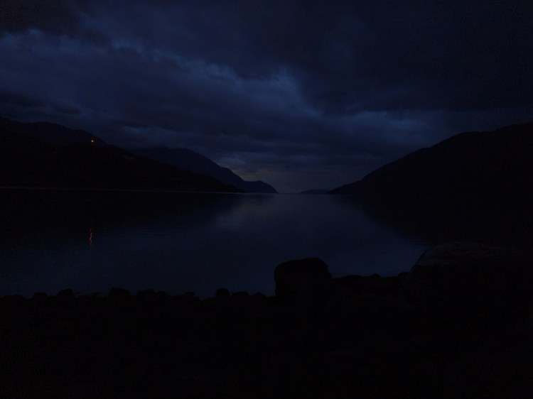
The thought of winds roused me from my morning musings. I couldn’t hear any wind outside. I checked the forecasts on Windy.com and the Government of Canada’s Howe Sound Marine Weather Forecast. They hadn’t changed. I was still likely going to encounter inflow winds. I just hoped that they would be mild. That was the motivation I needed to get out of bed. I quietly packed up my tent belongings, so as to not wake my neighbours, then made my way out into the twilight to break camp. I used the red light setting of my headlamp to maintain my night vision and not notify my neighbours of my presence. In order to navigate the forest path, I used the green light setting, which I had previously discovered worked well in woodlands by accident. I recently read about the distinctions between the different light colours, which corroborated my forest finding.
Breakfast on the beach was in the nautical twilight. Quaker Instant Oatmeal Apple and Cinnamon, along with dried mangoes, and an apple, was my camping breakfast of champions.
As a side, if you’ve ever wondered why religious groups, particularly Protestants, have/had the breakfast cereal market on lock (e.g., W.K. Kellogg, Quakers), check out this hot (offside) take from The Blindboy Podcast titled, “Victorian Sex Communes and Breakfast Cereals.”
The tide was low, but you’ll have to take my word for it, as it is not necessarily visible in the image below. But the conditions on the water were calm. Time to get my act in gear!
With the lower tide, I decided to check out whether I could launch from my current location. Or would I need to relocate to the normal launching/landing site? My preference was to stay, as relocating meant lugging my board and kit over land. The newly exposed coastline was slippery with seaweed and algae. Do I risk slipping or do I cart my gear around? I decided on the former, I’d just move cautiously.
Moments later I felt a light drizzle. I pulled out my paddling jacket and put it on. Then realized it was incredibly warm. I decided to just keep my coat handy and see how the conditions turned out. The image below is my kit in order and ready to go, red jacket on top ready in case I needed it. I was on the water shortly after 0615 hours, 45 minutes ahead of schedule.

Below is my previous planned itinerary for Day Two. For the entire plan see here.
SUP FLOAT PLAN: Day Two
September 4, 2022
0700 🏄🏽♂️ ↗️ Tantalus Landing (10 km)
0915 🏄🏽♂️ ↔️ Zorro Bay Ts’itpsm (5 km)
1020 🏄🏽♂️ ↘️ Islet View Marine Recreation Site
1050 🥘 ⏸ Islet View
1120 🏄🏽♂️ ↗️ Islet View (11.5 km)
1350 🏄🏽♂️ ↘️ Ramillies Channel MRS
1410 ⛺ ⏸ Ramillies Channel
(~27 km)
(Christie Islet/Pam Rocks – Round Trip ~10 km)
Completing the extra trip to Christie Islet and Pam Rock was highly unlikely at this point.
The change in conditions from Day One was drastic. I went from sun powered near surf to flat, foggy, and fall-like. It was a great reminder of how beautiful the fall season is for paddling, calm waters, cool temperatures, and all coupled with quiet and solitude.
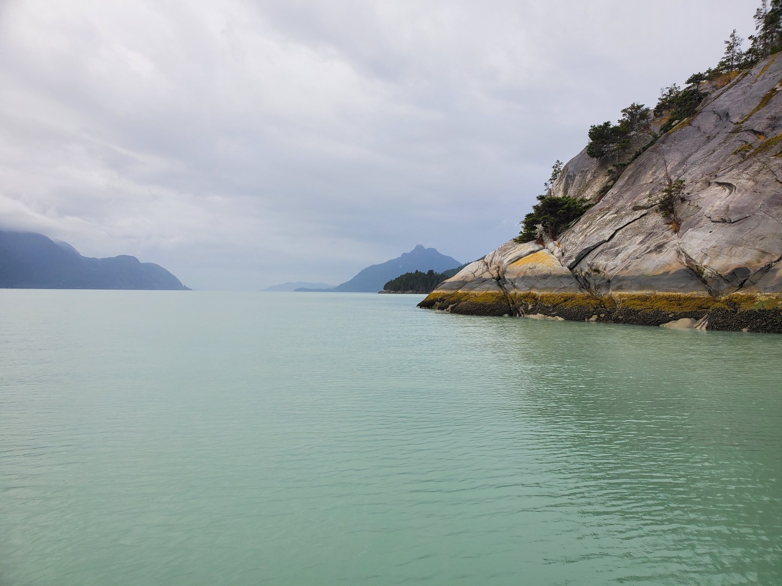
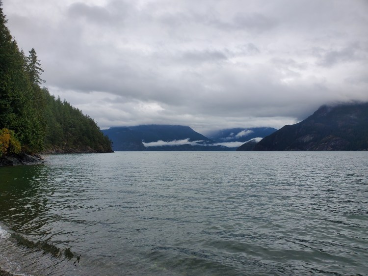
I aimed more or less toward Watts Point, with the ultimate destination for the first leg of Zorro Bay. The rain picked up out on the water, but it was warm enough that I didn’t want my rain jacket. The images below are of Britannia Beach, the west side of the fjord, and the view back toward Squamish over Watts Point.

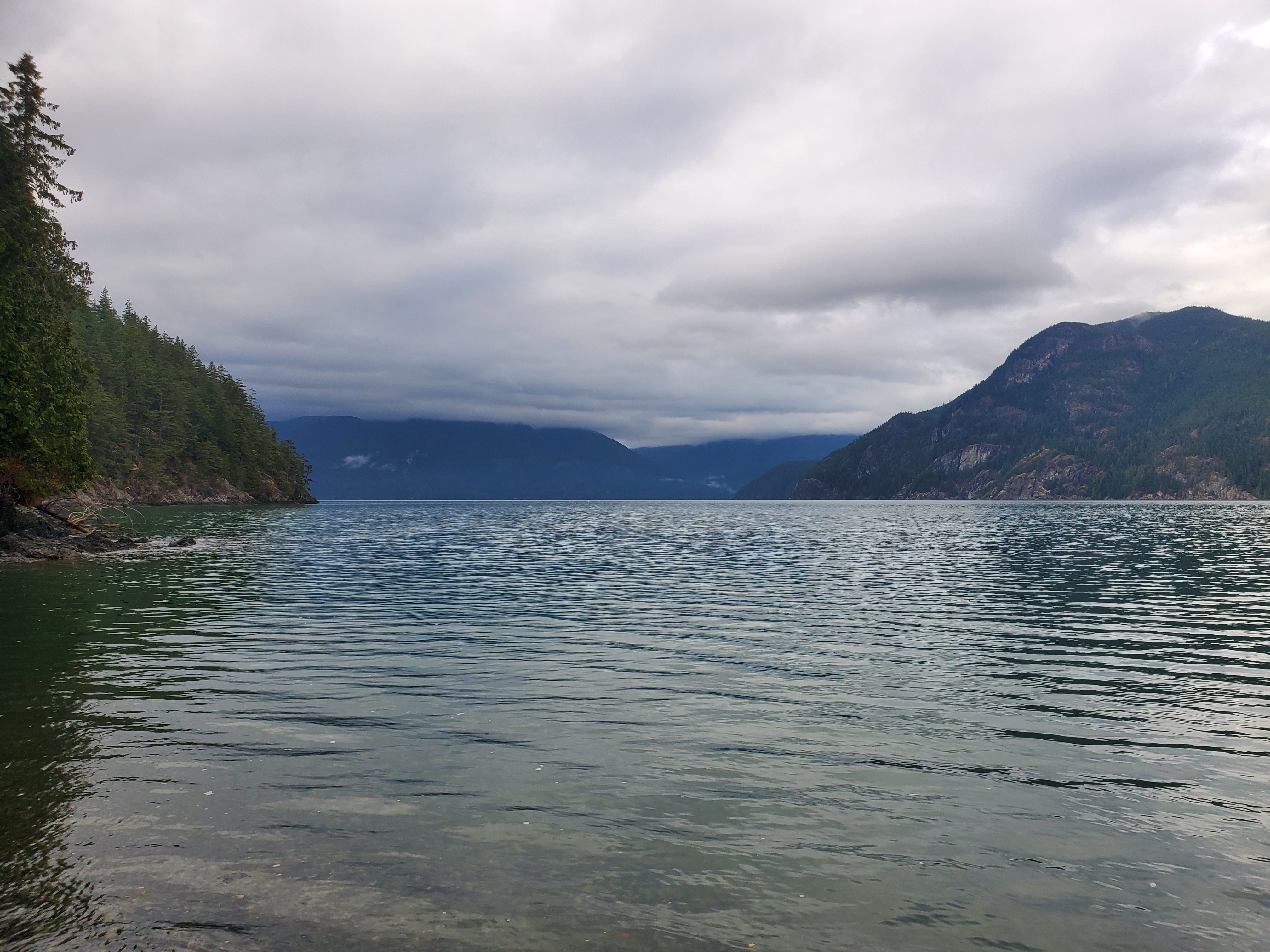
I made good time getting to Zorro Bay as there was little wind. When planning the trip, I had provisioned time for headwinds and anticipated hugging the coastline for shelter. With the calm conditions, I took a much more direct route toward Zorro Bay. I planned to arrive at Zorro Bay at 0915 hours, but arrived at 0755 hours. The image below is the point at the north end of the bay. Behind the point, the peninsula at the south end of the bay is visible, along with Lhaxwm (Anvil Island) and Nex̱wlélex̱m (Bowen Island) in the background. I had a quick snack before pushing on to Lhemlhemḵwús (Islet View Marine Recreation Site).

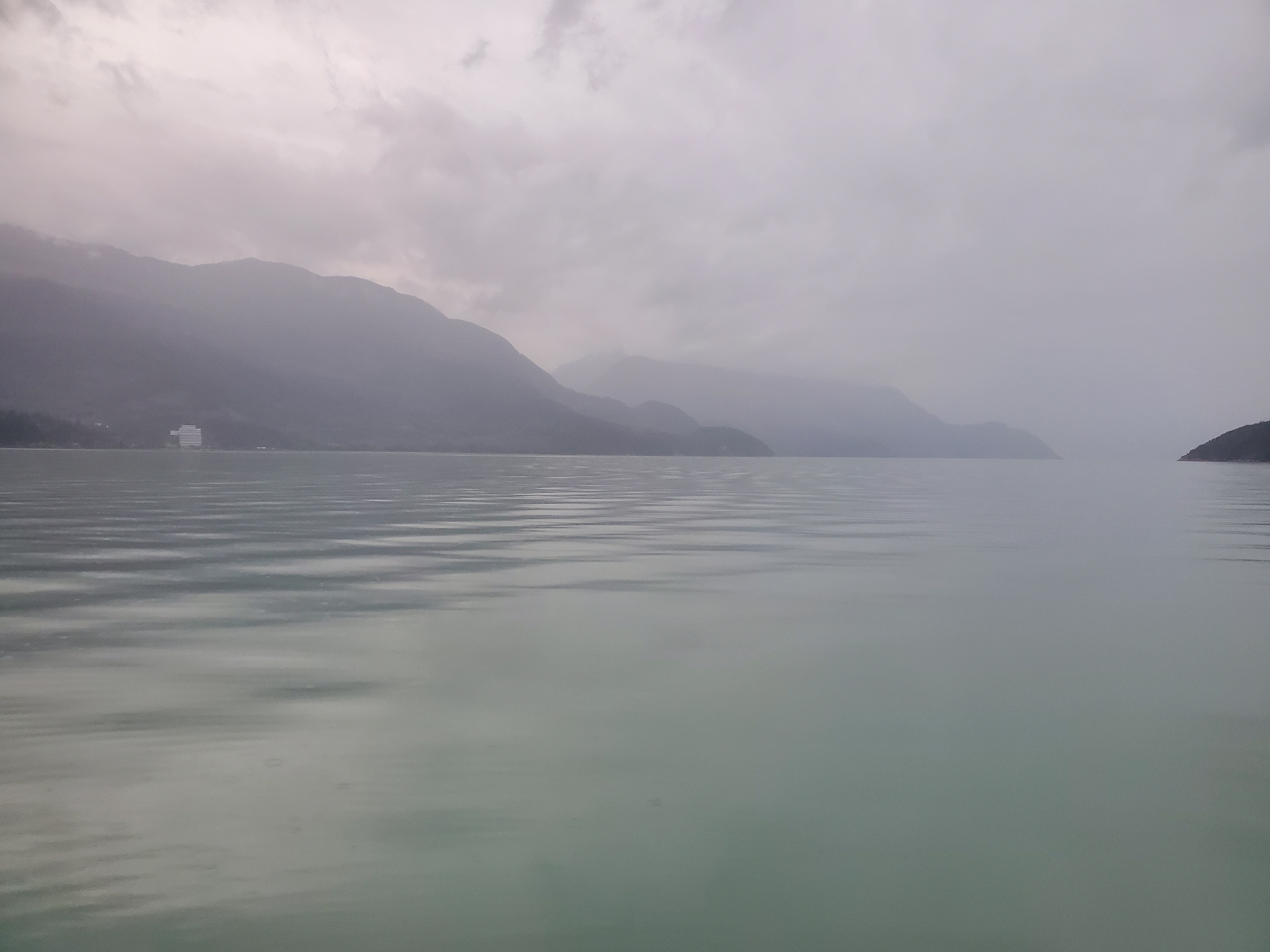
The rain picked up more over this portion of the paddle, so my photo documentation waned. It’s not easy operating a touch screen device on a SUP in the rain. The conditions, however, remained calm on the water. My original plan was to have an early lunch at Lhemlhemḵwús (Islet View) at around 1100 hours. But when I arrived at 0850 hours, a 0900 hours breakfast seemed ridiculous. Plus, I didn’t want to disturb the campers at the site that still seemed to be slumbering in their sunshade sanctuaries. I knelt on my board for a snack and contemplated my options. The winds were mild, so I decided to take advantage by heading to ínaḵa Lhaxwm (Ramillies Channel) for a late lunch. While I hurriedly consumed my comestibles, I surveyed the campsite. There were at least two tents that I could see. On the shoreline, there was one single kayak, a canoe, and a yellow double kayak. I wondered if the double kayak was the same one I had seen the day before at Zorro Bay attempting to ford the fjord?
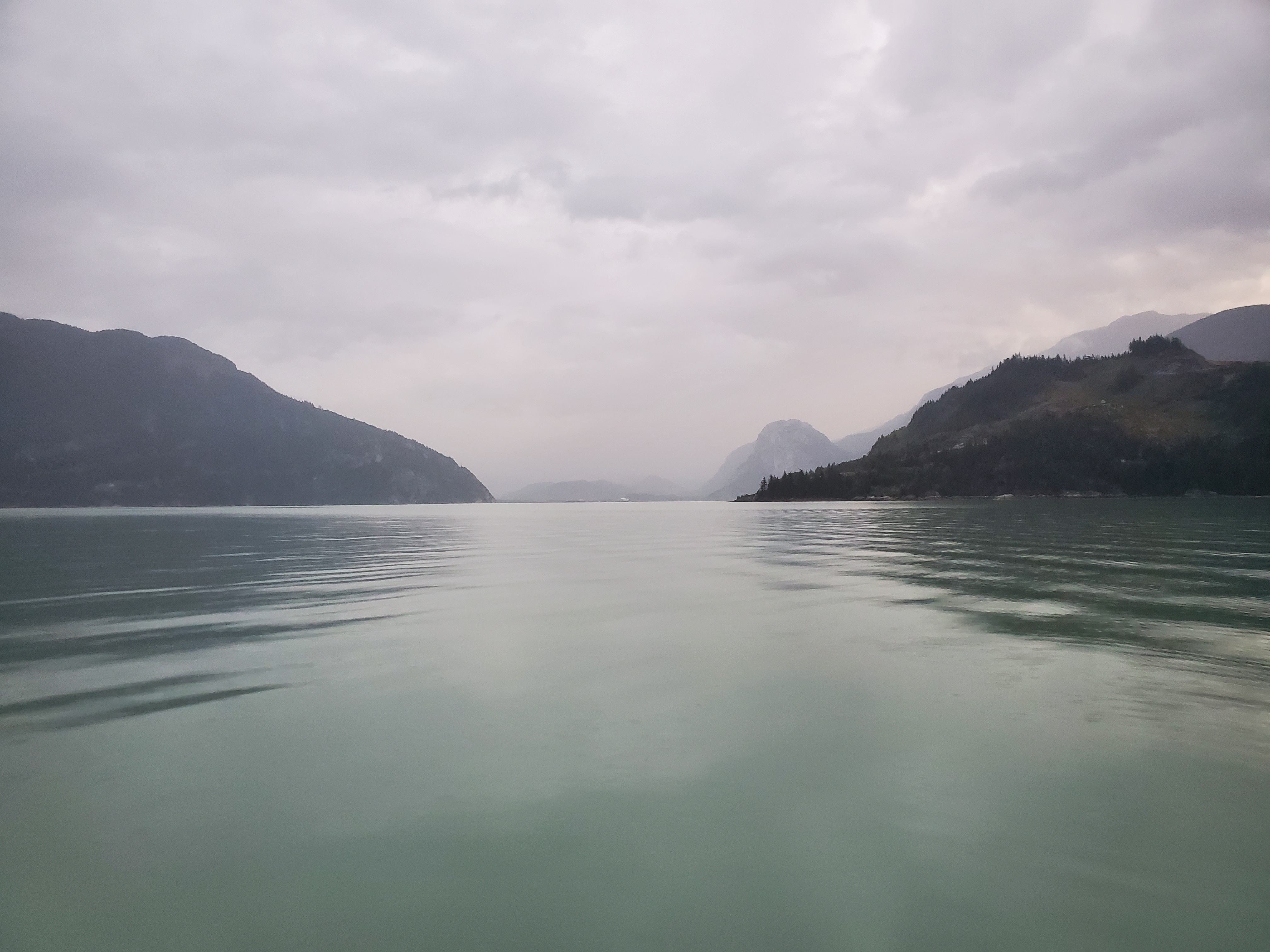
Again rather than hugging the coast for wind shelter as I had planned, I decided to attempt a straight shot across towards Domett Point on Lhaxwm (Anvil Island) to enter the northern aspect of Ramillies Channel. As I made my way out into the waters separating Lhemlhemḵwús (Islet View) from Lhaxwm, the winds started to pick up. It was manageable, but it was a deceptive deviation from the previous paddling conditions. I had a fleeting moment of panic. How strong would the winds get? Would I be able to continue to make progress? Thankfully, the waves and wind stayed on the mild side of the spectrum.
I started to wonder if the water condition was more tide related, rather than the wind. As I backtracked the tide times in my mind (thanks to my research into tides for this post, “On Tides“), I concluded that my transit was close to the midpoint between low and high tide. The flood current would likely be near its maximum. Not knowing if the sea state was being driven more by tide or wind, I decided to redirect toward the eastern tip of Domett Point, rather than the western. My hope was to use the island’s point as a windshield.
Two-thirds of the way across, I had a minor mishap. I had shortened my adjustable paddle for a shorter, more powerful stroke, and also allowing for a semi-squatting stance for less windage. But in doing so, it felt like the bolt to the adjustable clamp was loose. This had happened to me before when the bolt came completely loose and ended up on my board. Miraculously, I saw it and resisted my innate urge to kick it off my board, not knowing what it was. Eventually, I realized that it wasn’t some stray bolt that had washed up onto my board (yes, I know how ridiculous of a thought that is, but hey, it’s what crossed my mind at the time). It was my paddle clamp bolt that had fallen down onto my board! Worried about a similar incident, I figured it was better to pause and tighten the bolt, even though I would lose ground (water?). I used my Akua River Knife, which has a blunt tip and was conveniently attached to the front of my PFD, to tighten the bolt. Unfortunately, in the unsteady waters the blunt tip slipped from the bolt slot, and the not-so-blunt knife edge sliced my finger. It’s a sharp knife, so it was a solid gash, but thankfully somewhat superficial. Though it was deep enough that I was bleeding from my righthand second digit with a first aid kit tucked away in the back of my board and wet hands that were unlikely to be adhesive. I decided direct pressure was the solution and awkwardly paddled onward to Lhaxwm (Anvil Island), pinching my thumb to my index finger whenever I wasn’t opening my hand to switch stroke sides.
I made it across, taking shelter at Domett Point. In the calmer waters, it dawned on me to MacGyver a bandage with the tape I had in my waist pack for emergency repairs. I envisioned board or paddle repairs when packing the tape, but personal punctures were now on the list of possibilities. I went with electrical over the duct tape, and it worked well.
I then paddled onward, hugging the island’s coastline while simultaneously contemplating whether my windshield was actually helping or not. At times it felt like it was, but maybe those were just the lulls in the wind? I also wondered whether any advantage in wind reduction was lost by waves rebounding off the shoreline.
In any case, I hugged the coastline until about two-thirds of the way down the western shore when the waves in Ramillies channel appeared to be heading southeast. I waited for a bit to confirm my observation. But it was soon evident that the waves were now coming from the northwest along with the wind. I guessed that the waves must be coming out of Thornbrough Channel and making their way into Ramillies Channel and then into the greater part of the Sound south of Lhaxwm (Anvil Island). In hindsight, and looking at the geography in greater detail, I think that is exactly what happened. The water coming out of Thornbrough Channel diverged at the “Y” created by Lhaxwm, with one branch travelling northeast and the other southeast. The closest thing I could find as evidence to support this hypothesis, outside my experience, was a 1993 paper on sediment pathways in the Sound. Figure 4 shows a net movement of sediment travelling southeast through Ramillies Channel. But at the same time, it shows a northwesterly net path of sediment through the channel north of Lhaxwm. Hardly the smoking gun I was searching for. So, take my experience as the good news (i.e., the etymology of “gospel”).
Cutting out and away from Lhaxwm (Anvil Island), I made my way into the heart of Ramillies Channel. Unfortunately, I was in a cross-chop and found myself wanting to turn and ride with the water out of Ramillies Channel towards Christie Islet and Pam Rock. So I alternated between riding with the waves and across them, ultimately trying not to overshoot ínaḵa Lhaxwm (Ramillies Channel) on my ferry across the channel.
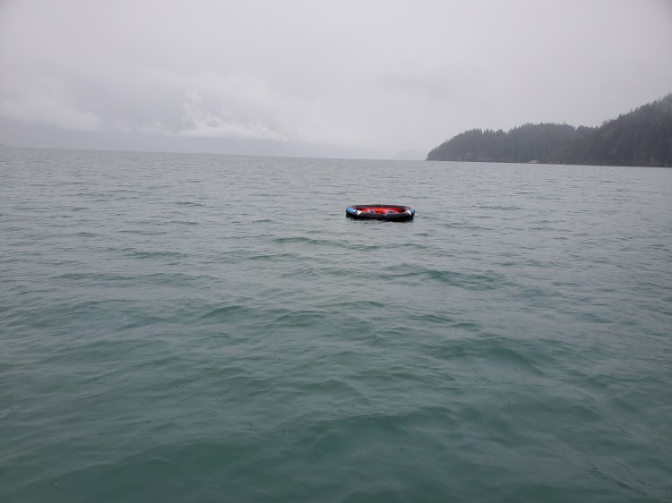
I spotted the curiosity in the image below at a distance and decided to investigate. At first, I thought it was a floating wheel of sorts. As I approached, I realized it was a tubing floaty, which I initially thought had escaped a dock in the wind. Then I noticed that it was anchored and must be a trap marker. An interesting choice, but I guess it would be harder to miss on retrieval.
The rains were strong by the time I arrived onshore at ínaḵa Lhaxwm (Ramillies Channel) shortly after 1100 hours. On land, I put my paddling coat to use as an extra layer as I started my camp setup. Last year, we chose the most southern tent site because it was canopied by higher trees and easily accessible. This year, I picked the tent site north of the site from last year. I hoped it would be easier to set up a tarp solo there, with the lower surrounding trees. My tarp game was not as strong as the previous time I was at Camp Ramillies, since I was missing my wingman, T-maz, to show me the ropes (literally and figuratively). But after a few attempts, ‘Camp Peeters’ came into its own. It is in the image below. I was able to set up my tarp to get a good enough runoff that was draining to the beach and not upland.

It was only after setting up camp, when I was under shelter, that I realized I didn’t have reception. My texts to loved ones had not been sent. I change to my Garmin inReach Mini satellite communicator to send out messages. Eventually, the texts were sent and received, but the reception was so spotty it was completely unreliable. I realized that it was better to time-stamp my messages in the text body so the recipients would know when they were actually sent.
The rain settled down shortly after my shelter was erected. After changing to dry clothes and warming up, I made lunch under cover and a light drizzle. Lunch was Nomad Nutrition‘s, Kathmandu Curry. I debated between that and their Indian Red Lentil Stew. I think I was craving more the Indian-style curry, so the Kathmandu, while good, was a bit of a letdown. Not the chilled-core comforting curry I was craving.
I listened to the Howe Sound marine weather forecast on my VHF radio. The rain was forecasted to end in the evening. I was socked-in at present (see image below), so I hunkered down in my tent for a rest. I considered the possibility of trying to get home today but decided that it would be better tomorrow with potentially better weather. And I would be dry (hopefully) and warm (at least to start) for my journey home. I read and made some trip notes before drifting off to sleep.
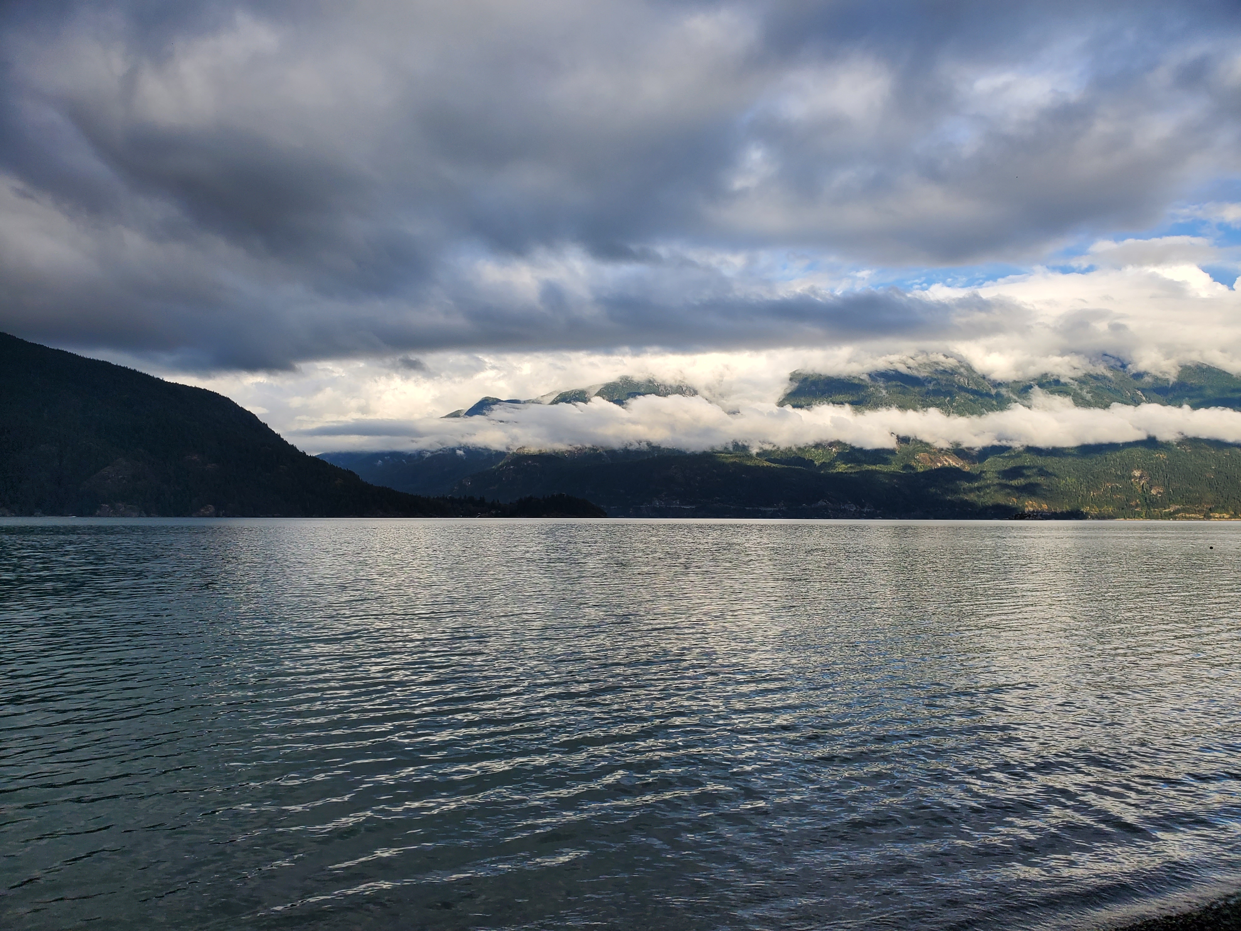
By the evening, the skies were starting to clear. The radio weather forecast was calling for southerly inflows again. Without cellular reception, I couldn’t get any other details from any other weather sources. I would trust the forecast and my observations. Given the breaks in the cloud cover and glimpses of blue sky, the weather looked more favourable for the following day. The first image below is the view over the southern side of Lhaxwm (Anvil Island), where things were starting to clear, followed by the view north, where the cloud cover hadn’t quite cleared yet.

I took the photo below for consistency and posterity. I thought it was prudent since I took the same shot at Sxwan’shnm (Tantalus Landing).

By dinner time, the weather was in fine form. The cloud cover made for some spectacular colours. I enjoyed dinner from the comfort of my Karrimor cushion-lined log on the shore of the pebbled beach and took in the scenery.

Below is a survey of the surrounding shoreline skyline.
I skipped a few stones to pay tribute to my past visit to these shores. And despite wavier waters, I was much more successful after having been educated in the science of the perfect rock throw. Then it was camp clean-up before retiring to my quarters for some pre-sleep reading. I wanted to be up early again to beat the inflow winds.
The image below is my route for Day Two and statistics recorded with Geo Tracker.

The video below recaps my route created on Relive from the Geo Tracker GPS data to give the images above more context. If the video below doesn’t work, here is a link to the video on Relive’s site.
Stay tuned for Day Three…

2 thoughts on “SUP’in the Sound 2.0: Day Two”