
Sunday, November 21, 12021 HE
If you haven’t already, check out day one here.
gam·bier
/ˈɡamˌbir/
noun
an astringent extract of a tropical Asiatic plant, used in tanning.
https://languages.oup.com/google-dictionary-en/
gam·bit
/ˈɡambət/
noun
a device, action, or opening remark, typically one entailing a degree of risk, that is calculated to gain an advantage.
https://languages.oup.com/google-dictionary-en/
After such an early bedtime the night before, I woke very early. Too early, as it wouldn’t be light out until much later. I started to read again, which eventually put me back to sleep. I’m reading Peter Frankopan‘s The Silk Roads, which is incredibly fascinating but very dense, not to mention taking me forever to finish.
I woke later at a more reasonable hour though it was still dark out. After searching out the composting toilet in the dark, I was ready to start breaking up camp. As a side note, both the composting toilets I’ve used at the BC Marine Trails sites have been excellent for the outhouses’ odors and cleanliness.
It rained lightly overnight, but everything underneath my tarp was dry. I packed up my sleeping gear and tent before making breakfast, Quaker Instant Oats Maple and Brown Sugar, dried mango, mixed nuts, and a cup of Earl Grey tea.
I ate breakfast down by the marine site’s launch and landing, watching a mix of sunrise and Vancouver‘s background irradiation.

When I came back up to my campsite, I noticed some mud on my hydration backpack. As I wiped it away, I noticed another small pellet of mud. And that’s when I realized what it was. Mouse turd! A little visitor had scampered about through the exterior pouch and the slightly unzipped main compartment, leaving me a trail of morning nuggets.
While paddling, I often stow the wrappers to snacks in the exterior pouch of the hydration pack to be thrown out later. I had moved the wrappers to my garbage bag the night before, which I left sealed and stored in the bear cache. But I guess there was still enough remnant aroma to attract my murine mate. And in hindsight, I had spotted a mouse last yesterday when setting up my tent. Furthermore, I suspect some of the nighttime sounds that I heard were the scampering of my murine manure-mail make-good.
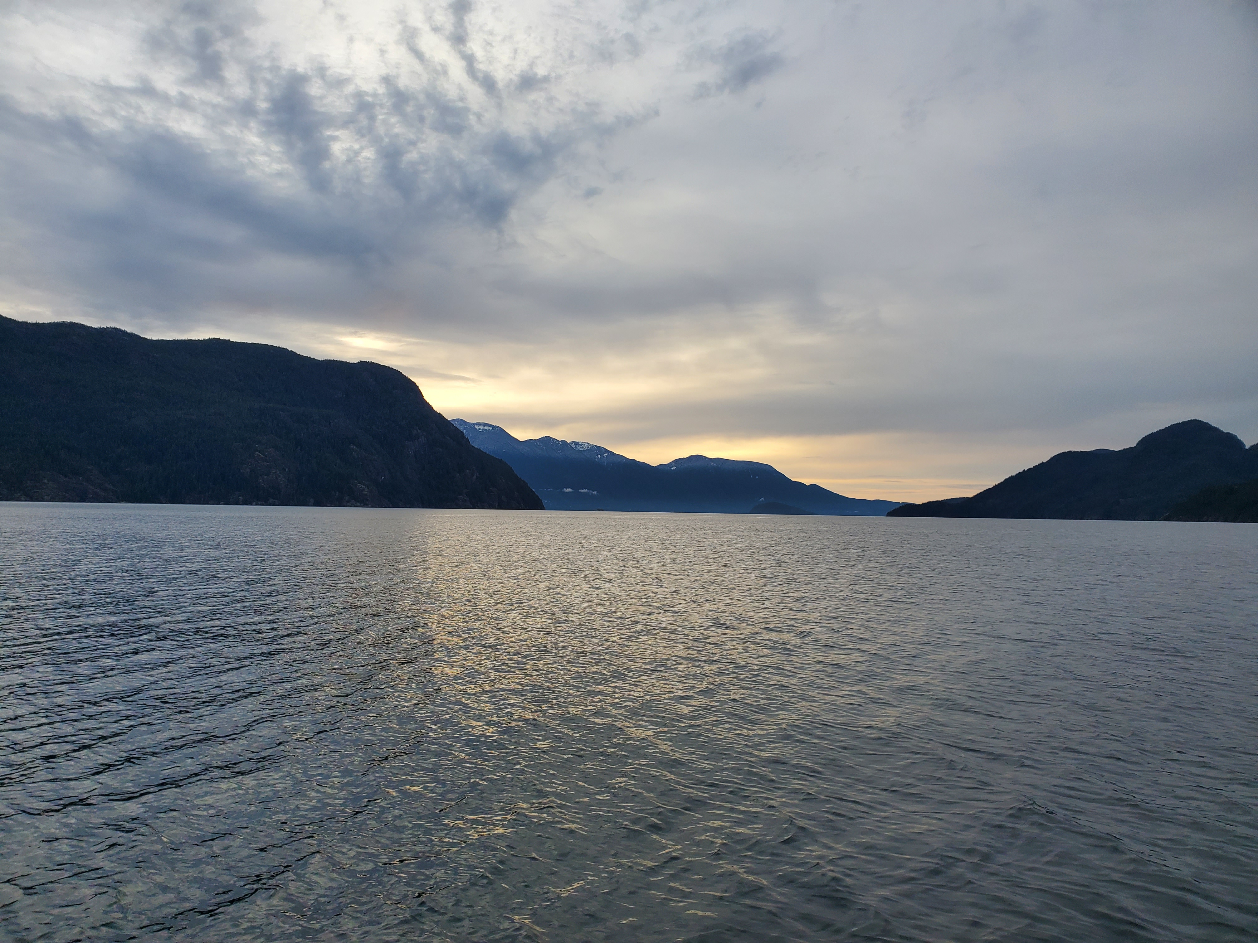
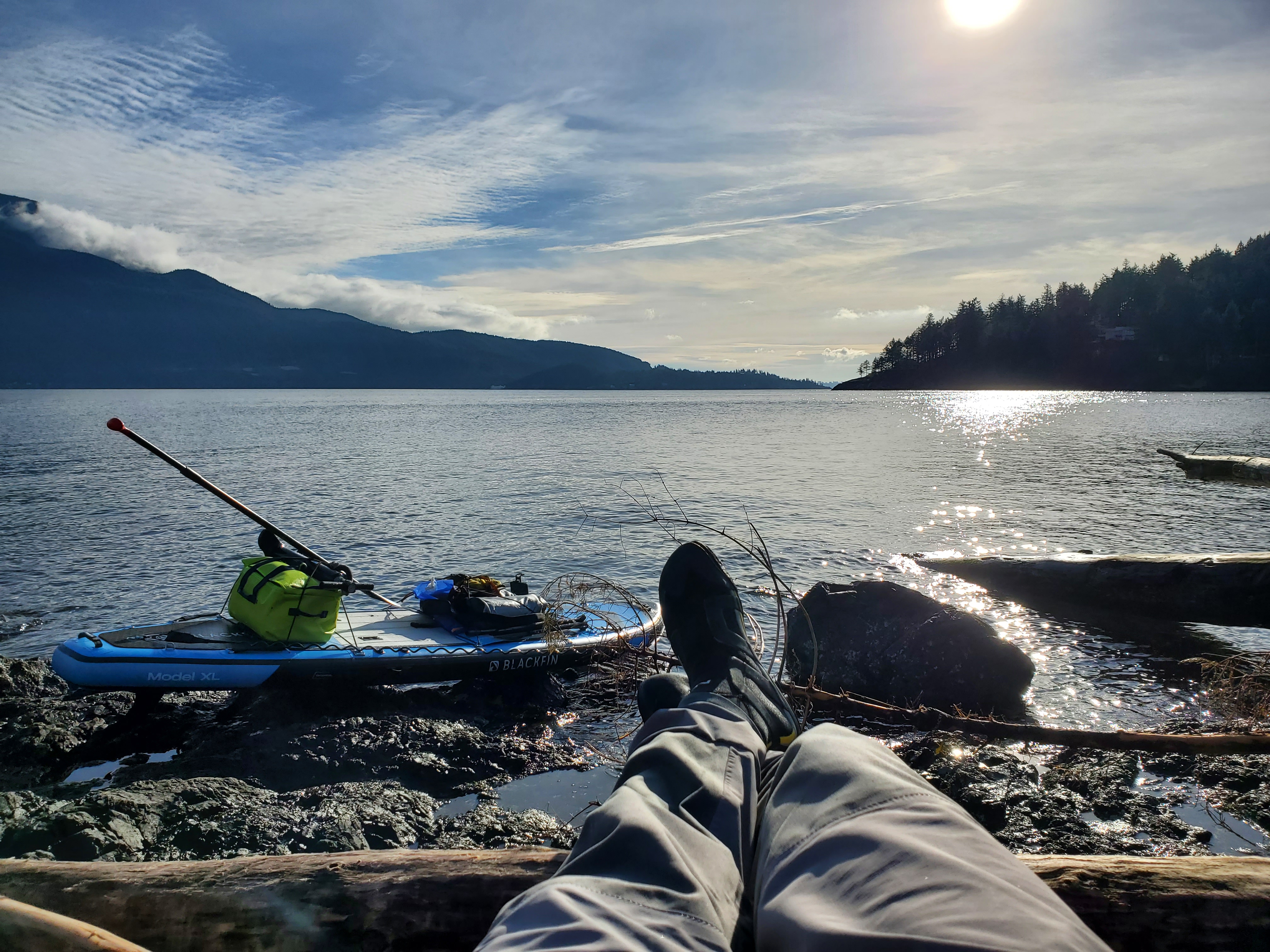
The feculence clean-up delayed my departure, and I missed the cresting of the rising sun. When I made it back down to the shoreline, the sun was on the horizon already. I decided to set my camera up on my board to record while I finished packing up.
Below is a timelapse of the morning sun as I prepare the rest of my gear before departing txwnaḿ Chá7elkwnech (Thornbrough Channel).
When I was finally ready to embark, it was 08:00. My defecation disposal delay has cost me a few minutes. I was now around 30 minutes behind schedule. But I was also departing from txwnaḿ Chá7elkwnech (Thornbrough Channel) rather than Smenmántm Ḵ’í ḵp’ikw (Bain Creek). So my schedule would be somewhere between my two tentative itineraries. Below is the itemized itinerary for day two of my paddle. For the entire SUP float plan see here.
SUP FLOAT PLAN: Horseshoe Bay to Gambier Island (Round-trip)
Itemized Itinerary
November 21, 2021 (Day 2)
07:30 🏄🏽♂️ ↗️ (Bain Creek) or Thornborough Point ((9) or 6 km)
(09:00) 08:30 🏄🏽♂️ ↔️ Ramillies Channel (9 km)
(10:30) 10:00 🏄🏽♂️ ↔️ Christie Islet (1 km)
(10:45) 10:15 🏄🏽♂️ ↔️ Pam Rocks (9 km)
(12:15) 11:45 🏄🏽♂️ ↘️ Cates Bay
(12:20) 11:50 🥘 ⏸ Cates Bay
(13:20) 12:50 🏄🏽♂️ ↗️ Cates Bay (6 km)
(14:20) 13:50 🏄🏽♂️ ↘️ Horseshoe Bay
(14:40) 14:10 👥 ↔️ Horseshoe Bay
(14:50) 14:20 🚗 ↗️ Horseshoe Bay
(15:35) 15:05 🚗 ↘️ Home
(~34 or ~31 km)

There was a northeasterly coming down the sound, giving me a moderate crosswind to contend with as I made it out past the protection of the point. I planned to paddle to Christie Islet and Pam Rock to check out the sights. But the more easterly wind had me questioning my decision. I would have to fight a bit of crosswind only to likely later ride it back to the west closer to Chá7elkwnech (Gambier Island) and Halkett Point.
As I made my way more toward ínaḵa Lhaxwm (Ramillies Channel), the wind and waves started to feel like they were slightly more behind me. So I decided to stick to my original plan of heading toward Christie Islet and Pam Rock. I hoped that the further south I went, the more northerly the wind and wave direction would be. I tried to get a gauge of the sea state ahead. There was some calmer water on the leeward side of Lhaxwm (Anvil Island), but ahead of that and more westward, things looked more lively.
The image below shows the change in water texture to a more lively state from the flatwater of yore. The view is northeast past Thornbrough Point on the left toward Lhemlhemḵwús (Islet View Marine Recreation Site) and the Kwum Kwum (Defence Islands) in the centre of the image. On the right, there is Domett Point. Whenever I see Lhaxwm (Anvil Island) on a topographical or terrain map, I can help but think that Domett Point looks like a phallus at the end of the island. You can judge for yourself here if you’re so inclined.

Further into ínaḵa Lhaxwm (Ramillies Channel), the waters were calming. But there was a crispness to the air that wasn’t there from the day before.
The waters were very calm once I was leeward of Lhaxwm (Anvil Island). I took advantage of the sea state to practice some single-leg paddling. It was a bit different with a loaded board, but I am gaining more confidence paddling on one leg.
As I passed the southern side of Lhaxwm (Anvil Island), the wind from the sound made its presence felt. There was a building east-northeasterly wind. And as I made my way closer to Christie Islet, the crosswind and waves were mounting. It would be very easy to get back to Chá7elkwnech (Gambier Island). The wind and waves would take me right there. There were about 10-15 knots of wind as I approached Christie Islet.
With the wind blowing, I took a moment to shelter from it on the southeast corner to take the photograph below. The islet is a bird sanctuary, so I was hoping for calmer waters to explore around its perimeter. It is prohibited to go onto the islet. Given the conditions, I didn’t spot any birds of interest. I was distracted by the sea state during my limited pass of about one-fifth of the perimeter. In the time it took to take the pictures below, I was already blown away from the islet toward Chá7elkwnech (Gambier Island).

Once clear of the windshield, I made my way into the northeasterly wind. The waves were travelling more east-northeasterly. I still wanted to pass by Pam Rock, so I had to cut across the waves, which was easy with them crossing from behind and the tailwind.
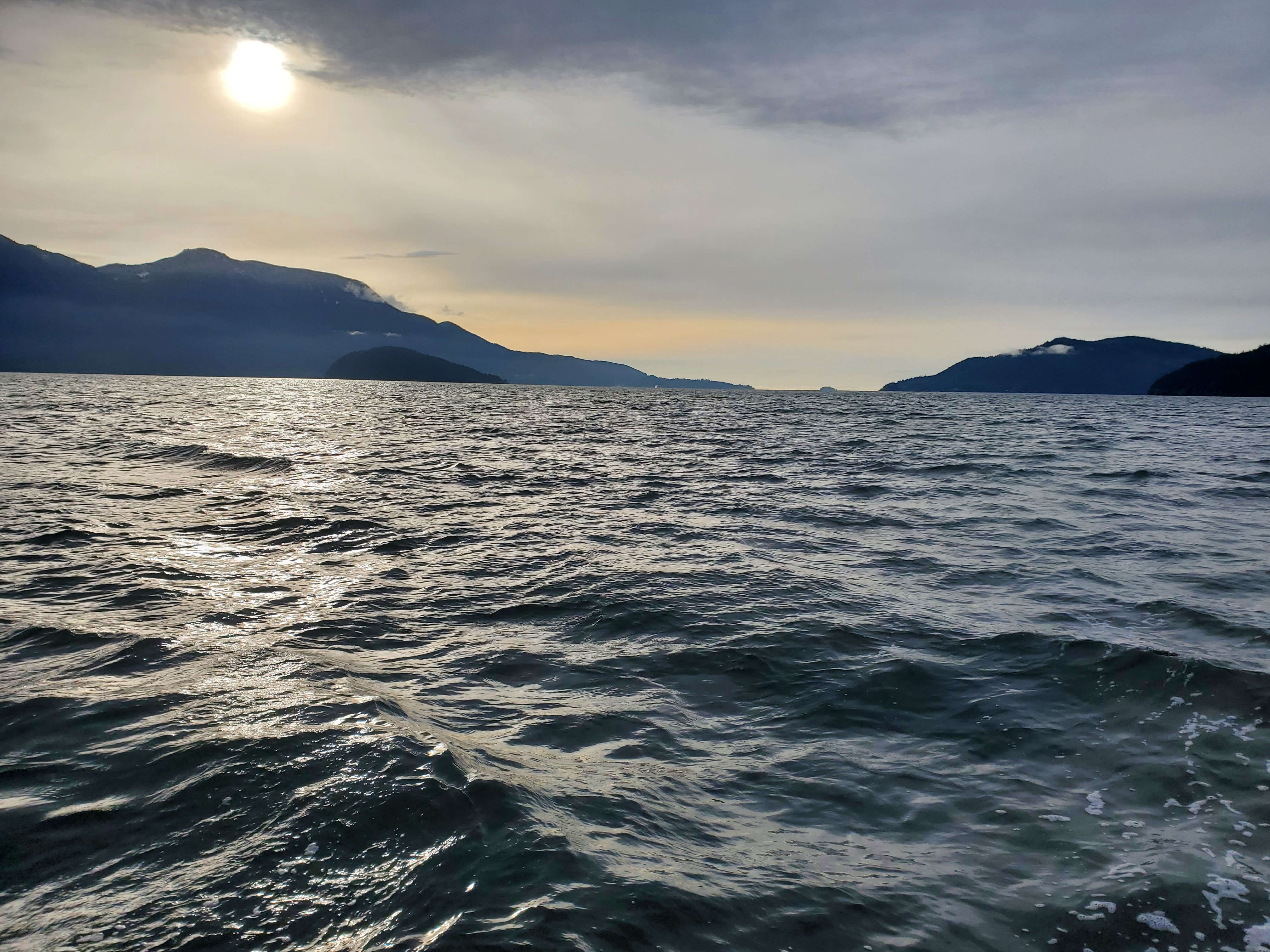
I was moving quickly with the tailwind. I had already made up time to be ahead of my itinerary and was now travelling even faster. I passed Pam Rock without incident. The image below is from south of Pam Rock with Bowyer Island on the left. The tip of Chá7elkwnech (Gambier Island) is on the right, with Nex̱wlélex̱m (Bowen Island) behind that. Passage Island is in the far distance, slightly to the right of the centre of the image.
As I rode over the bumps of Átl’ḵa7tsem (Howe Sound), I thought to myself, why hadn’t I done more trips through the sound in the summer to ride the anabatic wind and waves? The logical answer is it takes two as you would need to shuttle back to your vehicle on a strong downwind. I made a mental note for a goal for next summer to ride some of the anabatic inflows next summer. The video below is a short clip of the water.
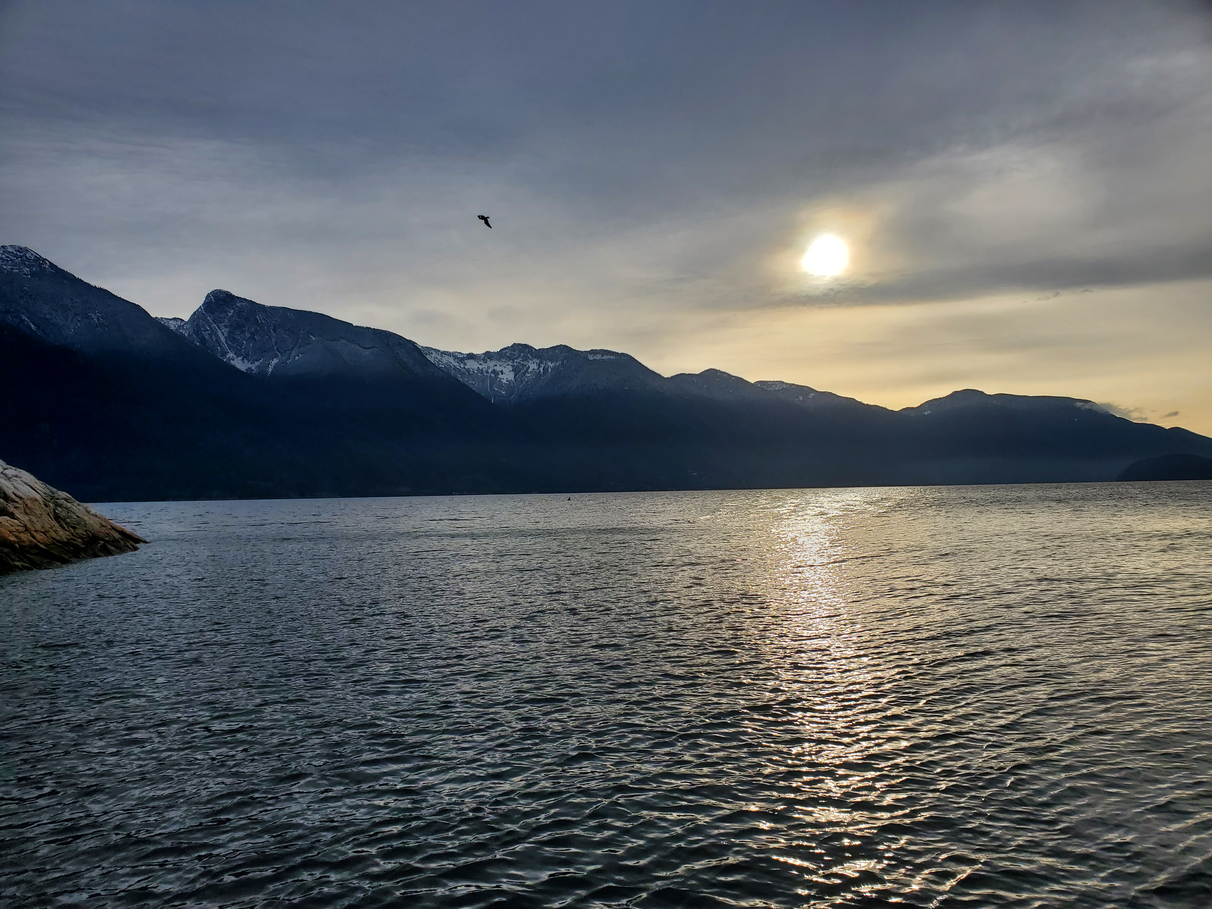
I took a quick over-the-shoulder northerly pic of the sound. It was tough to balance to take the photo, so I was super impressed with how level the image was considering. You can see Pam Rock with the lighthouse on the left and Christie Islet more left. Mount Garibaldi is in the background to the left.

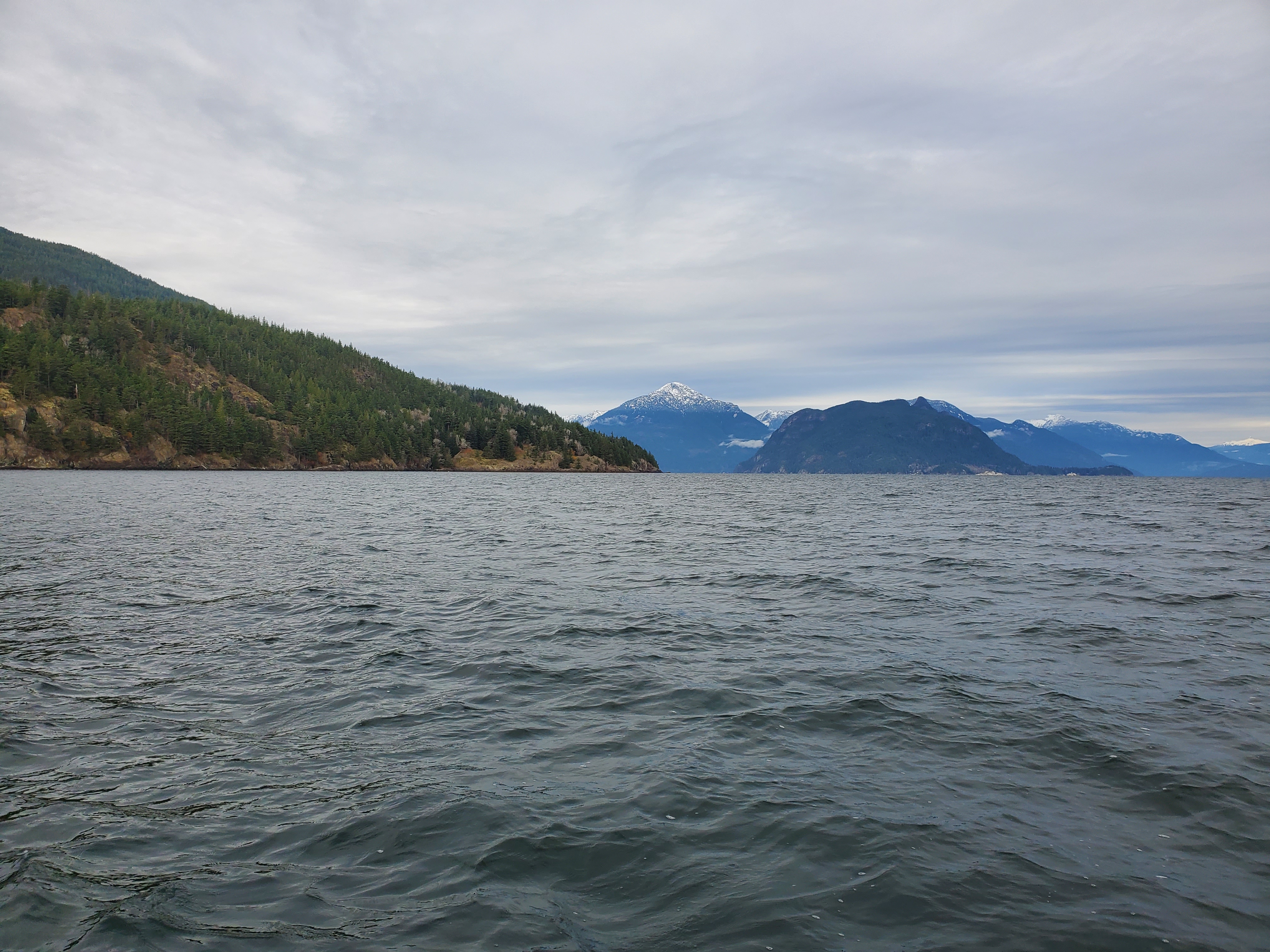
Below is a good view of Mount Wrottesley as seen in between Chá7elkwnech (Gambier Island) and Lhaxwm (Anvil Island) through ínaḵa Lhaxwm (Ramillies Channel).
As I approached Halkett Point, I kept an eye out for the ferries. I would plan my crossings accordingly. I saw the Langdale ferry heading to the Sunshine Coast, so I knew I had my window to cross. I would stop at Cates Bay for lunch before doing the last leg back to Horseshoe Bay. As I neared Finisterre Island and Nex̱wlélex̱m (Bowen Island), it looked like there would be a waterway in between the two islands again.

The tide was lower than the previous day, but I was just able to make it over the tombolo with a minor portage. Basically, I paddled until the nose of my board was beached on the tombolo and then lifted the tail of my board and spun it around to the other side to clear my fins. From there, I skirted between low-lying rocks to a small alcove at the northern end of Cates Bay Beach, where I set up to have lunch. The small cove provided shielding from the northeasterly wind. And with the sun out, I sprawled out to enjoy its rays on the driftwood, albeit still in my semi-drysuit.
I made a telephone call to my father-in-law, Michael, to coordinate a pick-up. He had some things to do on his boat that he would do before coming to pick me up. Thank you once again, Michael, for the shuttle!
Lunch was a small pack of Hungarian Goulash by Nomad Nutrition, more mixed nuts, and an orange. I had a pair of crows watching over me as I ate. And when I went to dispose of my waste in a park waste bin, I came back to find that they had rummaged my waist pack for food. I only realized it when I saw that a ziplock bag full of my emergency duct and electrician’s tape was on the ground beneath the driftwood. I didn’t recall dropping it, and when I came back to my gear, one of the crows took flight from next to my kit. I assume that the crow grabbed the bag, thinking it was a tasty treat. The image below was from near the park waste bin was when the crow took advantage of its opportunity.

As I left Cates Bay, I felt fortunate to have had such mild-mannered weekend weather for my excursion.

For the last leg of my trip to Horseshoe Bay, I still had to cross two ferry lanes. After exiting Cates Bay, I saw the ferry from Nex̱wlélex̱m (Bowen Island) leaving Snug Cove. And in the distance, I could see the Nanaimo ferry. I picked up the pace. If fast enough, I would be able to sneak in behind both of the boats.
About midway across, I was approached by a vessel on my port side. The captain of the ship called out, asking if everything was alright. I called back that everything was fine without breaking my paddle cadence. I am not sure if it was my frantic paddle or my crossing through the ferry traffic area that worried him? But, in any case, the concerned-citizen-considerate-query was appreciated. In hindsight, I wish I had more explicitly stated so. But at the moment, I was focused on getting through the ferry gauntlet ahead of me.
I was a bit further behind the ferries than a perfect pass would have called. But it was a successful crossing nonetheless. Though, the return of the Bowen Island ferry came a bit sooner than I would have liked. I had to make one last hard paddle push to ensure I was out of the ferry’s way when it came back around Tyee Point.
From there, it was easy paddling into the public dock at Horseshoe Bay. I landed just before 13:00, after approximately five hours of travel and just over four hours of paddling. Michael was there shortly after I landed, and we loaded up my kit before heading off to the Red Lion Bar & Grill in West Vancouver for a celebratory pint and bite to eat!
Then it was off to home for a Sunday family dinner capped off with a hydration popsicle. Somewhere, in the boys’ hydration soup preparation, they decided to freeze the mixture rather than boil it. Elijah was quick to recount the secret ingredients: water, potato, bell pepper, cucumber, carrot, strawberry, raspberry, and lemon juice. Then he disclosed that they were “the most disgusting popsicles” that he’d ever had. I took one for the team as a good dad and finished mine to the last lick… suck? Whatever.

I have to extend a big thank you to Sara for helping to get me to the starting line for this trip. To Annie, Elijah, and Kieran for allowing me to go and for my hydration popsicle. We may have to tweak the recipe for future paddles, but I think we are on to something in the world of recovery and regeneration. And my in-laws, Michael and Laetitia, for helping with the kids and transportation.
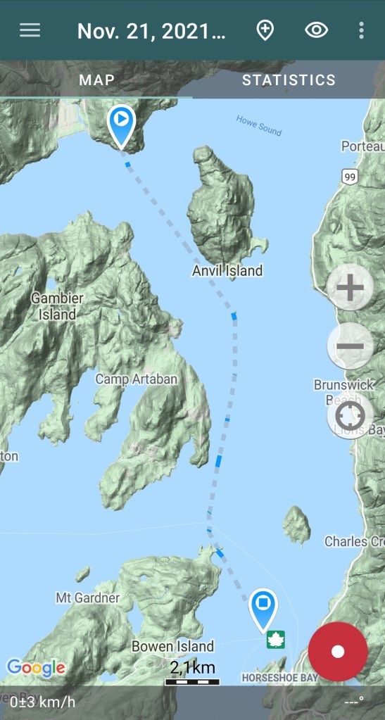
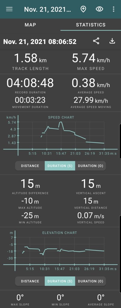
Below is a recap of the route that I took on Relive for day two. The route I recorded on Geo Tracker ended up being a bit spotty for accuracy. But, I was able to recreate a slightly more accurate route post-hoc. That’s why the path looks like more or less a straight shot through the sound, but it gives you a general sense. If you are unable to view it below, here is a link to the video on Relive’s site.
Here are the map and statistics from Geo Tracker for day two, which are slightly off. From the map I created, it was about 23 kilometres of paddling.

One thought on “Gambier Gambit: Day Two”