
Monday, April 11, 12022 HE
I first attempted this paddle on Sunday, March 13, but failed. It was a calamity of errors. First, I was unaware of the time change that morning. I woke up to check my clock, which had automatically adjusted, and saw that it was 0515 hours. After getting my final preparations in order, I was stunned for a moment when I looked at our kitchen clock. It was actually 0430 hours. I was so confused? Did I misread the clock on my phone? I double-checked … nope, my phone read, oh-five-hundred. I looked back at the kitchen and microwave clocks … oh-four-hundred‽ Time change‽ A quick internet search confirmed March 13 as the date of the change to daylight savings time.
I am always slow to figure out what daylight savings time does to the actual daylight. Spring forward. Does that mean we have more daylight in the morning or the evening? I’ll admit I cheated by checking the daylight (sunrise and sunset times) at timeanddate.com. Damnit! The sun would be up later. After a moment’s hesitation, I decided to continue as planned. I’d be there early, but I doubted I would fall back asleep, so I might as well get going.
To make a long story short (well … kind of, I am generally verbose), I arrived in darkness and rain, to discover what I had feared. The gate was closed. I had expected this as the parking lot hours are listed on the BC Hydro park website. My contingency plan was that I would be able to hike into the area board in hand or on my back. But unfortunately, the gate was located quite far from the lake. With the inclement weather and far distance, I was reluctant to walk my board into the grounds. My backup-backup plan was to park in the surrounding residential area and then hike in. But with the inclement weather and sunrise delayed by an hour, I started to reconsider. I didn’t have enough time to wait until 0800 when the gate was to open. Nor was I sure it would open at 0800 with the time change. And as I mulled over my options, I recalled reading that the water levels on the lake were low due to upgrades on the tunnel between the Coquitlam Lake reservoir and Buntzen Lake. I imagined myself out on the water pre-park opening with the lake rapidly flooded. My mind must have made the loose connection to the 12020 (HE) tragedy with the Cleveland Dam. The dam opened accidentally and without warning, flooding the Capilano River and killing two fishermen, and forcing others along the riverbank to scramble to safety. Not the same scenario, I know, but your mind can do funny things in the wee hours of the morning with an hour’s less sleep. That vague thought, coupled with a darker and wetter morning than anticipated (I didn’t account for the time change and thought the rain would be over by the early morning), resulted in me cashing my chips in that morning.
Buntzen, or perhaps better stated, I, would have to wait for another day.
Buntzen Lake
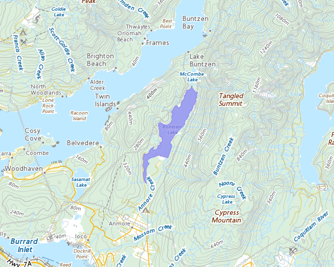
Rationale: I have never paddled it, and it is in the local area.
Location: https://goo.gl/maps/k9Gv3fGGHQeuGHfAA
Estimated Travel Distance: 42 km
Estimated Area: 1.44 km²
Estimated Circumference: 9.9 km
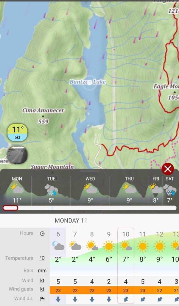
It turns out it would essentially be a synodic moon period. Or a complete cycle of the lunar phases. I had hoped to do a sunset paddle last night and then complete Buntzen Lake over the Easter long weekend. But thankfully, a hail and thunderstorm began before I was out on the water. That put an end to that plan. Instead, I did a grocery run and made dinner for tonight, so I would have the morning to play rather than complete errands and household chores. And it proved to pay off as the passing of last night’s storm resulted in clear morning skies. Though, the forecast on Windy.com did predict gusts of wind. I didn’t know what to expect on the water with the extreme differences between the baseline wind and the wind gusts (see image below). Twenty plus knots of northerly winds would make the northbound portions of the paddle … um, challenging?
I put together a paddling itinerary. The itinerary was more for me to estimate how long the entire endeavour would take. But at the same time, it is always a good thing to share with someone when doing a solo paddle.
SUP FLOAT PLAN: Project Paddle: Buntzen Lake
DATE: Monday, April 11, 2022
ROUTES: Circumnavigation of Buntzen Lake
VESSEL: Teal Blackfin Model XL iSUP
EST. DEP. From home: 0915
EST. DEP. From Buntzen Recreational Area: 1030
EST. ARR. @ Buntzen: 1230
EST. ARR. @ Home: 1345
Details:
Estimated Circumference
• Buntzen Lake 9.9 km
Wind
• Forecast: see Windy App
April 11
• North-Northwest to north-northeast (NNW, NNE) 3-5 kt (21 kt wind gusts)
Air Temperature
• 5-8°C
Water Temperature
• ~8°C
Daylight (Apr. 11):
• 0554 – 2032
Drive Distance: 38 km
Drive Time: ~1 hr
Paddle Distance: ~9.9 km
Paddle Time: ~2 hrs
Personal Info
TRAVELLERS: 1 (Mon Jef Peeters)
VEHICLE: [Colour] [Year] [Make] [Model] [ABC 123]
PHONE: [xxx-xxx-xxxx]
Itemized Itinerary
• 0915 🚗 ↗️ Home
• 1015 🚗 ↘️ Buntzen Lake
• 1035 🏄🏽♂️ ↗️ Buntzen Lake (9.9 km)
• 1235 🏄🏽♂️ ↘️ Buntzen Lake
• 1250 🚗 ↗️ Buntzen Lake
• 1350 🚗 ↘️ Home
The drive out to Buntzen Lake had spectacular views. You get awesome views of Coquitlam Mountain and Golden Ears heading into Coquitlam en route to Anmore. The thought crossed my mind to take a photo while driving, but I refrained for safety and legal reasons. The views of snow-capped peaks on a crisp and clear spring morning alone were worth the trip, in my opinion. I didn’t see any of this in the dark of night on my first attempt at circumnavigating Buntzen Lake.
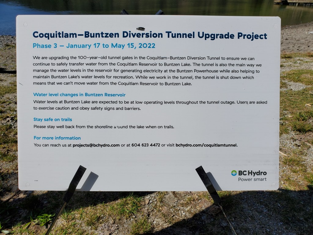
Arriving at Buntzen Lake I decided to do a quick survey of the shoreline and water before setting up my kit. From my previous attempt to paddle Buntzen Lake in March, I had read that the water levels would be low. BC Hydro was upgrading the diversion tunnel between the Coquitlam Reservoir and Buntzen Lake (see image below). So I wanted to ensure that the water levels were navigable.
I didn’t have much to compare the shoreline to. It had been a long time since I had been to Buntzen Lake. The beach appeared extra-long and the swim area extra-short, but that wouldn’t affect me. The water looked paddleable.
I got my kit in order, then went back to the beach. There was a trio of hikers getting ready at the same time. I pump up and deflate my board on my trailer hitch bike rack, so the hikers joked that my paddleboard rack could also hold bikes.
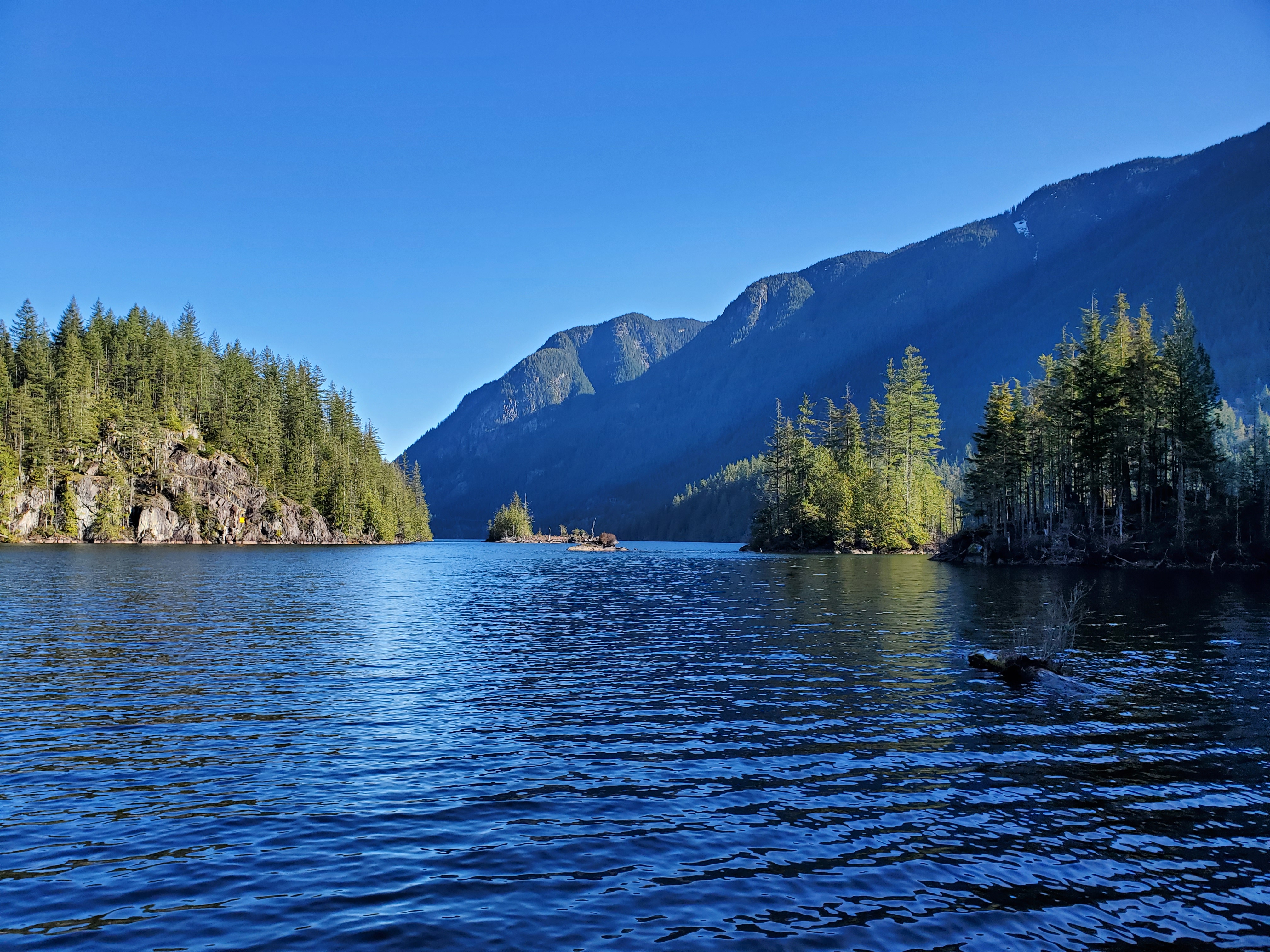
At the lakeshore, there was a moderate northerly wind. Wind waves were forming in the central waters of the lake. I decided to head south to start, launching from the shoreline west of the dock in the Recreation Area and travelling in a clockwise direction.
The lake was quiet, with a few fishermen, beachgoers, and hikers out and about in the Recreation Area.
I planned to take advantage of the lake’s geography with a clockwise circumnavigation. I hoped that the various coves on the western lakeshore would provide some wind coverage. The water looked low as I paddled southward down the channel between the two islands and the lakeshore near the Recreation Area. There was plenty of deadwood. Snags and deadheads littered my path southward. Thankfully the water was clear, and I could see them all. I wondered how much higher the water levels typically were. Then my fin made contact with a deadhead unexpectedly, and I stumbled on my board. I would need to be cautious and paddle slowly through this section.
I could see the pumphouse intakes across the lake. See you shortly, I thought to myself.

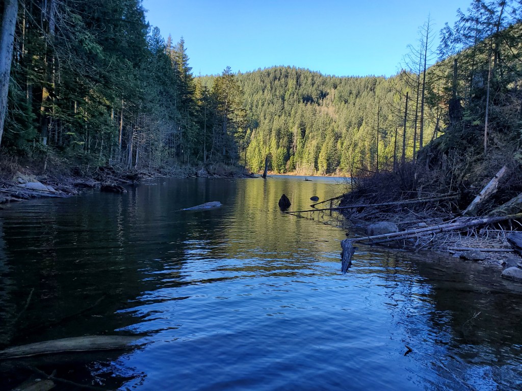
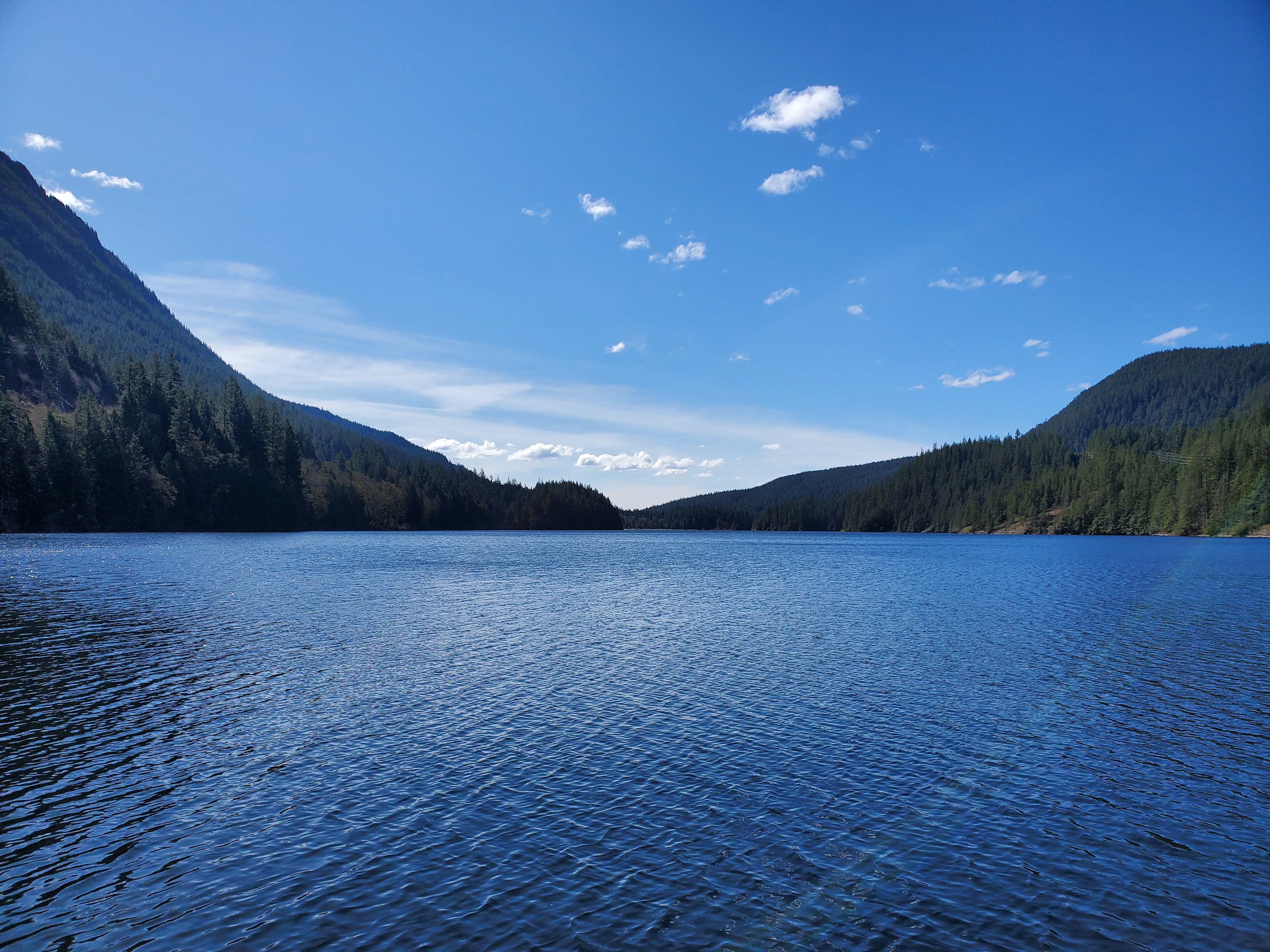
I made my way past the islands and entered the narrow portion of the lake. The effects of the wind through this southwest section were evident. Small wind waves propelled me forward. And I could feel the gusts edging me along like a sail. I hoped my choice of paddling direction would pay off. Below is the view looking back northward.
Below is the view looking toward the southern end of the lake.
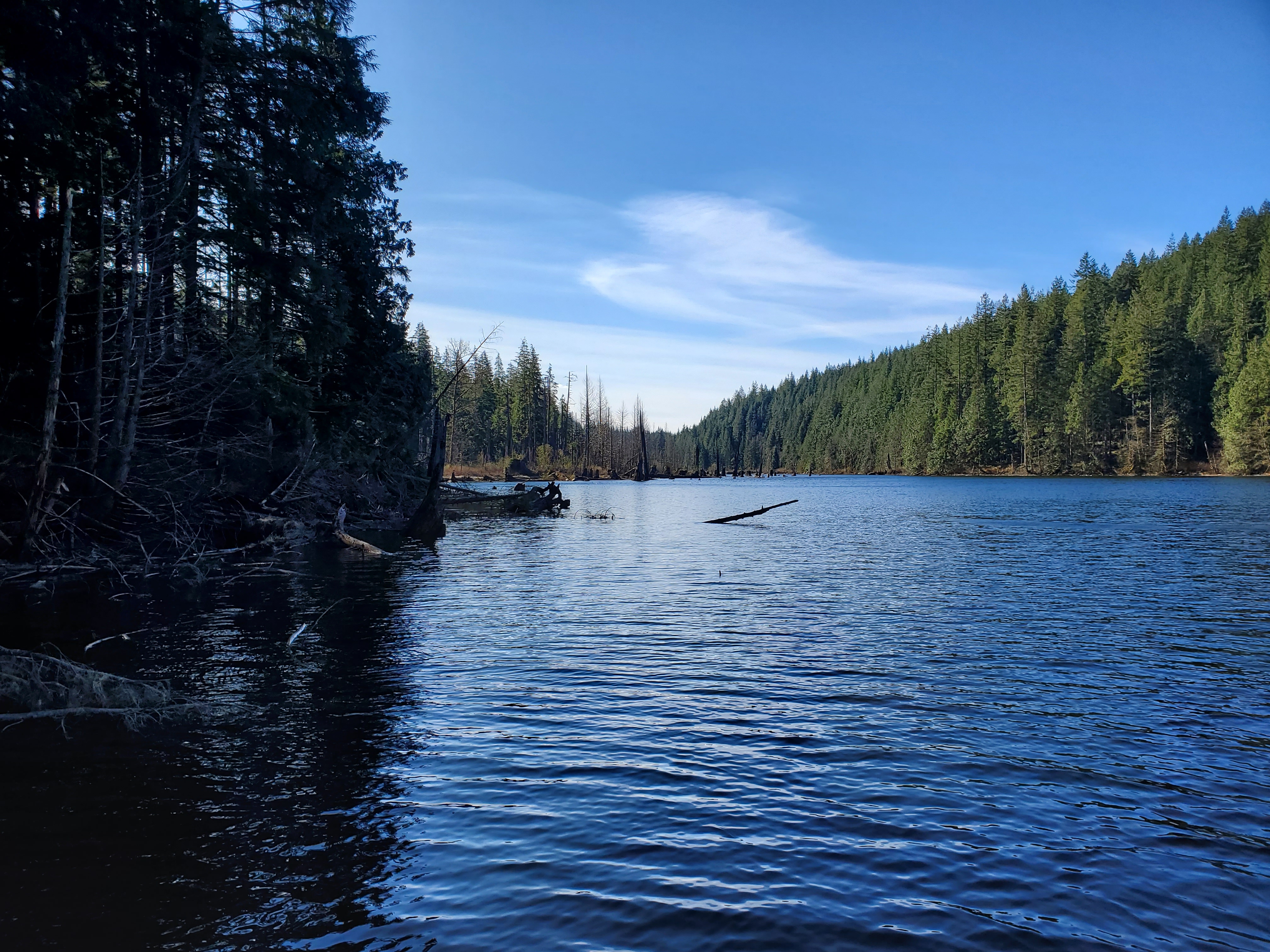
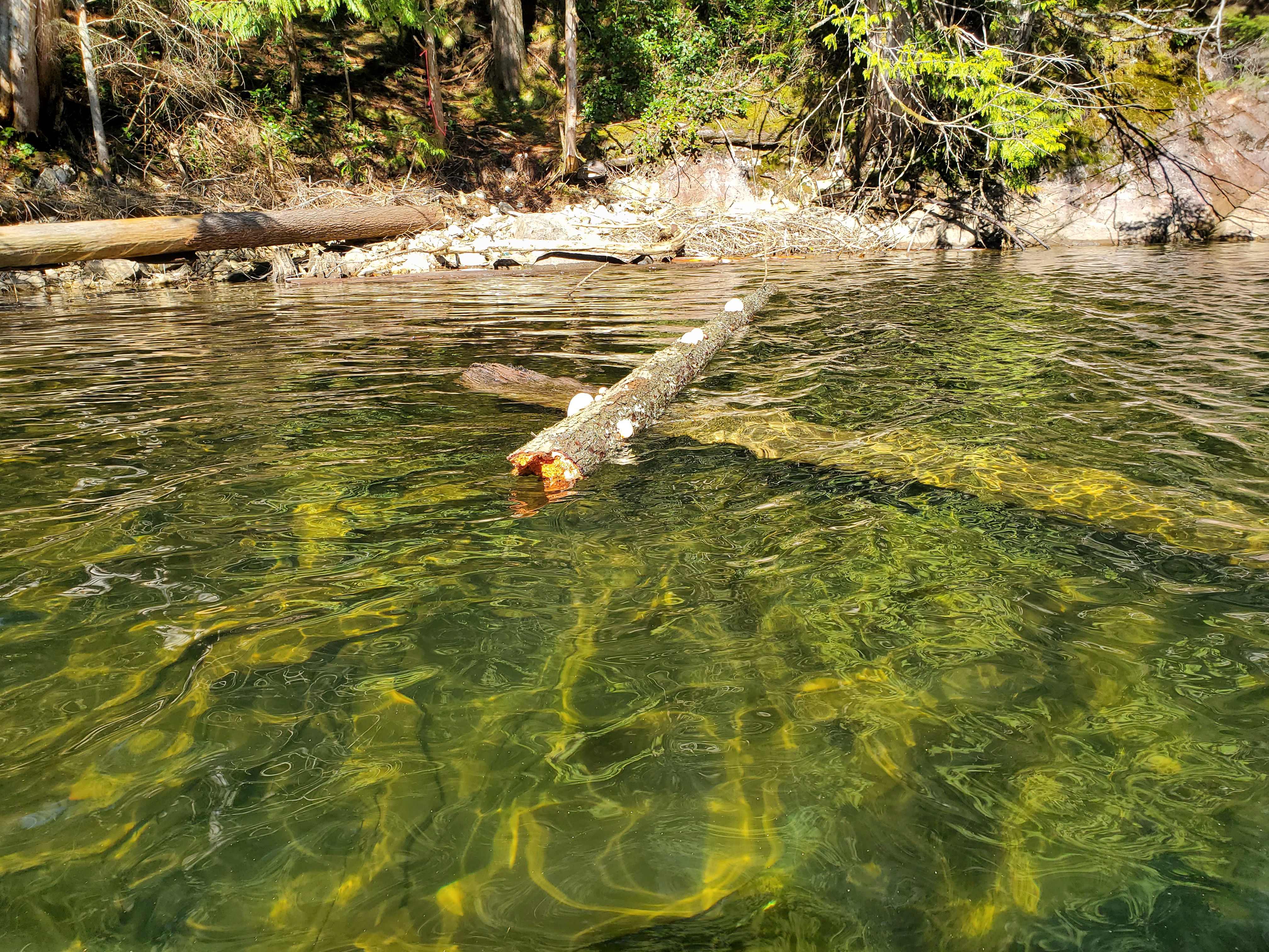
Around the point, there were plenty of deadheads in view. In fact, many of them were stumps poking through the water. I wondered if they had been logged? And I assumed that when Buntzen Lake was converted into a hydroelectric facility, they must have increased the lake size. I figured that was the reason for the submerged forest (flood?) plain.
Post-paddle, I found this historical account of Buntzen Lake. Essentially, an 11898 HE report suggested that creating a tunnel through Eagle Mountain to what was then known as Trout Lake or Lake Beautiful would be a better option than the original plan of diverting water from Coquitlam Lake to Port Moody. Trout Lake/Lake Beautiful would later be renamed Buntzen Lake after the first general manager of B.C. Electric Co., Johannes Buntzen. Check out the link above to read a more thorough history.
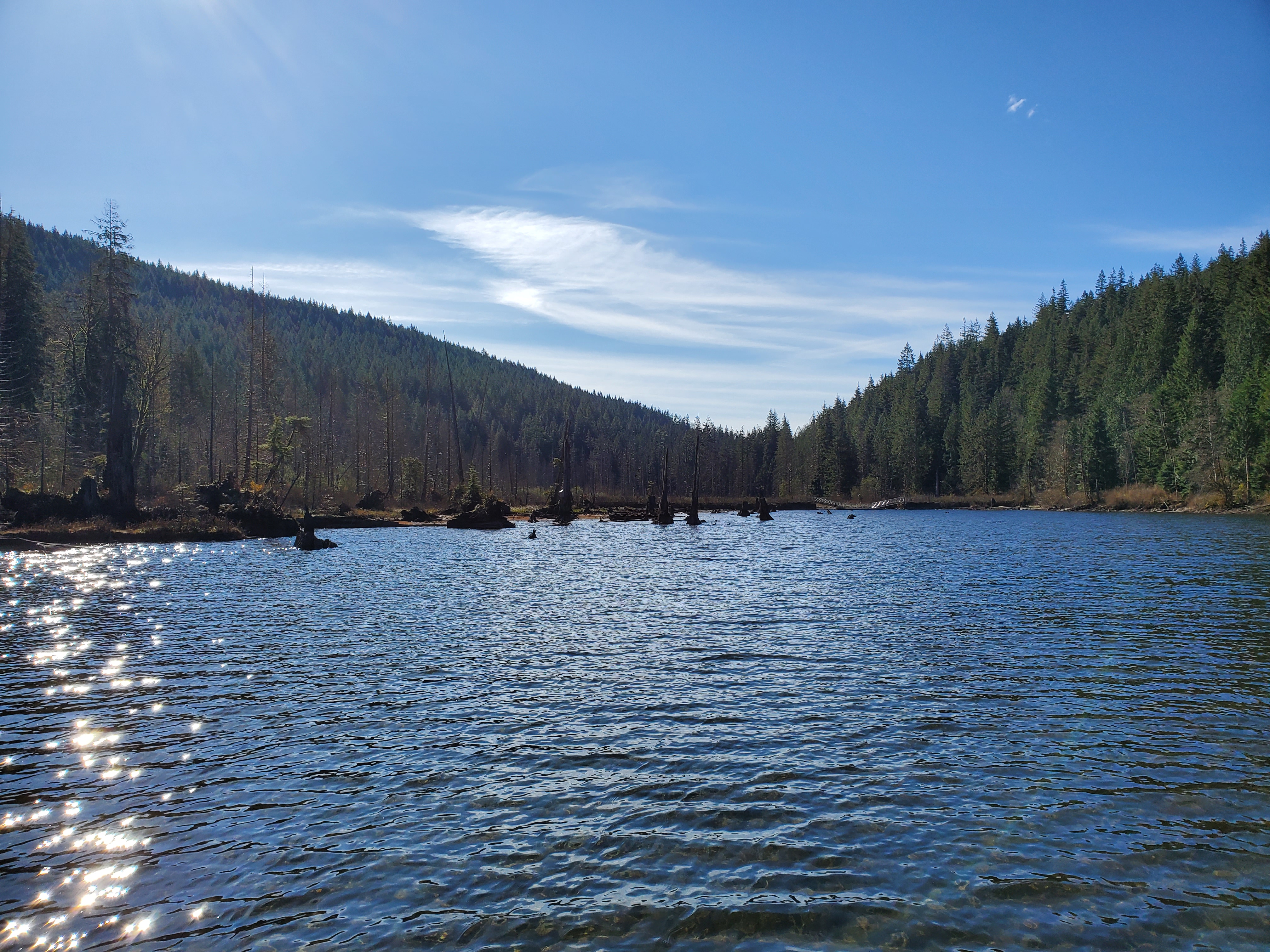
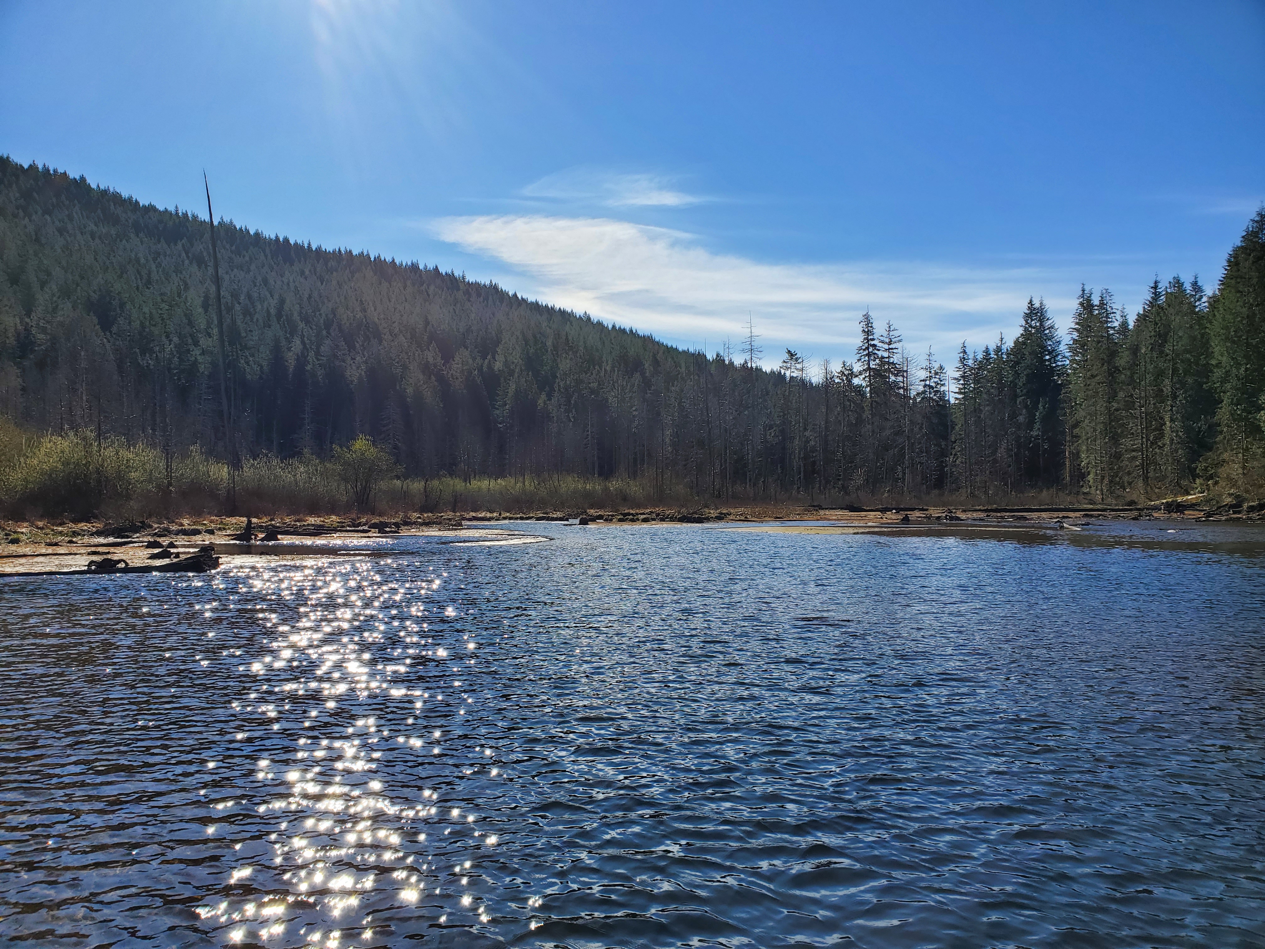
The water levels were low around the southeastern portion of the lake. I found myself dodging snags constantly. At one point, my fin hit a snag unexpectedly, and I fell to my knees to avoid falling off of my board. I slowed my pace and kept a better eye on the lake bottom.
Being able to nose walk proved to be a useful skill. I made it over the top of several shallowly submerged snags by dipping the nose of my board to raise my fin out of the water over the snags. But, in a shallow section of water, the nose of my board bottomed out. I was stuck. Unable to go forward, backward, or sideways. I had no choice but to dismount and portage my board to deeper water. Thankfully, it was only a few paces. I decided to stick to the slightly deeper water, paddling further from the lakeshore to avoid getting stuck again.
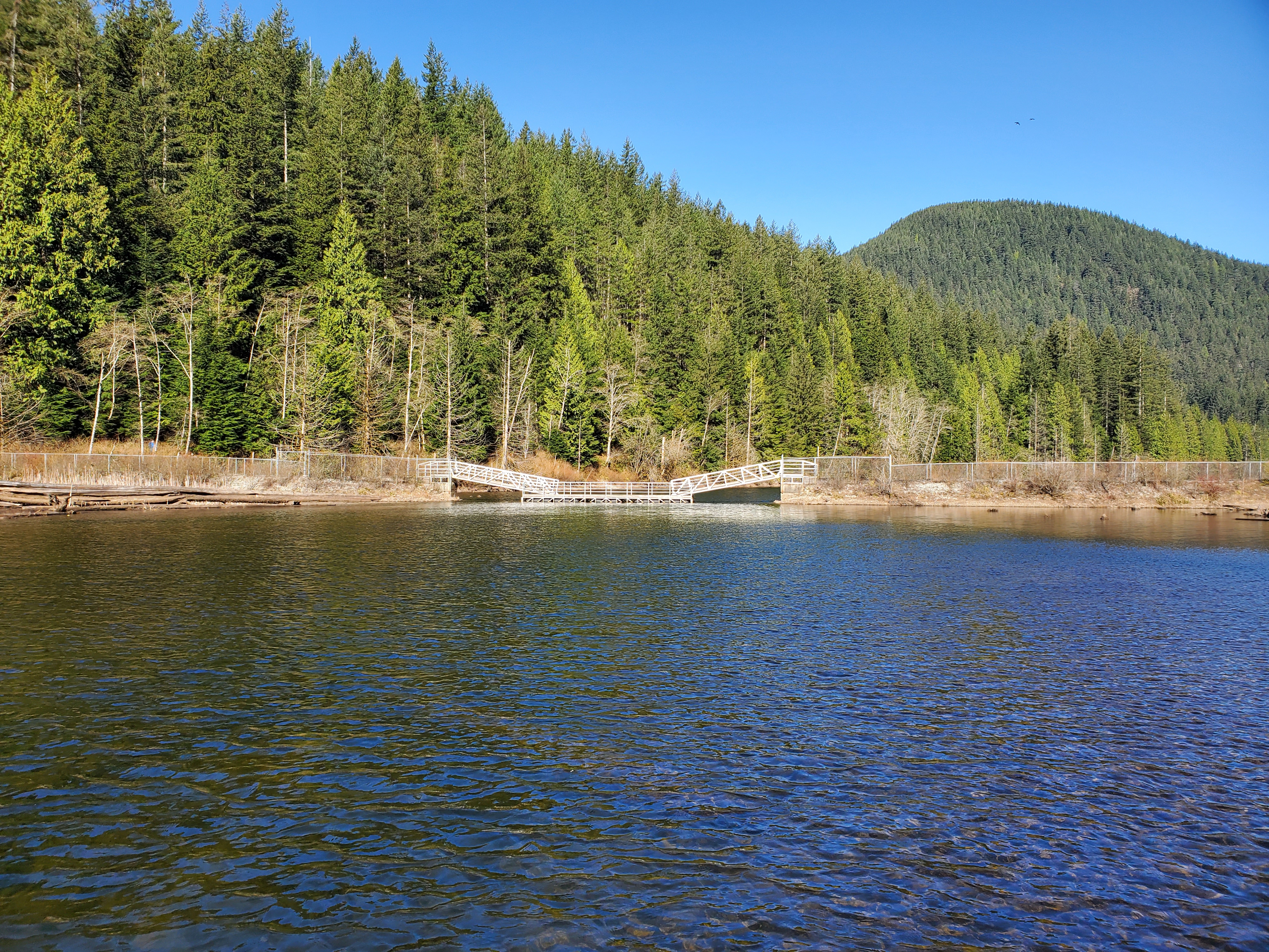
I reached the floating bridge. Should I go under to explore the other side? I passed successfully underneath the on-ramp leading to the floating middle section. There wasn’t much to see on the other side of the bridge. It was more egoism. An attempt to reach the southern end of the lake, to say that I did. In the end, I didn’t venture too far as the waters were shallow, and I didn’t want to get stuck again.
Below is the view of the floating bridge from the southern side.
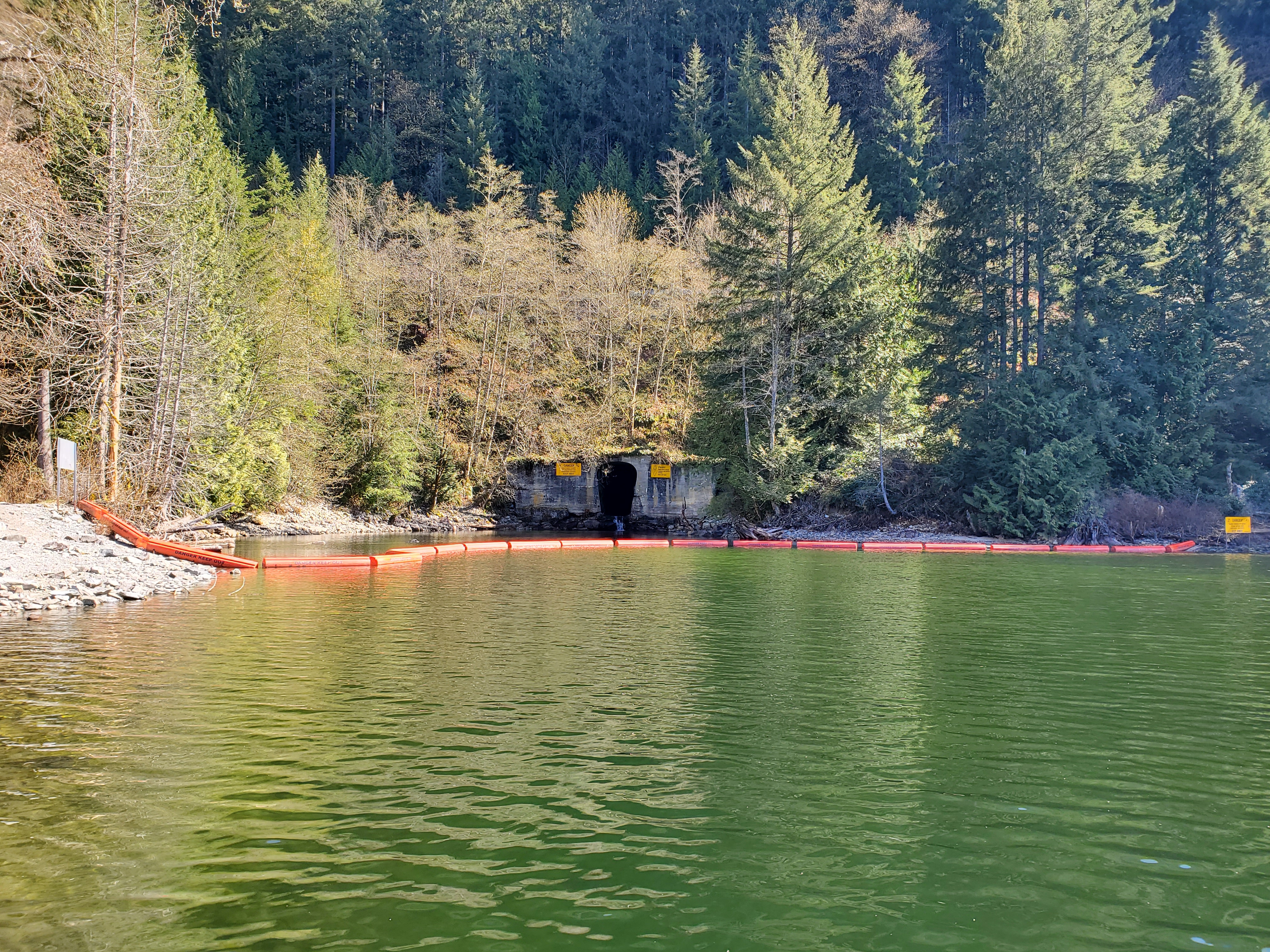
Now time to venture north against the northerly wind. I stayed as close as possible to the western shoreline, using it as a windshield wherever convenient. The wind was strong during the gusts but manageable. I set my sights on the powerhouse in the distance. Though, I was slightly trepidatious given all the warnings about keeping clear of the intakes.
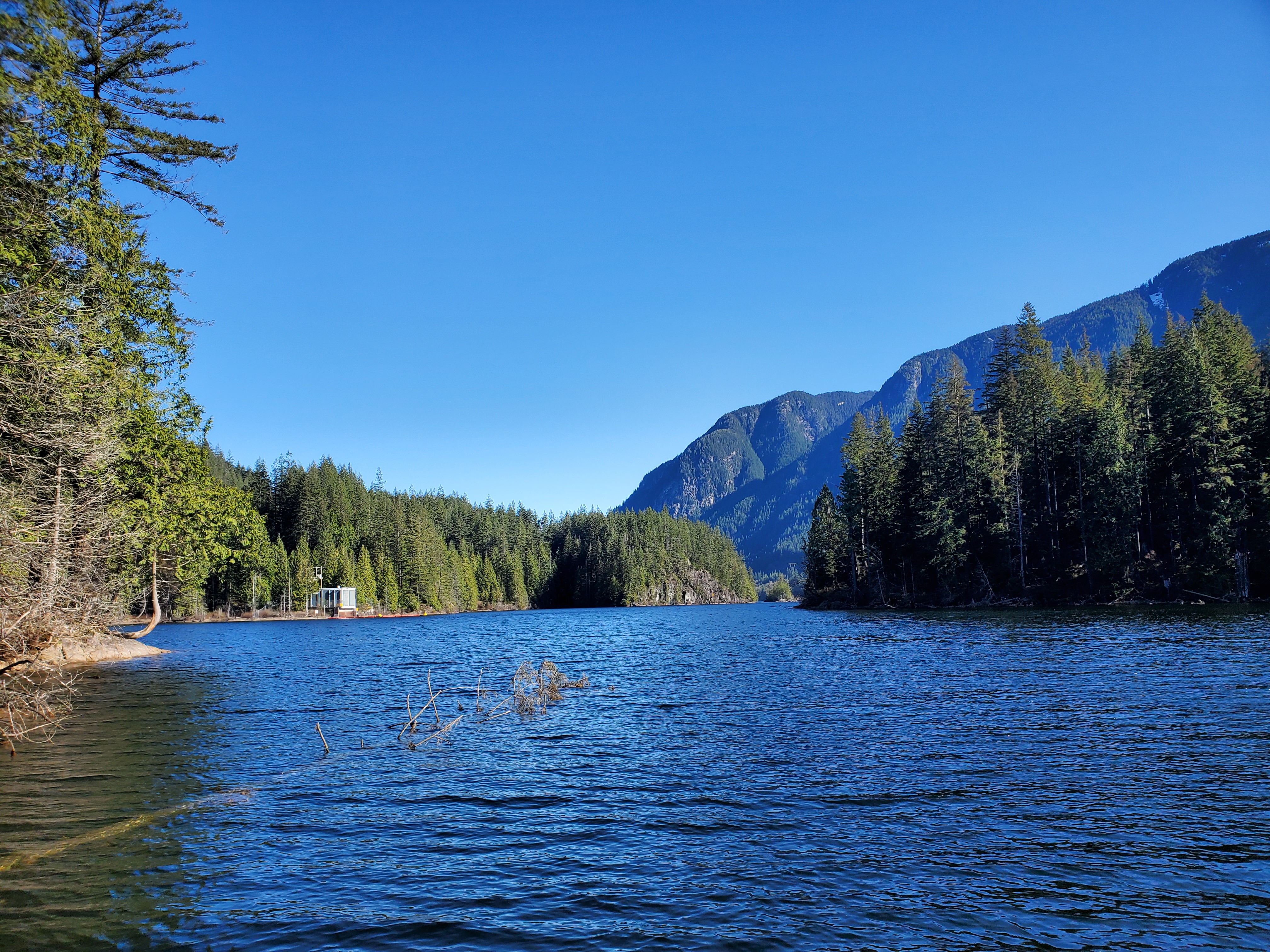
The image below is the view south from near the pumphouse. The intake area is very well marked and blocked off with safety booms. My trepidations were unfounded. I suspect BC Hydro gives off so many cautious warnings to create some apprehension and dissuade anyone from tempting their luck around the hazards.
I quickly explored the small cove north of the pumphouse. Well, at least as closely as I could with all the driftwood and snags.
I paddled past the small island across from the main Recreation Area. I made a short detour from my perimeter circumnavigation to explore it. The wind coming down through the narrow channel between the lakeshore and island was strong and created a small surface current. I continued to the larger bay north of the island.

And below is the view to the southeast from the northern part of the same bay.

The photo below looks back to the main Recreation Area as I paddle out of the southern bay.

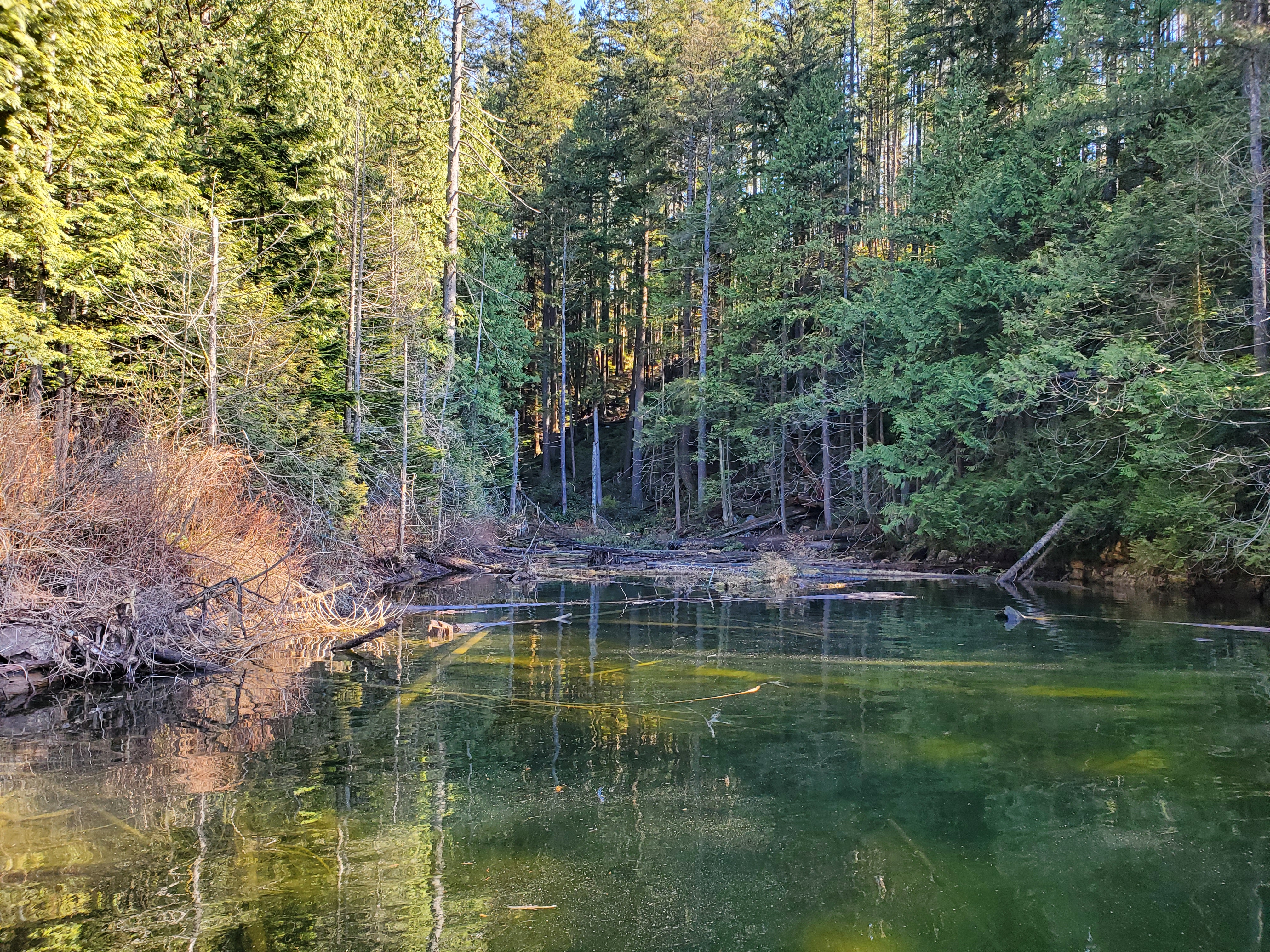
The picture below was an amusing attempt to capture the fungi on this piece of driftwood. In my mind’s eye, I envisioned a bokeh version of the fungus with the scenery to the south behind it. However, the wind was quite strong here, so I defaulted to a picture looking more northerly with the proximal shoreline in the background rather than the far shore.
The next section of paddling was the windiest, with respect to a headwind. There was the northern wind mixing with a northeasterly wind. As I pushed through the wind, I had a minor epiphany. It dawned on me that the easterly wind through this section was a product of the geography. Eagle Mountain is on the eastern lakeshore and has a steep downslope. I realized that the easterly wind was a product of the downslope. I had previously experienced a similar phenomenon on my Gambier Gambit paddle in Átl’ḵa7tsem (Howe Sound) and in Səl̓ilw̓ət (Indian Arm).
To be sure, I wasn’t just making up some nonsense, I searched for evidence to confirm this hypothesis/phenomenon after my paddle while writing this post. Eagle Mountain is approximately 1000 metres at its peak with a steep eastern slope, as seen here on Google Earth. And a downslope wind is a phenomenon generically defined as any wind coming down a mountain slope. More specifically, it can be part of a katabatic system. This phenomenon results from a thermal, and thus, pressure gradient at the slope surface and down the mountain slope. That wind was then travelling across the lake surface. I wonder if the water surface temperature to land temperature was having any effect or if it was just the atmospheric column effect described here. I think this will be a useful lesson for future paddle plans. Yet another reason to take advantage of the terrain view in Google Maps or Google Earth to assess the area’s topography.
The northerly winds were strongest along the last portion of the western lakeshore. I reached the north end of Buntzen Lake. The waterway through to McCombe Lake (or Trout Lake) is again clearly marked off as a hazard. The lake is where the intakes are to the powerhouses, Buntzen No. 1 and No. 2. The suspension bridge traverses over the waterway.

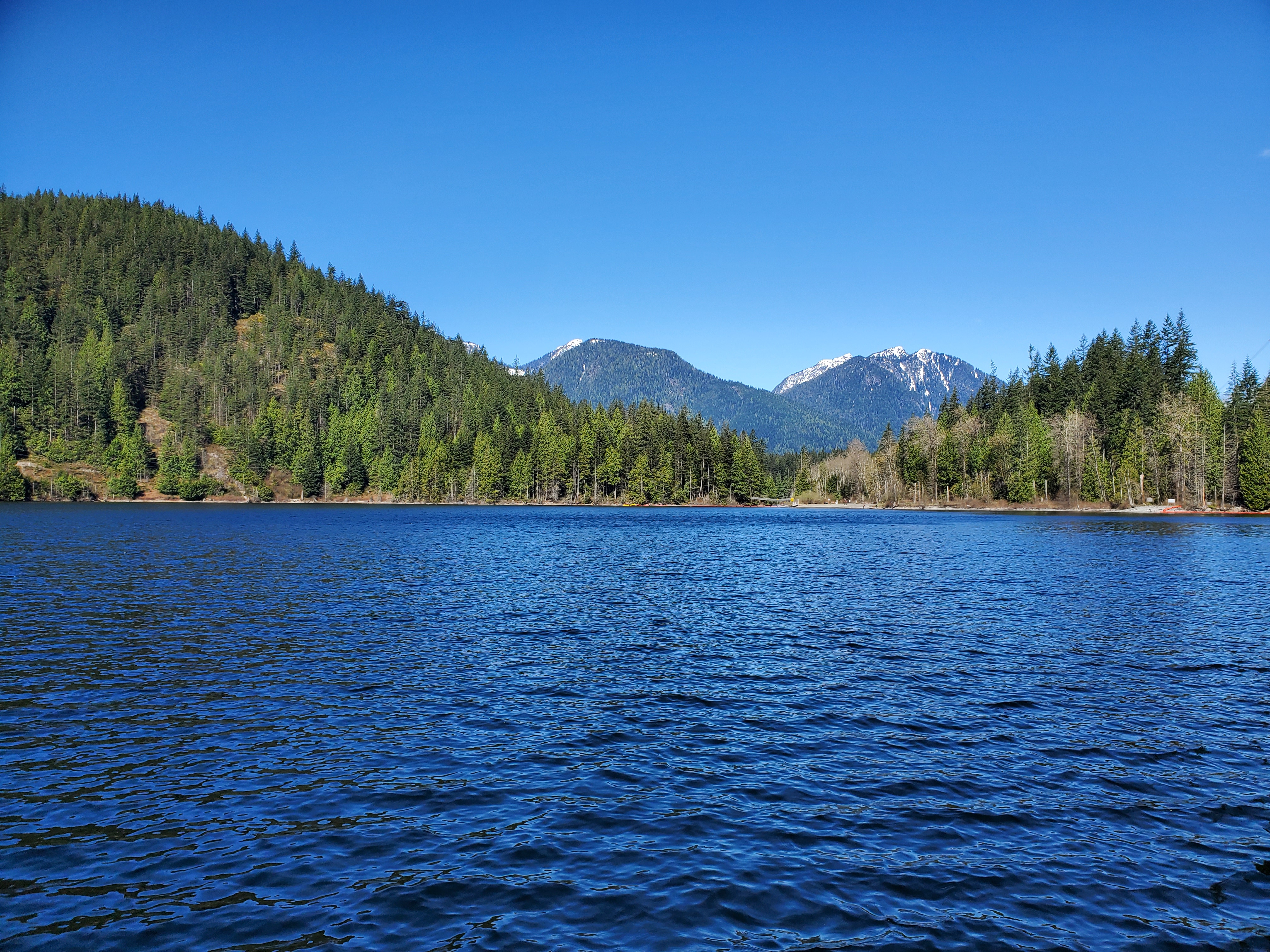
I took advantage of the North Beach for a bathroom break, landing at the pier. Walking past the beach, I crossed paths with the same trio of hikers that were setting out while I was getting my kit in order. Below is the view south from the north end of the lake.
Launching for my return route, I passed by the last hazard area on my lake tour, the Coquitlam Lake Tunnel Outfall. It was only a trickle, but I wasn’t sure if that was normal or due to the tunnel upgrade project.
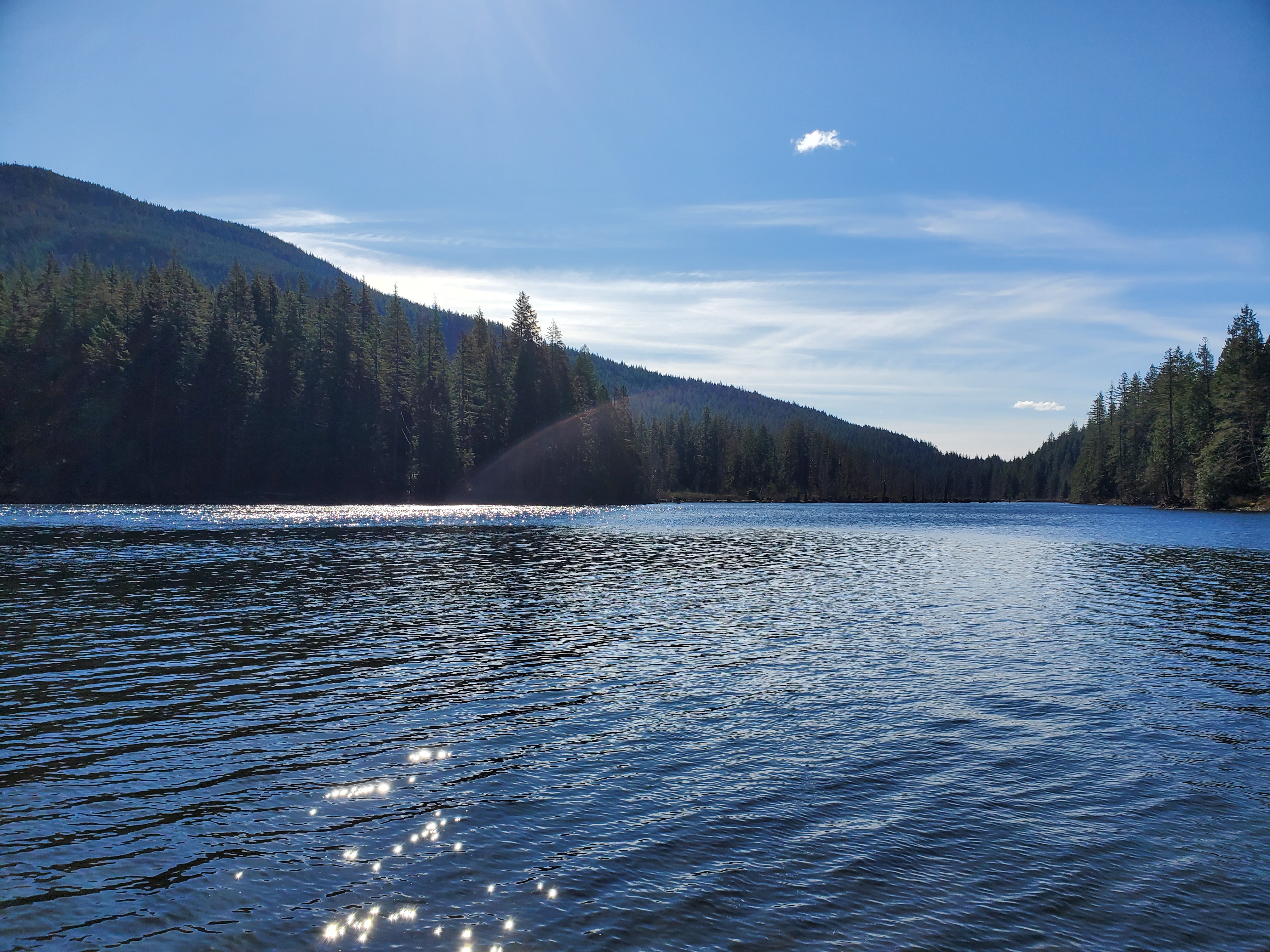
Below is the view northward from the west side of the lake over the trees and across Səl̓ilw̓ət (Indian Arm) toward Mount Seymour Provincial Park. I believe the peak on the right is Mount Bishop and Mount Elsay is on the left.
From here, my lake tour turned into a miniature downwind session. With the wind at my back, I decided to venture away from the shoreline to get into the catch. It wasn’t anything too extreme, but the wind rollers were adding up. At least I had an extra push at my back even if I wasn’t riding any big waves.
I clocked my top speed through this section, so the waves were definitely a help. When I reached the pier at the Recreation Area, I saved my GPS recording for my circumnavigation. I checked the time. I was about one hour ahead of my planned itinerary as I had been able to leave earlier than planned. I decided to do one more downwind run. I had scoped out the eastern shore and the water after the Buntzen Lake Viewpoint. The point was blocking the northerly winds, and the water was much calmer through that section.
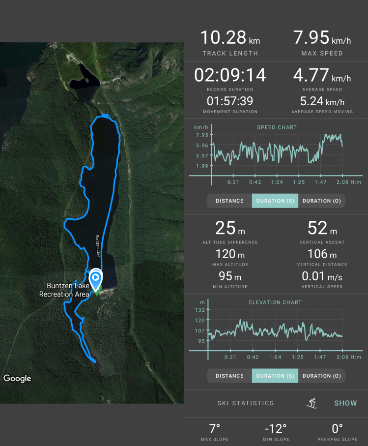
Below is the recap of my circumnavigation route created on Relive and recorded with Geo Tracker. If the video below doesn’t work, here is a link to the video on Relive’s site.
I made my way out across the wind and chop, from the pier to the eastern shoreline. That was the hard part. Once in the windshield, the paddling was easier. When I reached the viewpoint, I had to cut under the fishing lines of two men casting from the shore. They didn’t seem to mind too much. Then after a brief attempt to continue northward, I changed course and cut out into the lake to get more into the catch. It was a wind-aided run back to the pier before calling it a day.
Below are the map and statistics of my final downwind route from Geo Tracker.

I landed and made my way to the parking lot. A solo kayaker at the boat launch, getting his kit in order. He had a skookum roof rack which I later chatted with him about in the parking lot when he brought his car up to park.
All in all, it was a great day. Now the remaining lakes on my Project Paddle to-do list are all on the larger side of the spectrum. Alouette Lake is the smallest, with a circumference of approximately 39 kilometres. If conditions were right, I think I could do that in one massive day of paddling. But, given the unpredictability and likelihood of strong winds, I think an overnight paddle would be the safer option. Now, it is just finding a time that works for my (i.e., my family’s) schedule.
The other lakes, Pitt, Stave, and Harrison, come in at 50, 103, and 203 kilometres, respectively. These are all multi-day endeavours and may require another spring/summer for my family’s schedule to accommodate.

Interesting to read that you encountered northerly winds. I always run into southerly thermal winds in the summer afternoons, which makes it harder to get back to my launch point (could be scary for beginners!)
I await your post on Alouette Lake and Pitt Lake with keen eyes. Both are on my short list for a paddle camping trip, hopefully done sooner than later! Stave and Harrison, on the other hand, would be purely inspirational for now…
LikeLiked by 1 person
Yes, I remember when I was at Alouette Lake last summer the wind was southerly, blowing up the lake. I think the winter (spring) trend through the coastal fjord is that the temperature gradients are reversed resulting in outflows toward the coast. The cool arctic air in the interior pushes toward the warmer coastal air. But in the summer, in the afternoon, the temperature gradients drive inflows.
This is a great resource on the topic from UBC Earth, Ocean and Atmospheric Sciences:
https://www.eoas.ubc.ca/courses/atsc113/sailing/met_concepts/10-met-local-conditions/10b-inflows-and-outflows/#:~:text=This%20is%20because%20overnight%2C%20the,passes%20out%20through%20Howe%20Sound.
I hope to get to Alouette soon!
LikeLiked by 2 people