Wednesday, November 25, 2020
Despite the number of reported Covid-19 cases still being sky-high for British Columbia, it seems some people are following the new guidelines. At least that is what my sporadic client bookings would suggest. I am not complaining though, at least I am on the fortunate side of still having a job, even if things are slower. In my opinion, this slowing is a good thing as it reflects people taking the pandemic seriously. I think it is easy to fall into a pandemic paradox in which the perception is that we have done too much to curtail the spread of the SARS-CoV-2 simply because our numbers are down. A sort of success or survivorship bias. The problem with this logic is that it fails to consider the evidence that shows that our numbers are down because of the measures we have taken (along with a small dose of good luck). A perfect example of this is the influenza data that came out of countries in the southern hemisphere during our summer months (i.e. their winter/flu season), with them all reporting lower cases of influenza. For example, Australia saw as much as a 99% decrease in influenza cases for May 2020 compared to May 2019! Earlier in the year I remember hearing speculation about this phenomena and it made sense to me, but I was thinking more along the lines of a 50% reduction. Ninety-nine percent floored me to the point where I had to double-check the numbers after a client had quoted them to me. And then early this week on CBC Radio I heard that the numbers for BC are about the same, proportionately. Normally we have 700-800 cases of influenza by this point in our flu-season, whereas this year at the time of reporting there were only seven! Here is the article if you want to read it or check out the BC Centre for Disease Control for the Influenza Surveillance Reports. In my eyes, this all goes to show that we are doing something, as is the rest of the world (i.e. this is not just local/personal measures but rather a combination of factors including things like reduced international travel). Now, to be sure these are not pleasant nor easy things to do, but the numbers speak for themselves. The numbers in BC to date were not some aspect of random luck. If that were the case then the influenza numbers would be much closer to their normative values. So our collective actions are making a difference, and that is undeniable, the ambiguity surrounds the politics, ethics, and goals of these measures, which is a whole other story.
What does this have to do with paddling? Right, sorry I digressed.
I took a Covid day this week (one benefit of the pandemic) and decided to try my luck at getting to Bowen Island. I have been thinking about crossing the Queen Charlotte Channel over to Bowen for a long time with the plan of paddling to Snug Cove for a coffee at a cafe there. I felt like I missed my ideal window when the ferry traffic was reduced due to the lockdown in the spring. But at that time Snug Cove was not on my radar.
One of my current paddling aspirations is to do some overnight touring trips. Initially, I set my sights on completing the Sea to Sky Marine Trail for next summer, but more recently I have decided that it would be wiser to start off with a few shorter overnight trips before jumping full into a multi-day excursion. So then Bowen Island re-enters the picture centre stage. Ideally, I would do a one-night paddle to Bowen Island and camp overnight. However, I am not sure that camping on Bowen Island is permitted. For example, this site states that camping on Bowen Island is not permitted, as does a Reddit posting. But, the BC Parks Master Plan document for Apodaca Provincial Park on the BC Parks Apodaca site does mention camping several times. Though it needs to be acknowledged that the document was approved in 1984. In any case, I have contacted BC Parks and am currently waiting for a response.
So with a little bit of extra weekday time on my hands, I decided to go see how suitable a camping site Apodaca Park might be. My overnight trip plan to Bowen Island (if allowed) would be to leave from Spanish Banks. This would allow me to take an Evo Car Share down to my launch point so that I do not need to be dropped off or take away our single-family car. From Spanish Banks, the plan would be to cross the Burrard Inlet to Point Atkinson, then head to Passage Island, before continuing on to Bowen Island near Apodaca Provincial Park. Trevor and I recently did the first leg of our reconnaissance mission paddling from Spanish Banks to Point Atkinson. Today’s paddle was going to cover the last leg of the trip, the destination.
Paddle Plan
DATE: Wednesday, Nov. 25, 2020
ROUTE: Whytecliff Park to Bowen Island (Apodaca Provincial Park)
EST. DEP.: 1120
EST. ARR.: 1320
DETAILS:
Tides (Point Atkinson)
- 0734 Low 2.6 m
- 1403 High 4.4 m
Wind
- Forecast: see Windy App
- Easterly (E, SE) 2-4 kt (7-8 kt wind gusts)
Sunset
- 1622
Paddle Distance ~8 km
Paddle Time ~1.5-2 hrs
Personal Info
- TRAVELLERS: 1 (Mon Jef Peeters)
- VEHICLE: [Colour] [Year] [Make] [Model] [License Plate]
- PHONE: [xxx-xxx-xxxx]

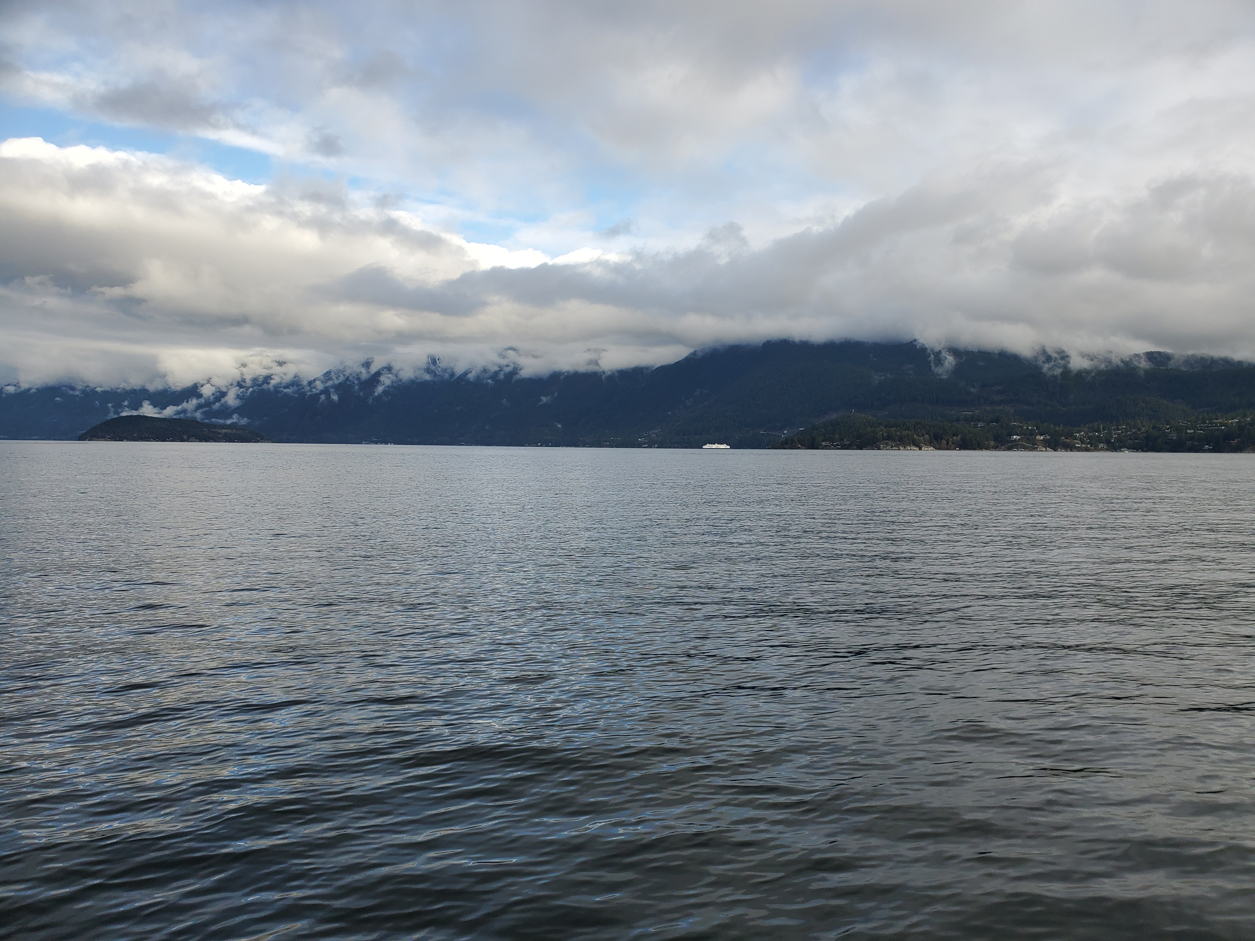
I pumped up the board in the parking lot to Whytecliff Park and then carted it down the ramp to the beach The waters looked pretty calm. I tried to do a quick check for ships but I was unable to get a good signal and became impatient. I waded into the water and then I was off. As I exit the bay past Whytecliff Point I spotted the Bowen Island Ferry coming around Tyee Point, leaving Horseshoe Bay. I had a momentary panic as I wondered if the plate ferry could be en route to Departure Bay but as it held its bearing towards Snug Cove I relaxed and aimed dead-straight for Bowen Island. My goal destination of Apodaca Provincial Park was further south but I wanted to take the shortest route across the channel.
There was not much wind and minimal chop in the channel. It was very pleasant paddling. I made note of the lack of wind as that meant it would be a headwind for the return trip. I found that whenever I think there is no wind there really is a tailwind.
On the far side of the channel, I entered an area with more floating logs and I relaxed more as I figured I was outside of the ferry lane now. I paused to take a few photographs of the scenery. I had Passage Island to my front left and Bowyer Island to my back right. I knew Bowyer by sight as I had previously done a circumnavigation of it in the summer. And Passage Island is a potential snack stop on my future Bowen Island excursion.


As I paddled down along the Bowen Island coastline I was passed by the Departure Bay to Horseshoe Bay Ferry. This would be good timing as then I would likely encounter it on its return to Nanaimo on my return paddle. When the wake from the ferry made it to the shore it was just large rolling waves and the chop was very manageable.
I was surprised by how many properties there were along the coastline. Maybe this is the reason that camping is prohibited, you would be in someone’s backyard.

It was a spectacular view back towards Vancouver. Time was starting to be a factor as I had to make it back to Vancouver in time to pick up my son from school. I checked my GPS coordinates. I was close to Apodaca so I set a timer on my phone to go off for when I would need to be heading back to make it on time and then put my head down to paddle.
Eventually, I spotted a concrete pillar with what looked like a boat tie ring on it. I figured it had to be just up around the point. When I reached the point there was a large bay with a boat fishing. On the shoreline, there appeared to be more development than what I would have anticipated for a provincial park. I checked my phone again for my coordinates. I was passed Apodaca and was in fact in Seymour Bay. In my mind, I was anticipating more of a bay or park-like infrastructure for Apodaca. My alarm went off. I quickly munched down a snack and then turned around. There was the wind! Not too strong, but definitely present. I would not have any time to explore where the bay to Apodaca really was. I started to paddle back and fast.
My plan now was to paddle northeast along the shoreline until I saw the Nanaimo ferry and then I would start into the channel to cross behind it. But as I continued to paddle straight up the coast I began to wonder if the ferry was coming. Again, I grew impatient but this time I search for a signal. I pulled out my phone and found that the next sailing was at 1300. As 1300 passed and I continued to paddle northeast without any sight of the ferry I started to wonder. How long does it take the ferry to come around the point? Could the ferry be delayed? If so, for how long? How far out in the channel can I go and still be safe for the ferry crossing?
Finally, the ferry poked out from behind Tyee Point. I started to angle out into the channel to shave off some distance.
I still had lots of distance between myself and the ferry when it finally passed by. It created some large rolling waves. I set my course for Whyte Islet and picked up the pass alternating 10 to 20 strokes per side and shifting between a staggered stance for more hip rotation and a tandem surf-style stance.

At the end of the paddle, I had a better feel for the coastline of Bowen Island but I was not able to get a good sense of what Apodaca Provincial Park is like. I guess I will have to wait for a response from BC Parks and plan from there.
One last side note is that there is a hose at the top of the ramp leading down to the beach at Whytecliff Park. A nice amenity for cleaning up post-paddle which I imagine is courtesy of the dive community that utilizes the bay.
My Route


2 thoughts on “Bowen Island: Checking Out the Coastline”