Sunday, July 25, 12021 HE
For day one of my trip and the backstory, see here.
Below is a virtual recreation of the route I paddled on day two to give you an overview of the blog post. I used Google Maps, Google Earth Studio, and OpenShot Video Editor to create the virtual tour. You can see the full route for both days here.
And here is the Google Map of my day two route departing from Little Flower Islet.
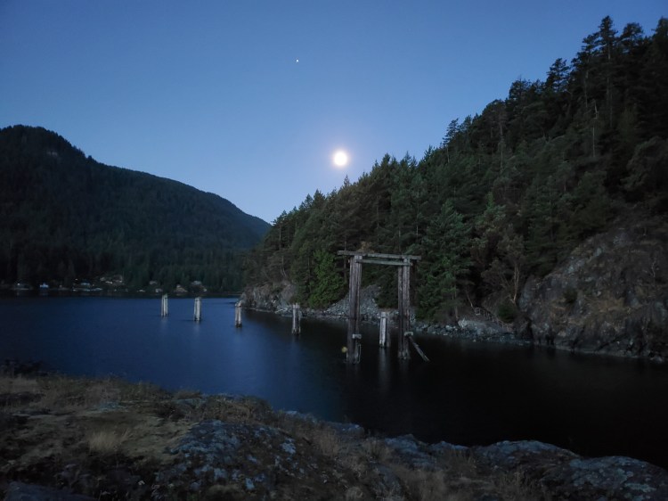
After what turned out to be over 30 km of paddling the day before, I woke to a Waning Gibbous Moon. Below is a photograph of the Moon over the top of Hutt Island from taken from Little Flower Islet.
After a brief survey of the island and the surrounding waters for the morning, I broke camp and then made breakfast. I ate instant oats while enjoying the view to the north of the morning twilight.

Below is a short video for a more real-time feel of the morning. You can see the West Lion to the right of where the sunlight is brightest, slightly in the background from the other peaks. And Brunswick Mountain is the high point just left of the prominent peak in front of the brightest section.
My itinerary for the day is below, which I forwarded to Annie, just in case. I was slower getting ready in the morning and didn’t launch until 06:40, so I was behind schedule. I texted Annie the update and kept her posted about my progress throughout the day.
From the day before, I found that I didn’t take as long a break as I had envisioned, so I hoped to make up the time to get back on schedule. Though after listening to the weather forecast on my marine radio, I was worried about the winds. All the more reason to get moving on the calm morning waters.
SUP FLOAT PLAN: Spanish Banks to Bowen Island Circumnavigation, Day 2
July 25, 2021
06:00 🏄🏽♂️ ↗️ Hutt Island (4.4 km)
06:50 🏄🏽♂️ ↘️ Crayola Beach
07:00 🏄🏽♂️ ↗️ Crayola Beach (4.7 km)
08:15 🏄🏽♂️ ↘️ Cape Roger Curtis
08:25 🚶🏾♂️at Cape Roger Curtis
08:55 🏄🏽♂️ ↗️ Cape Roger Curtis (8.4 km)
10:40 🏄🏽♂️ ↘️ Apodaca Cove
10:50 🏄🏽♂️ ↗️ Apodaca Cove (3.3 km)
11:35 🏄🏽♂️ ↘️ Passage Island
11:45 🥘 at Passage Island
12:45 🏄🏽♂️ ↗️ Passage Island (3.5 km)
13:30 🏄🏽♂️ ↘️ Point Atkinson
13:35 🏄🏽♂️ ↗️ Point Atkinson (7 km)
15:15 🏄🏽♂️ ↘️ Spanish Banks
15:45 🚗 ↗️ Home
16:05 🚗 ↘️ Home (total ~31 km)
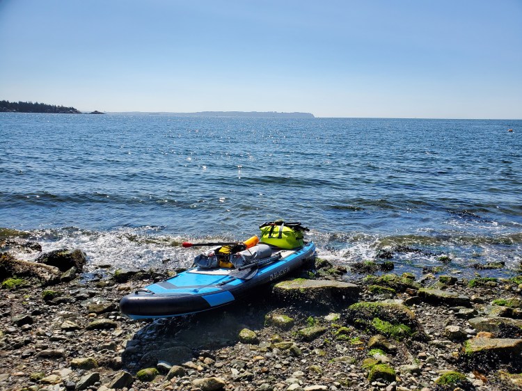
The tide was high, which made for a rocky shore launch rather than the low tide shell beach landing the day before. I was able to find a small alcove to place my board in and then load up my gear while it was on the water. Below is my board, fully loaded and ready to go. You can see how I moved the front bungee cords back along with the back cords forward from the factory setup (see the image underneath).


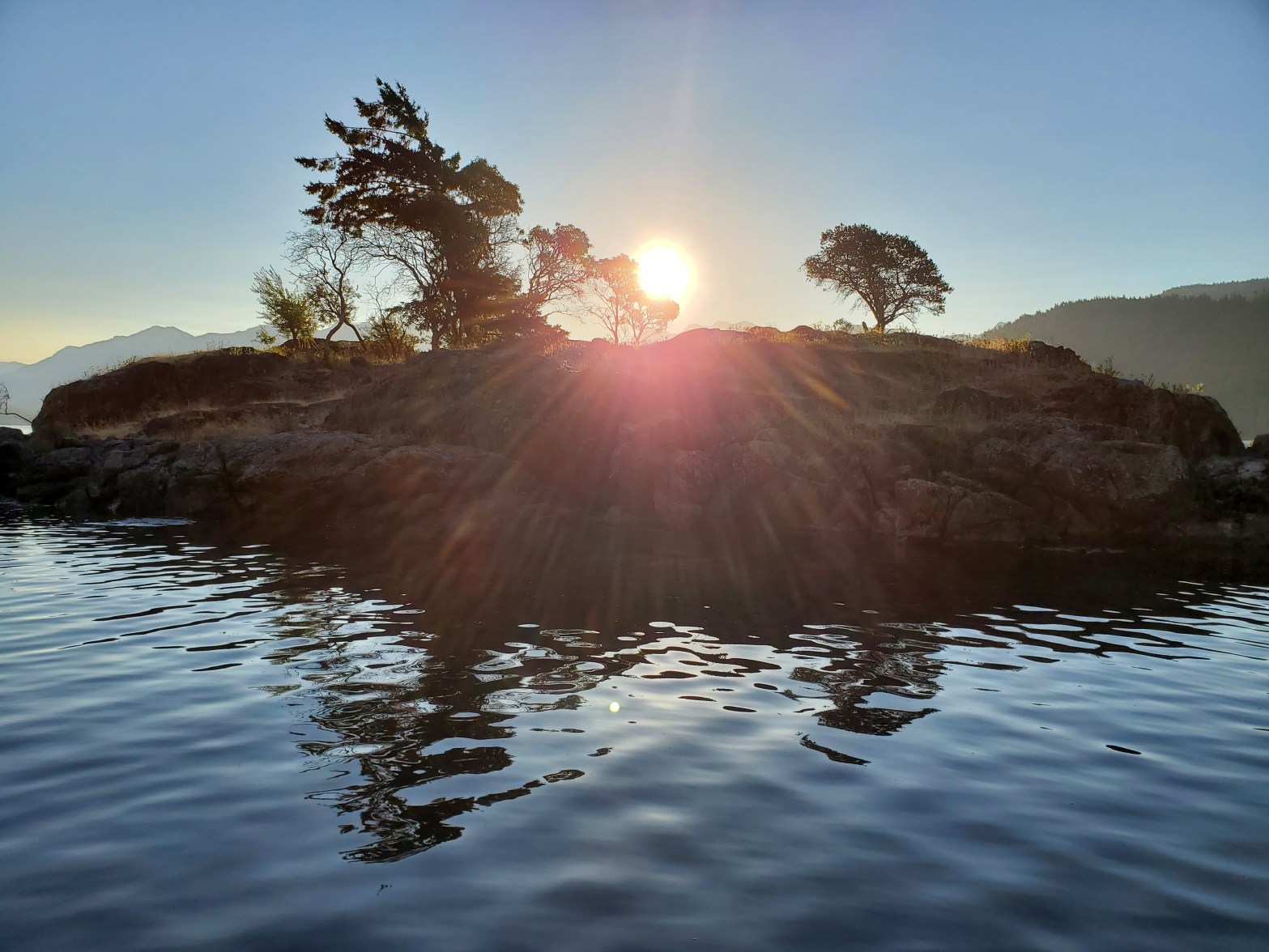
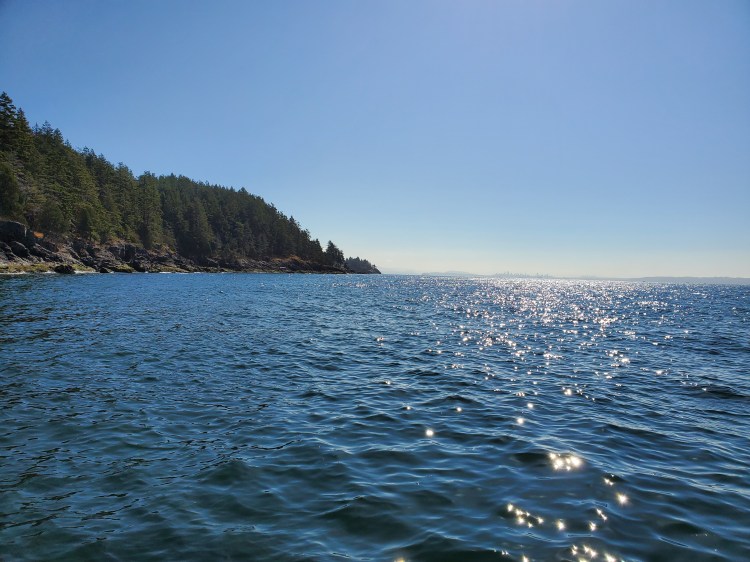
The sun was now up and peering over the top of Little Flower Islet as I departed, making my way into and down Collingwood Channel.

Here is the view northwestward toward the north end of Hutt Island from Collingwood Channel.
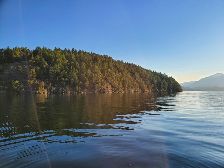
And the view southward with Pasley Island in the distance.

Below is a last look north toward Hutt Island as I make my way south toward Bowen Bay.

I spotted a few cracks along the west coast of Bowen Island that almost formed some caves close to Mossy Outcrop. It would have been interesting to take a closer look, but I wanted to make progress before the wind picked up. Yesterday the wind up Collingwood Channel was fierce and I was hoping to get to the southern end of Bowen Island before the winds picked up.

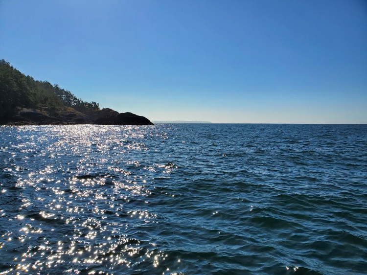
Below is the view west from near Crayola Beach. Ragged Island is visible in the centre, with the southwestern peninsula of Keats Island on the right of the photo. To the left of the image is Pasley Island and behind Ragged Island you can see the mainland of Elphinstone on the Sunshine Coast.

As I rounded Arbutus Point and made my way across Bowen Bay, the wind and waves picked up. I was now fully exposed to the incoming winds and water of the Salish Sea. There was moderate southwesterly wind, so it was a battle to made headway. I contemplated paddling further into the bay for wind shelter but decided to continue straight ahead, taking on the crosswind.
Further into the bay as I made my way into the waters just outside of Tunstall Bay the winds picked up. Was my decision in error? Should I have gone in closer to shore? It is funny how your mind can play tricks on you when you are alone with it.
I stayed the course taking on chop from my starboard side and setting my sights on point at Collingwood Beach.
I was hoping that the forecasted southeasterly wind would shift to be more southwesterly but as I got closer to Cape Roger Curtis I started to come to the realization that my hopes would not be met.
I could see the Cape Roger Curtis Lighthouse now in the distance. But the winds were stronger as I approached. Eventually, I got close enough that I could take shelter in the leeward side of the cape.

I spent a bit of time walking around the shore to rest my legs. It had been a prolonged partial squat crossing Tunstall Bay to deal with the wind and waves.
Crossing over to the windward south side of the cape let me know there was still some hard paddling ahead. There did not seem to be any chance that the southeasterly wind was going to ease.
There was a garbage at the end of Lighthouse Lane which I took advantage of.
After getting rid of my waste and then having a snack I got my kit in order for the next leg of the trip. It wasn’t going to be the easier tailwind paddle I had envisioned. Instead, it was a choppy paddle with wind and waves coming from the southeast and rebounding off of the rocky shoreline. It was a cool mess of chaotic waters accompanied by stunning scenery in the times that I was able to relax and take them in.
Eventually, I could see Point Grey off in the distance. I contemplated whether I should try to shoot straight across the inlet to Spanish Banks or round Bowen Island to head north to Apodaca Cove to complete my circumnavigation. I settled on saving my decision for when I was at the crossroad.
Have you ever wondered why Canada geese are coloured the way there are? I can’t say that I had explicitly wondered this before, but my encounters with Canada geese tend to be in grass fields, and they are not very camouflage in that environment. But paddling along Bowen’s south coast, it dawned on me that the geese’s colouring is to blend in with the Pacific Northwest coastline.
See if you can spot any of the geese in the photo below.

Here is one of them…

The Vancouver city line was now in view, but I still had to make it around Cowan’s Point at the southeastern end of Bowen Island.
Here is the view around Point Cowan with Passage Island visible.

As I made my way around Point Cowan, I was relieved to have a nice tailwind. The road to Apodaca Cove would be much easier than the path I had just covered. And thankfully, the current was manageable. In fact, it felt like the current was assisting me despite it being around 10:30. High tide was around 06:00 and low tide was just after 13:00. I had missed the peak ebbing current at 09:30 but I had been expecting a stronger current after my experience crossing the Queen Charlotte Channel the day before.
At the north end of Seymour Bay, there was a man fishing from his boat. Shortly after I passed him I could hear an electric motor spinning followed by an array of F-bombs and other profanities depicting fellatio. I assume he must have tangled a line somewhere on his vessel. Based on the enthusiasm of his cursing I imagined it to be around his propeller. I looked back and there were other boats in the channel that were more suited to lend a hand if needed, so I continued on.
I reached Apodaca Cove just after 11:00. The timestamp on the photograph below is 11:05, so I was only 15 minutes behind my schedule.
I made the crossing to Passage Island and stopped for lunch at Passage Island south. As I set up my burner I was cautious to find a stable surface on the rocky shoreline. Later after my meal was prepared I was approached by one of the residents of the island. Her first question was if I was vaccinated. After I had responded yes, she seemed to deem me okay to talk to. But then she went off, in a polite way, about how I was welcome on the island as it is a public beach but that I was not to go beyond the beach. Her next chastisement was that I was not to bring my burner if I was to return at a later date. She did qualify this by saying that there were no amenities or fire services on the island and that there had been a fire on the island in the past.
While I can appreciate her concern given the dry conditions were are having I couldn’t help but think that all throughout BC’s provincial parks where there is a fire ban there is no restriction on gas burners. I thought about explaining this to her but decided that it was not worth my time or effort. I wasn’t planning to be on Passage Island in the foreseeable future and now would likely go out of my way to not be on the island after this encounter.
But I could resist asking how people on the island cooked in their homes, which I assumed to be gas. When she responded that all the homes were solar-powered I decided not to bring up the risk of fire that is inherent with any electrical device. I believe that the risk of having solar panels and home electrical systems would be riskier than me using a propane/butane/isobutane fuelled burner to boil water on a rocky beach metres away from the ocean. But that is the strange thing about risk, we are all not very good at assessing it.
After her tirade, she did change the tone of the conversation and we did end up having a pleasant conversation about kayaks, SUPs, and iSUPs, and of course dehydrated meals.
Lunch was again by Nomad Nutrition and this time was Kathmandu Curry. I enjoyed this more than my Nomad lunch from the day before, but Mountain House was more flavourful in my opinion. Though it was nice to support a local business and I suspect Nomad is a healthier more environmentally friendly product.
I had a tail/crosswind heading back to Point Atkinson.
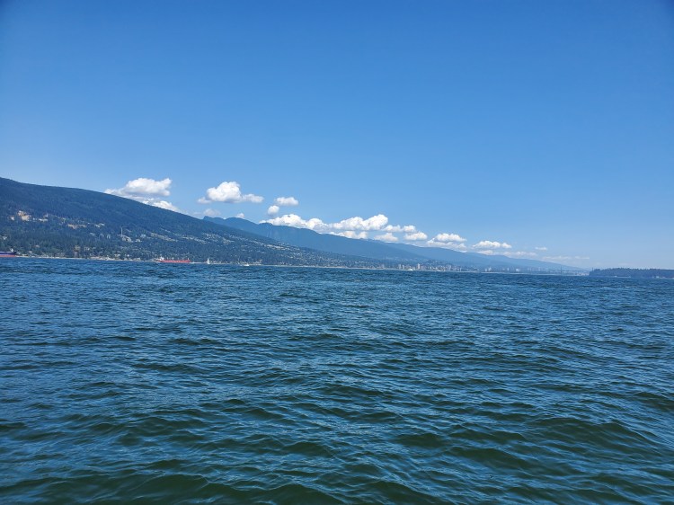
A short way into my crossing I took stock of the clouds over the top of the North Shore. Since taking up paddleboarding I have paid more attention to weather phenomena and gained a fascination with meteorology and climatology with respect to the four W’s: weather, wind, water, and waves. It was striking to see how the mountains had forced the air up cooling it off and allowing for moisture in the air to condense forming the clouds.
Closer to Point Atkinson I had to contend with the wakes from recreational, tour, and party boats. Along with the mixing of the different waters around the point it altogether made for some interesting paddling.
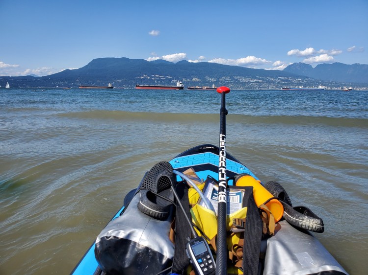
After a short hydration and refeulling break, I double-checked the deep-sea transit route traffic before embarking toward Spanish Banks. There were some interesting currents to paddle through as I crossed səl̓ilw̓ət (Burrard Inlet). The wind and waves were coming from the southwest as I made my way southeast. At times there were fast currents that seemed to be both ebbing and flowing in different sections. And there were a couple of occasions where the currents, wind, and waves all combined to make some large cross chop.
Annie and I had texted earlier in the day that she and the boys would be able to pick me up at the beach and then we could do a concession stand dinner. But knowing that parking would be a challenge on a Sunday afternoon I planned to stay as west as possible so that I wouldn’t have to backtrack to rendezvous with them. The only problem was that wind and tide had different plans. I was being pushed to the east.
When I reach Spanish Banks I was close to the West Concession stand, but I had some time to kill so I decided to paddle west to the lighthouse. My plan was to fasten my SUP leash to the lighthouse ladder and rest in the current until I received word from Annie that she was parked. But when I arrived at the lighthouse there was an eagle perched on the top right above the ladder. I didn’t want to disturb the eagle nor did I want to be underneath its perch for fear of being hit by an eagle-sized load of guano.
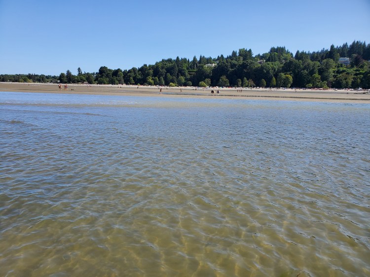
I paddled around for a bit in the now flooding current before deciding to ride the water back to the east. I set up shop offshore from the West Concession and waited to hear from Annie. The tide was still very low, and not wanting to carry all my gear over the sand bar I was happy to be waiting. I watched the beachgoers inland from my board for a while before turning to face north and watch the sea goers. The image below is my seaside view.
I had removed my fin so that I could rest and travel in the shallow waters. I soon received word from Annie that she had found parking, and fortuitously it was right next to the West Concession. We got a visual of each other with me waving my paddle in the air and then started to make our way toward one another. I was limited by my board and the slowly forming tidal pools. Eventually, I could see the boys far off in the distance, with Annie trailing behind (see the image below).
Here we are just a tidal pool away from one another.

Kieran was keen to guide me into shore while Elijah was preoccupied with finding treasures on the beach.

Kieran was keen to get on board/guide me to shore.

After some hugs and kisses, Annie and the boys set up shop to have a beach play while I packed up my kit. We then had a beach stand dinner before making our way home.
Here is the overall route that I took recreated using Google Maps and Google Earth Studio.
Below is a map recreating my entire route in Google Maps. In the video, day one’s waypoints are orange, and the pathway is in blue. And day two is marked with blue waypoints and an orange path. Day one ended up being approximately 30 kilometres of paddling. I departed from Spanish Banks near the East Concession at 06:00, stopping for lunch in Smugglers Cove at Underhill/Sole Beach. And I arrived at Little Flower Island at approximately 14:30. After a short rest, I did a quick paddle around Hutt Island, departing at around 16:30.
On day two, I paddled approximately 33 kilometres. I left Little Flower Islet at 06:45 and arrived at Spanish Banks around 14:45.
So in total, it was approximately 63 kilometres of paddling over about 16.5 hours of travel (including rest breaks and lunches).
