
Monday, February 28, 12022 HE
Today was day two of Project Paddle, an attempt to circumnavigate some select lakes in the Vancouver area. For the backstory and relevant details, check out this post.
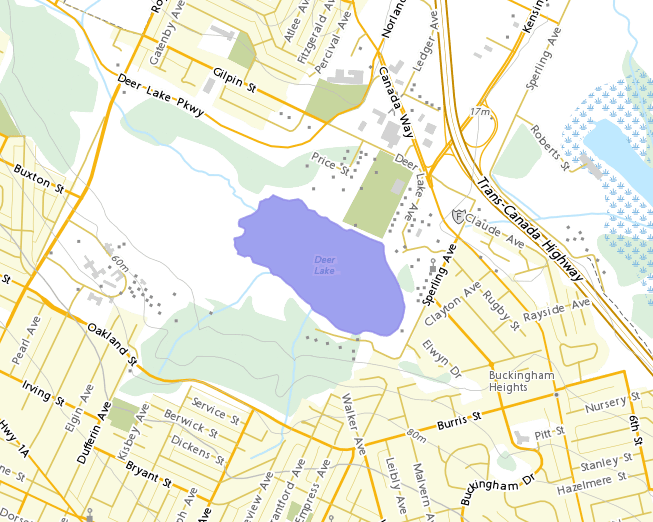
After tackling Burnaby Lake just over two weeks ago, it was high time to get another lake under my board. Today’s paddle was Deer Lake, just across Highway 1 from Burnaby Lake. I have never paddled Deer Lake, so it was fresh water.
Deer Lake
Rationale: I have never paddled Deer Lake.
Location: https://goo.gl/maps/VpZi8MT4b8nJSKHR6
Estimated Travel Distance: 14 km
Estimated Area: 0.25 km²
Estimated Circumference: 2.1 km
This paddle ended up being more of a last-minute run-out and get it done. I had a small window of time, and given that it would be a relatively easy and quick paddle, I figured I could get it done with minimal planning and preparation. After running a few morning errands, I made my way out to Deer Lake. There was a film crew on site with half of the parking lot “reserved.” This was much to my annoyance. I had already relocated my vehicle once. Initially, I parked at the north end of the parking lot. But after walking to the washroom facilities, I saw that there were many more vacant spots closer to the northern dock, which I had decided would be a good launch spot. I re-parked my car closer. My annoyance came from the fact that there was no signage stating that the lot was reserved. Only after parking was I verbally informed by the film-sets parking lot attendant that I was not allowed to park there. Well, I am already parked and setting up my kit, I thought‽ Instead, I responded that it would be more efficient for everyone involved if they had signage posted.
I relocated my vehicle and then got my kit in order.
It wasn’t raining yet, and the water was calm. I was hot by the time I inflated my board. I contemplated foregoing my semi-dry suit in place of just a raincoat. But with the threat of rain, I figured it would be better to have the suit on for my paddle.
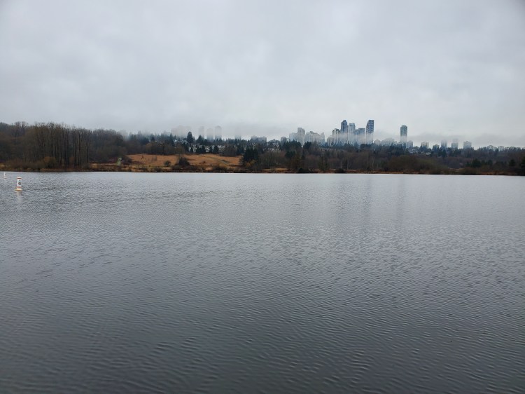
Below is the view from the north dock at the east side of the lake.
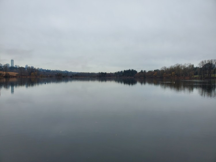
I could see some tall towers off in the distance under socked-in skies. I believe the buildings are part of Metrotown. It is a fascinating contrast between a more raw nature setting and the towers of urbanization. I set out in the direction of counter-clockwise navigation of the lake.
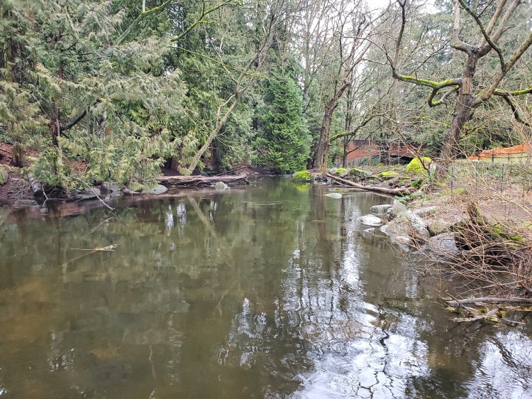
I made my way up along the northeastern shore of Deer Lake, arriving at the headwaters of Deer Lake Brook. The brook connects Deer Lake to Burnaby Lake and is the only outflow of Deer Lake. I found the name of the brook on this document, “Waterways of Burnaby.” I am curious to come back here in the summer. The image on Google Maps satellite shows this section of the lake covered with lily pads. But it was completely clear, now in the winter. There were a few deadheads to dodge and some boulders underwater to pay attention to. The waterway looked like it picked up speed closer to the bridge in the image below, but I didn’t venture far enough to explore. I wondered if it would be possible to navigate the waterway to Burnaby Lake underneath the highway. However, from my previous paddle on Burnaby Lake, I knew that if you were able to cross you would end up in the protected habitat zone. So, I doubted a crossing would be possible.
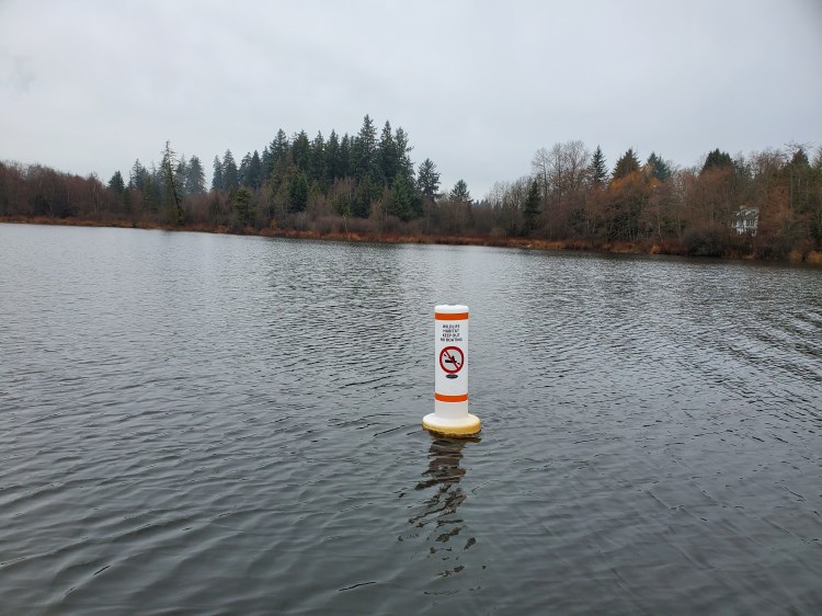
Returning to Deer Lake, I hugged the northern shoreline as best as possible. In the distance, I could see a line of buoys as I made my way westward. I suspected that they were markers for a protected habitat zone like the ones I had seen on Burnaby Lake.
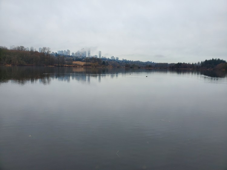
To be sure, I paddled out to the closest one to investigate. The image below is the end of the paddle area of the lake looking southwestward.
Here is what the buoy markers informed me. There was no paddling beyond this area.
I changed course and cut directly south across the western border of the paddling zone of the lake.
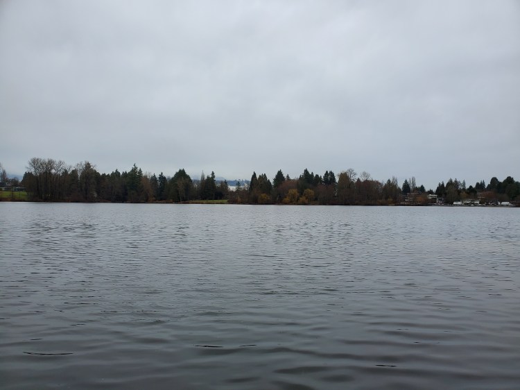
The image below is the view northeastward from the southern shore. Burnaby Mountain is just visible through the gap in trees in the centre of the photograph. The wind was a bit stronger on this side of the lake blowing in from the northeast.
There are a few shallow parts on the southern side of the lake that I needed to navigate around. I didn’t bottom out with my fins, but you easily could. The “Waterways of Burnaby” document depicts and describes the network of creeks that drain into Deer Lake on the southern shore. The creeks deposit their silt here near the old Third Beach site and Second Beach,
There was a beautiful fallen tree in the water a little ways past the historic Baldwin House. Vines covered the tree, and I stopped to check it out and take a picture.

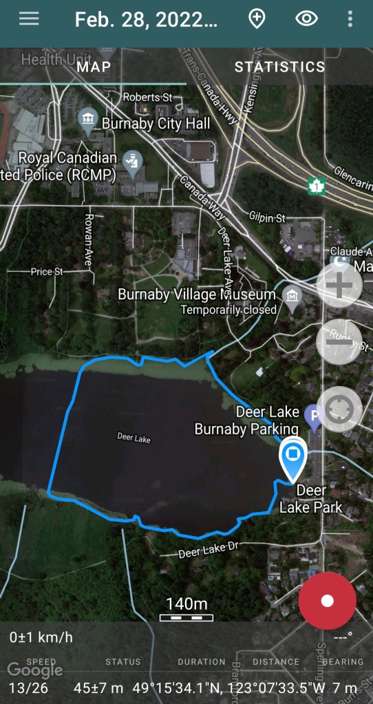
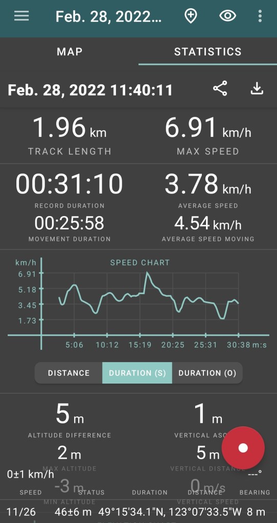
My trip ended up being quite a bit shorter than anticipated, with the western third of the lake restricted for access. It was still about two kilometers of paddling as I contoured the shoreline quite closely.
Below is a recap of the route that I took created on Relive. I recorded my trip with Geo Tracker. If you cannot view it below, here is a link to the video on Relive’s site.

3 thoughts on “Project Paddle: Day 2 (Deer Lake)”