
Sunday, March 20, 12022 HE
Project Paddle is my attempt to circumnavigate some select lakes in the Vancouver area. You can read about the backstory and relevant details here. And here are the stories of the lakes I have already completed: Day 1 (Burnaby Lake), Day 2 (Deer Lake), and Day 3 (Səl̓ilw̓ət (Indian Arm) to Sasamat Lake). You can see the remaining lakes I plan to circumnavigate here.
With spring break, easing pandemic restrictions, and waning infections (hold off Omicron BA.2), we went to Squamish to visit some friends, the Wilson’s. While planning our visit, Annie’s girlfriend, Ali, informed her that her husband, Kelsey, would be working. Would I be able to entertain myself for the day without another adult male around, they mused? Annie responded that she was sure I would be able to entertain myself. She was sure there was a SUP route I would be happy to do. Little did she know that I had three, Brohm, Cat, and Browning Lake, on my radar. Here was my chance to knock all three off of the list.
I grew up in Squamish. So there is a healthy dose of nostalgia for motivation to complete the three Squamish area lakes on my Project Paddle list. All three lakes are places that I frequented in my youth to swim, so I was excited to revisit them. It had been years since I’d last been to any of them!
Alice Lake didn’t make the cut. But that is only because I have previously SUP circumnavigated it several years ago on a camping trip in June 12020 HE. That’s why Alice Lake isn’t on my Project Paddle lake list. However, last night while doing some last-minute research, I started to wonder about adding a fourth bonus paddle, Stump Lake. I would be in the area after leaving Cat Lake, so it would be easy enough to include, time permitting. It would be a game-time decision.
The forecast was not ideal, with Environment Canada calling for rain and Windy.com suggesting snow. It was my first official spring, i.e., astronomical spring, SUP. So, it was only fitting that there was a chance of snow. Spring this year officially started at 0833 Pacific Standard Time today (March 20, 12022 HE).
Since we would be visiting our friends in the Garibaldi Highlands, I put together the float plan below. I wanted to get a sense of how long my SUP session would be to see if doing all three lakes would be okay. I would start with Brohm Lake, then Cat lake, and then finish with Browning Lake before returning to the Highlands.
SUP FLOAT PLAN: Project Paddle Triple Crown (Browning, Brohm, and Cat Lake)
DATE: Sunday, March 20, 2022
ROUTES: Circumnavigation of Browning, Brohm, and Cat Lake
VESSEL: Teal Blackfin Model XL iSUP
EST. DEP. From Highlands (Squamish) to Brohm Lake 1100
EST. ARR. @ Highlands (Squamish) 1540
Details:
Estimated Circumferences
Brohm Lake 3.6 km
Cat Lake 1.1 km
Browning Lake 0.6 km
Wind
• Forecast: see Windy App for up-to-date
March 20
• Southeasterly to southerly (SE, S) 2-4 kt (10-20 kt wind gusts)
Temperature (ambient)
Brohm Lake
• Low -4°C
• High 1°C
Cat Lake
• Low -4°C
• High 1°C
Browning Lake
• Low -2°C
• High 2°C
Water Temperature
• Brohm Lake 3-7°C
• Cat Lake ??°C
• Browning Lake ??°C
Daylight (Mar. 20):
0715 – 1925
Civil Twilight:
0643 – 0715
1925 – 1957
Nautical Twilight:
0605 – 0643
1957 – 2035
Paddle Distance: ~5 5 km
Paddle Time: ~1.5 hrs
Personal Info
TRAVELLERS: 1 (Mon Jef Peeters)
VEHICLE: [Colour] [Year] [Make] [Model] [ABC 123]
PHONE: [xxx-xxx-xxxx]
Driving Distances and Times
Garibaldi Highlands to Brohm Lake: 13 km (15 minutes)
Brohm to Cat Lake: 3.5 km (10 minutes)
Cat to Browning Lake: 24 km (25 minutes)
Itemized Itinerary
March 20, 2021
0000 🚗 ↗️ Squamish
+0015 🚗 ↘️ Brohm Lake
+0035 (+00h50m) 🏄🏽♂️ ↗️ Brohm Lake (3.6 km)
+0015 (+01h05n) 🏄🏽♂️ ↔️ Brohm-Cat Lake
+0010 (+01h15m) 🚗 ↗️ Cat Lake
+0015 (+01h30m) 🚗 ↘️ Cat Lake
+0020 (+01h50m) 🏄🏽♂️ ↗️ Cat Lake (1.1 km)
+0015 (+02h05m)🏄🏽♂️ ↔️ Cat-Browning Lake
+0025 (+02h30m) 🚗 ↗️ Browning Lake
+0015 (+02h45m) 🚗 ↘️ Browning Lake
+0015 (+03h00m) 🏄🏽♂️ ↗️ Cat Lake (0.6 km)
+0015 (+03h15m) 🏄🏽♂️ ↔️ Cat-Browning Lake
+0015 (+03h30m) 🚗 ↗️ Horseshoe Bay
+0010 (+03h40m) 🚗 ↘️ Garibaldi Highlands
First up was Brohm Lake…
Brohm Lake

Rationale: I grew up in Squamish swimming here, so there is that nostalgia/root vibe happening.
Location: https://goo.gl/maps/WqWRH6NG4szqR9TP9
Estimated Travel Distance: 82 km
Estimated Area: 0.12 km²
Estimated Circumference: 3.6 km
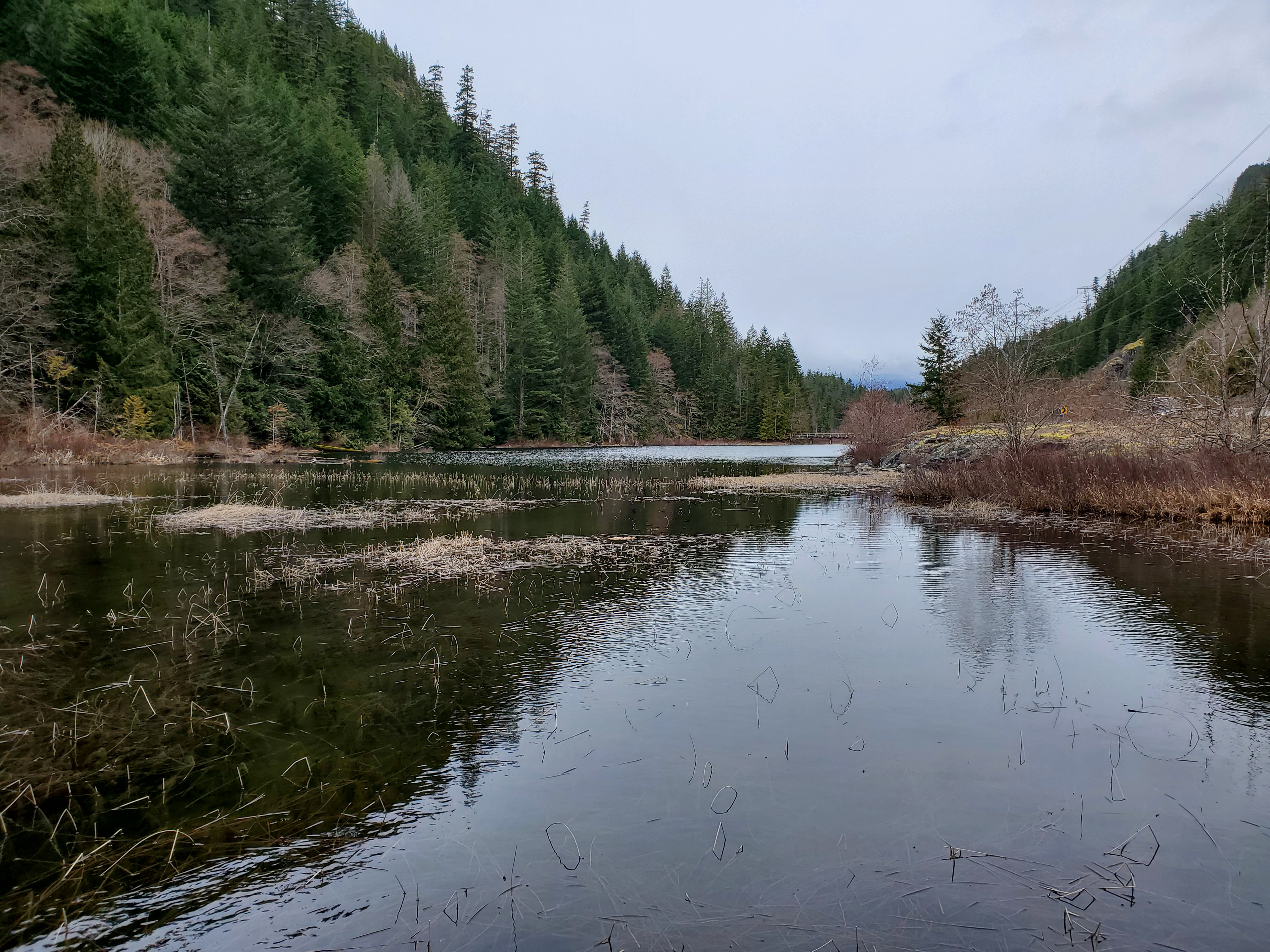
On arrival at Brohm Lake, the weather was much better than anticipated. On the drive up to Squamish, it was evident that it would not snow. But, I was still pleasantly surprised that it wasn’t raining. Underneath socked-in skies, I launched from a small rocky point. It was less than a 100 metre walk from the parking lot.

The wind is crisp and southeasterly. I estimate that it was 10 knots, maybe 12 at its highest. I set out into the wind heading south. I hoped this direction would make for easier paddling northward along the eastern shore. And maybe I would be protected from the wind along the northwestern shoreline on my return. The lake’s shape looked like it might provide wind shelter with this route. Furthermore, the southern end of the lake is more shallow and marshland. I reasoned it would be the slower, more difficult portion of the paddle.
I set my sights on the footbridge. Hopefully, I could pass under it.

The lake gets shallow quickly, but the water is clear, making for easy debris sighting. I kept a watchful eye on the bottom of the lake for logs that might catch a fin and send me in. Hugging close to the eastern shore, I made slow progress south, dodging deadheads and thick patches of reeds.
Near the footbridge, the wind picked up, and it was slightly more challenging to paddle against the wind current. It didn’t help that my fins were picking up reeds and adding to my drag. I had chosen to use my three-fin setup without much thought. Perhaps, I should have gone with one fin, I thought? I walked to the nose of my board to raise the tail and shake off some reeds. It seemed to help, at least until the next patch of reeds.
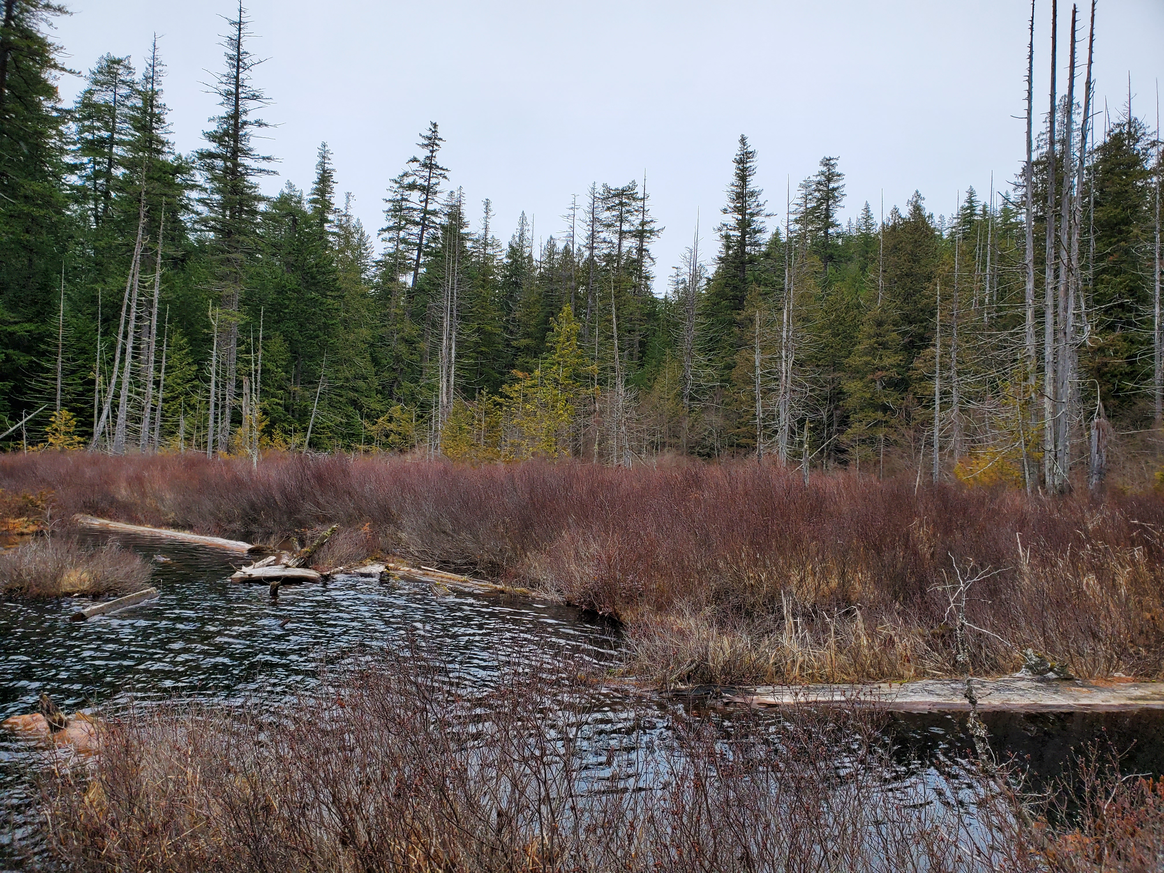
Below is the view south over the marshlands.

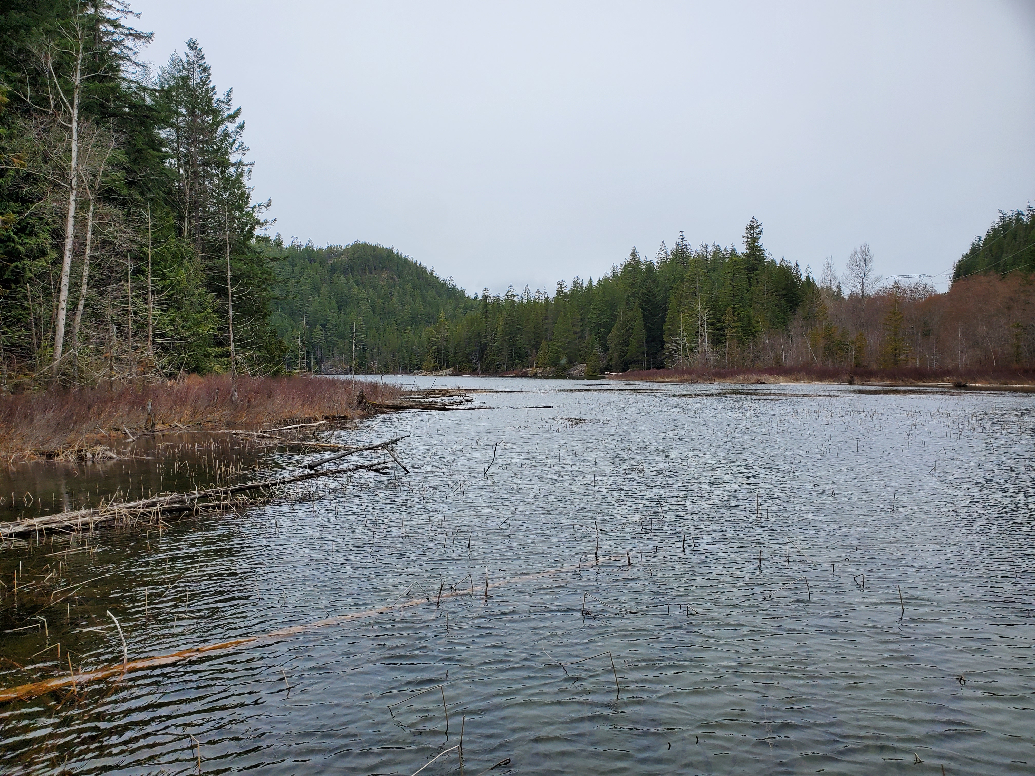
I was able to paddle further, weaving my way around and into what becomes Brohm River. Brohm River leads to the Cheekeye River, then the Cheakamus River, the Squamish River, and ultimately the Pacific Ocean via Átl’ka7tsem (Howe Sound).
With the waterway leading to Brohm River narrowing, I decided to turn around. I remembered the challenge of trying to turn/reverse my board in a narrow cave I explored near Juniper Point in West Vancouver. It is surprisingly (or perhaps not surprisingly on reflection of the fin setup) difficult to reverse a SUP. Unfortunately, I had paddled too far. It was too narrow to turn around. The nose and tail of my board were arrested by reeds. Reversing was challenging, as you have minimal ability to steer. I stepped to turn around and face backward on my board. It was a bit easier to steer this way versus backstroking to reverse. I made it into a wider section, with just enough room to spin around. First, I turned on my board, and then I turned my board to make my way northward. I stayed to the eastern shore as much as possible, occasionally circumventing a snag on my circumnavigation.
The wind was at my back now. And in the deeper water, I could pick up the pace. I scanned the surface for submerged snags while still trying to enjoy the shoreline scenery.

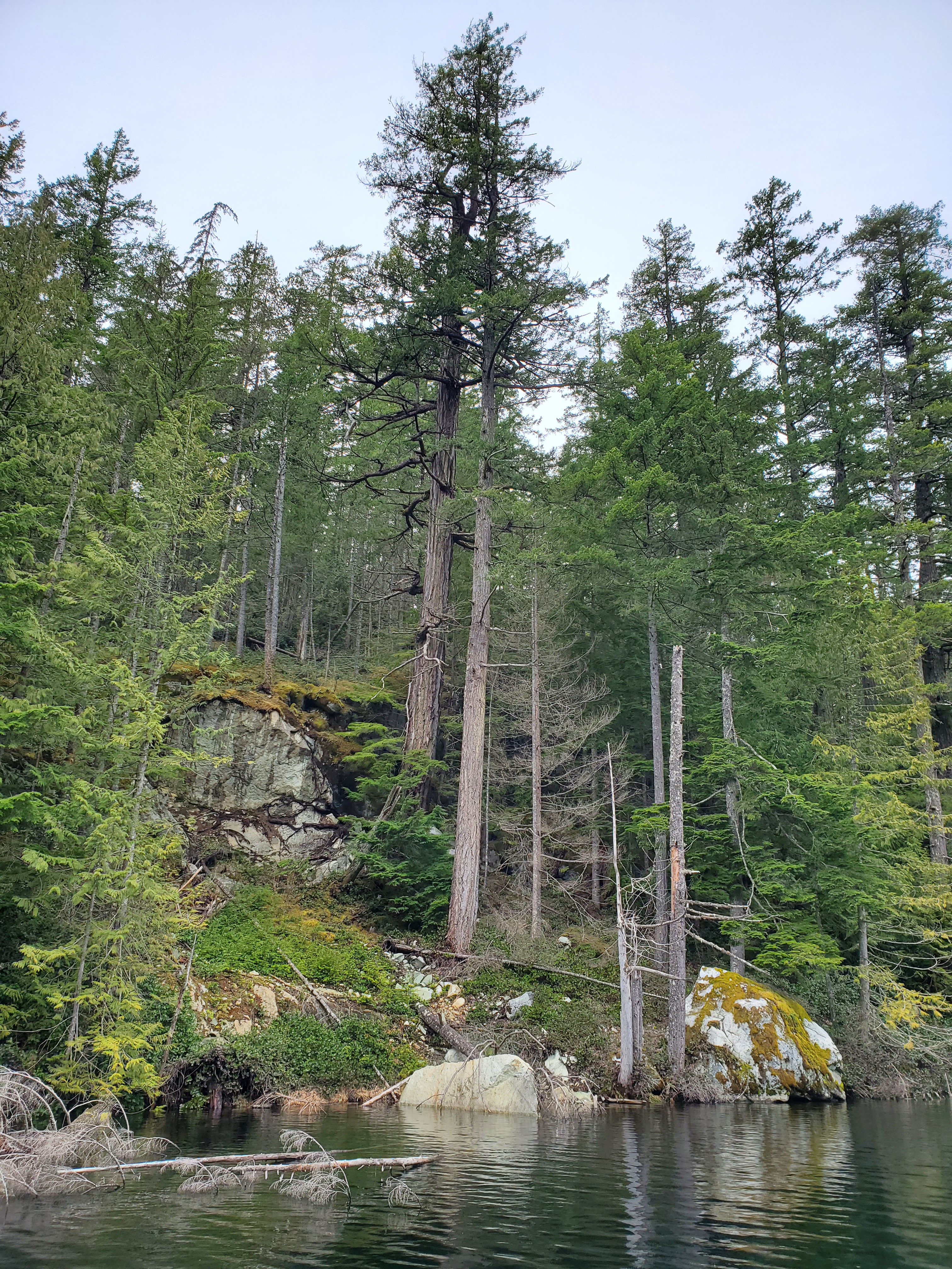
The western shoreline is lined with many snags. Some are more visible than others.

The water was relatively calm. I was the only one out on the water. I did, however, see and hear several hikers going around the perimeter trail. Then north end of the lake was much more peaceful as the Sea-to-Sky Highway traffic was no longer audible.

The western shoreline is a mixture of boulders, granite cliffs, and evergreen forests. My memory of the trees along the shore was that there were some deciduous tree sections. But, after re-examining my photos, I think I had mistaken dead evergreens for deciduous trees.

Approaching the north end of the lake, I could feel the wind was getting cooler. I sensed that the weather was going to change. The question was how long before that happened.
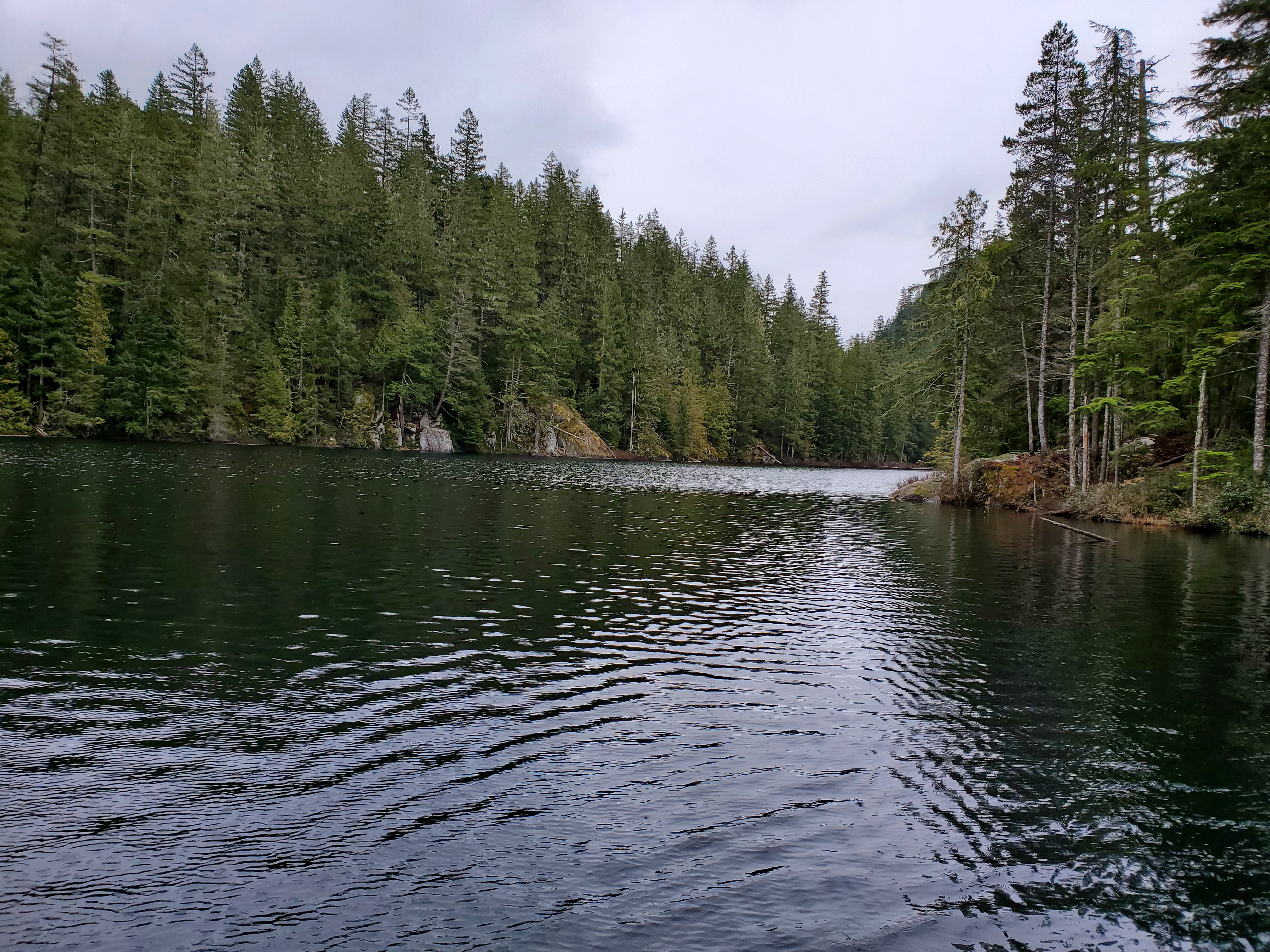
The image below is another example of the shoreline. The sky to the west doesn’t look too bad.
I reached the northern end of the lake, which is marshland too. But, here there was no pathway into the shrubs. There were many deadheads and no way to manoeuvre amongst them.
I rounded Brohm Lake to the northeastern side and started to make my way south. I could feel the wind now that it was a headwind. Thankfully, after passing through the straight southward stretch, I took shelter from the wind in the section that angled south-southwest.
I board hopped over several snags again, needing to walk to the nose of my board to submerge it and lift the tail. Thank you, SUPBoarder “Challenges” for making me more proficient and comfortable with cross-stepping (i.e., walking to the nose of my board).
Below is a recap of my route created on Relive. I recorded my trip with Geo Tracker. If the video below doesn’t work, here is a link to the video on Relive’s site.


One thought on “Project Paddle: Day 4 (‘Triple Crown’: Brohm Lake)”