
Tuesday, August 9, 12022 HE
gallery noun
https://www.merriam-webster.com/dictionary/gallery
gal·lery | \ ˈga-lə-rē, ˈgal-rē \
plural galleries
Definition of gallery
1a: a roofed promenade : COLONNADE
b: CORRIDOR sense 1
A year minus a day later, I find myself in the same waters. Last year, on the 10th of August, I circumnavigated Saysutshun (Newcastle Island Marine Provincial Park). After having ventured to Jáji7em and Kw’ulh Marine Provincial Park (aka. Sandy Island) on the Qualicum Beach leg of our Vancouver Island family vacation, I was looking for a new adventure closer to Parksville for the second half of our sojourn. Looking at a map, I came up with the options of Protection Island, next to Saysutshun or Mudge Island. Since I had already explored the area around Saysutshun, I set my sights on Mudge Island. Some internet sleuthing led me to this gem of a post on managing the currents that arise in the narrow passages of the BC Coastline. Mudge Island lies between Gabriola Island and Vancouver Island. It is considered part of the De Courcy group of islands and is one of the many Gulf Islands. Dodd Narrows separates Mudge Island from Vancouver Island, and False Narrows separates it from Gabriola Island. To the north of Dodd Narrows is Northumberland Channel and Stuart Channel is to the south. I knew enough about the waters to know that the channel passes could be a challenge. From conversations with my father-in-law, an avid sailor, I knew that the tide tables alone would not tell you the currents through the channels. For the passage currents the Government of Canada produces a separate currents table. For a great explanation of this phenomenon, see this article, “One-way tides”, by Nick Doe. The surprising and confusing (and potentially dangerous) part of this is that the flood and ebb of the current precede the raising (flood) and lowering (ebb) of the tide. And for Dodd and False Narrows, they flow in the opposite direction of what one might assume. To picture this, visualize the current as the horizontal movement and the tide as the vertical movement of water, which isn’t completely accurate, but makes a good distinction for conceptual purposes. A better view of what tides actually are, is given by Neil deGrasse Tyson in the YouTube Short below. It kind of blew my mind. I had the same reaction that his co-host Chuck Nice had 🤯!
For more on the currents in the Gulf Islands and BC Coastal passages, see the following web articles: “BC Tidal Passes: Part 1 – Passes of the Gulf Islands” and “Learn How To Predict Tidal Currents For Sea Kayaking.”
Knowing that the pass around Mudge Island was possible (see “Fun in the Currents“), I just needed to find a time that worked with the currents and my schedule. According to the article, the best route was to travel northwest through Dodd Narrows at the end of the flood current. That way, you would be paddling close to the turn of the current, meaning the flow of water would be at its slowest velocity (yay calculus!), and then you can take advantage of the burgeoning ebb current down False Narrows as you head southeast. I quickly looked at the start of our holiday while in Qualicum to see what days would work best. Perhaps I searched too wistfully, because I saw that the currents would work while we were in Parksville. Perfect, I thought, as it would shorten my commute to the launch site at the Cedar Boat Ramp. The image below is a section of the Dodd Narrow Current Table. I was looking at the possibility of completing my paddle on August 8th or 9th. However, I made the mistake of reading the turn from ebb (-) to flood (+) as the window of time that I could paddle. I thought that an early morning paddle would be best as it would limit the amount of thermal wind (to a degree). Moreover, the morning adventure would reduce the boat traffic. I was comfortable that my planning could limit the turbulence in the water by travelling near slack current, but boat wakes were the unknown. But, I made the mistake of reading the 0605 “turn” on the 8th and 0708 “turn” on the 9th as being transitions from flood to ebb. In fact, since the maximum current speed on the line above was a minus (-) value which signifies an ebb, the times I was looking at signalled transitions from ebb to flood. I wanted to catch a flood to ebb transition! Thankfully, while confirming my plans the night before my trip, I caught my error! I am not sure what things would have been like if I had missed the error and gone ahead with my trip. That is, would I have clued-in to the reverse water flow direction in real-time? And if so, would I have aborted in time to not get caught on the north side of the channel with a building flood current up False Narrows, versus, down as hoped and planned‽
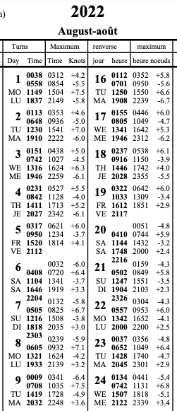
It is worth noting that I have had no formal training on reading tide or current charts, for that matter. So, maybe I am completely off. I am an autodidact concerning my tide and current knowledge. I developed this plan by reading various posts and finding the current direction labelled at the bottom of the current charts below the table. The direction name and orientation are labelled for the passage. In this case, the flood is 355 degrees true north, and the ebb is 155 degrees.
So with my plan dashed, I didn’t feel comfortable taking the afternoon transitions (1321 or 1419, respectively). I needed a new plan. Thankfully, I did have a tentative backup plan. In case I decided that braving Dodd Narrows solo on SUP was too unhinged, my backup was to explore the Galiano Gallery (aka. Malaspina Galleries by Gabriolans) on Gabriola Island. The Galiano Gallery is a geological formation on Gabriola Island at the end of Malaspina Point. Nothing is confusing about that, given another Gulf Island is named Galiano Island, and Gabriola Island is known locally as the Isle of the Arts. It is understandable then that many people confuse the geological site for an art gallery when visiting. Here is another article by Nick Doe explaining the dilemma in detail titled, “Malaspina Galleries—what’s in a name“.
The downside of this trip was that there wasn’t a great launch spot to get to the gallery. From the Go Paddling App, the closest launch site I could see was off of Queen Elizabeth II Promenade. Launching from there meant that after paddling between Saysutshun and Protection Island via Xwi’thi:sucun (The Gap), I would be left with a long crossing of the Salish Sea (Strait of Georgia). But without an alternate option and with the promise of a natural treasure at the end, I decided the roughly 3.5-kilometre crossing was worth it. Tuesday was forecasted to be the less windy of my two potential days. So, Tuesday it would be.
I modified my float plan for my new itinerary. It is below. I noted that there was a strong wind warning in effect for the Strait of Georgia south of Nanaimo, but I was comfortable with the wind speeds, even if there were slightly stronger than predicted. I planned to use my PFD, rather than an inflatable waist belt, for an extra layer of protection since I was paddling solo. And I packed a VHF radio in addition to my cellphone in a waterproof waist pack.
SUP FLOAT PLAN: Queen Elizabeth Promenade to Galiano Gallery (Round-trip)
DATE: Tuesday, August 9, 2022
ROUTE: Nanaimo (Queen Elizabeth Promenade) to Gabriola Island (Galiano (Malaspina) Gallery)
VESSEL: Teal Blackfin Model XL iSUP
EST. DEP. From Resort: 0500
EST. DEP. From QEP: 0545
EST. ARR. @ Galiano Gallery: 0730
EST. ARR. @ QEP: 100
EST. ARR. @ Tanglewood: 1050
Details:
Tides (Nanaimo Harbour)
•0200 High 4.3 m
•0956 Low 0.5 m
•1752 High 4.5 m
Wind
•Forecast: see Windy App
•Northwest (NW) 3-6 kt (9-13 kt wind gusts)
•Environment Canada: *Strong Wind Warning Strait of Georgia south of Nanaimo
Air Temperature
•18-23°C
Water Temperature
•~13°C
Daylight:
•0559 – 2042
Civil Twilight
•0523 – 0559
Drive Distance 34 km
Drive Time ~29 min
Paddle Distance ~12 km
Paddle Time ~ 4.5 hrs
Personal Info
TRAVELLERS: 1 (Mon Jef Peeters)
VEHICLE: [Colour][Year][Make][Model]
PHONE: [xxx-xxx-xxxx]
Itemized Itinerary
•0500 🚗 ↗️ Resort
•0530 🚗 ↘️ Queen Elizabeth Promenade
•0545 🏄🏽♂️ ↗️ QEP (2-2.5 km)
•0630 🏄🏽♂️ ↔️ N Protection Island (3.5 km)
•0730 🏄🏽♂️ ↔️ Malaspina Gallery, Gabriola Is.
•0800 🏄🏽♂️ ↗️ Malaspina Gallery(3.5 km)
•0915 🏄🏽♂️ ↔️ Protection Island (2-2.5 km)
•1000 🏄🏽♂️ ↘️ QEP
•1020 🚗 ↗️ QEP
•1050 🚗 ↘️ Resort
On my drive to the promenade, I spotted a planet in the morning sky. I guessed that it was Venus. Once at my launch site, I couldn’t locate Venus again. Later, I checked the Sky Tonight app to see what planet I had seen. The application opened to the Serpens Caput constellation being handled by a kneeling Ophiuchus. A surprising sight to say the least. I hadn’t stargazed in some time, and I was now re-inspired.
The waters looked calm from the parking near the promenade.
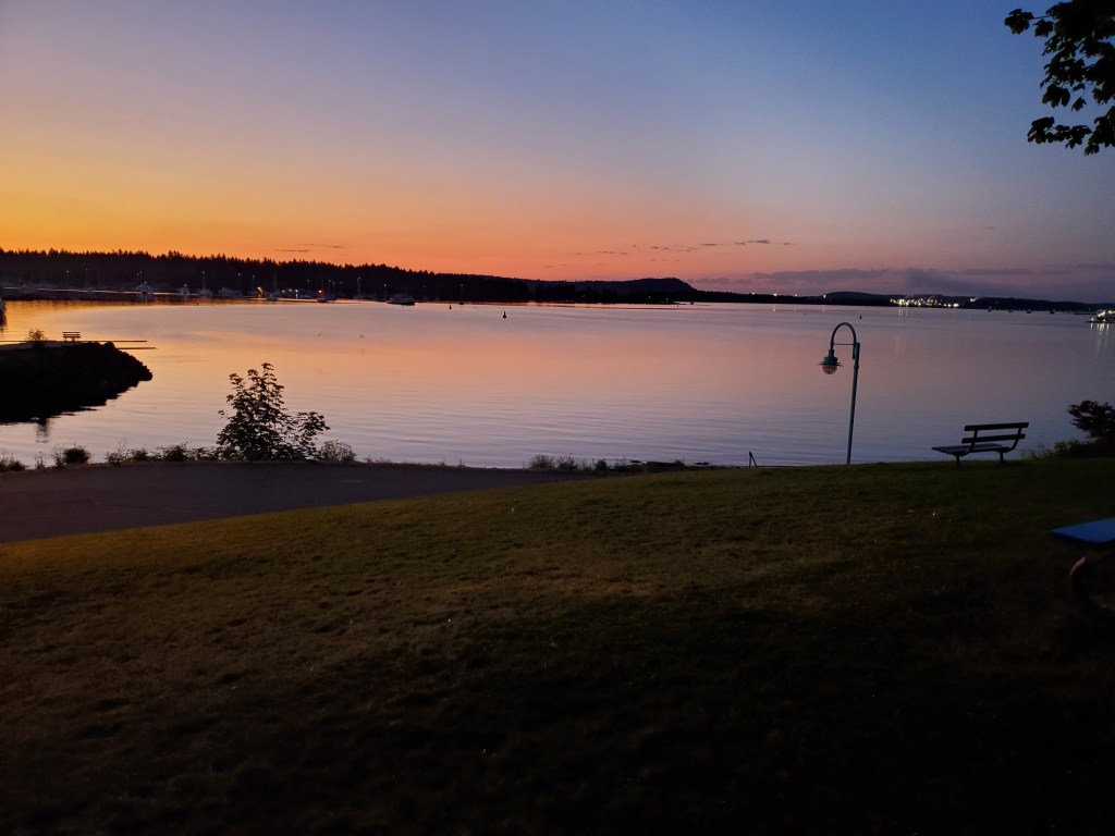
There was no wind as I set out. The conditions were in stark contrast to my previous paddle toward Xwi’thi:sucun (The Gap), which was on a windy afternoon.
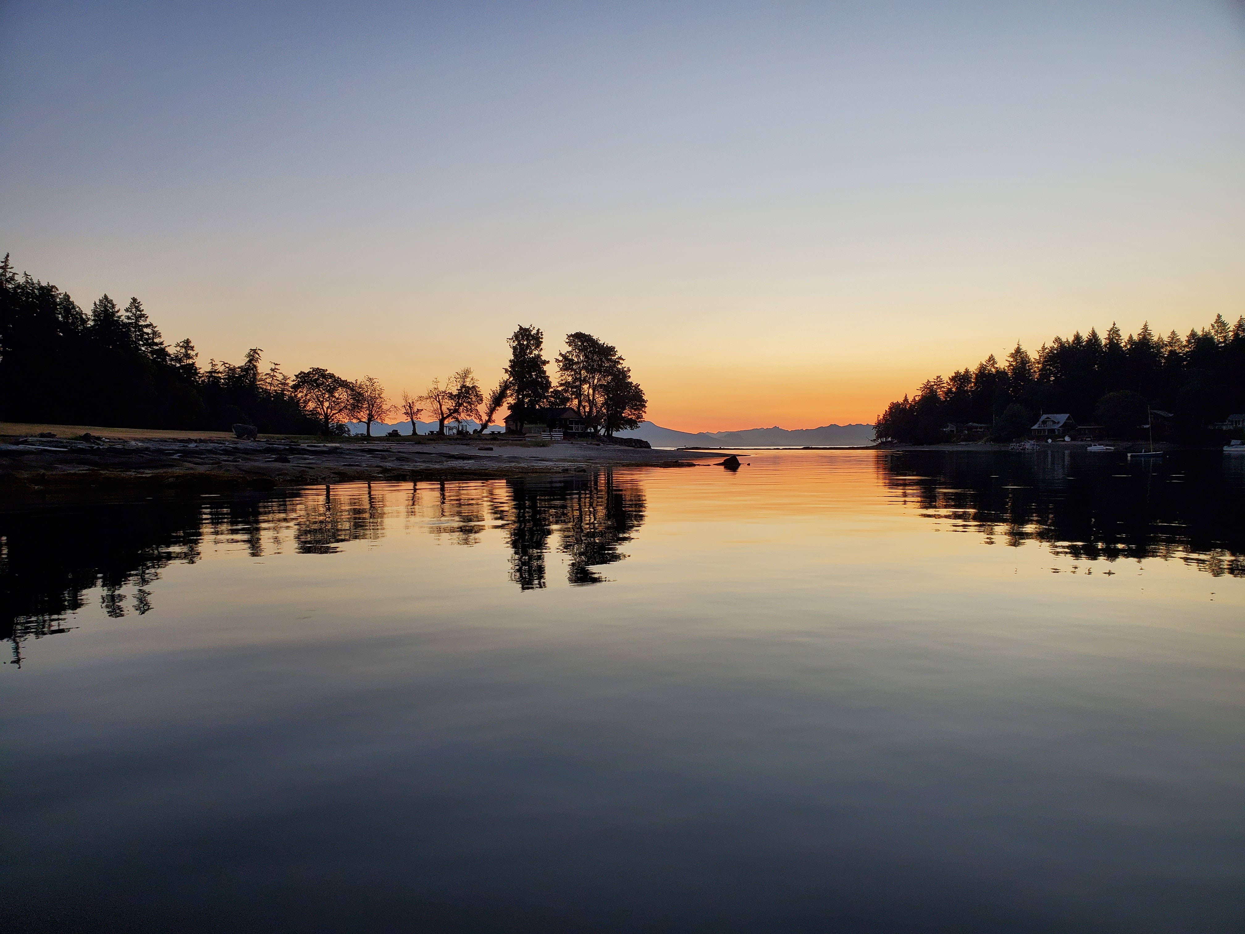
It was shortly before sunrise as I crossed Newcastle Island Passage to Bate Point, the southern tip of Saysutshun. The tide was higher than my previous paddle here, so I hope to be able to cross The Gap sans suptage (i.e., SUP portage). The mouth of Say Set Sun (Mark Bay) was calm and peppered with moored vessels. “Why Knot” and “Current Toy” gave me an internal chuckle. Witty, I mused.
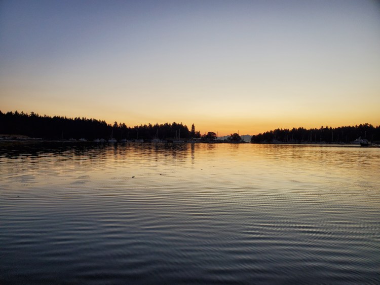
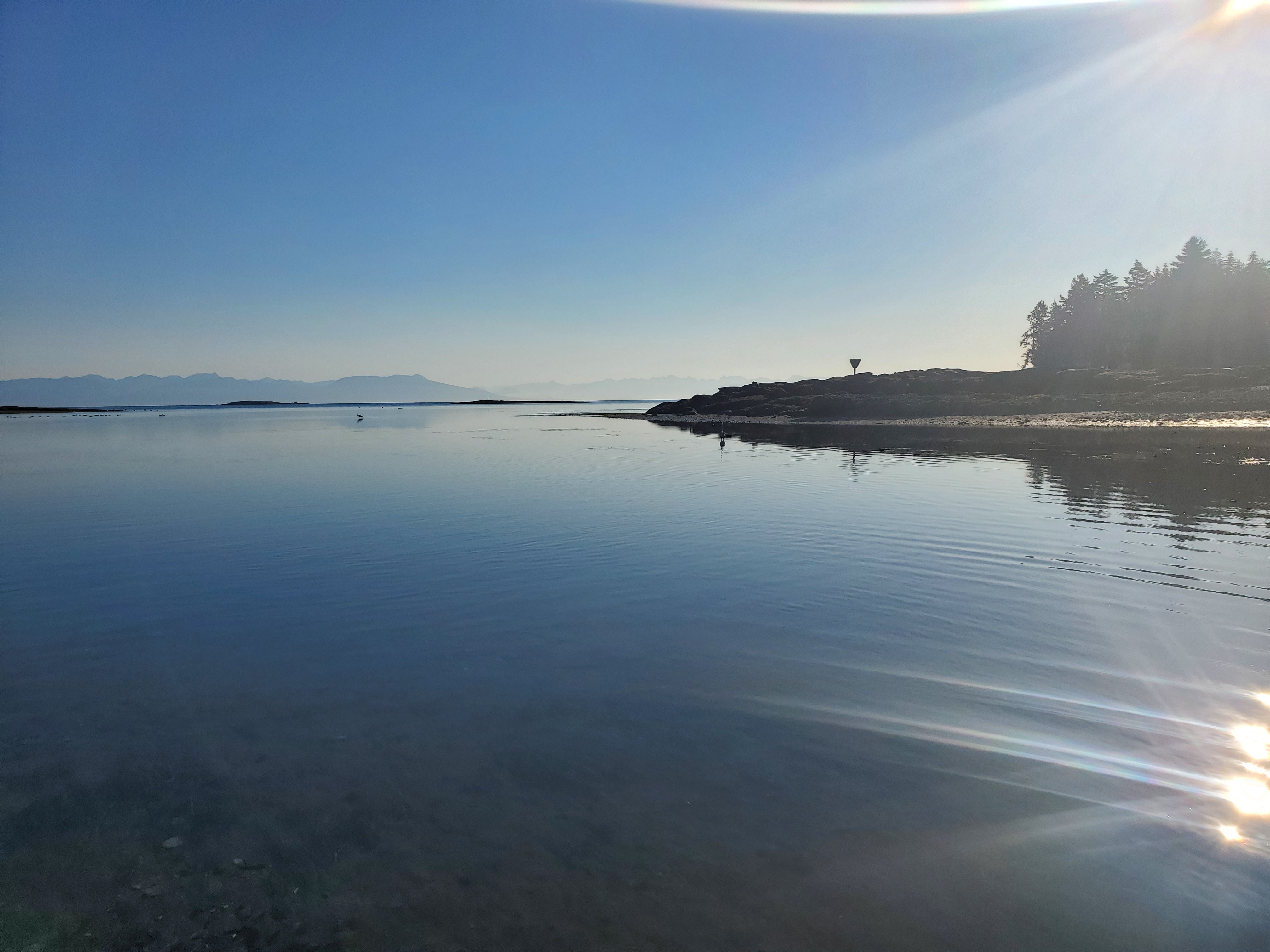
The conditions were glassy as I entered the channel.
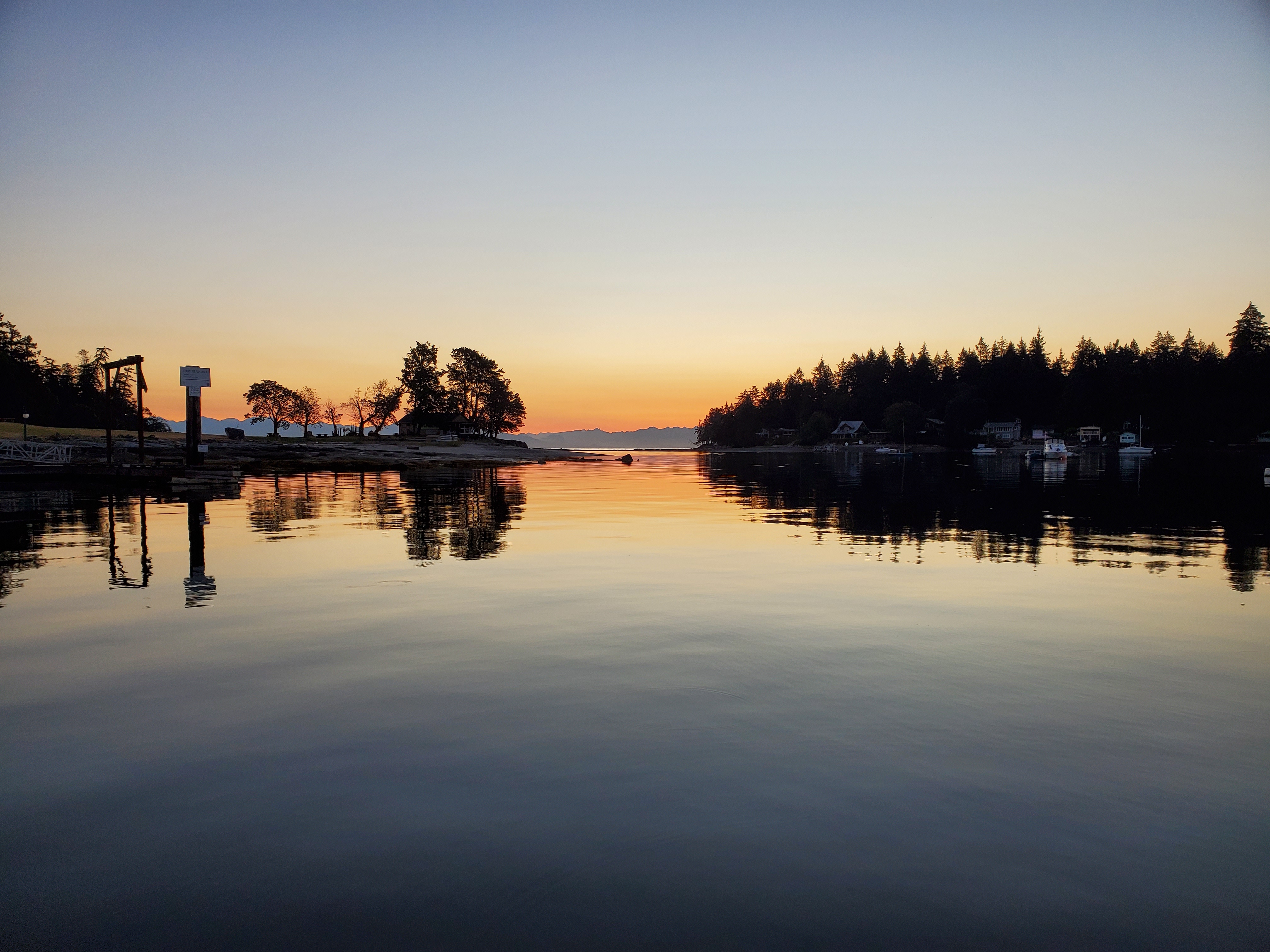
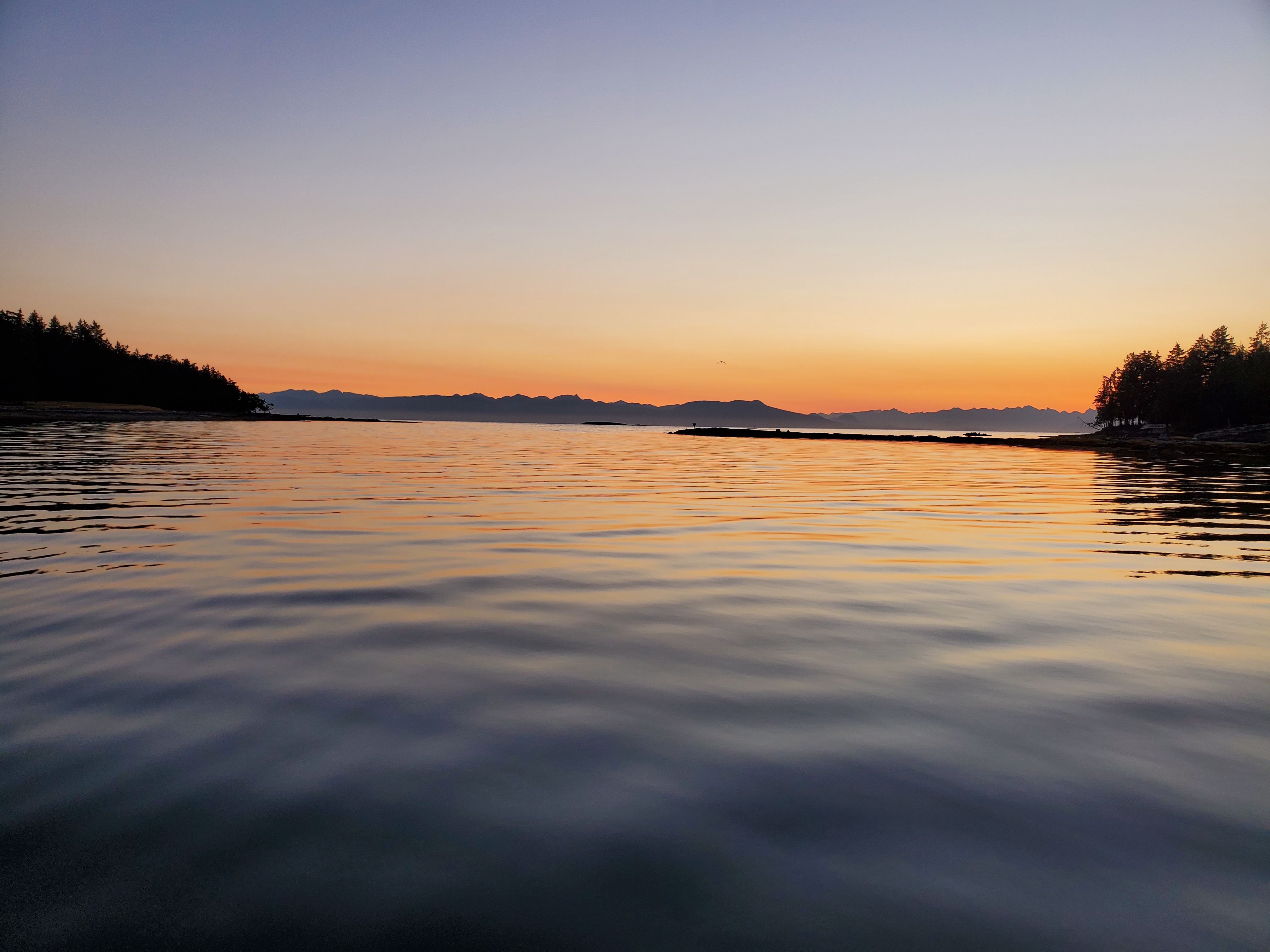
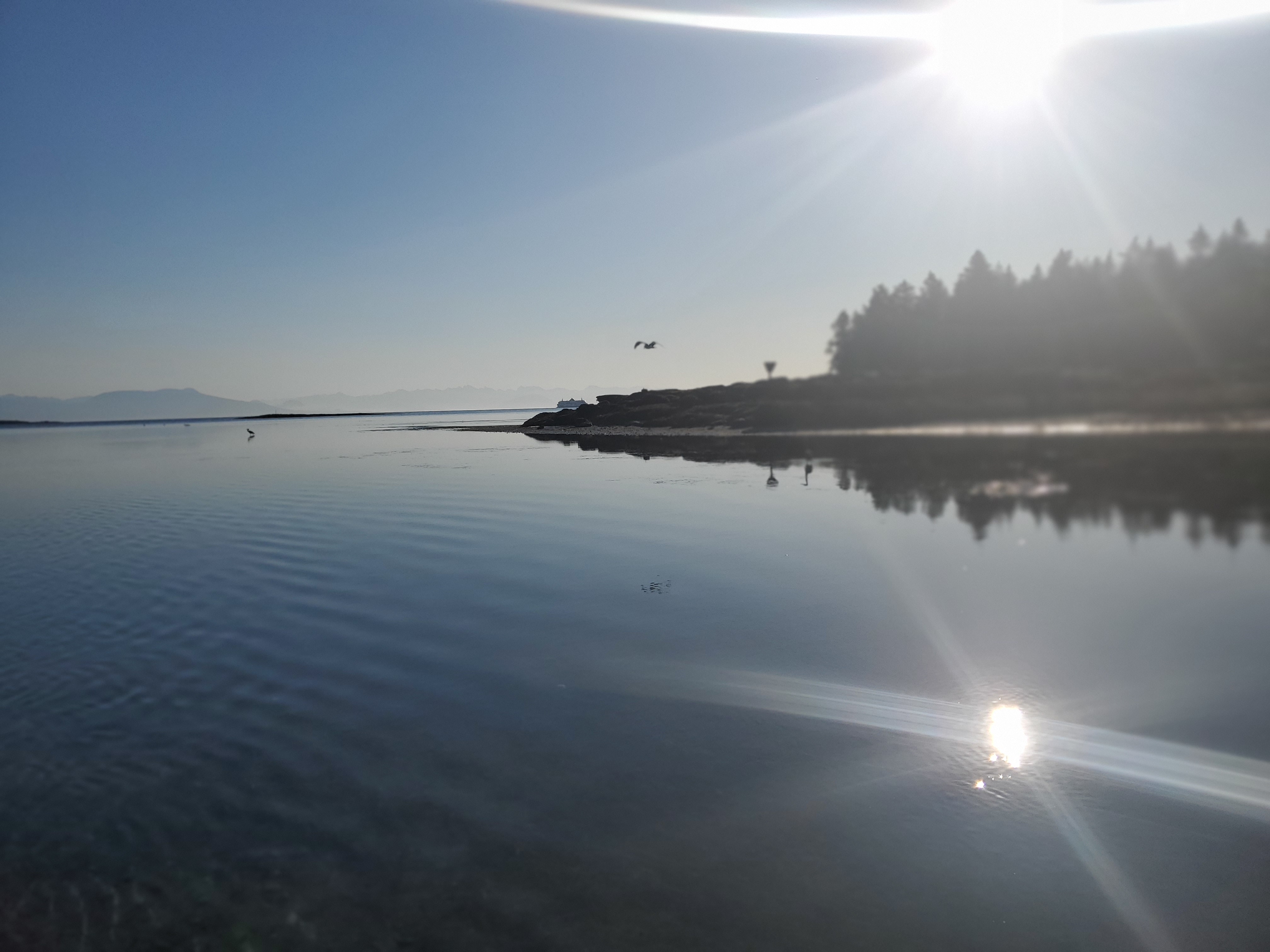
The water in Xwi’thi:sucun (The Gap) was low but passable. A few tents were adorning the shoreline of Sayautshun. I was leaving the channel just as the sun started to make its way over the horizon. The last images below show Malaspina Point off in the distance across the Salish Sea (Strait of Georgia).
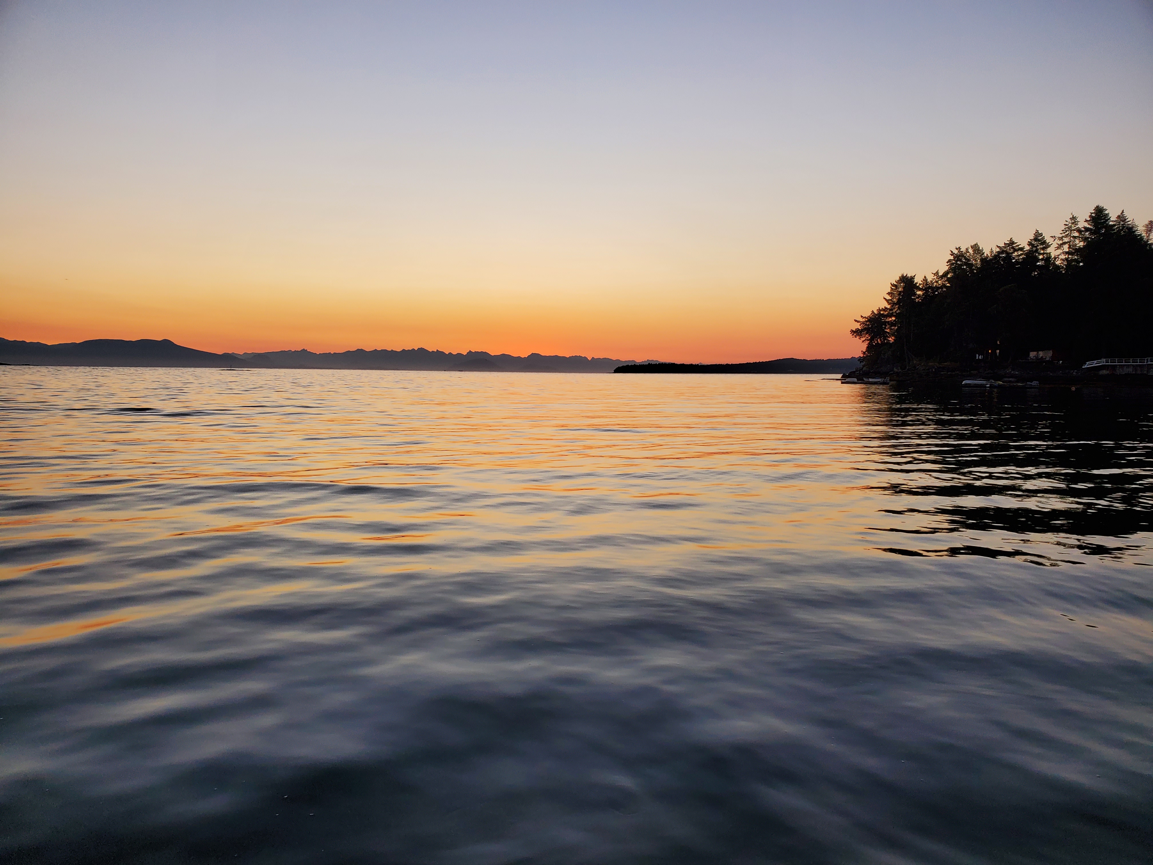
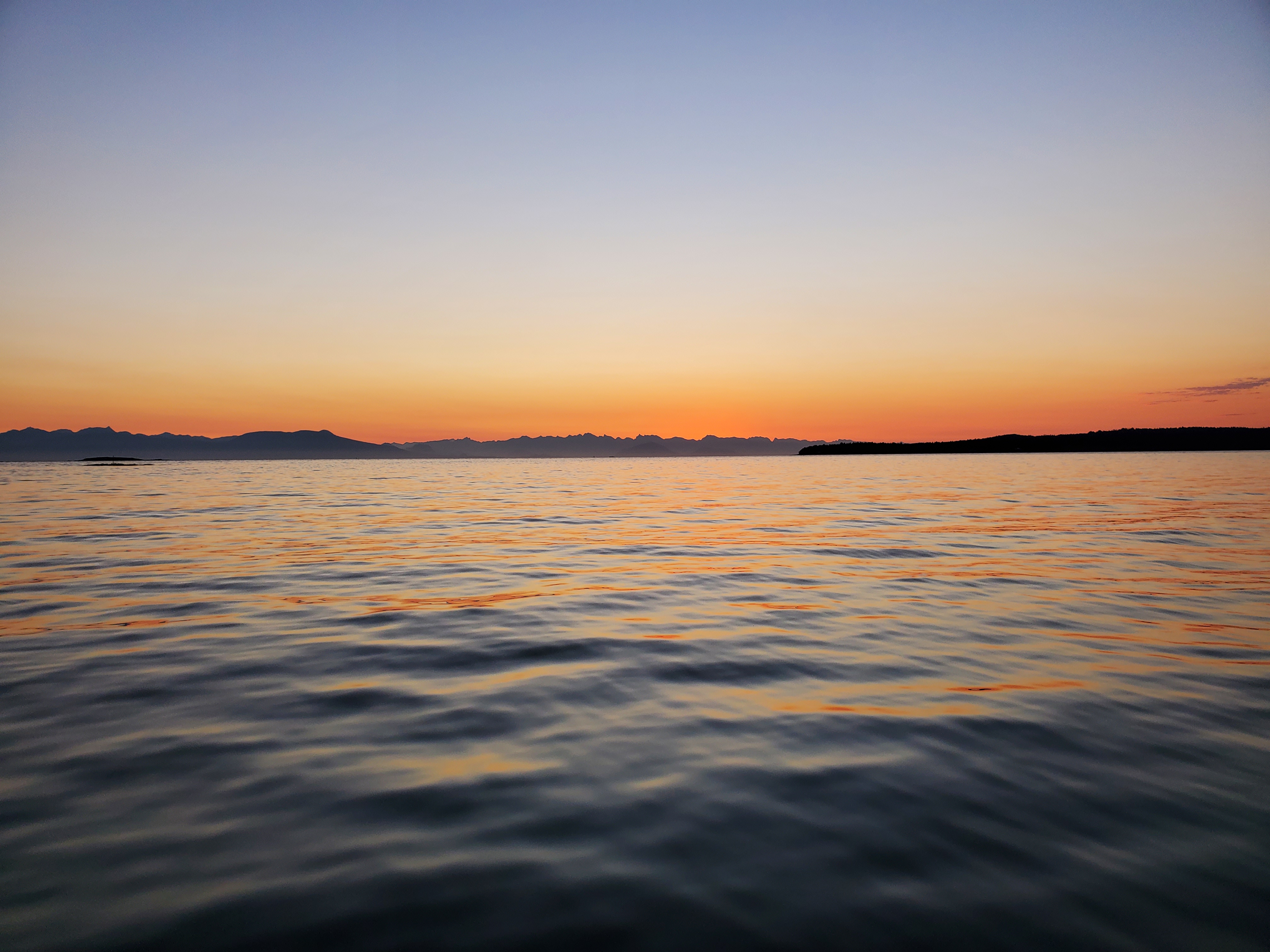
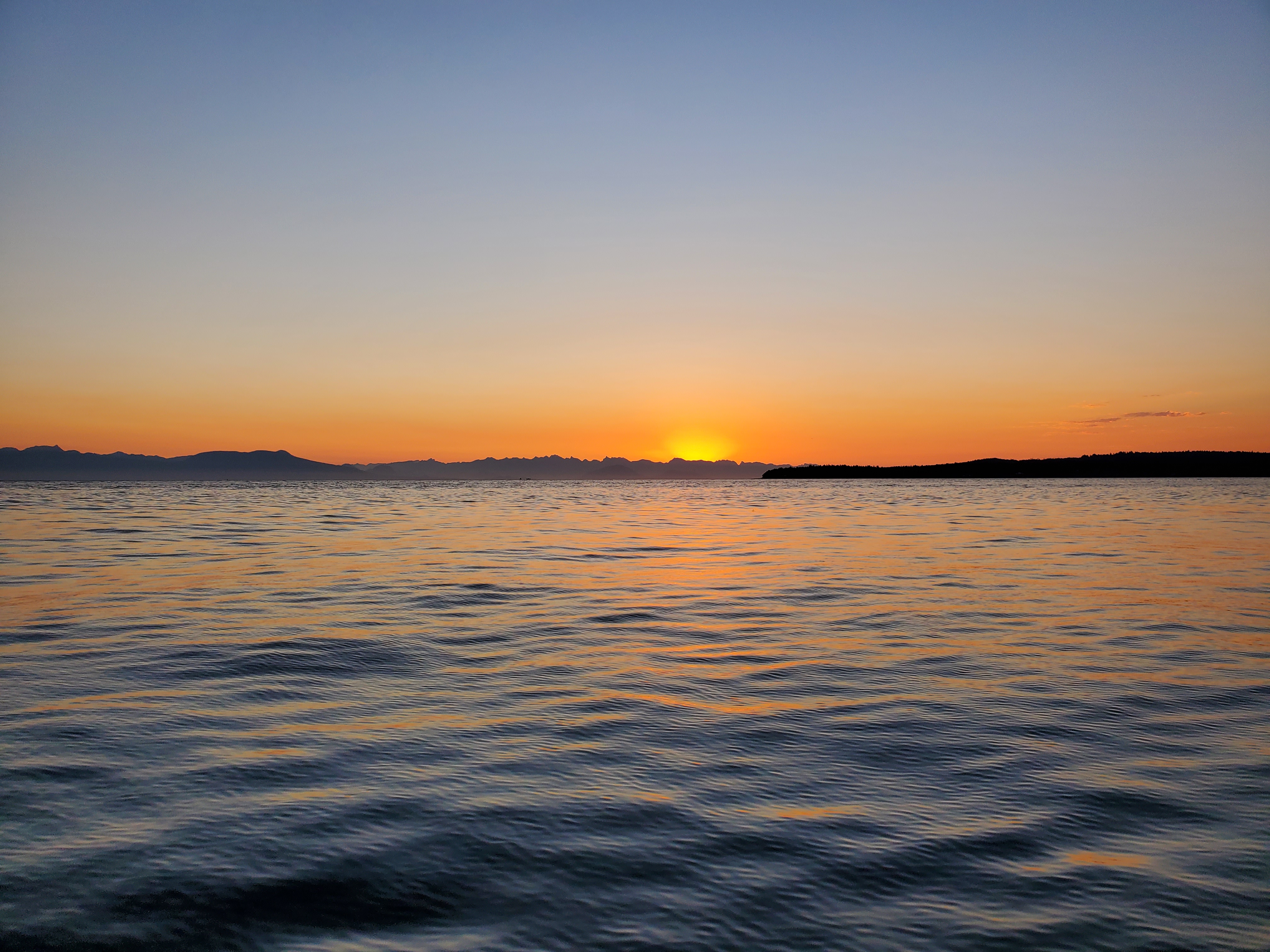
As I exited the protected waters of Xwi’thi:sucun (The Gap), there was more action in the Salish Sea (Strait of Georgia) (see the last image above). The wind and waves were northwesterly, as forecasted. They were light at first, but as I ventured farther out to open waters, both picked up. The northwesterly origin meant I had a crosswind and cross-chop to contend with on my port side. And, if I am honest, the waves were bigger than anticipated. About a third of the way into my crossing, the waves were big and battering me about. Thinking about the conditions for my return, I considered turning back. I knew the wind forecast called for lighter winds later in the morning. I hoped that would be the case. I looked to where the waves would take me. A downwind paddle into Northumberland Channel looked appealing. But then, I would be stranded without a vehicle wherever I ended up on shore. I contemplated my options. A super hard paddle back if the winds didn’t ease. Or a hard paddle back if they did. And my exit strategy, ride the wind and water to the Gabriola Island Ferry Terminal and then ride back to Nanaimo as a walk-on. I didn’t like the element of chance with my first two options, but with a third backup option, onward I went.
I hadn’t seen a ferry yet, apart from the plate ferry to Gabriola Island. Not wanting to waste time checking to see if one was coming, but also not wanting to be surprised by one rounding the northern point of Gabriola, I paused to check my marine radar app. Nothing close. Back to riding the waves.
Closer to Gabriola Island, I decided to ride with the waves to ease my paddle. But the waves were taking me south away from my destination. Yet I was close enough to shore that it didn’t take me too far off course. I backtracked slightly up-island to get to Malaspina Point. I had made it! I had arrived at one of nature’s corridors!
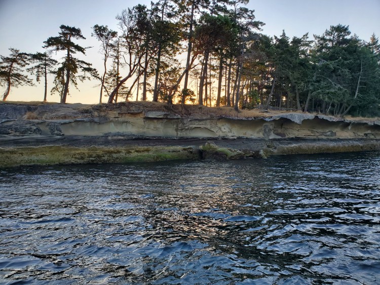
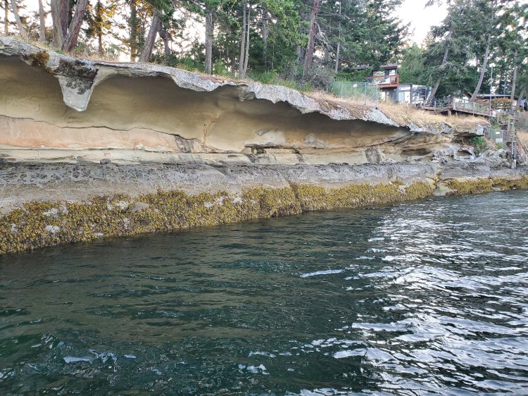
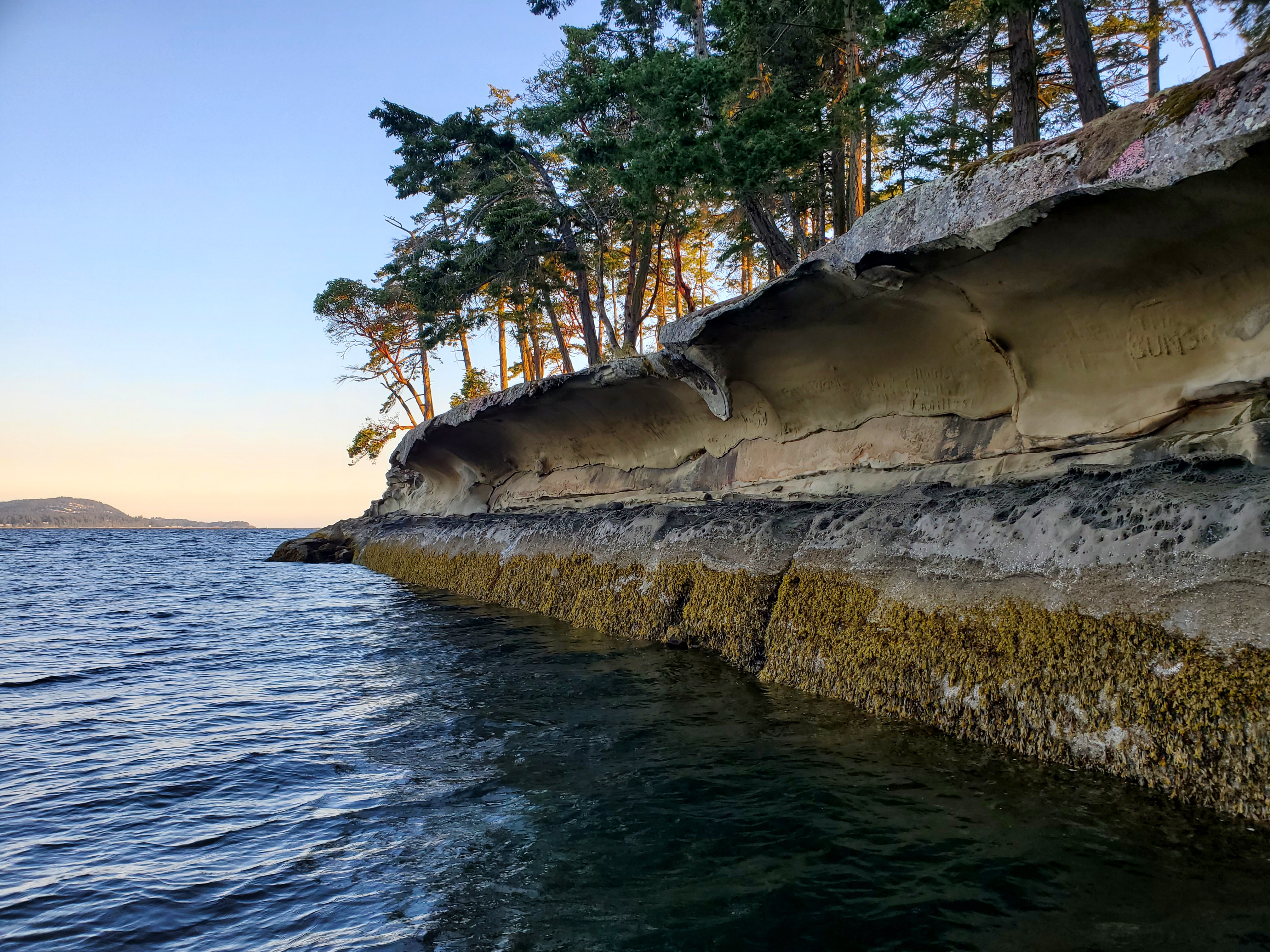
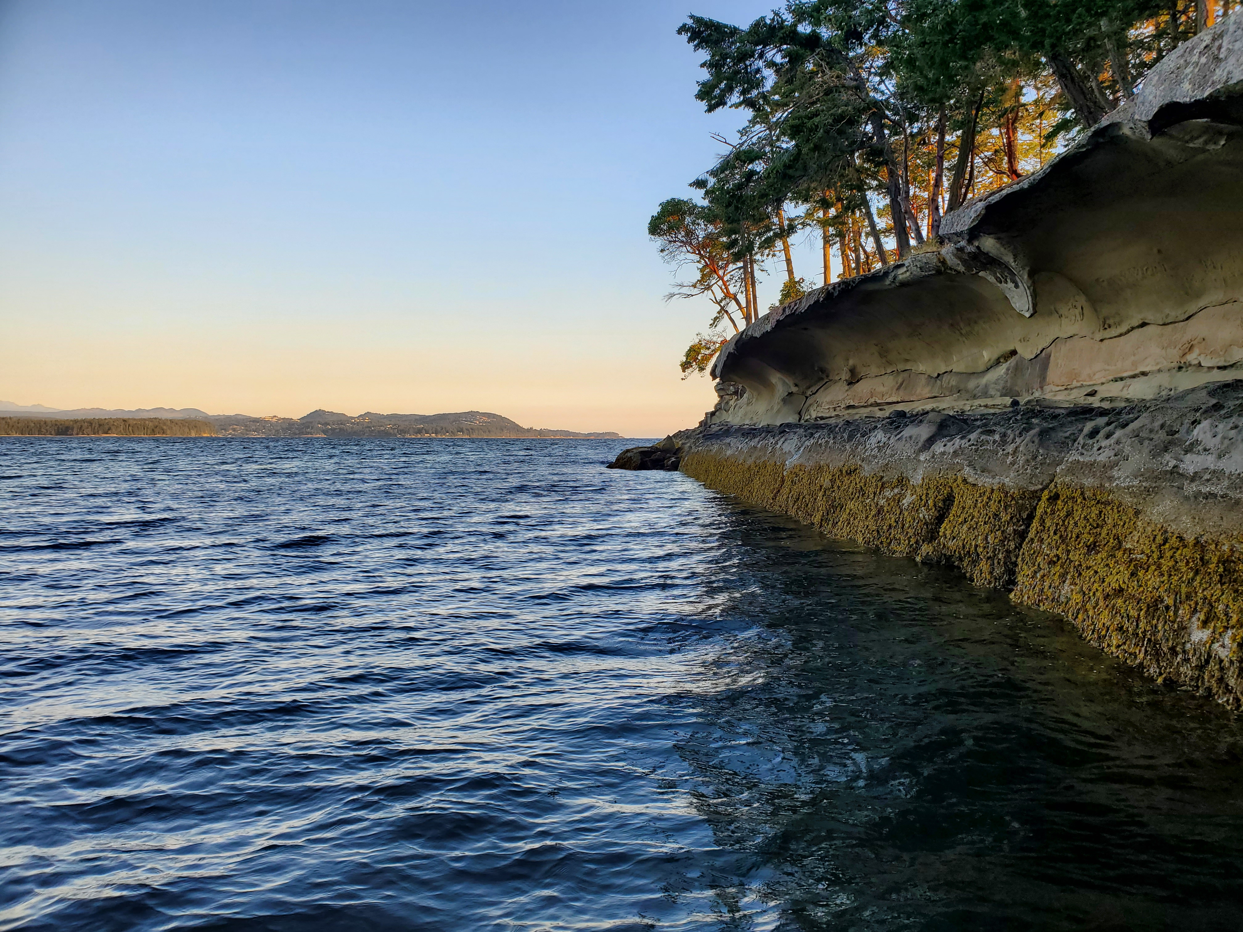
Closer up, the structure was very surreal. My thought, was that it formed via wave interaction and erosion of the sandstone over time. But I’d be wrong. I found this article, “The Malaspina Galleries,” about how the galleries formed. Chalk another one up for Nick Doe! A succinct description is that the galleries formed relatively recently (within the last 70 million years) from sedimentary rock, folded and fractured, then moved via glaciation, capped with minerals as the glaciers retreated, and finally eroded from beneath by salty groundwater. Not the process that I had envisioned, but spectacular nonetheless. The image below is the tip of the point as it disappears into the sea.
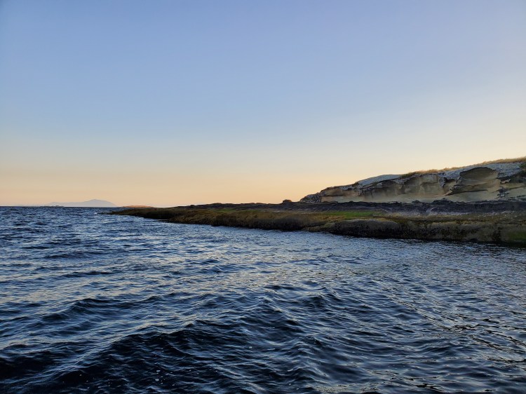
Further in, you can see where the sandstone has eroded to leave the hallmark hollowing of the gallery. The back wall is lined with salt deposits. Before reading Nick Doe’s article and while viewing the gallery in real-time I was left with the impression that someone had cemented the inner wall of the gallery. Geology is bewilderingly amazeballs!
Below is the view looking inland. After reading the article on the geology behind the galleries, I think the homes in the background are safe for some time.
The view below is seaward. You can see the graffiti remnants mentioned in the article by Doe.
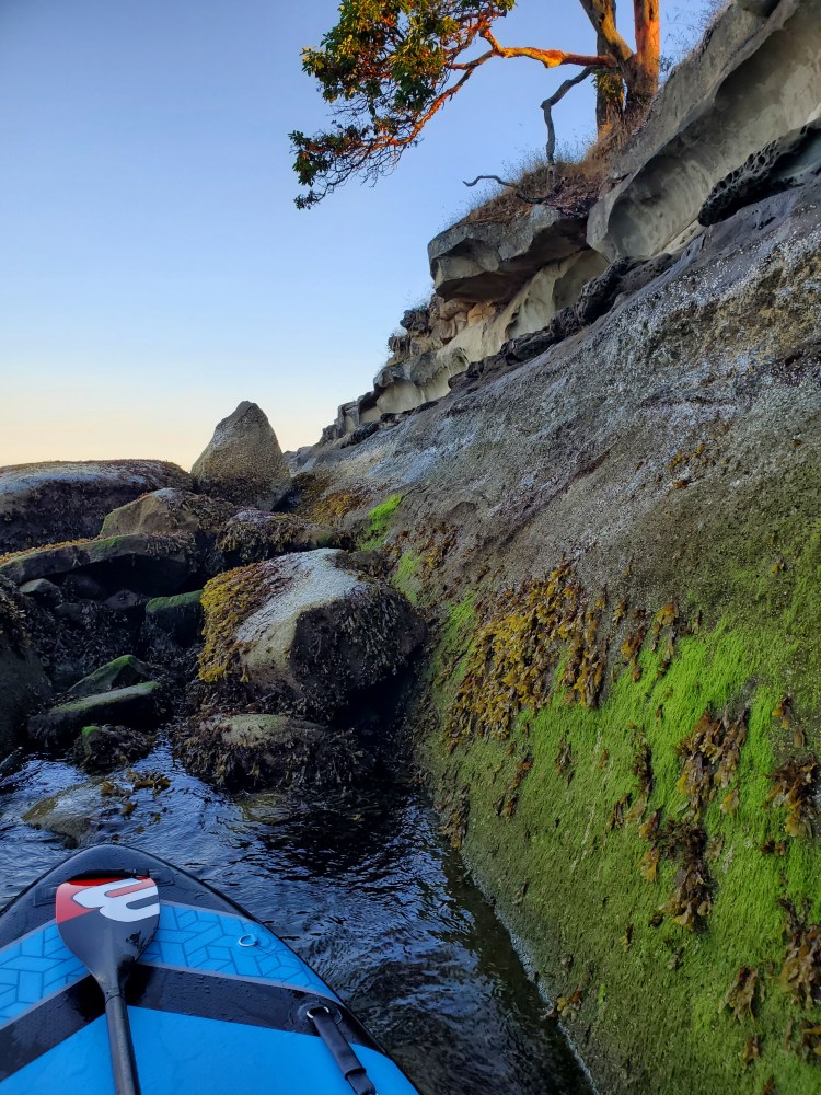
The cove was much calmer than the open water, but the waves still made their way into the cove. I took shelter behind a small rock outcrop where the gallery had given way long before for a quick snack.
I then checked again for ferries and found that the Tsawwassen ferry to Duke Point was on the north side of the island, near Orlebar Point. Not sure how much time I had nor how fast I would be able to make progress into the wind and waves, I decided to play it safe. I made my way out around Malaspina Point to Taylor Bay and waited for the ferry to come into view. When it came into view around the Tinson Point peninsula, I embarked on my return.
The winds were not as strong as I had imagined. Perhaps they had diminished, the currents had eased, or it was just easier going into the waves when you could see them coming.
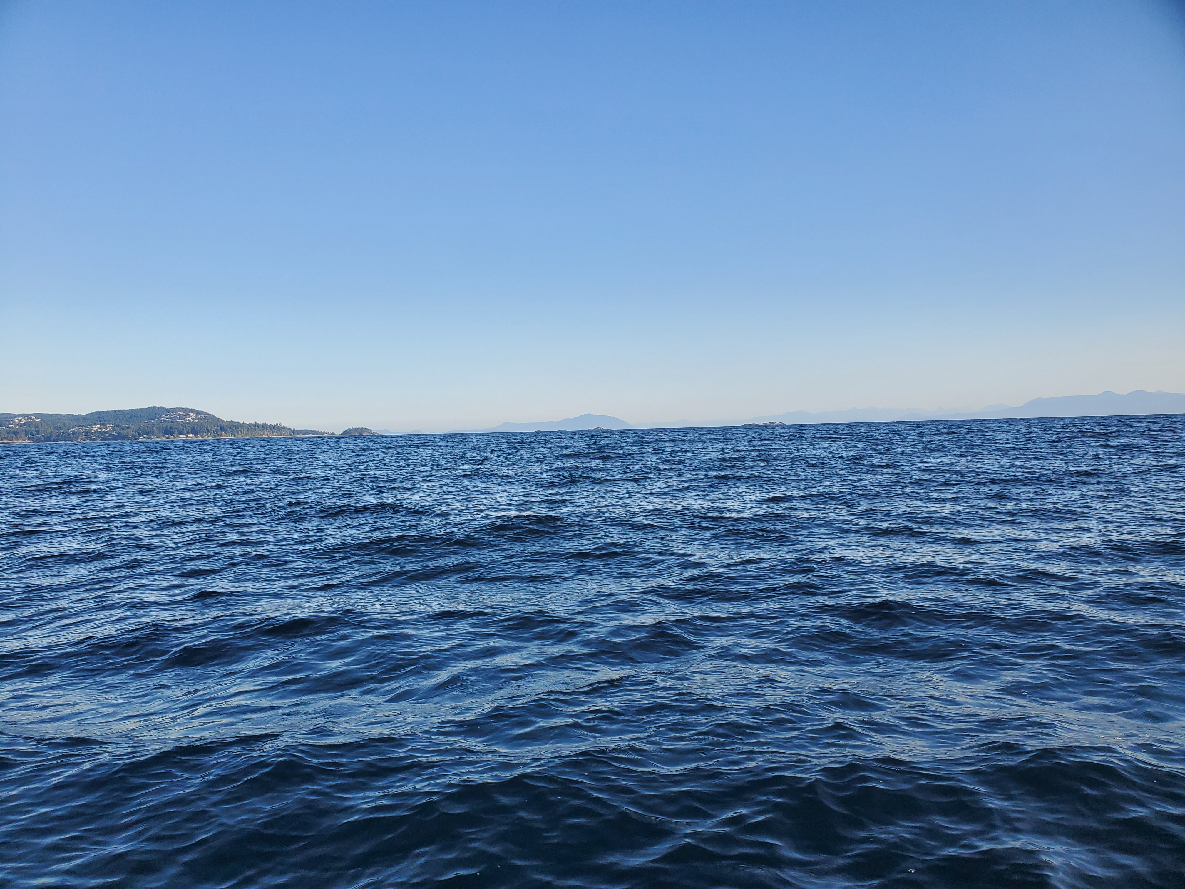
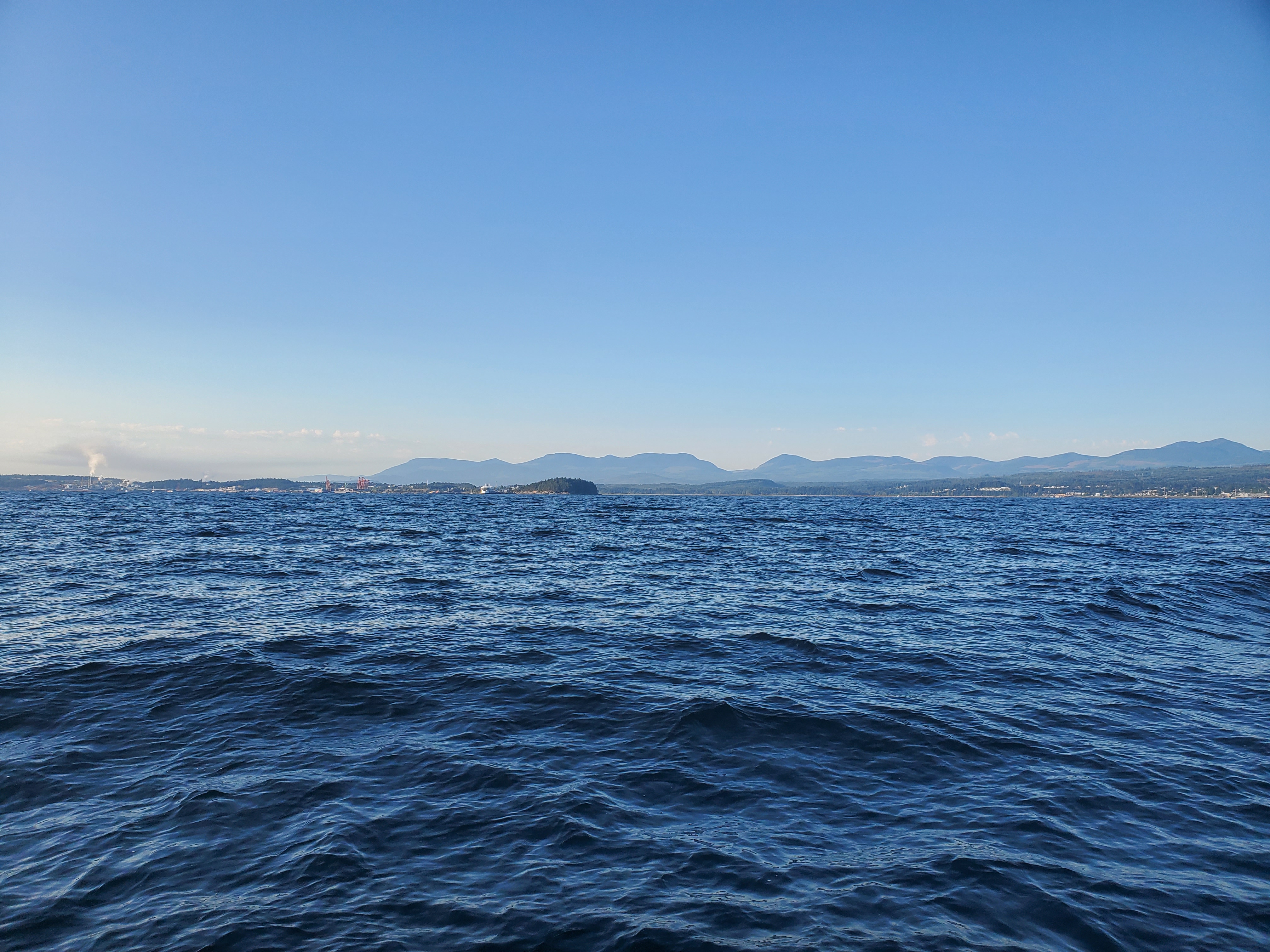
Mid-crossing, I stopped to take the photos below. The first picture is looking north. You can see Horswell Bluff on the left. The small landmass at the tip of the peninsula is Pipers Lagoon. In the centre, backdropped by the Sunshine Coast, you can just faintly make out the islands of the Hudson Rocks Ecological Reserve. On the right is what I think was Five Finger Island. The second picture is the view looking south. In the centre, is Jack Point and Biggs Park, with the Duke Point to Tsawwassen ferry on the left.
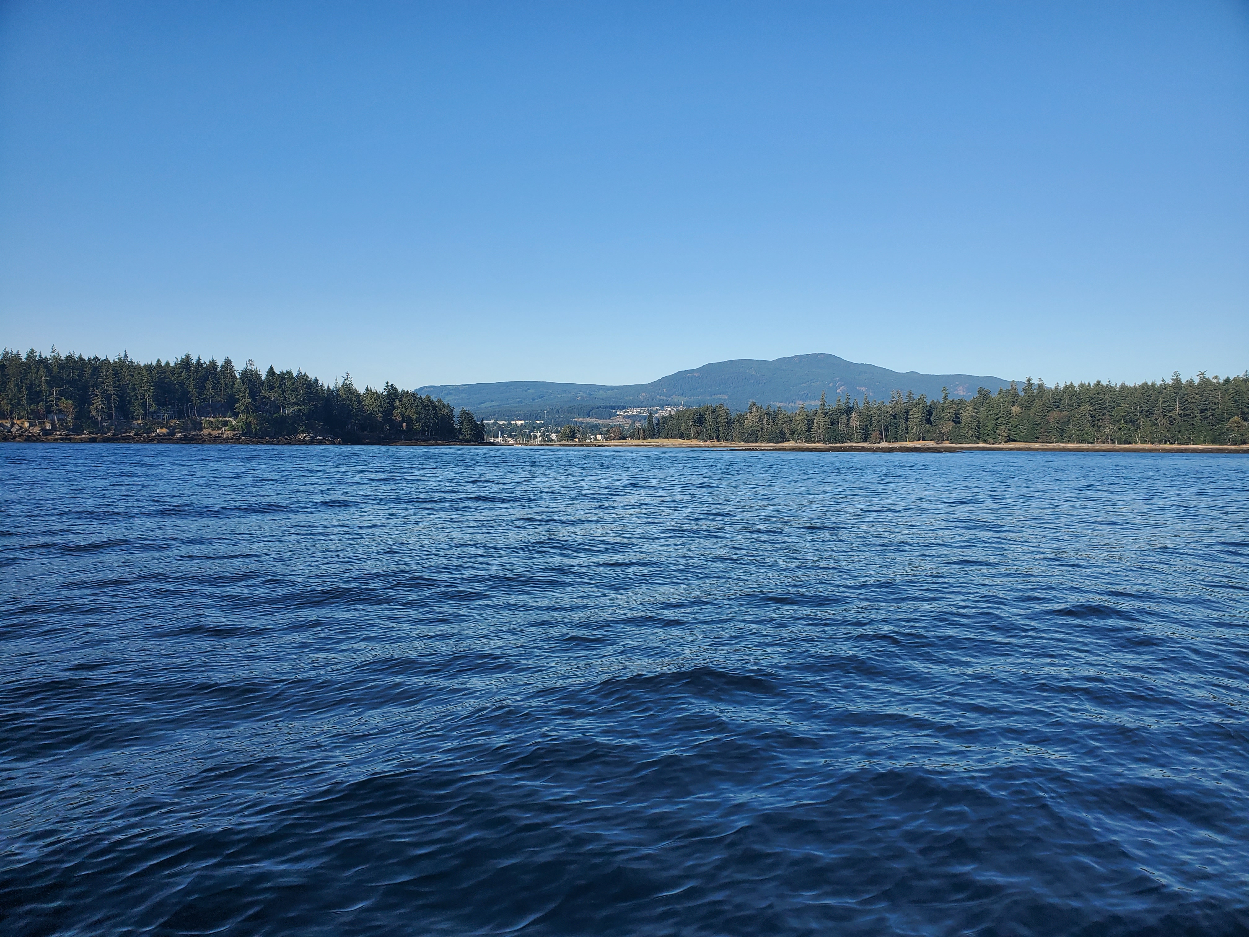
Closer to Xwi’thi:sucun (The Gap), the waters were calmer. Below is the view looking inland between Protection Island (left) and Saysutshun (right).
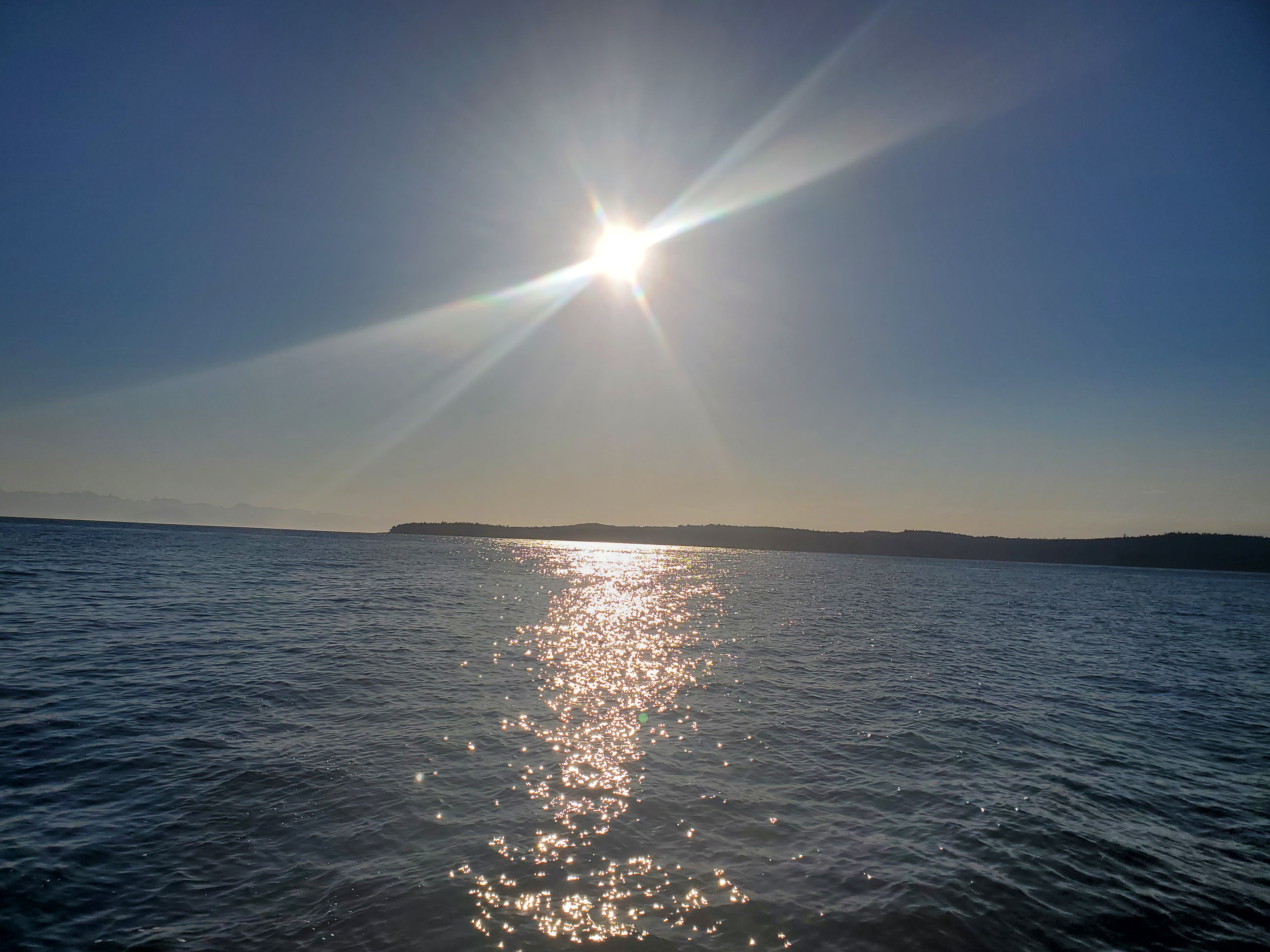
The sun was now out in full force, as you can see from this over-the-shoulder shot back toward Gabriola Island and Malaspina Point.
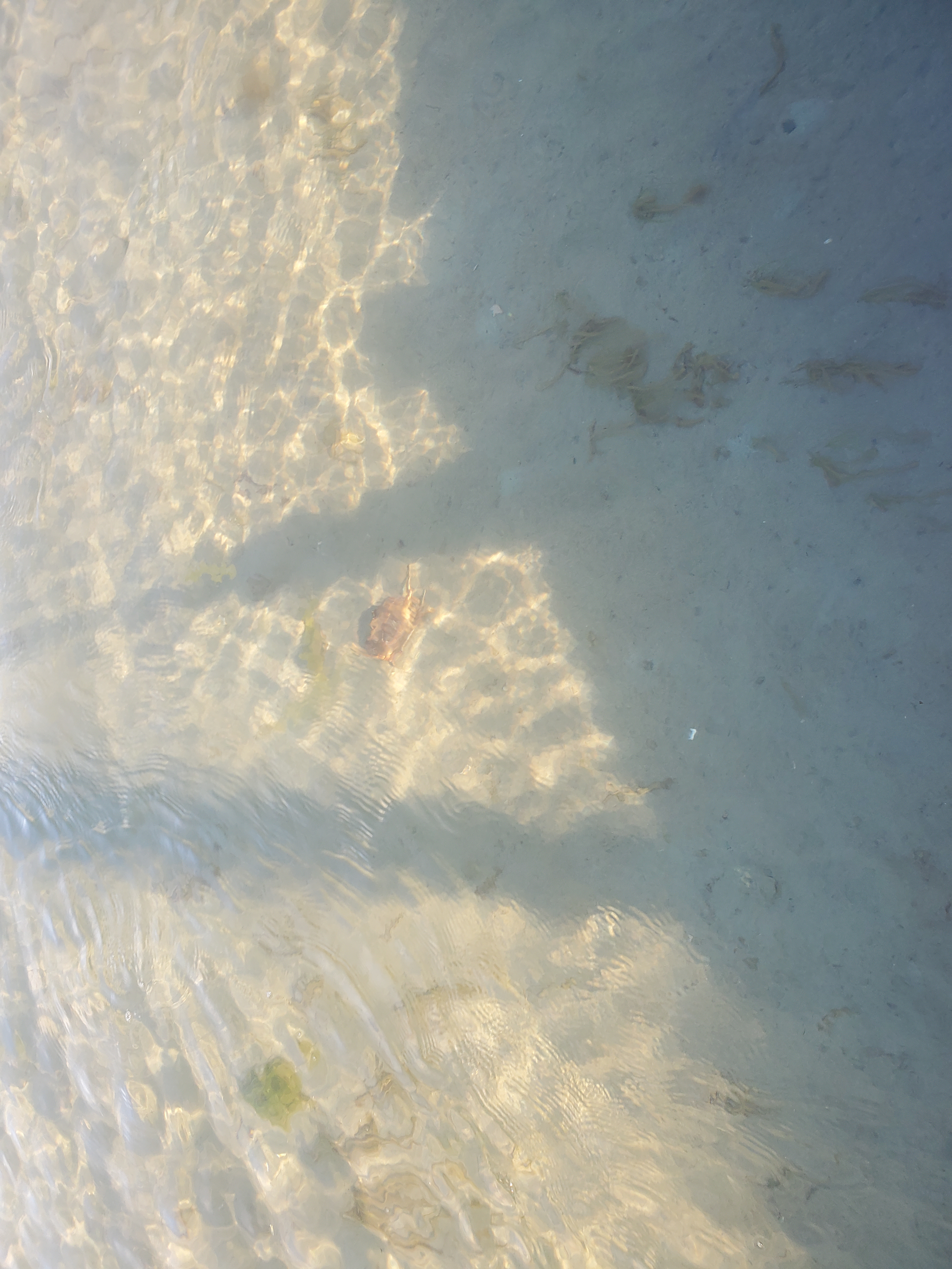
The shoals of Xwi’thi:sucun (The Gap) were lower now, and I had to paddle from the nose of my board to clear my fins in the most shallow sections. Thankfully, there was still enough water to avoid a suptage. I spotted a larger crab scurrying across the seafloor. Unfortunately, the image is not very clear, but it is below, along with a short video. I wasn’t sure if I caught the crab moving on camera, so I gave it a poke with my paddle as a prompt.
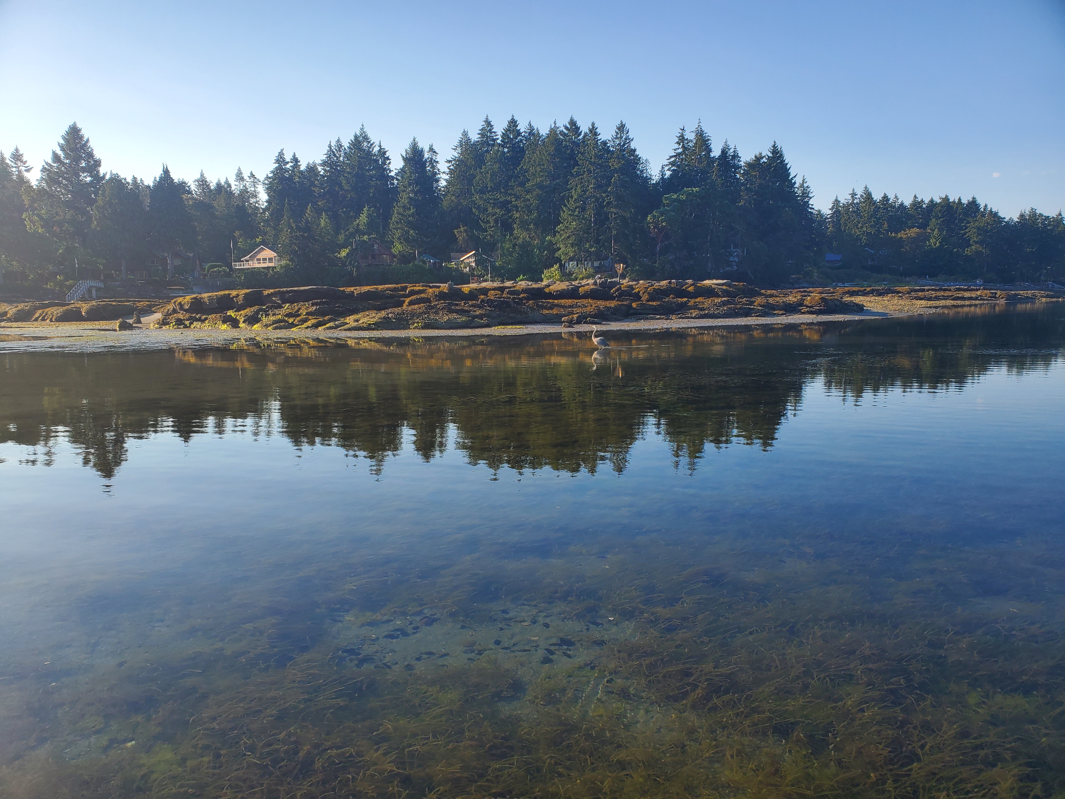
There was also a blue heron searching for its breakfast along the shore. I saw plenty of little fish darting about, so I am sure the heron had its fill.
I also found a cash of Pacific sand dollars.
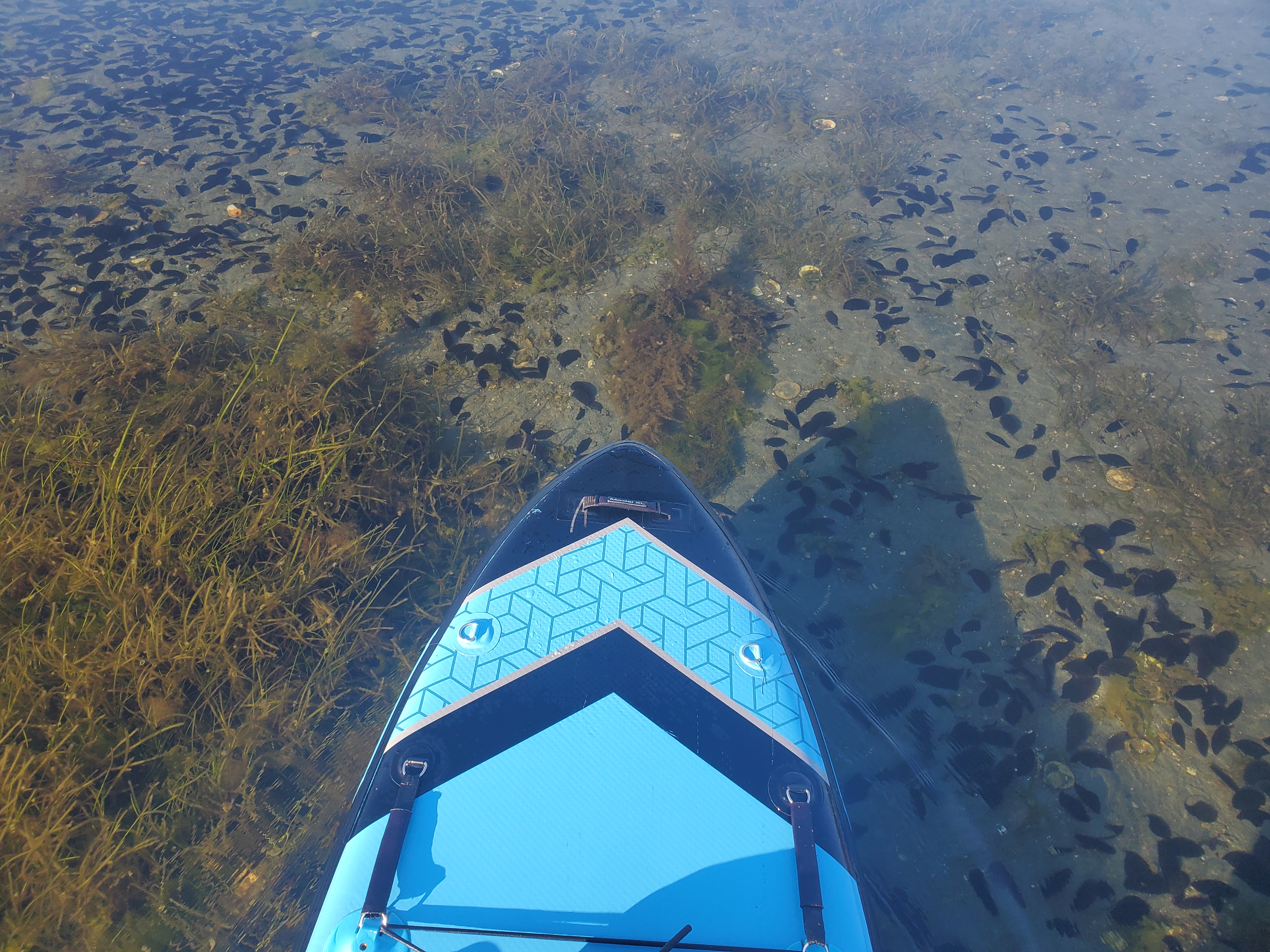
The video below is a quick glimpse of the shoals of Xwi’thi:sucun (The Gap).
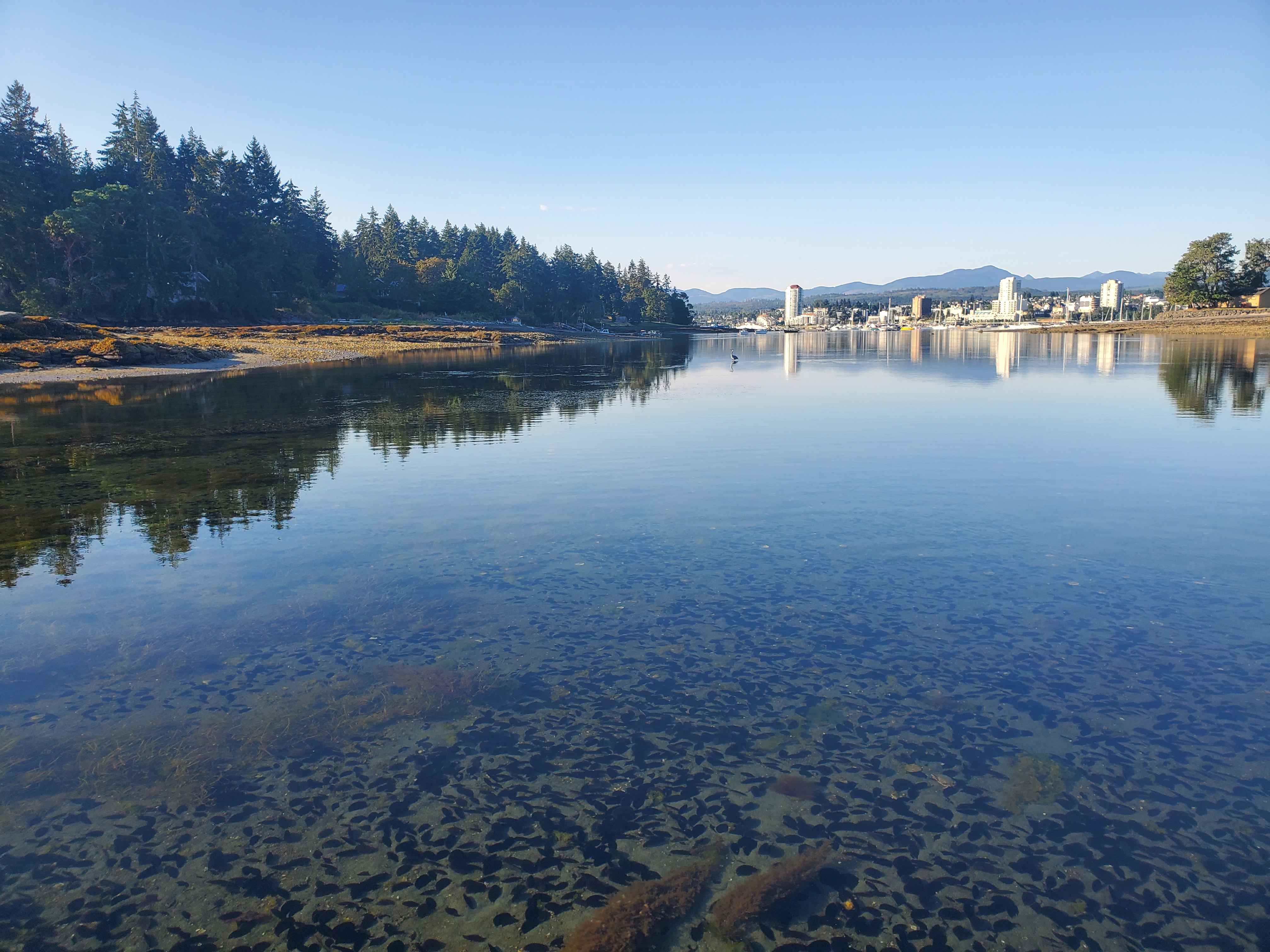
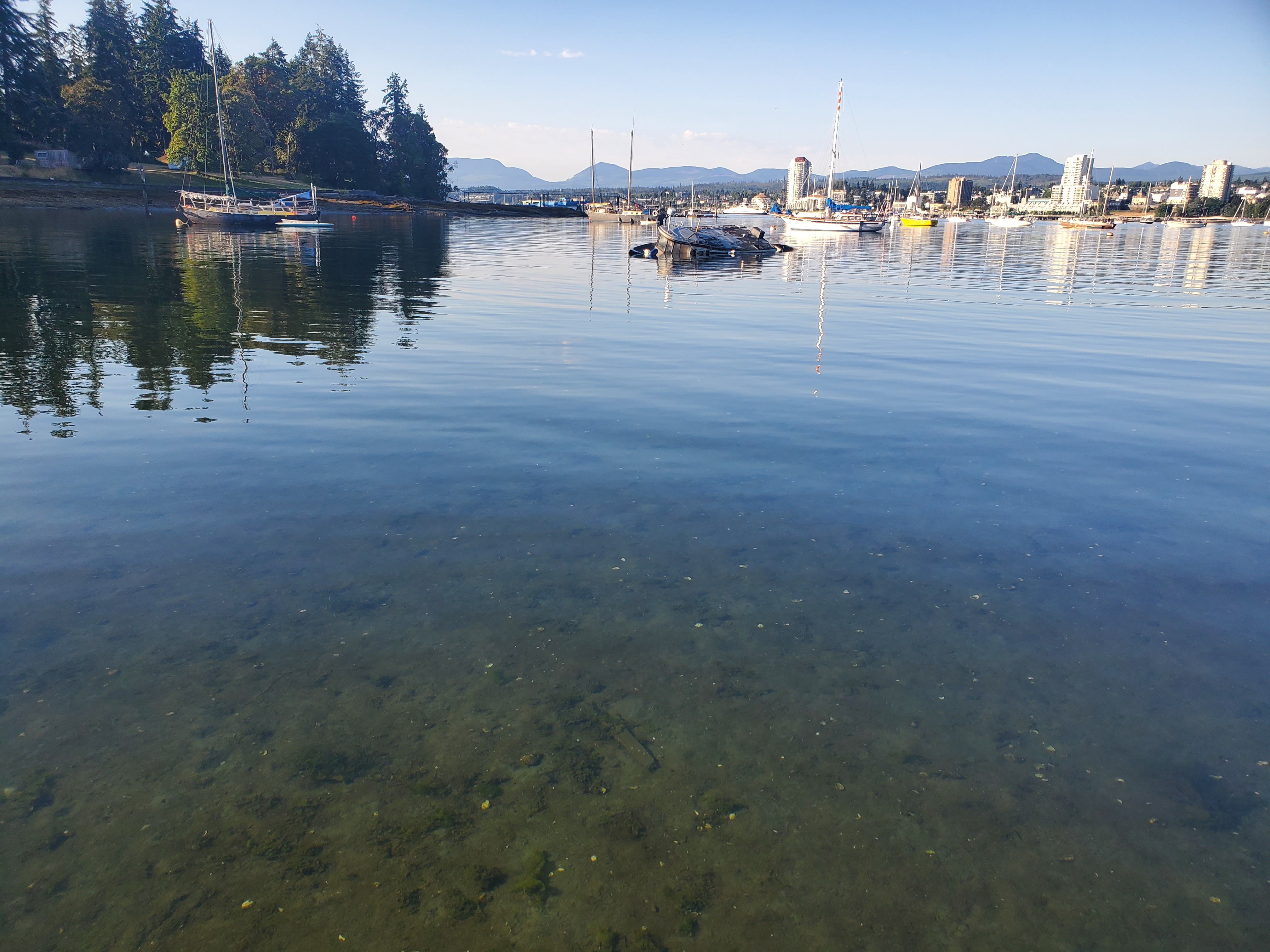
The last photos I took are a view of the Nanaimo Harbour, a couple of looks back through Xwi’thi:sucun (The Gap), and a sunken ship I passed by. In the end, it wasn’t the pair of paddling passages I planned, but it turned out to be a gorgeous geological gallivant to Galiano Gallery on Gabriola Island.
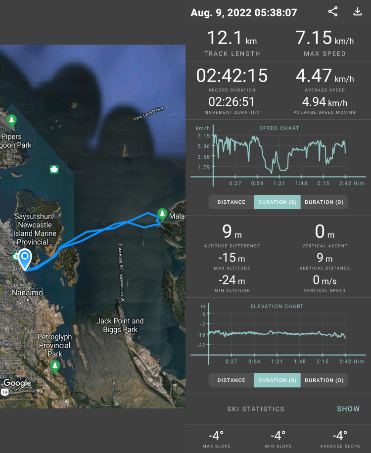
The image below is my route and statistics recorded with Geo Tracker.
And a recap of my route created on Relive from the Geo Tracker data to give the images more context. If the video below doesn’t work, here is a link to the video on Relive’s site.

3 thoughts on “Galiano Gallery, Gabriola Island. Say what?”