
Tuesday, August 10, 12021 HE
We are away on Vancouver Island for a family vacation. We did the same trip last summer after the pandemic lockdown eased. We had booked for the spring of 2020 but, with the British Columbia Provincial Health Officer issuing a travel advisory recommending against non-essential travel, we decided to cancel our trip. Fortunately, the place that we had booked offered to honour our reservation in the summer if the travel advisory ceased. As things turned out, the travel advisory was rescinded, and we had an amazing time in Qualicum Beach and Parksville last summer. To read the paddling posts that I did last year, check the following: How Far Can You Go?, Denman Island Crossing: Baynes Sound, Correctly Mistaken Island, Winchelsea Islands or Were They?, and Ballenas Island(s).
We had such a good time last year that we booked again for this summer. Here are my posts from this year’s trip so far, SUP ‘Surfs’ Up and Wildlife Explorers.
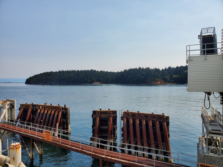
On the ferry ride over from Vancouver, I was much more attentive to the surrounding waters and geography than any other ferry ride I’ve taken before. Both because of my newfound hobby/passion, stand up paddleboard (SUP), and since I was keen to see Bowen Island from the ferry after my recent paddle around it. So when we sailed into Departure Bay, I took note of Saysutshun (Newcastle Island Marine Provincial Park) on our port side.
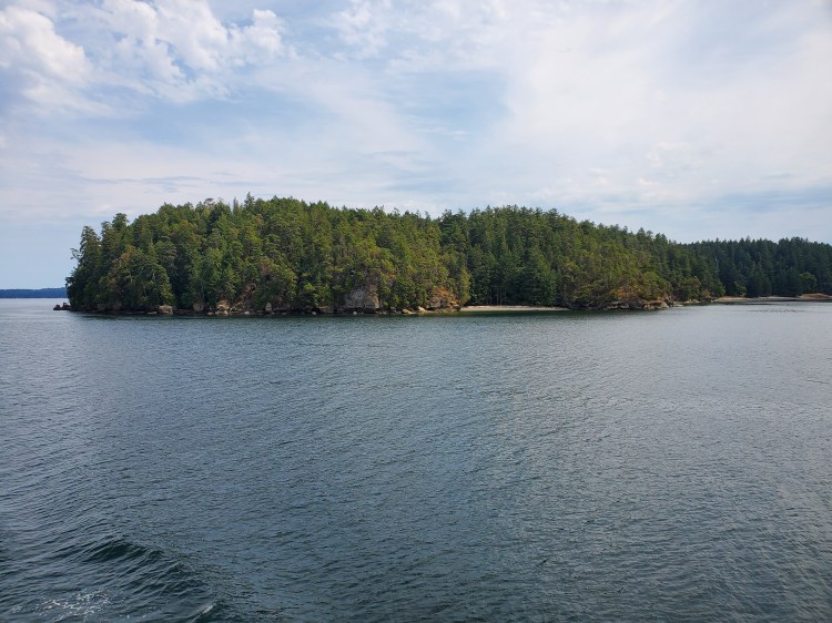

At the time, I thought that it could be a fun island to circumnavigate. Since we were staying near Qualicum Beach at the start of our trip, I thought it would be more efficient travel-wise to save a paddle around Saysutshun for our time in Parksville. And then I almost forgot about it until this morning.
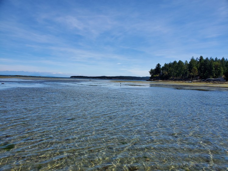
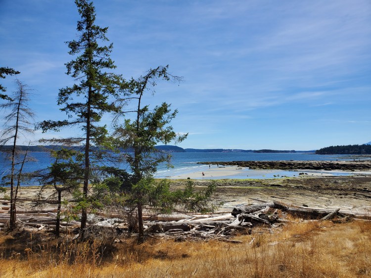
Yesterday, I had a great paddle session off of Brant Point at the northeastern tip of Rathtrevor Provincial Park. With the combination of the wind and tide, there were light surf/downwind conditions. There was enough wind for me to mix a bit of downwinding with a shore break in the low waters of the Rathtrevor Beach land shelf. I had a blast catching the small rollers and practicing some basic SUP surf skills.
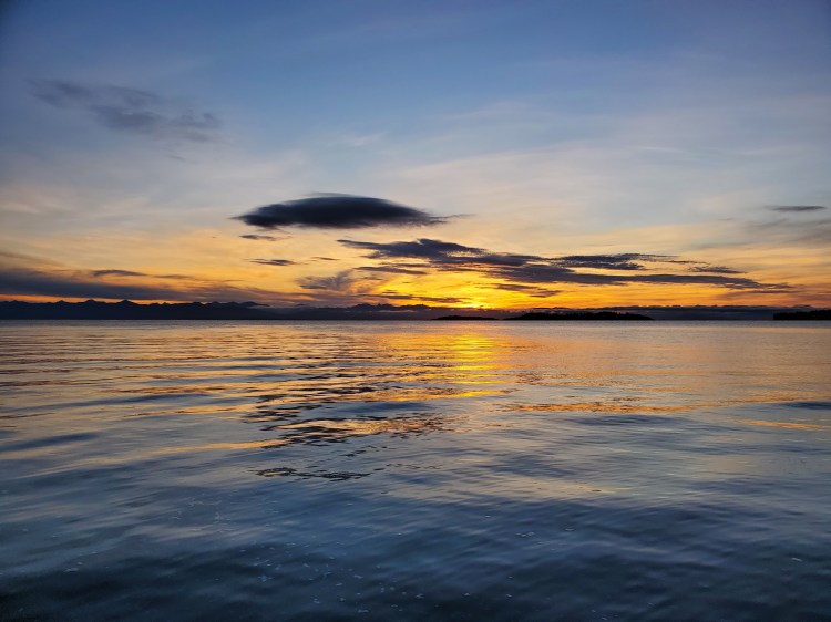
This morning the forecasted conditions were similar so, I decided to get out early to see if I could catch them. However, the wind wasn’t strong enough, and there were no waves. But it was a glorious morning out on the water nonetheless. It is wild to me that the conditions could be so different in the same spot. I guess that is what makes forecasting so challenging. There are so many factors that go into it that it is a bit of a butterfly effect phenomenon. The image below is the sunrise from the shore looking out over Craig Bay.

The next photo is the sunrise from the water in Craig Bay.
Below is the tree line of Rathtrevor Beach Provincial Park, looking northwestward from near Brant Point. There were no worthy waves today, but I swear there were some at sunrise the day prior.

That was my morning paddle. When I got back to our rental place, something queued me to my plan to paddle around Saysutshun from earlier in our stay. Annie and I briefly discussed it, and I tentatively made a plan to do it the following morning. But a little later in the morning, Annie suggested that I should do it today. Our afternoon plan was to go to Morningstar Farm with Annie’s parents. They were now staying at the resort next to us for a few days. Annie figured they could all go to the farm in one vehicle, and then I could go and do my paddle around Saysutshun. It sounded good to me. The only drawback was that I knew it would be windy as I had briefly checked the forecast earlier in the morning. Wednesday (the following day) was forecasted to be very windy also, even in the morning.
I decided to take my opportunity. I reasoned it would be windy for half of the trip. I just needed to figure out which half of the trip was better to have the headwind on. Below is the wind forecast for Saysutshun from Windy.com. I would be launching ³around noon. The 8-10 knots of wind I knew I could handle, but the 22-23 knot gusts would be something else. I hoped the estimates were on the high side but feared that they were on the low side.

And below is the wind and wave forecast from Windy.com. The waves were forecast to be similar to the forecast from the day before and the morning. But my experience from my morning paddle left me with the synopsis that scientific modelling of the weather is a game of guesswork with large margins of error. The question would be whether those margins were more or less than the forecast?

As I quickly gathered my kit, my father-in-law, Michael, and I discussed my tentative plans. I planned to leave from this launch site off of the Queen Elizabeth II Promenade that I had found on the Go Paddling App. I found the juxtaposition between the nomenclature of my launch site and paddle destination ironic. The name for Saysutshun has transitioned from its colonial-era name of Newcastle Island in recent times to its historic Indigenous name of Saysutshun. I can only suspect that it would have been called by its Indigenous name historically until, over time European settlers had encounters with the island, prompting a name change to something more European. According to this Wikipedia page, the European name of Newcastle Island was given to the island after a local Indigenous man showed the Europeans where they could find coal on the island. The name Newcastle was then given to the island after the famous coal-mining town of Newcastle-upon-Tyne, in Northumberland, England.
Departing from the eponymous Queen Elizabeth II Promenade was a distinct reminder of the colonial history of the island, the area, and British Columbia more generally. The irony of highlighting British Columbia as I emphasize its colonial roots is not lost on me. I will use both European names and Indigenous names throughout this post, mainly due to familiarity and convenience for the latter. Though I acknowledge the colonial legacy and that much of the land in Canada is an unceded territory (or perhaps more elegantly stated, stolen under the rules of the very people who took it). Hence my attempts to use the traditional place names.
As a side note, I have no issue with the whole argument of a conquered people (emphasis added because this is not my particular viewpoint) needing to give up their territories. History is full of examples of this. Constantinople or Istanbul comes to mind as a city whose name has changed throughout time depending on who was in power and whom you were asking. Human history is often depicted as cruel and brutal, which it was, but more importantly, the narrative in the present is told by those in power, the so-called winners. My problem with the argument of a conquered people in this context is that different rules were at play. At the time, Europeans used legislation and treaties to govern land and territories, and this was by no means a new practice of the time. A revisionist history of ancient civilizations reveals that both tolerances of culture and codification of land laws have a long history.
As an addendum on the topic here is a great account from ABC‘s Rear Vision program that came out in 12023 HE. Rear Vision looks at current headlines through a historical lens, giving “you the background you need to understand today’s news.” The episode, aptly titled, “Treaty making—a recognition of existence,” presents the history, process, and implications of treaties. This episode is a topic that has intrigued me for some time so I was particularly pleased (so much so that I felt I needed to add this addendum) when I came across it as it covers treaties in the context of New Zealand and Canada. Spoiler alert, against the conquered peoples’ narrative, the episode highlights that agreements were made between the Crown and the indigenous inhabitants of the lands after the issuing of the Royal Proclamation of 1793 by King George III on the 7th of October 11763 HE. A curious question raised in the program relates to why the origins of the American Revolution were a revolt of the rich. The simple summary of history suggested in the podcast is that revolutions are started by the dispossessed, not the elite and privileged. Though, my concurrent reading of the historian Annelien De Dijn‘s book, “Freedom: An Unruly History,” adds to the argument. De Dijn highlights that Revolutions are complicated and messy, yet often influenced, if not instigated by the intelligentsia, which in my regard, tend to be a subset of the elite. In any case, the first episode, “Rich Man’s Revolt,” from Season 4, “The Land That Has Never Been Yet,” of Scene on Radio attempts to answer this question. Why was the American Revolution a revolt of the rich?
In both Yuval Noah Harari‘s Sapiens and Peter Frankopan‘s The Silk Roads, I was intrigued by the accounts of Cyrus the Great and how he popularized the practice of religious and cultural tolerance. My understanding of European and Indigenous history is that the accepted rules and protocols of the Europeans themselves were ignored or co-opted in this context to best suit European interests. And that the underlying impetus for this was economic. The economics of the New World plantations (perhaps more accurately called a forced labour camp) provided the incentive to justify a new form of slavery in the Atlantic Slave Trade. Europeans needed to come up with a justification for this new form of slavery, which is where the origins of scientific racism reside (see the video below for a summary). The idea that certain peoples were inferior laid the groundwork for the disenfranchisement of the local native populations. Since the Indigenous peoples of the Americas were less resilient to the newly introduced European communicable diseases, they proved to be unsuitable for the labour required in the New World. This was one reason for the European’s need for the Atlantic Slave Trade.
Concerning the idea of a conquered people, the normal rule of law no longer applied (and the argument of a conquered people is not something from history as evidence by this 2020 CBC article). My gripe with this history is that if you are living by the rule of the sword, then do so. But, if you are living by the rule of the pen, then you must also do so. In this case, the Europeans coopted their laws to serve their interests at the expense of the native populations. It follows Lord Acton‘s adage that, “Power tends to corrupt, and absolute power corrupts absolutely.” I see why they did it, but it goes without saying that the hypocrisy is almost palpable.
The history section on the Newcastle Island Marine Provincial Park Wikipedia page is fascinating. I found the part on Indigenous peoples seasonally travelling from Saysutshun to Gabriola Island and then traversing the Salish Sea (Strait of Georgia) to the mouth of the Fraser River in pursuit of the various fish stocks fascinating. Particularly, since a friend of mine had suggested SUPing from Vancouver to Victoria after an article he had read. When I first read the article almost two years ago, I thought the idea was crazy. After becoming a more avid and proficient SUPer, the idea is now on my extended bucket list. Though I do think there are more scenic routes that I would like to complete beforehand. The open water crossing of the Salish Sea is more a feat of accomplishment than it will be scenic. But the latter portion of the trip through the Gulf Islands would meet the scenic criteria.
And for further inspiration, here is a short film on why Bruce Kirby did his paddle from Vancouver to Victoria.
But I digress…back to present-day Saysutshun.
I was planning to launch from the site near the Queen Elizabeth II Promenade and then paddle through, Xwi’thi:sucun (The Gap), the channel separating Saysutshun from Protection Island en route to an anti-clockwise circumnavigation. Michael agreed that I should paddle anti-clockwise around the island and gave me fair warning that it would be windy in Departure Bay. I was surprised when looking at the forecast at the amount of wind in Departure Bay, so this was a good confirmation to get from him. I had assumed that the bay would be sheltered from the wind so it was great to get his insights. He also pointed out that I might not be able to make it through the Xwi’thi:sucun (The Gap). I assumed I would, even despite his warning, reasoning that my SUP would be able to navigate very shallow waters. I only briefly checked the tides before setting out which should have tipped me off more. Below is a screenshot of the tide forecast for Nanaimo Harbour from the Water Levels App. The low tide would fall in the middle of my paddle window.

I launched from a muddy low tide shoreline here. I was on the leeward side of the marina docks, and as I came out into the exposed Newcastle Island Passage, the wind and current took hold of me. It reinforced my plan to do an anti-clockwise rotation of the island. I was hoping the southeastern coast of the island would be protected from the northwestern winds. I made my way across the channel and then turned to ride the wind and the current down towards Bate Point. With the low tide I needed to paddle out further to round the southern tip of the island. As I rounded Bate Point and made my way toward the mouth of Say Set Sun (Mark Bay) the wind was strong. Given that I was travelling northeast with a headwind, it was going to be a tough leg across the bottom side of Saysutshun.
While researching the location points and names (post-paddle) I used Google Maps, i-Boating, and this Newcastle Island map from the Snuneymuxw First Nation (which is below). Pre-paddle I usually use Google Maps and Google Earth to get a sense of the physical geography. In addition, I tried to find articles about other paddlers doing the trip to make sure that I am not crazy. In this case, there were lots of posts of people paddling around Saysutshun, just perhaps not with these wind conditions.
I was heading into a headwind as I made my way across the mouth of Say Set Sun (Mark Bay). Below is an image from my deck-mounted camera of the mouth of Say Set Sun (Mark Bay).

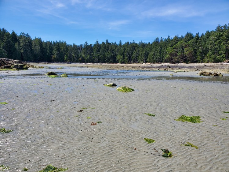
Once I was on the other side of Say Set Sun (Mark Bay), as I rounded the next point, I was disappointed to see how low the water was. As I said above, I didn’t check the tides as well as I should have since my opportunity to paddle came about a bit impromptu. It looked like Michael was right, it was going to be difficult to get through Xwi’thi:sucun (The Gap).

Below is the view a bit further into the channel. I hoped that the shallow water went all the way through, but as I made my way further into the channel I realized that it didn’t. I checked Google Maps quickly. Could I go around Protection Island? How much more distance would that add? How much more upwind paddling would that add? I decided it would be better to test the channel and portage whatever parts that weren’t possible to paddle.

Eventually, my fin started to bottom out so, I abandoned ship, and changed to a partial portage. I pulled my board from the tail-end letting the nose drag in the water so that I didn’t have to fully carry it.
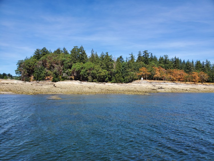
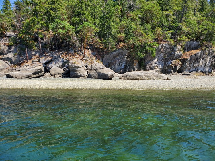
The colours along the shoreline of Saysutshun were stunning. The shoreline was a mix of browns and greys, along with the green of the trees, the mustard yellow of the dry grass, and the burnt orange of the foliage.

I could see Gabriola Island off in the distance beyond Protection Island. Another future journey, I thought.
And then I ran out of water and had to change to a full-on portage. Luckily I had packed light, with only my water and foam clogs strapped to my board. I also had a waterproof waist pack with a few snacks, a cellphone, and keys. The image below is from my deck-mounted camera showing the seafloor of Xwi’thi:sucun (The Gap).

Once I was back on the water, I started to question my choice of circumnavigation direction. There was a strong headwind and solid cross chop. So much for the leeward shelter from the northwest wind I had hoped for. The wind here felt northeasterly. I found myself wondering, what would the other side be like? I doubted that there would be the same wave chop. But, I wasn’t sure if the wind would be stronger through the narrow passage on the west side of the island compared to the wind on the open exposure on the east side. I would have to wait to find out or turn around and start anew in the reverse direction. Neither option was particularly appealing at the moment. Onward into the wind I concluded was the better choice.
Plus, I reasoned it would be good training for the anabatic winds in the Átl’ḵa7tsem (Howe Sound). I hope to do a multi-day SUP tour on the Sea to Sky Marine Trail near the end of August (see here or my Potential Paddle Plans page for details). For this trip I am anticipating a tailwind while heading north and a headwind for the return south. Though, my understanding is that the wind direction will depend on the temperature inland versus offshore, with the onshore southerly winds building through the day as the inland temperatures in the interior of British Columbia rise. I hope to mitigate the effects of the wind by hugging the coastline and paddling early for the southward sections.
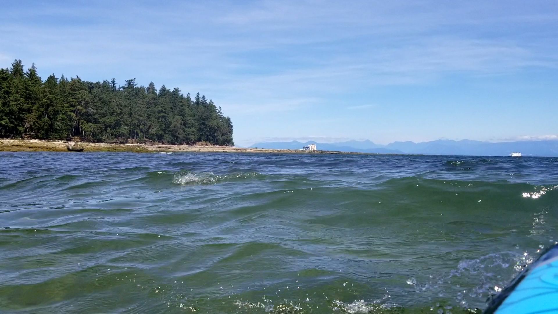
The clip below gives you a feel of the waters and wind. I am just past Brownie Bay at the southeastern corner of Saysutshun. You can see the ferries bound for Departure and Horseshoe Bay, respectively, off in the distance.
After combining some kneeling paddling to reduce my windage with some standing paddling for more power, I eventually made it to Kanaka Bay. It was beautiful at low tide and, many beachgoers were exploring the shoreline. I would like to see the beach at high tide too. I quickly explored the shoreline. The walk allowed me to rest for my legs and, at the same time, take some photos. I also wanted to survey the scene on the other side of Angie Point.
The image below was the view from the Shoreline Trail near Angie Point looking southeast over Kanaka Bay. My board is visible on the beach to the left of the rocks in the right of the image. Those rocks are the northern portion of what forms Gurney Point.

And a similar view is shown in the image below with a bit broader perspective.
Below is a quick video was taken from Angie Point. You can see McKay Point before the view pans over the top of Angie Point towards Kanaka Bay and Gurney Point. From right to left, you can see Protection Island, Nanaimo (Jack Point and Biggs Park, I think), and Gabriola Island. But my real goal with the video footage was to capture the sound of the wind.
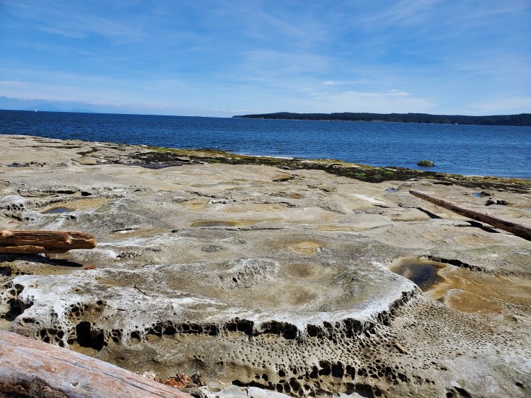
With the low tide at Kanaka Bay, you could see much of the sandstone and the erosion patterns. As a child, I remember spending summers on Salt Spring Island and exploring the shores and being taken by the porous appearance of the rock.
I wasn’t aware of this story about Kanaka Bay at the time and only read it post-paddle. It is a fascinating read that ties in migrant workers, Indigenous peoples, colonial corporations, marriage, and murder. The story has all the makings for a thriller and is worth a quick read.
After I rounded McKay Point, there was only slightly less of a headwind but a lot more cross chop. My starboard side was now completely exposed to the Salish Sea. I tried to take in the majestic scenery while not getting too caught up in my rapture that I ran the risk of capsizing.
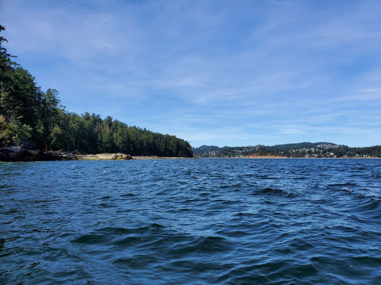
I loved seeing the different geography of the coastline. The northeastern coast was a mixture of large rocks with a higher beach marking the high tide waterline before reaching the evergreens. Having read beforehand that part of the island was mined for coal and stone, I found myself wondering what the natural state of the island was. Perhaps non-anthropogenically modified would be a better description as Homo Sapiens are as much a part of the natural cosmos as anything else that exists.

I liked the image below for the contrast of colours and the light refractions. Not to mention the colour contrast between naturally produced scenery and my anthropogenically introduced artifacts.

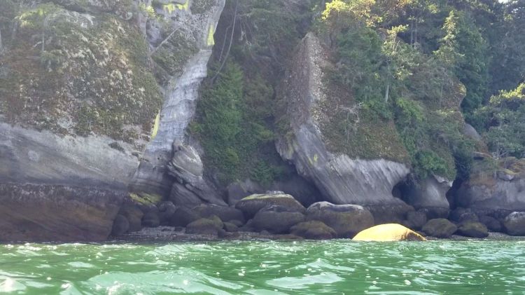
Further westward along the northern coast, there were beautiful large rock formations eroded and shaped by the ocean.

You could also see points of exposed tree roots against the eroded shoreline.

And more of the wear patterns of the rock. I wish I had taken more of an interest in my grade ten earth and ocean science course at the time. Perhaps I would have more geological knowledge now.
As I approached Nares Point, I started to wonder a bit more about the ferry. I had surveyed the ferry wake on our arrival to Vancouver Island. But it is one thing to see it from the ferry and another from the water.
And sure enough, as I approached Departure Bay, there was a ferry departing. It was closer to the shoreline than my memory. But thankfully, the slow speed at which it was travelling created a very manageable wake. The bumps were big but broke right on the shore so, they just gently bobbed me up and down like a cork on the water.
Below is the view of the shore near Tl’elpoles (Sunset Bay). I didn’t photograph the bay as it was right when I was navigating the ferry wake, and I didn’t want to risk the spectacle that may have resulted for the onlooking ferry travellers.

Below is the view from a slightly different perspective.
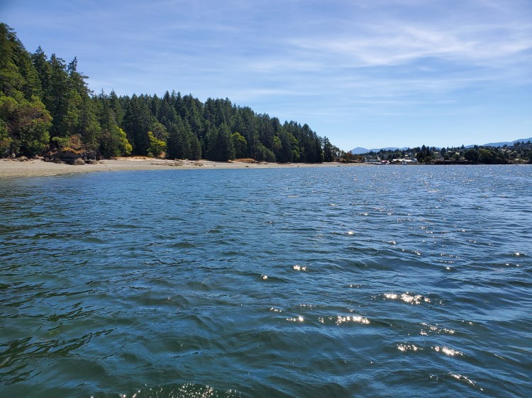
I made my way past Tyne Point toward Saltery Beach (Roga Beach). You can see the long sprawling beach in the image below.
The video below is the south end of Saltery Beach just before Shaft Point at the entrance to Newcastle Island Passage.
Once I rounded Shaft Point, I observed the light station. It had signage that said the light would illuminate when a floatplane was landing or taking off. I hugged the shoreline on the left to make sure I would be out of the way. I let the current guide me around the mouth of Midden Bay. As I paddled along, I could hear the rumbles of a plane ahead of me at the docks. I turned back to see if the light station light was on? Not yet.
The plane eventually pulled out into the channel and made its way north toward the light station. Still no illumination. I recorded the process with the thought that my boys would be into seeing a floatplane take off. Below is a short clip of the takeoff. The light station comes into view at around 48 seconds but, it didn’t appear to me that the light came on at any point. Either I couldn’t see it, it wasn’t working, it only worked in lower lighting, or that small floatplane wasn’t enough of an aircraft to warrant the light warning. Who knows?
I leisurely drifted and paddled down Newcastle Island Passage. The wind was at my back, but the current felt more like it was resisting me. I wondered if it would have been easier coming up against this wind than the wind and waves on the east coast? But then again, there was nothing to say that the conditions I was in currently were the conditions that I would have been in earlier.
I used the wind to assist me in crossing the passage close to where I departed. It was a muddy landing, and I tried to hop rock to rock or oyster shell to avoid my clogs getting stuck in the muck. In the end, I made it around the island despite challenging wind conditions. And as I said, it was good upwind training for the Sea to Sky Marine Trail.
I had GPS recording issues that prevented me from getting an accurate depiction of my route or time. But, from text messages, I departed just past noon and was back on the shore just before 14:30. So I was just under two and a half hours to complete the tour around Saysutshun.
Friday, August 13, 12021 HE
Today we left Vancouver Island to go home to Vancouver. I was keen to get another view of Saysutshun from the ferry. As luck would have it, the wind and water were calm. Not the conditions that I had experienced. Unfortunately, I didn’t get a good view of the island from the ferry deck as we left Departure Bay. Apparently, I was the only family member who wanted to see Saysutshun from the ferry again, so below is the view from the car deck before we departed. 😀

4 thoughts on “Saysutshun Circumnavigation”