Monday, August 1, 12022 HE
We are on Vancouver Island again for a family vacation. We’ve done a similar trip the last couple of years. It is a great family getaway, with the added bonus that we are close to the water with many new places to explore.
Yesterday we met some friends at Spider Lake and spent the day there. With the recent heat, the water was warm, and we spent a lot of time in the water. There were toads on the shoreline which are migrating. The toads kept the kids entertained, and the accompanying educational placard kept me entertained (see below… who doesn’t love a good pun). I took advantage of the warm and flat water to push the boundary on some stand up paddleboard (SUP) skills/tricks (one-foot paddling, step-back turns, nose 360, and Rapid Shift). I spent a lot of time in the water, but it is always fun to push your limits.

Priceless, if you ask me.
We are staying near Qualicum Beach and will be visiting our friends who live in Courtenay. Annie suggested I could do a paddle while the kids were playing together. Searching Google Maps in the surrounding area, I spotted Jáji7em and Kw’ulh Marine Provincial Park (Sandy, aka., Tree Island, as per the locals) at the north end of Denman Island. Try as I might, I wasn’t able to find a good guide on how to pronounce the island names in the traditional K’omoks way. I did come across a post explaining that the “7” is a glottal stop, i.e., a pause.
I had previously explored the south end of Denman Island and gone around Chrome Island. With a potential destination, I used my Go Paddling application from paddling.com to see if there were any launch spots nearby. Union Bay and Argyle Road came up as options. Searching for more information on “day paddles near Comox”, I came across this list from the Comox Valley Paddlers website. It had Tree Island listed with Union Bay as the launch site. I also came across the Comox Valley Guide website’s kayaking page, which cited the end of Argyle Road as a launch site. Not wanting to paddle north against the forecasted northwesterly winds for the morning, I was hoping the Argyle site would work.
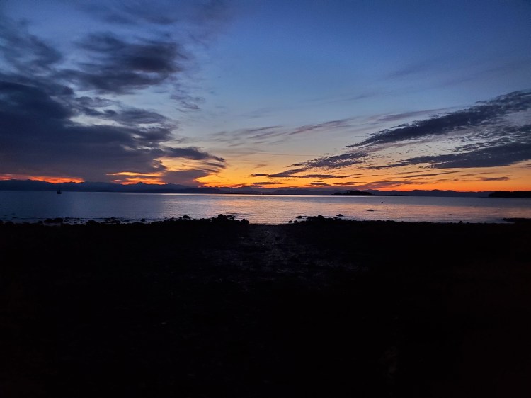
I woke quite early, which was good as I wanted to be a waterman and a family man on this vacation. An early start meant I could paddle and be back before the family day got rolling. Sunrise was at 0549 hours, but civil twilight was 0511 hours. I pulled up to Argyle Road, and the scenery and conditions looked good from the view outside of my car door.

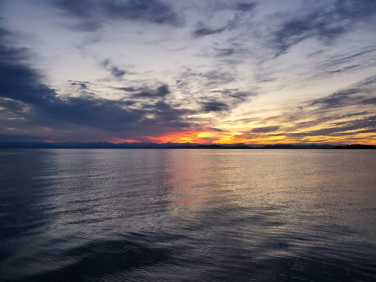
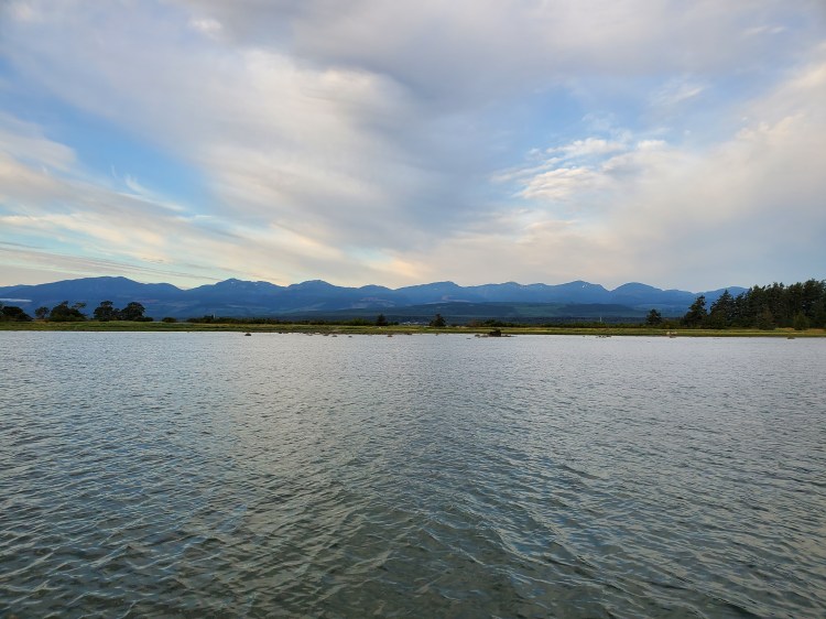
I quickly went down to the water to survey the conditions and launch site. Both were on point, so I went to my vehicle to get my kit in order. I packed light, a few bars and gummies, iced water (the last few days have been hot early in the day), and some emergency tape (duct and electrician’s). I was on the water by 0525 hours in time for the first light festivities. Below is the view from the water at the bottom of Argyle Road with the islands silhouetted just right of the image centre.
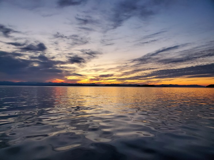
The winds were mild, and the waters were calm as I set out. But as the sky took on a crimson hue, I couldn’t help but recall my adventure on the Sound (Átl’ka7tsem, Howe Sound) with Trevor last summer and the old sailor’s adage regarding red skies. When crossing the Lions Gate Bridge, the skies had a red hue that would be an omen of foul future weather.
Red sky at night,
sailors delight.
Red sky in the morning,
sailors take warning.
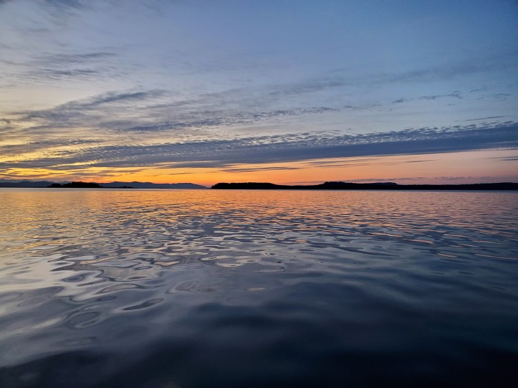
There is nothing like a ‘pre’-meridiem peaceful paddle to start off your day.
Making my way further from the shore, I looked back to site some landmarks for my return. An unfamiliar shoreline can look very ambiguous to me, so I wanted to have something to guide me back. I noted some tall trees onshore and a sailboat moored offshore. There was also a large ship docked further south that would make for a very visible and descript feature.
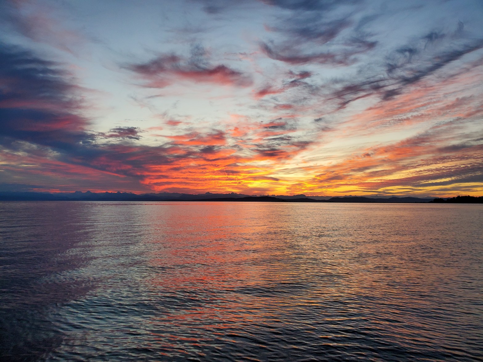
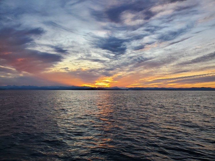
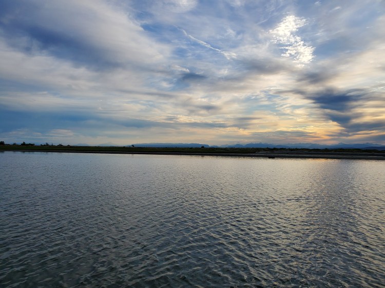
If the start of my paddle had only hints of hues of red, as the morning and sunrise unfolded, there was no doubt about the sky’s culminating colour.
Below is a quick 180-degree video view of my surroundings for a bit more realistic review.
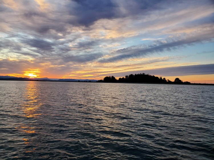
The last few days have been clear skies, so I lucked out with the cloud cover for my morning paddle. The cirrocumulus and cirrostratus formations made for a marvelous morning mirage (to a degree all optics are an illusion of sorts).

I see a dragon or a snake slithering forward in the centre of the cloud formation below.

The water became a bit more active as I made my way further from shore. The waves were a light cross chop coming from the northeast.

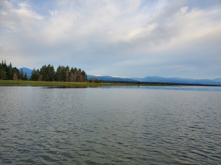
Initially, I was aiming for the north end of the marine park. I planned to have the northerly winds at my back as I travelled south along the east side of the islands. Closer to the park, I changed my plan and decided to ride the waves and winds which were now more northwesterly, toward the south side of the park. I hoped the island would provide some shelter as I switched from my southern sail.
The view below was better in real life, with the rising sun filtering through the trees.

There is a small bay on the southwest side of Sandy Island. There were several boats moored in the sheltered, shallow waters. And along the shore, there were several groups of campers. Not a bad place to spend the night, I thought, perhaps a future adventure destination. The video below is in the arc of the bay.
I made my way across to the other end of the bay. But eventually, my fins bottomed out. Rather than run the risk of seeing if I could cross closer to Longbeak Point, I decided to suptage (SUP portage) across the sand, rocks, and shells. I felt slightly bad for the marine life. However, I rationalized my actions with the knowledge that the journey between Denman Island and Jáji7em and Kw’ulh Marine Provincial Park is advertised as a walk along the tombolo at low tides on the BC Parks website.
On the other side of Sandy Island, I was not met with the calm waters I had envisioned (hoped?). Instead, the wind was stronger and northeasterly, with the wind waves pushing up the largest waves of my trip as I entered the shallow waters. I waded into the deeper water avoiding the larger stones (boulders?) scattered about the shoreline while simultaneously wondering how they got there. I concluded that they were deposited at the end of the glaciation process, as the ice beneath them melted. But who knows if that is correct?
I made my way into the channel that separates Sandy Island from the Seal Islets. Here the wind was being funneled through the gap. Along with the shallow waters, it made for slow progress. Thankfully, it didn’t get so shallow as to require another suptage. There were a few points where I walked to the nose of my board to lift the tail and fins out of the water and off the seafloor to prevent them from grounding out. My trick/skill session at Spider Lake was proving useful.
The view westward was spectacular in its own right. There wasn’t the technicolour spectrum of the eastern sunrise. Rather, there were more mundane terrestrial browns, greens, and blues. The view was still superb in its own right.
The image below looks more northerly over the first Seal Islet with Point Holmes in the left background. Further on the horizon is the qathet Regional District of the British Columbian coast’s mainland. I think there is an aspect of the northern end of Texada Island in the right corner of the image?

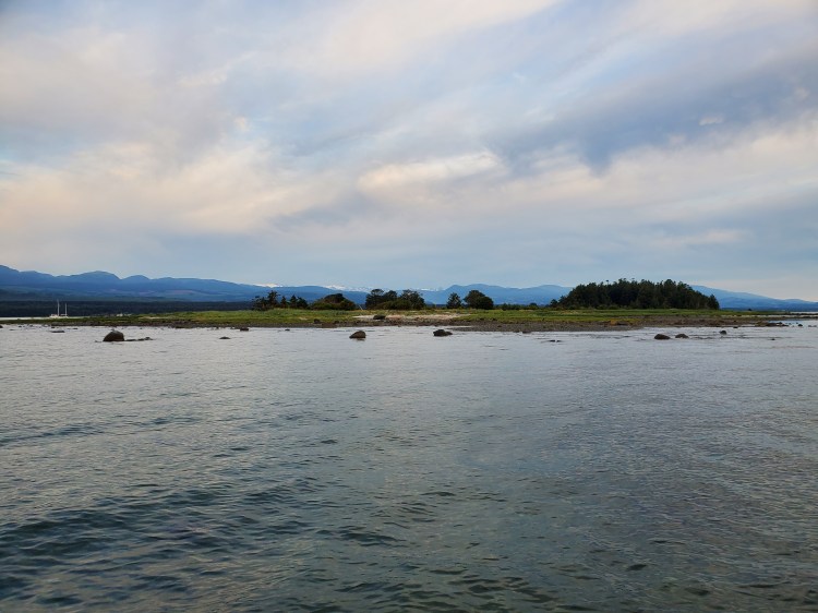
In the image below, Sandy Island is living up to its local name Tree Island.
The photo below combines the terrestrial colours with a touch of the celestial.
Shortly after taking the photo above, I noticed some movement behind me off of one of the islets. Two deer sprang from the shores into the shallow waters before swimming across to the southern islet. I scrambled to fish my phone from my flow-fending-fanny pack for the fun fawn fording but could only capture the swim and scramble to shore on camera. With the backlit recording, it is hard to make out the cervinae, but they are in the video below. Somewhere lost in the light at the start of the video, but you can see them a bit more easily exiting the water on the right near the end of the recording.
I decided to land briefly on this Seal Islet for some victuals before venturing out for the return leg to Argyle Road. The shoreline was a mixture of coarse sand and seashells. It would be an excellent spot for any burgeoning Mary Anning to search for seashells by the seashore.

Refueled and ready, I made my way offshore for my return. Worried about stronger winds later in the morning, I had conserved energy coming out to the islands. For my return, I tried to keep my pace up. Plus, I only stopped for one photo.

The scenery this morning was fantastical! Very fitting since it was BC Day (see here and here for two takes on the history of the civic holiday). The province was living up to its eponymously sanctioned tagline, “Beautiful British Columbia“.
The image below is my route and statistics recorded with Geo Tracker.

And a recap of my route created on Relive from the Geo Tracker data to give the images more context. If the video below doesn’t work, here is a link to the video on Relive’s site.

One thought on “Jáji7em and Kw’ulh Marine Provincial Park”