Sunday, July 4, 12021 HE
As I sit down to write this I noticed a strange coincidence. Last year on July 4, I paddle to Bowyer Island. And this year I did again. Strange and completely unplanned.
I still have my eyes set on an overnight trip to Gambier Island but the stars have yet to align for me, with weather and work at odds. After spending three nights at Sasquatch Provincial Park (for details check out these plogs: Deer Lake and Hicks Lake) the weather this weekend was wonderful but the timing was wrong.
Instead, I decided to do a little more reconnaissance work and check out Ansell Point as a launch site. As a departure point to get to the Sea to Sky Marine Trail, Ansell Point has the advantage of avoiding crossing any BC Ferries‘ lines. I planned to paddle across to the southern tip of Bowyer Island and then cross over to Finisterre Island, Bowen Island.
I grew up in Skwxwú7mesh (Squamish), so maybe it is just some nostalgic psych phenomena, but I feel like there is something special about paddling in the Howe Sound. Maybe it is just as simple as I don’t get to do it as often since it is more out of the way. But I guess that in and of itself is part of what makes the sound special for me.
I was up really early as I knew this was going to be a longer paddle. I had made this float plan the night before to share with my wife as I would be paddling solo. I always provide her with a float plan when I paddle alone in more challenging waters.
SUP FLOAT PLAN: Ansell Point to Bowen Island
Paddle Plan
DATE: Sunday July 4, 2021
ROUTE: Ansell Point to Bowen Island (Finisterre Island) Round-trip
VESSEL: Blue Blackfin Model XL iSUP
EST. DEP.: 0530
EST. ARR.: 0800
Details:
Tides (Point Atkinson)
- 0130 High 4.2 m
- 0900 Low 1.6 m
Wind
- Forecast: see Windy App
- NW 1-2 kt (6 kt wind gusts) changing to SW 2-3 kt (6-8 kt)
Sunrise
- 0514
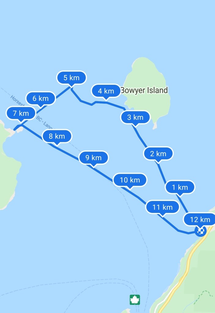
Paddle Distance ~12 km
Paddle Time ~2-2.5 hrs
Personal Info
TRAVELLERS: 1 (Mon Jef Peeters)
VEHICLE: [Colour][Make][Model][Year][ABC 123]
PHONE: [###-###-####]
Route:
- Ansell Point to Bowyer Island
- Bowyer Island to Finisterre Island (Bowen Island)
- Finisterre Island to Eaglecliff, Bowen Is.
- Eaglecliff, Bowen Is. to Ansell Point
In the back of my mind, I held on to the possibility of heading over to Halkett Point, Gambier Island to explore. I would decide on the water depending on the weather, wind, and waves.
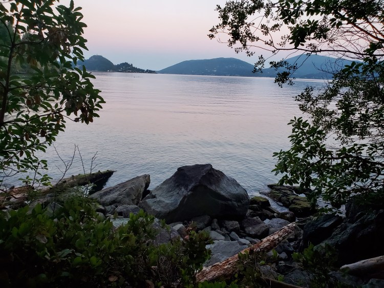
When I arrived at Ansell Point I did a quick reconnaissance sans SUP to make sure the launch site was okay. It is a steep pathway down to the water. It would be a rocky launch, but completely doable. Below is the view of the water from the shoreline slightly above the launch site.
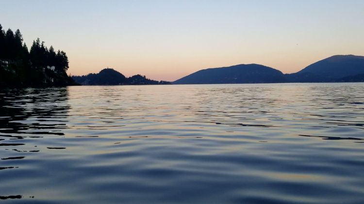
Here is the view from the water just before I launch looking southwest. Leftmost you can see the point at Sampson Park. In the centre background, there is Whytecliff Park flanked by Bowen Island on the right.

Here is the view from the water from my deck-mounted camera.
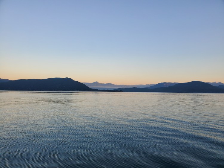
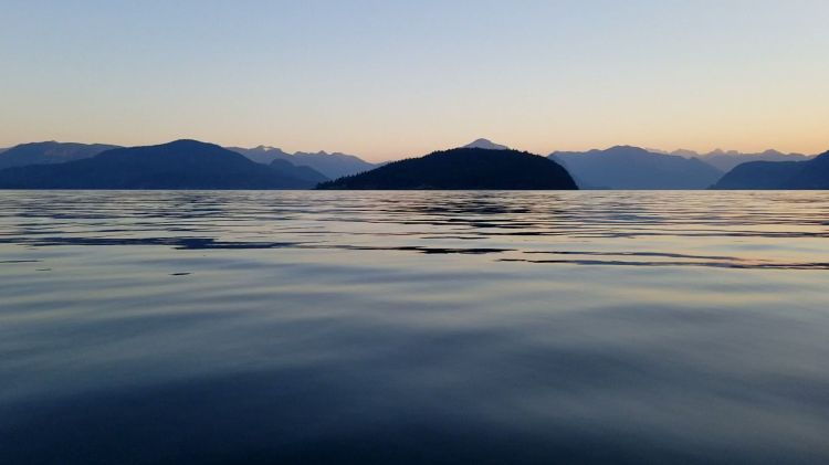
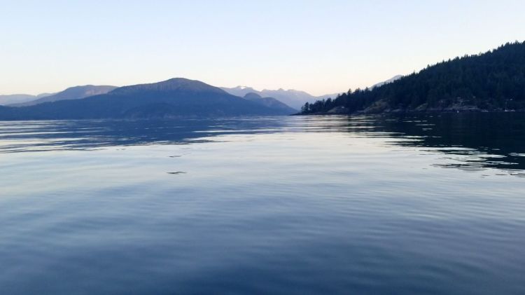
Below is the view westward across the sound with Bowen Island on the left, Gambier Island on the right, and the Sunshine Coast in the background with Tetrahedron Peak prominent.
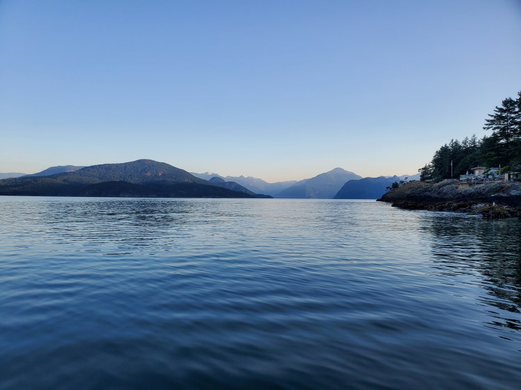
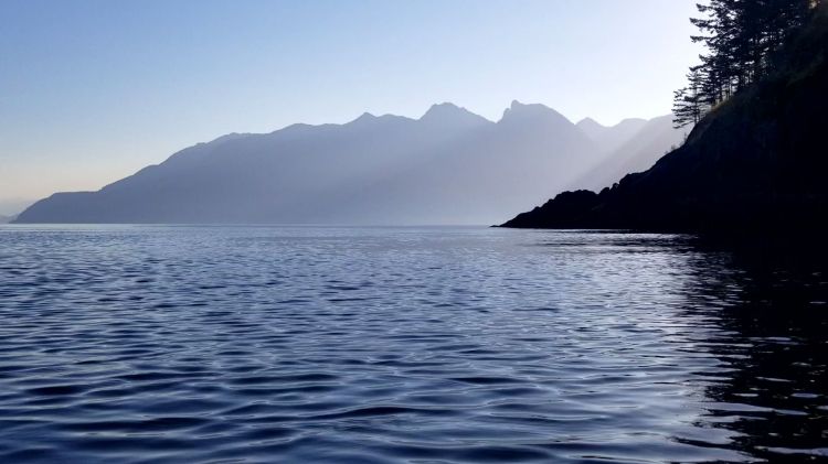
The image below is looking northward toward Bowyer Island. Tunnel Point is on the right with Archer Point in the background.

The wind was mild, as forecasted. Though, I could feel it getting a bit stronger as I made my way further out into the fjord.
Here is the view a bit closer to Bowyer Island.
And the view of the Sea to Sky corridor.
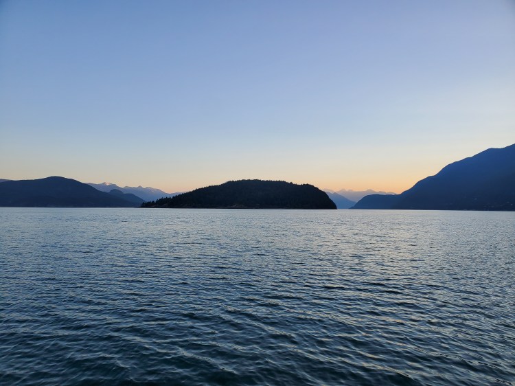
Below is the view southward out toward the Salish Sea (Georgia Strait). You can see Passage Island in the centre flanked by Horseshoe Bay on the left and Bowen Island on the right.

And the image below is looking more northerly toward the southwestern side of Bowyer Island.
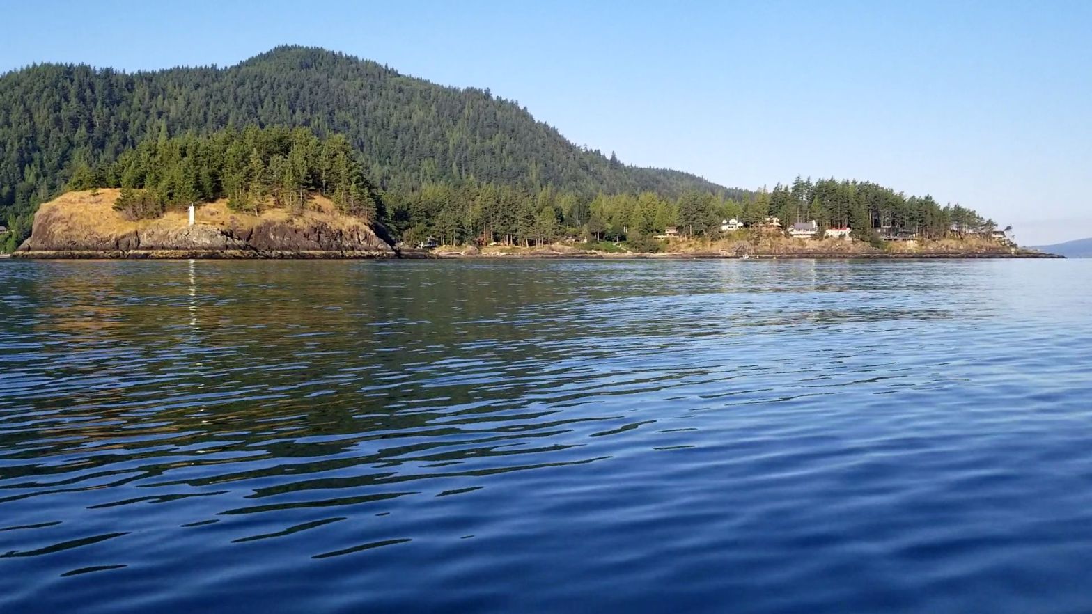
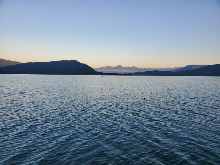
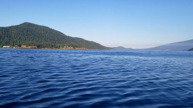
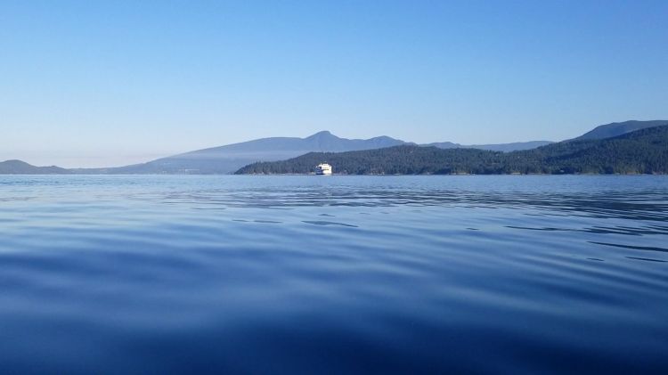
When I reached the southwestern tip of Bowyer Island I stopped for water and a snack. Below is the view northward from the water there with Bowyer Island on the right, with Mount Wrottesley rising above in the background.

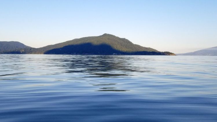
And then here is the view across to Bowen Island.
And again, here is the view northwesterly after I drifted a bit further away from Bowyer Island. You can now see some of Anvil Island behind the tip of Bowyer Island. Mount Wrottesley is in the background rising over Anvil Island. Gambier Island can be seen on the left of the image.
The BC Ferries website has a ferry tracking webpage where you can see vessels in real-time. I checked both the schedule and the real-time tracker for the Langdale ferry route. It was just after 06:15. The 06:20 ferry would be passing through soon en route to Horseshoe Bay. I considered trying to make it through to Finisterre Island before the ferry but figured it would be best to wait. I checked Google Maps to confirm my location to the ferry line. It looked like I had a lot of room.
I decided to paddle northwestward toward Gambier Island while waiting for the ferry to pass by. Then I could turn and cross toward Bowen Island. You can see the ferry off in the distance at the Langdale Terminal in the image below.

As I paddled toward Gambier Island, Anvil Island was in plain sight in the middle of the sound.

Here is a closer view of Bowen Island.
Looking back to the south, I could see the Nanaimo and Bowen Island ferries about to cross paths. This was just after 06:30.

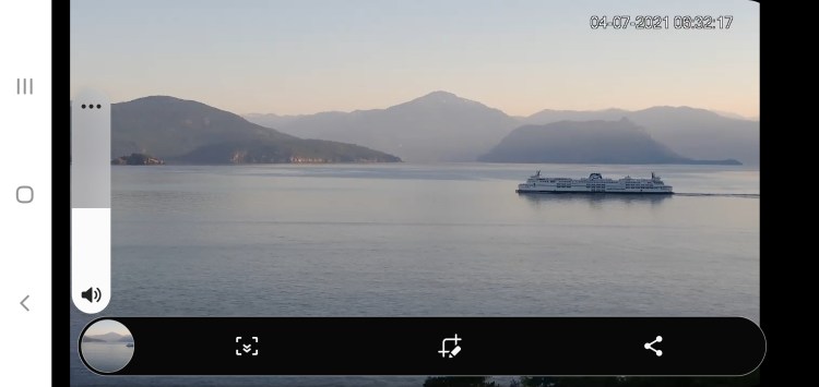
It dawned on me that I might be able to get some interesting images from the Howe Sound webcam site. I had used this site previously to confirm my estimates of when ferries leaving from their respective terminals would round Tyee Point. So I knew that it could capture the ferries passing by. I wondered if I would be visible off in the distance? I opened up the site and took a few screenshots. I could see the ferries but, I couldn’t tell at the moment if I was visible. Here are the screenshots. There was no sign of me on my SUP in the distance.


I turned my attention back to the Langdale ferry which, I could now see approaching.

I checked my position. If the Google Map was correct, I wanted to position myself right in the current trajectory of the oncoming ferry. That way when the ferry made its turn southeastward off of Hood Point, I would no longer be on a crash collision course with a 20,000-tonne vessel barreling toward me at 15 to 20 knots. Below is the image of the ferry approaching. It was just slightly nerve-racking watching it approach as I sat bobbing in the water waiting for it to turn.
Eventually, it did turn, but I have to admit it came out a lot further than I was anticipating. In hindsight, after looking at the nautical map below from i-Boating, which puts the turning point farther north and east than the Google map version I suspect that was why the ferry came so close. Rather than the captain giving me a cautionary flyby pass, they were simply following their route. The two map versions are below for comparison.


Here is a clip of the ferry passing by set to the “Wild West” Western showdown music by AudioAgent.
And then, as expected, there was a pretty solid wake to ride after it had passed. Here is a video of me riding the bumps. Fortunately, they were nice rollers.
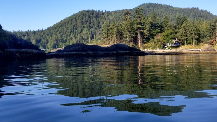
Here I am outside of the danger zone approaching Finisterre Island.

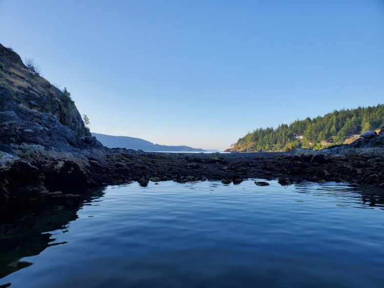
And around the backside of Finisterre Island in Montevista Bay. I stopped here for a quick power-up snack.
There was no way to circumnavigate Finisterre Island. Perhaps at a maximum flood tide, it would be possible to cross the tombolo.
I double-checked the ferry schedule once again before setting out for my return to Ansell Point. There weren’t any ferries scheduled to be passing through so, I decided to forego my original plan of heading down to Eagle Cliff to cross the Langdale ferry line more perpendicularly. Instead, I would head straight across to Ansell Point from Finisterre Island. Here is the view coming back around Finisterre Island back into the body of the sound.
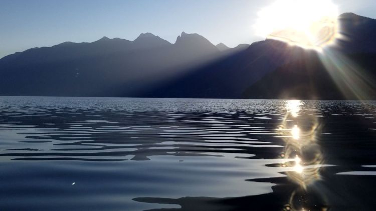
The path back to Ansell Point was straight into the rising sun. It was a bit of a slog as it was open water with less to see coupled with the loss of the novelty of adventure for the return trip. I tried to focus on some of the stroke mechanic drills I had learned from my SUP lesson to pass the time.
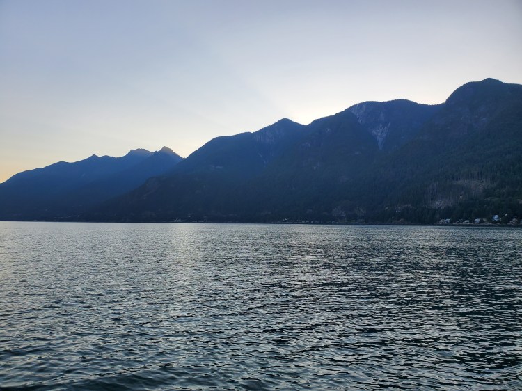
Here is a shot of just before I head into the shade of the Cypress Mountain Area.
And a drastic change of colour now that I was in the shadow of the mountains. The water was much more of an emerald-y hue.

With the tide a bit lower, the exit was a bit challenging. Rocky and slippery. But I managed and was able to capture this photo before packing up my kit. The Langdale ferry is in the background, thankfully far away from me this time.

Here is the route that I took from my Google Fit GPS recording.
And my Google Fit activity statistics.

