Saturday, August 5, 12023 Human Era (HE)
- Preamble Rambles
- What About Dodd Narrows
- Doing Dodd
- SUP Float Plan: Circumnavigation of Mudge Island
- Leaving to Launch Site
- My Kit
- Launch Site
- Paddle Log
- GPS Comparison
- Relive Review
- Final Thoughts
Preamble Rambles
Last year, 12022 HE, on a family holiday in Parksville, I was looking for a stand up paddleboard (SUP) touring trip to do nearby and came up with the idea of circumnavigating Mudge Island. In 12021 HE, I circumnavigated Saysutshun (Newcastle Island) on a similar vacation. And now that I am being totally reminiscent of my island circumnavigation fascination, I realize that it all stemmed from my encounter with the island of the mistaken.
Selecting Mudge Island
However, last year, my Mudge Island circumnavigation did not go according to plan. The adventure started after searching maps for other islands close by to circumnavigate. Two potential options presented themselves, Protection Island and Mudge Island. Since I had previously paddled around Saysutshun, I ruled out Protection Island as I assumed it would be similar. I set my sights on Mudge Island and began researching.
What About Dodd Narrows
Some internet sleuthing led me to this apposite post from the blog Life on the Island, titled, “Fun in the Currents.” The post specifically covered how to conduct the currents of Dodd Narrows. Dodd Narrows is the slender body of water that separates Mudge Island from Vancouver Island. It has the daunting (unofficial) reputation of being one of the top three most dangerous passages of the S’ólh Téméxw‘s (British Columbia) coastline. The S’ólh Téméxw coast has many narrow passages that can make for gnarly navigation (more on this below), so the top three ranking got my attention. Despite my suspicion that the unofficial title was a slight overstatement, I was still taking it as a serious warning that the narrow was nothing to trifle with.
Situating Mudge Island
Mudge Island lies between Gabriola Island and Vancouver Island. It is considered part of the De Courcy group of islands and is one of the many Gulf Islands. East of Mudge Island lies False Narrows, separating Mudge from Gabriola. North of Dodd Narrows is Northumberland Channel and Stuart Channel lies to the south.
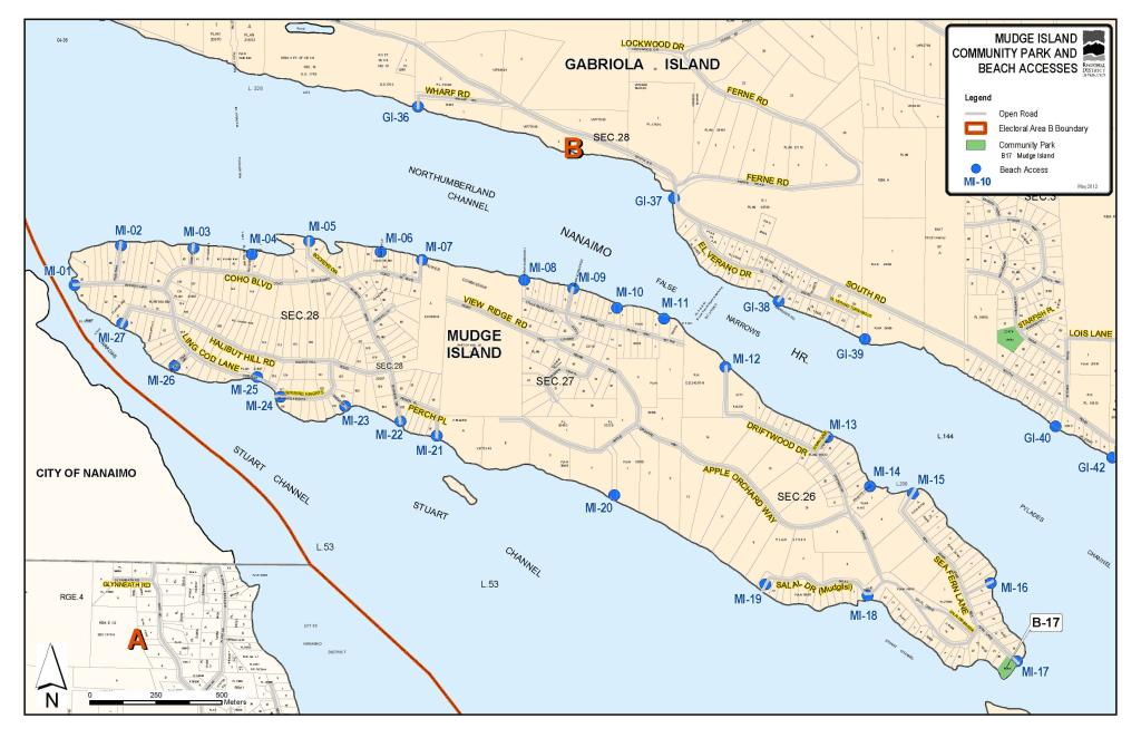
Below is a screen capture of Mudge Island in Navionics.
Currents Vs. Tides
From conversations with my father-in-law, an avid sailor, I knew that the narrow coastal passages were not trivial transits. However, when I first set my sights on Mudge Island as a smaller, closer, more navigable destination, I was unaware of the notoriety of Dodd Narrows. I knew enough that navigating the narrows would need more than just a tide table. In the narrow coastal channels, tides do not tell the total tale. You need to know the currents. Thankfully, the Government of Canada produces a current table, too. For a great explanation of the coastal currents and tide phenomenon, see this article, “One-way tides,” by Nick Doe.
The surprisingly confusing and potentially dangerous part of the passage currents is that the flood and ebb of the current precede the raising (flood) and lowering (ebb) of the tide. At face value, this is completely counterintuitive to me. Wilder still is that for Dodd and False Narrows, they flow in the opposite direction of what one (read I) would assume based on the tides alone.
It is worth highlighting this distinction between tides and currents. I have a post “On Tides” for the curious reader. To picture the difference, imagine the current as the horizontal movement of water. Conversely, the tide can be conceived of as the vertical movement of water. This isn’t completely accurate, but close enough at our Earth level lived experience. A better, broader cosmological view of what tides actually are is given by Neil deGrasse Tyson in the YouTube Short below. I had the same reaction that his co-host Chuck Nice had 🤯!
Researching paddling through Dodd Narrows proved it was possible, provided one used the proper currents to their profit. However, initially, I was reluctant to attempt it solo for obvious reasons. I have written on the pros and cons of paddling solo before, and you can see some of the resources I consulted on the topic here. After reading various accounts of paddlers (SUP, qajaq, and canoe) successfully clearing the pass purely on paddle power, I felt it was possible with proper planning, preparation, and precautions.
Learn from your Mistakes
However, last year’s preparatory “P’s” went wayside. In the process of determining which day and when to make the passage, I made an error reading the current chart, mistaking the turn times of the ebb and flood. In hindsight, I think there was a degree of confirmation bias at play in that I wanted the currents to work for the days that I had available, and thus, read them as such. Thankfully, on the evening before my paddle, while reviewing my trip details, I spotted my error. Proper planning, preparation, and precaution would prove protective to my person. I still wonder what would have happened had I not clued into my mistake ahead of time. I would like to think that I would have noticed that the water was not moving in my favour, but at slack current, perhaps things would not be so evident. Not to mention if the surface winds were in the opposite direction. In any case, I did clue in and made the game-time decision to paddle to Galiano Gallery on Gabriola Island instead (click the link for details).
Doing Dodd
Fast forward one year, and I am still keen to paddle through Dodd Narrows and around Mudge Island. Provided the currents work, and I read them right!
I wanted to cross the narrows in the morning to limit the amount of boat traffic. Especially after reading this account on the BC Marine Trails website, “Sea Kayaking the Salish Sea Marine Trail from Nanaimo to Sidney,” where the author describes having to zigzag through Dodd Narrows at midday on a busy August weekend to manage the currents and the boat wakes brought up by boats trying to buck the current. For my first solo attempt, light currents and minimal boats would be plenty enough. Though I did worry that too early might run the risk of being all alone with no one around should things go wrong.
My plan was to offset the absence of onlookers with communication devices. Specifically a cellular phone and VHF Marine Radio. However, the night before my paddle, I realized I had forgotten to pack my marine radio on vacation. At home, I have a paddling box that is my grab and go kit that has nearly everything I need in it. My box was too big to bring for this trip, so I just grabbed the essentials. Or so I thought. Waterproof headlamp, PFD, dry bags, solar-powered waterproof light, etc., but I failed to grab my radio. Would I be breaking my own “Rules of Engagement” solo-SUPing without my radio? I reasoned (okay, maybe justified) that I would have my cellphone and be in reception should I need to call for help and concluded the lack of radio was not a deal breaker.
Planning Particulars
I used my float plan template from last year to plan, updating the currents, tides, weather, daylight, and dates. I now have access to Navionics, so I also used the Navionics application to confirm the currents at Dodd Narrows. You can scroll through dates and times to see a graphical representation of the currents along with a directional arrow superimposed on the chart. I find this works well for my brain rather than just reading the numbers off a table.
However, I did have to adjust from previously estimating the current speed from the slope of tide graphs. At first, I was subconsciously applying Calculus and taking the slope of the current graph, not realizing that the graph was already giving me the water speed information I was after. Even after clueing into this discrepancy, I did find that the times from the Navionics app did not completely coincide with the Government of Canada current charts, but they were close enough. Though it did leave me wondering why they were different and which one had the more accurate data (which I suspect was due to Navionics attempting to model more real-time data with more current [cough, timely] weather data applied).
Regardless of minute minutiae, Saturday morning would be my best window, and thankfully, it worked with family plans. I could get away early and be back late morning if all went according to plan.
I would launch from the Cedar Boat Ramp, which I had found listed on the Go Paddling app as a close by launch site. From there, I would paddle north through Stuart Channel to reach Dodd Narrows at slack current. Then I would head down False Narrows and hopefully cut back between Mudge Island and Link Island to head back to my launch site. If I was unable to cross there, I would continue to the south end of Link Island and hopefully be able to pass through there.
Below is a more detailed description. I put together a float plan/paddling itinerary. I find creating them useful for estimating my paddle duration. Plus, it is a key safety practice to leave one with someone in case fit hits the shan, which I always do for extended/non-routine paddles.
SUP Float Plan: Circumnavigation of Mudge Island
DATE: Saturday, August 5, 2023
ROUTE: Circumnavigation of Mudge Island (CW from Cedar Boat Ramp)
VESSEL: Teal Blackfin Model XL iSUP
EST. DEP. From Accommodation: 0445
EST. DEP. From Cedar Boat Ramp: 0545
EST. ARR. @ Cedar: 0850
EST. ARR. @ Accommodation: 0945
Details:
Estimated Distances
•Cedar Boat Ramp – N Stuart Channel 2.2-2.5 km
•S Dodd Narrows – N Dodd Narrows – 1 km
•False Narrows (NW – SE Mudge) – 5 km
•Link Island (SE Mudge – SE Link) – 1.5 km
•SE Mudge – Cedar Boat Ramp – 3-3.5 km
•Link – Cedar – 4.5 km
Currents (Dodd Narrows)
Aug 5
| Turns | Maximum (kts) |
| 0050 | 0329 +5.7 |
| 0622 | 0917 -6.8 |
| 1226 | 1537 +8.0 |
| 1856 | 2220 -7.2 |
Tides (Boat Harbour)
•0248 Low 2.1 m
•0753 High 2.9 m
•1416 Low 0.8 m
•2116 High 3.9 m
Tide (Harmac)
•0321 Low 2.3 m
•0833 High 3.9 m
•1458 Low 1.1 m
•2148 High 4.7 m
Wind
•Forecast: see Windy App
•Northwest (Nw) 6-8 kt (13-18 kt wind gusts)
Air Temperature
•19-28°C
Water Temperature
•~13°C
Daylight:
•0553 – 2049
•Civil Twilight
•0516 – 0553
Drive Distance 48 km
Drive Time ~40 min
Paddle Distance ~12 km
Paddle Time ~ 3 hrs
Personal Info
TRAVELLERS: 1 (Mon Jef Peeters)
VEHICLE: [Colour][Year][Make][Model]
PHONE: [xxx-xxx-xxxx]
Itemized Itinerary
•0445 🚗 ↗️ Accommodations
•0525 🚗 ↘️ Cedar Boat Ramp
•0545 🏄🏽♂️ ↗️ CBR (2.5 km)
•0615 🏄🏽♂️ ↘️ N Stuart Channel
•0620 🏄🏽♂️ ↗️ S Dodd Narrow (1 km)
•0650 🏄🏽♂️ ↘️ N Dodd Narrow
•0750 🏄🏽♂️ ↗️ N False Narrow (5 km)
•0755 🏄🏽♂️ ↘️ S False Narrow
•0805 🏄🏽♂️ ↗️ S Mudge Island(3.5 km)
•0820 S Link Island (+1.5 km)
•0850 🏄🏽♂️ ↘️ CBR
•0910 CBR (via Link Is.) (4.5-5 km)
•0905 🚗 ↗️ CBR
•0935 🚗 ↗️ CBR
•0945 🚗 ↘️ Accommodations
•1015 🚗 ↘️ Accommodations
Leaving to Launch Site
I woke up late. Despite having set an alarm, it did not go off. Or if it did, I silenced it and then fell back asleep. Thankfully, my spirit seemed to be in the eastern time zone, and I spontaneously roused just before 0500 hours. I was behind schedule, and the thought crossed my mind whether I messed up my timing for catching the current. Thankfully, the window was large enough, plus I had planned a buffer into my arrival for slack current. I figured it would be better to arrive at the channel early and have to wait rather than be late. I dressed quickly, grabbed my pre-packed provisions, and was off.
The weather was slightly overcast, but the cloud cover would make for a spectacular morning. The Sun was making its presence felt as I made my way down Highway 19 toward Nanaimo.
My Kit
Clothing
Given the summer weather, I dressed lightly. Shorts and a T-shirt, along with a hat and sunnies. My sunglasses were attached to a floating strap. You know, just in case.
Paddle. Board.
I was riding my Blackfin Model XL inflatable SUP (12020 HE model). It would be slower than my my hard board (12020 HE), but I was pretty sure I would appreciate the extra stability from the additional 0.20 metres (8 inches) of width travelling through Dodd Narrows. I was using my BlackProject Adjustable Lava paddle, but I also had the stock three-piece paddle from my inflatable board as a back-up.
Accessories
For safety, I wore my PFD and packed my cell phone attached to a floating lanyard inside a Seal Line Seal Pak® Hip Pack. As mentioned, I wish I had packed my marine radio on the trip for one extra layer of safety for a solo early morning SUP. Mais, c’est la vie.
For footwear, I was paddling barefoot but had some garden clog shoe sandals in case I needed to land. Otherwise, I was travelling light with just a Nalgene water bottle and snacks packed in my hip pack.
Launch Site
The Cedar Boat Ramp is easily accessible. And at around 0550 hours on a Saturday morning, there was ample parking space. The signage suggests limiting your stay to less than six hours. Perhaps at peak hours, this rule would require enforcement, but it did not seem to be an issue in the early morning hours. Amenity wise, there is a port-a-potty on site in case a pre-paddle po… pe… uh, pause is in order.
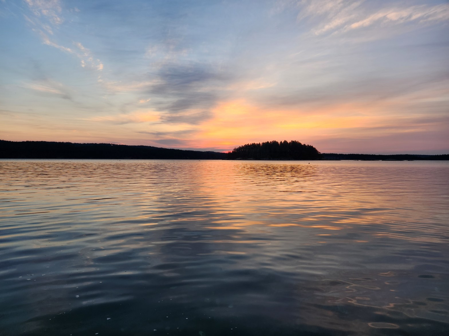
Down at the water’s edge, I took a picture of the skyline before setting my GPS trackers. Round Island is in the foreground with Mudge Island in the left background and Link Island to the right.

Waxing on Wearables
I was running two GPS trackers to compare statistics. My watch, a Fitbit Charge 5, compared to my phone, using the Geo Tracker application. I am a mixed fan of wearables. Here is my hippie, I feel the Earth, feeling on tech-wearables. The appeal to feel like you are getting information that you need runs the risk of creating a dependency on technology to tell you some of the things that your body should feel or know intuitively. I am not a huge fan of them for telling you things like heart rate or tracking your sleep. These are things that you should be able to feel. In many cases, the information you are told is useless to the average person. How much REM versus NREM sleep did you get last night? Does that matter to most people? Or is the functional outcome of how fatigued or rested you feel a better measure? However, my hint of hypocrisy is evident when it comes to tracking distance. It is hard to tell how far you went, but you for sure can feel the functional outcome of physical fatigue for how far you have ferried.
For a great recent account of the ills of becoming too reliant on AI, give this episode, “Flying Too High: AI and AirFrance Flight 447,” of Tim Harford‘s Cautionary Tales a listen. It recounts an AI related airline crash from 12009 HE.
Ironically, after getting both gadgets in order, I looked up to see that a person was quietly reading/writing on the shore. I had initially missed them on my mission to mark my metrics. We exchanged salutation gestures before I set off northward. It was 0557 hours, so I was only 15 minutes behind schedule despite my late rising.
Paddle Log
Not wanting to waste any more time, I set to work on quickly making it up the Vancouver Island coastline. The sea state was slightly surprising. I was anticipating to still be riding the flood current northward through Dodd Narrows, but there were surface waves heading south. The wind was northwesterly as forecasted and must have been the cause of the waves. Or so I hoped. But I couldn’t quite kick the thought that what if I got the currents wrong, again? Maybe the oncoming waves weren’t wind waves, but were the ebbing current already building? The wind was strong enough to explain the headwaves, and there seemed to be back eddies along the covelets of the shore, so I proceeded onward, keeping a watchful eye of the sea state. I wasn’t quite ready to pull out my phone to double-check the Navionics app.
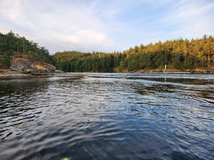
Closer to the channel, and more confident that I had closed my time gap, I paused for pics along the west shore. The first image is looking into the narrows, and the second is back towards Round Island.


Current Check
With my phone in hand, I decided to double-check the Navionics app. The currents were flooding, so I was relieved to confirm the waves were wind washed. With no boat traffic in sight, I decided to cross to the east side of the passage. On the east side I would be with the flow of any other vessels making the pass for the morning slack current.
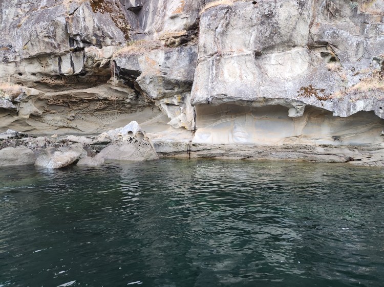
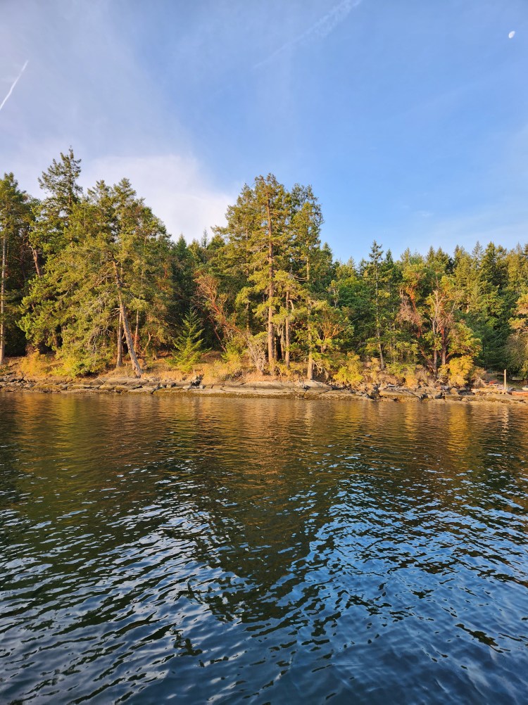
Once I was on the west side of Mudge Island, the flooding current was completely evident. I stopped to take in the sandstone surface of Mudge Island. Pausing for a picture, I could feel the pull of the passage’s progression propelling my paddleboard.

Enter the Narrows
One last pic as I drifted onward before I frantically packed away my phone in my hip pack. My pulse was rising as I paddled toward the narrowing of the narrows. I could see the texture of the water with fast-moving lines to my right and further to the left. There were no other boats around, so I had options for where to travel. Seeing the small spiralling eddies, I had a flashback to a past dip. During my tour of “The Fraser River Challenge,” an eddy created by the Barnston Island Ferry sucked me into the river, providing me with a cool wet dip in October at the start of my paddle. Eddies still seem to unease me. I adjusted my feet to be more balanced and readied my paddle to brace.
As my board rolled over the ruffled water, I was relieved that the flood rate was only two to three knots. That was enough for my first pass. Clearing the narrows, I entered into the Northumberland Channel. Was I in the clear? Had I made it through? Aside from one other section of mixing waters to pass, I appeared to be safe. I navigated around the more turbulent water and then found a flat section to look back. I made it.
Made It!
The video below is a panorama from Northumberland Channel on the north side of Dodd Narrows.
My legs were still a touch wobbly from the anticipatory adrenaline rush of crossing the narrows. Flat waters and morning skies awaited ahead to calm and curtail my catecholamine cascade.

I took one last look at Dodd Narrows.
False Narrows
Then I began to leisurely paddle eastward down False Narrows, regaining my sea legs.
I noticed several properties for sale along the Mudge Island shoreline. I found myself wondering whether I would want property on the island. I made a mental note to look into the logistics. That hasn’t happened as of writing this.
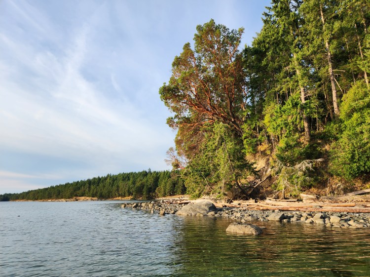
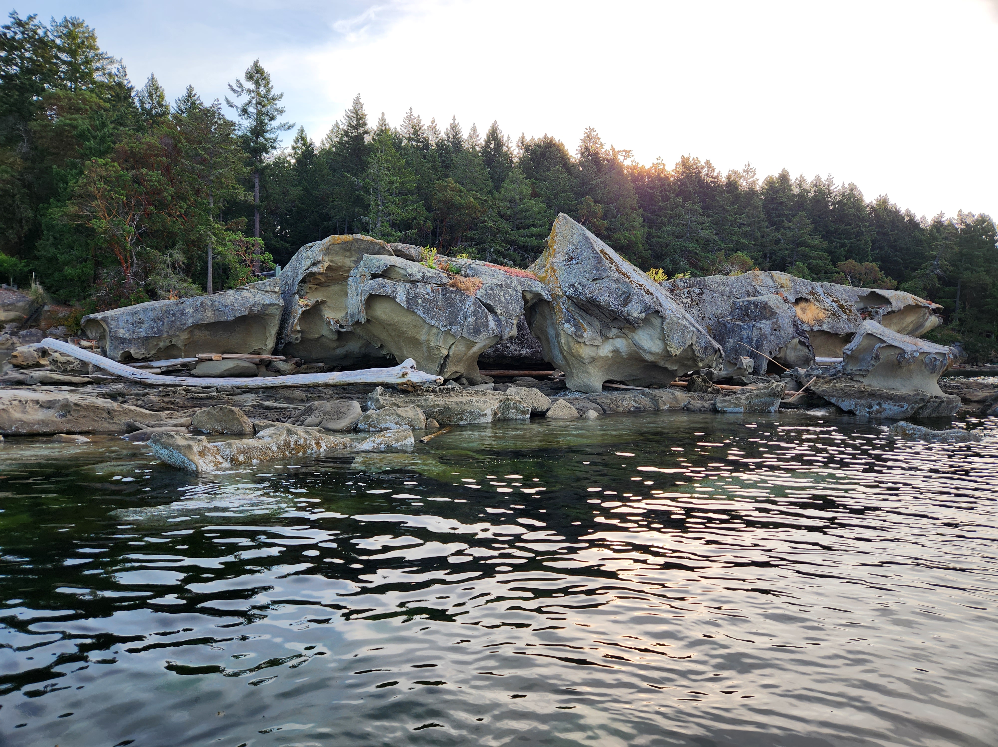
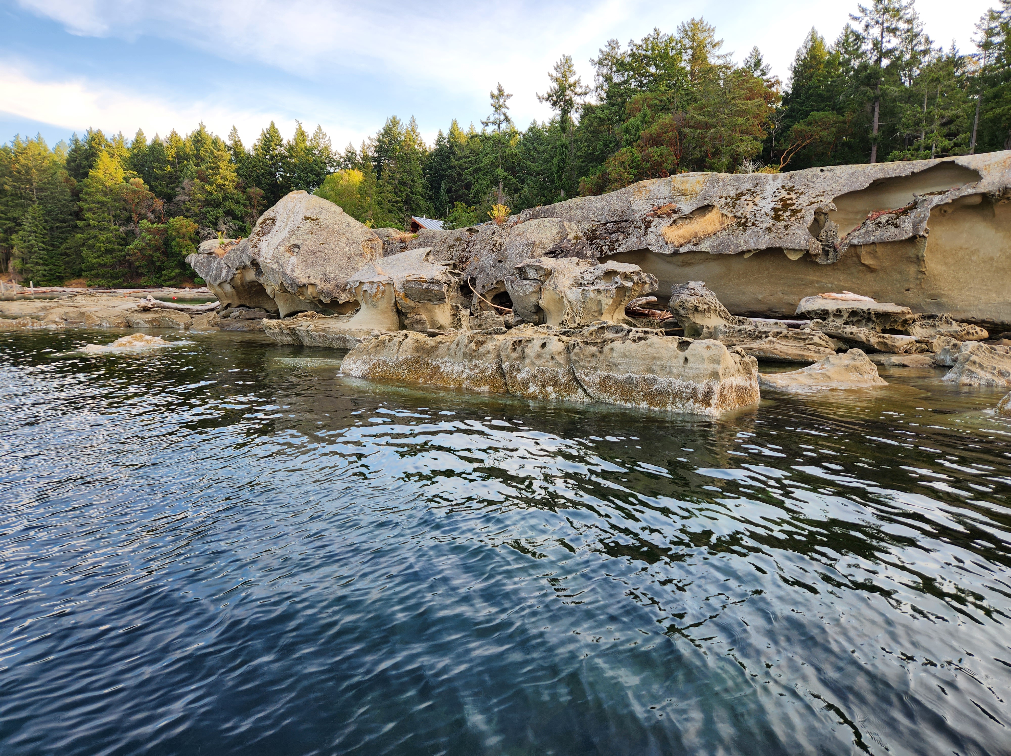
Just past Coho Cove and Moonshine Cove, I spotted the striking stone structures on the shore. The cohabitating coves are connected by a striking structure themselves, directed near due north. But back to the bulbous bumps of sunken sandstone sitting in series along the seaside. What geological process produced those protrusions I pondered?

A little ways later, I looked up to catch an eagle nestled in a tree overhead. It seemed quite content surveying the scene from its mid-tree perch.
A light tailwind was aiding me down the channel. And according the the Government of Canada current table, I was now in the slack current of the ebb. I kept my pace casual.
Bull Kelp and Mermaid Bladders
Closer to the southern end of the island, I came across a bed of nereocystis (aka. bull kelp). From a distance, I was curious what the bumps on the surface of the water were. As I approached, I realized that it was a myriad of mermaid’s bladders.

I floated over the top of the subtidally flooded free flowing kelp forest admiring its form.
End of the Island
As I paddled on, I knew I was approaching the southern end of Mudge Island. I kept anticipating that each oncoming corner would be the inter-island passage between Mudge and Link Island but kept uncovering continuations of coves and covelets. Finally, I reached the corner below and was near certain it was the end. I could see a tanker moored in Pylades Channel to my left that I had seen early when departing. I spied it through the inter-island gap.
Around the point, it looked like the passage would be navigable.

“Looked like” was the key operative as on closer inspection, the islands were connected by a tombolo at the current tide. I paddle into the inter-island bay(?) and then did a mini-SUPortage across the isthmus.

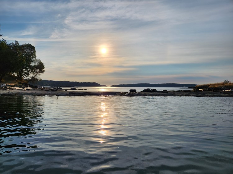
Looking back towards Pylades Channel from Stuart Channel, I could see Gabriola Island on the left, Valdes Island on the right, and the western opening of Gabriola Passage was the gap in-between.
Now, I set my sights on Round Island as my navigation bearing to return to the Cedar Boat Ramp.

Sandstone Stop
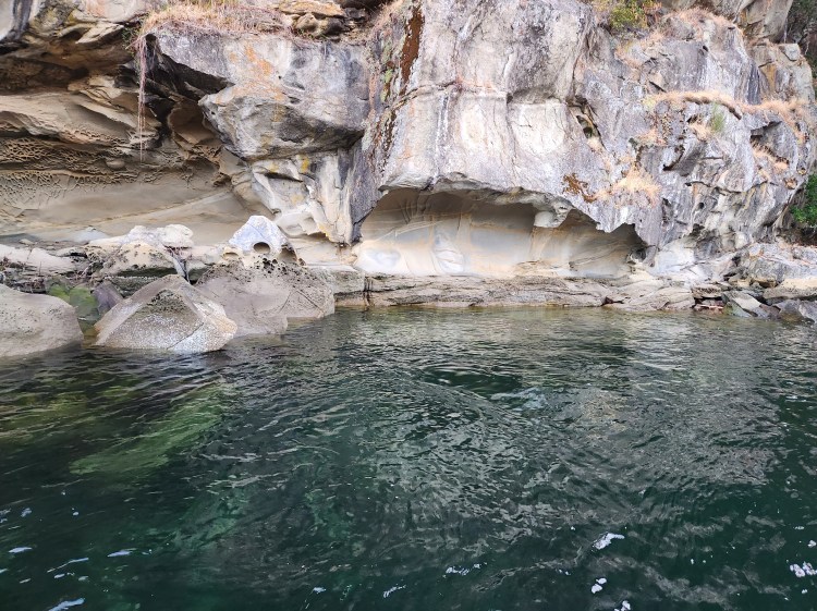
But exiting the cove, my curiosity was captured by the honeycomb cavitied creation close to shore on my starboard side. I rerouted to take a closer look.

The sandstone structure reminded me of my tour to Galiano Gallery on Gabriola Island, where the rock formation appeared to be eroded by waves. It turns out that the sandstone erosion occurs through a different mechanism, a decementation, likely from salt water erosion and evaporation. For full details, check out this article, “Gabriola’s submarine-fan formations,” by Nick Doe.

After admiring the geological glamour, I got back to getting back to my get-go ground. I decided to make the crossing more interesting by interspersing race pace intervals. I did five minutes at race pace intensity and then used a return to regular and routine nasal respiration as my recovery. The five minute fast-paced intervals mainly target maximal aerobic capacity (or power) by forcing a high glycolytic stress. I plan to do some blog posts on metabolics soon (which are now complete).
I ended up doing three intervals to make the crossing. While en route, I also spotted three ships that seemingly had made the southward sailing at slack current through Dodd Narrows.
I made great time and was one hour faster than my itinerary. Generally, I err on the side of slower when planning, but I think it is time to update my SUP touring pace for more accuracy. Speaking of accuracy…
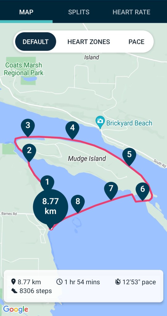
GPS Comparison
The images below are my route statistics recorded on my cellphone (Samsung Galaxy S22) with Geo Tracker and with my Fitbit Charge 5, respectively. Not surprisingly, the measurements were different, but I have to admit I was slightly surprised by the amount. The 10.4 kilometres recorded with Geo Tracker was more than 17% greater than the 8.77 kilometres recording with Fitbit. There are many reasons for GPS inaccuracies, but this little experiment has me wondering about the precision and accuracy of each measurement device. For now, I will just assume that the distance was around 9.5 kilometres.


Relive Review
For a better recap of my route to put the images into context, check out the Relive video below created from the Geo Tracker GPS data. If the video below doesn’t work, here is a link to the video on Relive’s site.
Final Thoughts
I felt fairly chuffed post-paddle to have made it through Dodd Narrows and around Mudge Island for two reasons. First off, it felt like the correct level of challenge to accomplish. Outside of my comfort zone but not beyond my capabilities.
Risk and Capability
I recently watched “The Deepest Breath” documentary on Netflix, so the threat of water was forefront in my mind. I am well aware that watersports impart a certain degree of risk. If things go wrong, there is a higher chance than other sporting activities of not being able to get adequate oxygen.
For some time now, I have been quite taken by the idea of hormesis. I use the concept all the time in my work as a physical therapist to educate clients about the dose dependency to the exposure of stressors. Not enough physical activity is bad for your health, but too much physical activity is bad for your health, too. Biology seems to require life to be within a niche Goldilocks zone where too much or too little of anything can be fatal. Too little water, and you run the risk of dehydration. Too much water, and you run the risk of overhydration. Both at their extreme can be fatal, and the documentary makes that patently obvious.
In my mind, the free-diving extremes that take place in the film are simply stupid. While I can appreciate the challenge of the thrill and pushing the body to the extreme, doing so in an environment where the risk of death seems to be so much higher than a zero chance probability is a set up for disaster. But our individual acceptance of risk is a relative calculation that we all make based on our perceived capacities. In my mind, my choice to solo-SUP around Mudge Island was a calculated risk that I felt I could manage. Before doing so, I spoke with several people who advised me against it and a few who felt it was within my capabilities. I took what I felt were necessary precautions to minimize my risk and happened to be successful. But I am well aware that things might not have turned out the way I wanted, and I am at risk of attributing my success to a survivorship bias.
Finishing What You Started
Possibly to a fault, I am stubborn. And I surely know others that are too. There is a drive toward task completion, whatever that task may be. So, secondly, one year on, to have completed my tour around Mudge Island after the idea of the task took hold in my imagination left me with a sense of satisfaction. Life often seems to be richer when we tend to make things a bit harder for ourselves.
