
Saturday, May 8, 12021 HE
It is week five of the virtual Tuesday Night Race (vTNR) series being put on by Coast Outdoors through Deep Cove Kayak. Here is a general overview of the event.
Here are the links to my past posts on the vTNR series: vTNR#1, vTNR#2, vTNR#3, and vTNR#4.
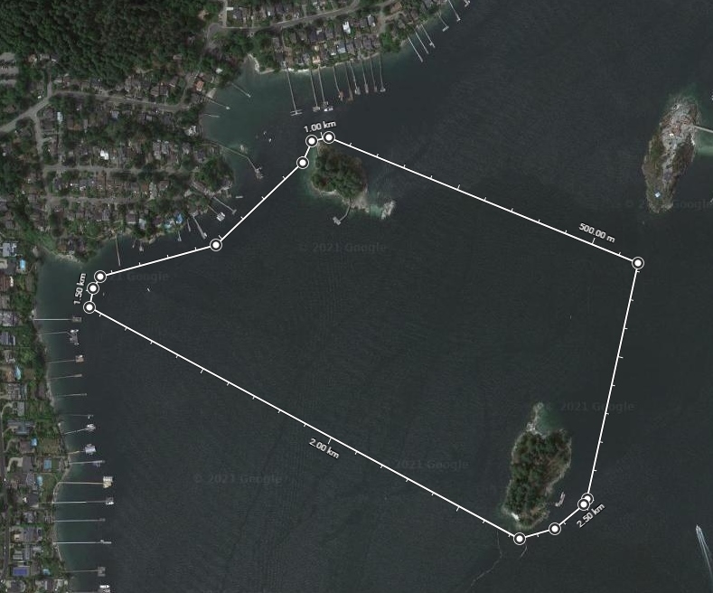
Here is the link to the course this week on webscorer. And below is an image of the route and the link to the course in Google Maps.
Below is a virtual tour of the race course created via Google Earth Studio.
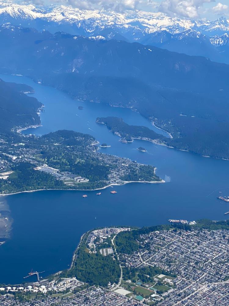
And for the real thing check out the pictures below that Wil sent me from his corner office suite. The cockpit aerial is from another day if you are wondering about the weather change from the paddle to the aerial pictures.

I had my thesis defence for my Diploma in Osteopathy Manual Practice at 16:30. So rather than be idle and overthinking the presentation, I figured getting out on the water for a paddle would be a great way to clear my mind. And thankfully, Annie was in full agreement. So after dropping Annie and the kids off at her parents’ place in North Vancouver and a quick re-read of my thesis paper I was off to Deep Cove.
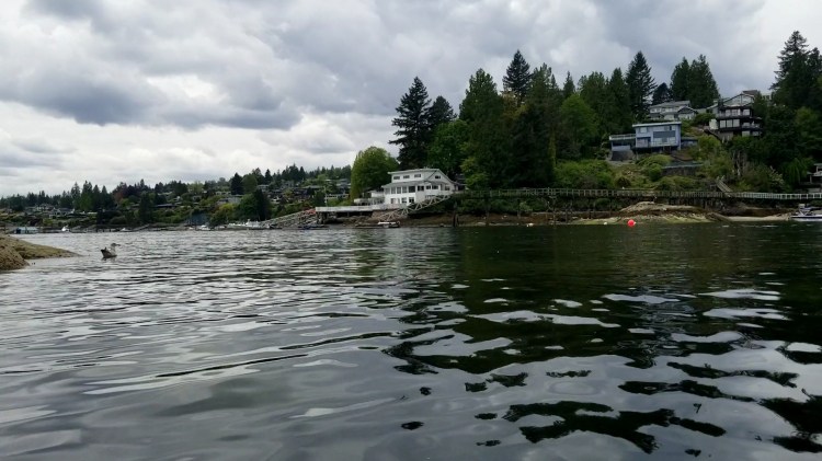
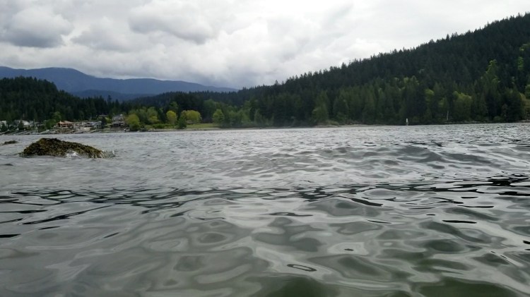
I left from my regular launching point at Lowry Waterfront Park and used the paddle across to Boulder Island as my warm-up. Below is the view from Lowry Park looking across Indian Arm toward Admiralty Point in Port Moody.

The water was glassy again and it was a pleasant paddle over. The tide was low so I kept an eye out for exposed boulders as I rounded the southern tip of Boulder Island as I made my way to the dock. There was one exposed rock with a lone purple ochre sea star on top of it. I was about to stop to take a picture but figured I would be able to take a photo on my return paddle.
When I arrived a gentleman was setting up his boat kit. He inquired as to this week’s course, speculating on whether it was a run to Jug Island and asking what was the time to beat. I informed him that it was a circuit around Grey Rocks Island, but that I had no idea about the fast times. I was just in it for completion marks. He wished me luck and then I was off shortly after that.
The first part of the course was a straightaway to the Hamber Island Lighthouse. With the low tide I wasn’t sure how much exposed rock there would be so I approached cautiously. Below is the lighthouse with Hamber Island in the background. Despite the lighthouse being well overground, there wasn’t any exposed rock.

After the first turn, it was then a crossing of the fjord towards Grey Rocks Island. I did a quick scan to check for any boat traffic travelling up or down Indian Arm. The coast was clear so I made a bee-line for the northeastern shoreline.

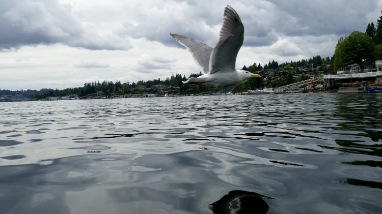
The next turn was rounding the northern tip of Grey Rocks Island. Again I was cautious of the lower water levels, but there did not prove to be any hazards. I had a bit of an audience as I went into a surface stance to pivot around the island. Some gulls in the water were probably wondering what the heck is this guy up to?
I had my camera mounted on my board so I was able to capture the still shot below from the video footage that I took.
I needed to find the three red and white buoys for the next turn. I knew they were in between the two longest docks nestled into a cove from the satellite imagery. But when I rounded the northern tip of Grey Island I was expecting to see them and I didn’t I worried for a moment. There was one single red and white buoy closer to Grey Rocks Island. I wondered if this could be it. But there were no other buoys in sight. I scanned the water as my mind began to play tricks on me. I took a bearing of Boulder Island and concluded that the buoys had to be further on into the cove ahead. I pressed on and was happy to spy three red and white buoys as I rounded the long dock.
I approached the first of the three buoys to make my turn. There was a couple on the shoreline enjoying the serene morning from their waterfront yard. No pressure I thought, another audience. Just this one was a little more apt to pass judgement than my former fowl friend in the event my turn was to go poorly. Luckily, as you can see below the water was very calm so the turn was easy.

The turn went off without a hitch and so did the subsequent turn around the third buoy.

Again it was time to cross the fjord, this time back to Boulder Island. I check for traffic and the coast was clear. There were boats but our trajectories would not intersect.
The image below shows a bit of the bumps that I encountered as I rounded the southern tip of Boulder Island.
The wave above approached and I was able to get a few cool still images from the video as the wave splash engulfed the camera.

No harm no foul. The images make the wave look much more intense than it was.

As I approached the dock the same gentleman was still preparing his watercraft. He called out to ask how I liked my time. I hollered back that it was good enough for me.
Lap two was much the same as lap one with a bit more boat traffic to be aware of. And a few more kayakers on the water. It was nice to see some other people out on the water taking advantage of the amazing environment that surrounds us!
Oh yeah, and here is the picture of the purple ochre sea star. I guess I should have take the shot when it was fully exposed at the lower tide.

Below is my route from Google Fit. Pretty consistent between laps.

And my statistics from Google Fit too. I was most impressed by the fact that my two laps were so close to adding up to 5 km. I will take that to mean that I was paddle very true to the line.

And here are this week’s results. I am no longer the solo <12′ SUP male participant. This could be a check to the ego in the coming weeks. 😛

4 thoughts on “vTNR#5: Boulder, Hamber Lighthouse, Grey Rocks Loops”