
Sunday, June 27, 12021 HE
The call-out came for the final week of the virtual Tuesday Night Race (vTNR) series being put on by Coast Outdoors through Deep Cove Kayak. Here is a general overview of the event. With the changes in pandemic restrictions, the vTNR is ending and the event will shift back to its historic live format. I am sad to see the vTNR go as I am not sure how many, if any, of the live TNRs I will be able to attend. But, on the other hand, I am happy that the vTNR is ending as it is a signal of pandemic progress.
Here are the links to my past posts on the vTNR series: vTNR#1, vTNR#2, vTNR#3, vTNR#4, vTNR#5, vTNR#6, vTNR#7, vTNR#8, vTNR#9, and vTNR#10.
And this is the link to the course this week on webscorer.
For the culminating vTNR, the call was to do a GPS art course. I was aware of the phenomena, with runners, hikers, and cyclists, but had never created one before. After quickly sketching out an image in the Google Maps app I realized that it would be very difficult to recreate on the water without some guidance. Also, my template was going to be much bigger than my initial attempt, as it came in at just over 3 km. Below is a screenshot of my first creation.

After a quick internet search about GPS art, I figured it would be worthwhile to try out an app-specific for the task. I downloaded Just Draw It and traced out a second template. It came out close to 6 km, the required course distance, so I decided to go with it. The image is below.
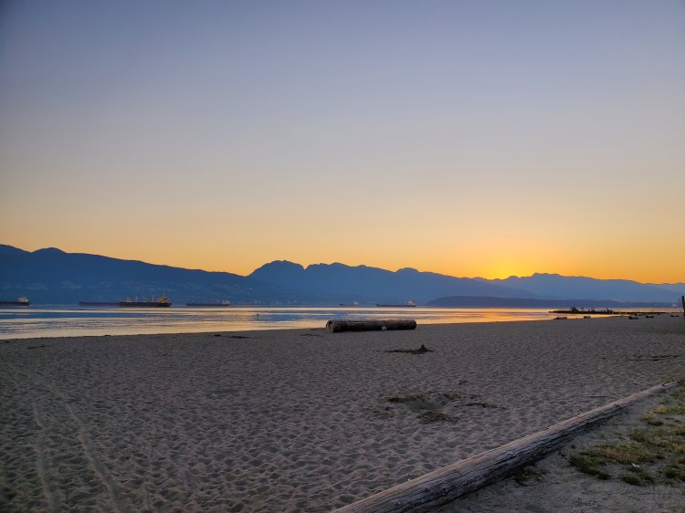
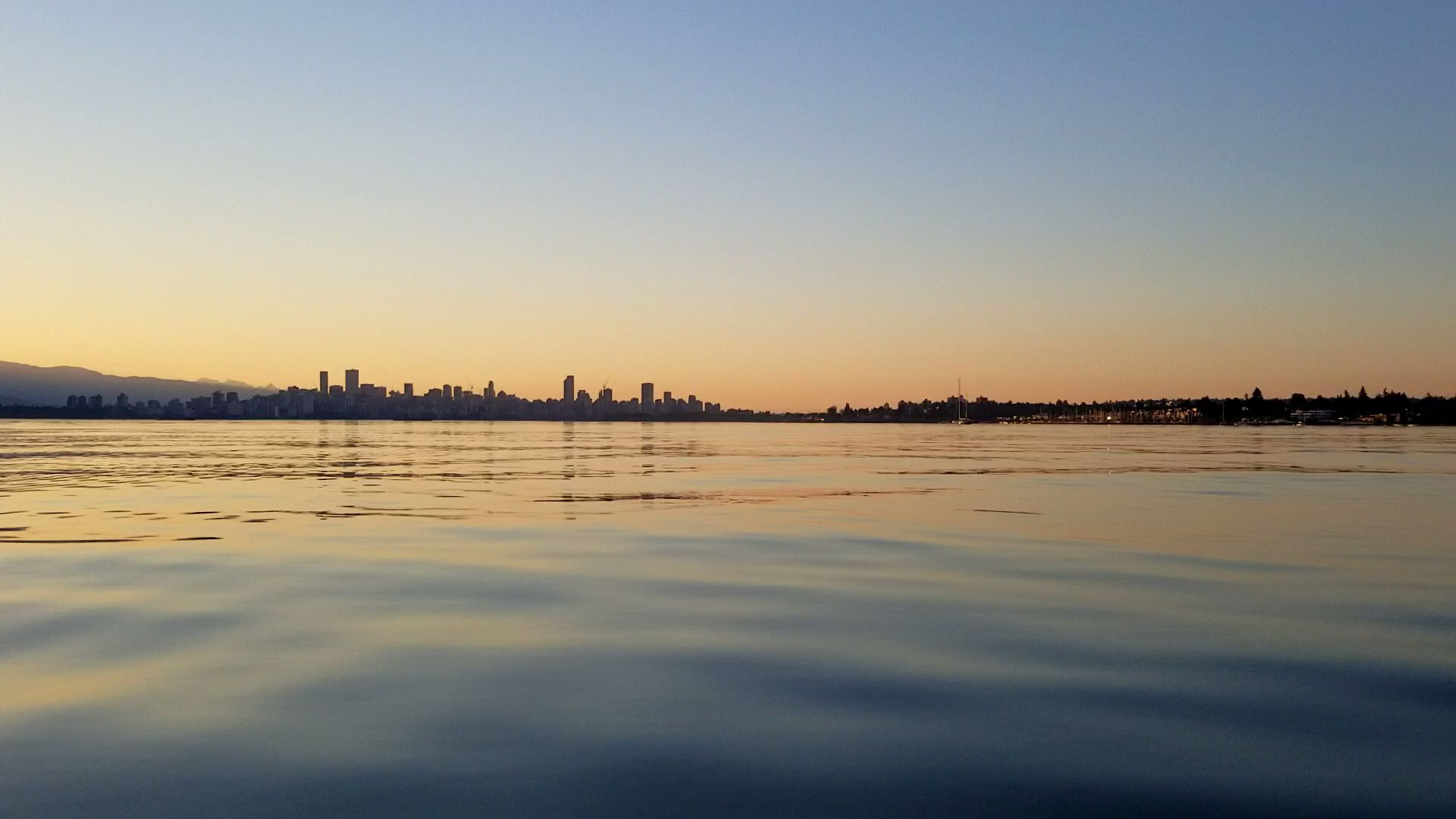
I left from Locarno Beach for my race. Though this was not going to be a fast one. First of all because of the heat, even though I was setting out early! And secondly, for the route navigation that I would need to do.
Here is the view from the parking lot at Locarno as I got my kit in order.
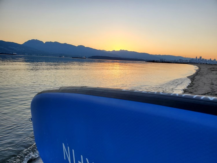
And the view from the shoreline.
I started to head out to my starting point. The Just Draw It application has a “follow” my route function so I turned that on to get my bearings. Unfortunately, it was at this point that I realized I had forgotten my cellphone-specific dry bag in my car. I had planned to bring it so that I could lay it down on my board deck to use as a map. But lately, I have been using my waterproof waist pack to pack my phone. I guess I put my kit together on autopilot and failed to grab the cellphone case. I considered going back for my bag as I was only a little way offshore, but decided against it. I would just keep my phone in my pocket to check for my location fidelity.
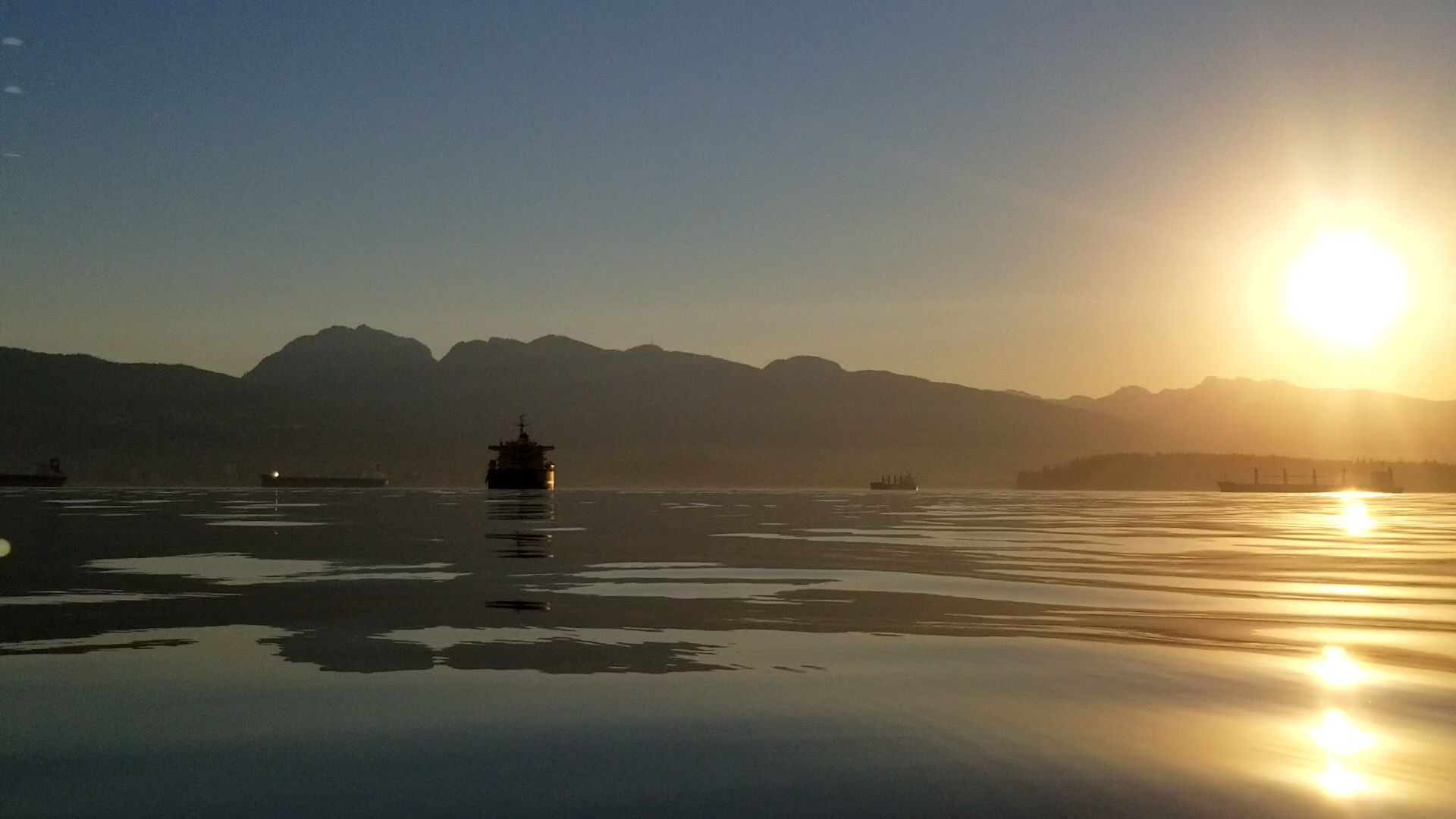
It was a glorious morning out on the water. The sun was just about to crest over the North Shore Mountains as I paddled out.

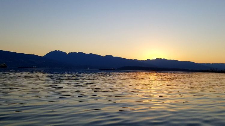
It was a corona sunrise in more ways than one. The crown of the sun was visible in the early morning sky.
I checked my phone and made some adjustments to my course. I needed to be more westward.

A few more phone checks later and I had reached my starting point. I was already regretting my decision of not going back for my cellphone case and I hadn’t even started the race.
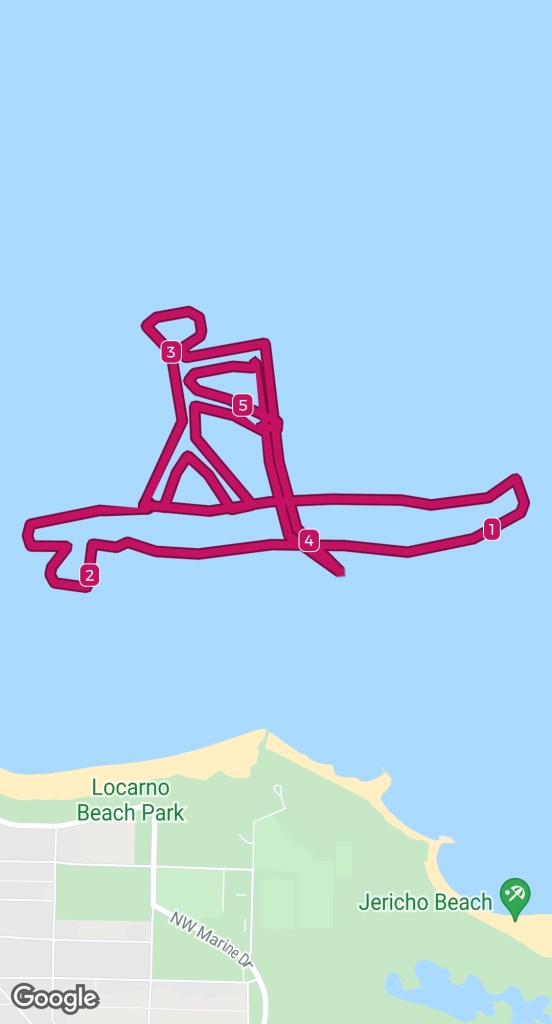
I started my GPS recording and was off eastward toward the city to draw the deck of my board.
I set my sights on one of the buildings of the Vancouver skyline and counted out my strokes to pass the time. After a couple of cellphone checks, I figured it was time to start the nose rocker of my board.

I made a slight course adjustment to head northeast before making the turns to close off the nose. There was a buoy marking a crab trap nicely positioned that I used as a reference point for when to finish the rocker of my board.
From there, I drew the bottom of the board, which had me get a bit off course. It ended up a bit more jagged and longer than I wanted.
A lot of the extra length came with drawing the fin and then the tail of the board.
As a result of the extra board length, I decided to cut out the paddler’s second arm. Both because I was running out of meters and I was getting tired.
The final product is below. It ended up taking on more of a staccato artistic nature.
I decided to make my first ever Facebook post. I posted my route on the vTNR Facebook group site. I tend to stay away from Facebook for several reasons. I remember my first time signing up for an account when it was the thing to do. I was put off on signing up due to all the personal questions asked. I tend to be a private person. Don’t worry, the irony behind creating a blog is not lost on me. Social media adverse self-proclaimed private-guy starts publicly accessibly internet blog. The other deterrents for me regarding Facebook are that I have always thought it would be a huge time sink and I generally find it voyeuristically creepy. I remember in university looking at other people’s Facebook pages with some friends through their accounts and thinking it was fascinating to look at other people’s photos, but also kind of creepy.
I eventually did sign-up for an account for work and networking purposes but I rarely used it then and this was the first time that I signed-in in a long-time.
I find the appeal of the ease of connecting with long-lost friends from the past or distant places alluring. But then I stop and reflect and realize that those most meaningful friendships I am already connected to. I don’t need to search for more. Plus it seems the trends are away from Facebook these days towards other forms of social media. I will keep on being a dinosaur (i.e. late or non-adopter).
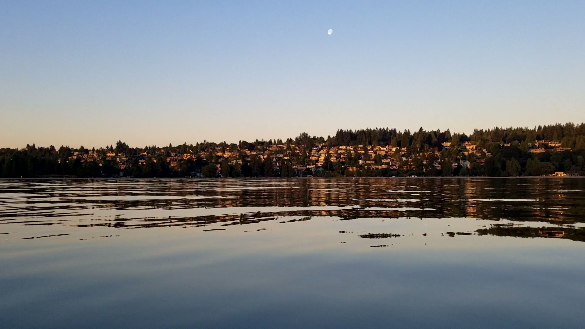
The moon was out and was a waning gibbous. Here it is in the morning twilight.
After my racecourse was complete I played around with some pivot turns. It was hot so I was happy to go in for a dip. The abominable snowman from bugs bunny saying “Gosh it’s hot” has been playing through my mind on repeat. Ironically, we often leave Vancouver in search of vacation spots that are similar in temperature to what we are experiencing. Yet, now that it is homegrown there is a cacophony of complaints. The major differences with vacation places and spaces are accessible air conditioning, lack of work, and typically easy access to water (i.e. oceans or pools).
After a few easy turns, I decided to test my limits and put the nose of my board up as high as possible. It wasn’t long before I was submerged and cooling off.
It was interesting to note how much harder it was to get the nose of my board up compared to the Cascadia XR4 that I had trialed from Deep Cove Kayak a few weeks before. Initially, when I was testing the XR4 I thought that it was the difference between a hard board and an inflatable. While I still think that is part of the story I now wonder how much of a contribution board shape and size are. Acknowledging of course, that for an inflatable the tail shape and size are necessitated by the board type. At present, you cannot taper the thickness of an inflatable board’s tail.
Here is a GIF of me playing around with some pivot turns just before I go for a dip.

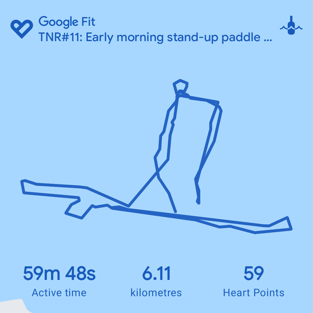
And here is my route from Google Fit with the distances marked.

And the statistics from Google Fit for my race.

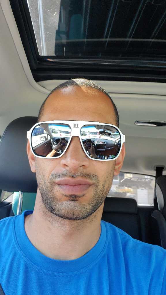
Oh yeah! I won one of the entry draws for this week’s race. A pair of Bliz Targa sunglasses! Thank you Bliz and thank you vTNR! I have now won a bag of Bean Around the World coffee, a pair of Ryders Nelson sunglasses, and a pair of Bliz Targa sunglasses. Not a bad year on the tour!

2 thoughts on “vTNR#11: SUP Art”