
Saturday, June 5, 12021 HE
It is week nine of the virtual Tuesday Night Race (vTNR) series being put on by Coast Outdoors through Deep Cove Kayak. Here is a general overview of the event. With the changes in pandemic restrictions, this week’s race went live for Tuesday night. Unfortunately, I was not able to make it, but fortunately, the event still ran virtually too.
Here are the links to my past posts on the vTNR series: vTNR#1, vTNR#2, vTNR#3, vTNR#4, vTNR#5, vTNR#6, vTNR#7, and vTNR#8.
And this is the link to the course this week on webscorer. The image below is the route and here is the link to the course in Google Maps. The green course is the local long route and the red route is the local short course.

And below is an aerial view that a friend, Wil, sent me from his office window a few weeks back. The cockpit aerial gives a great overview of this section of Burrard Inlet and Indian Arm with the TNR starting point of Boulder Island in the centre of the fjord.

I launched from my usual spot at Lowry Waterfront Park. There was a southeasterly wind and the skies were looking like they wanted to precipitate. I made my way over to Boulder Island and en route debated whether I should paddle the course clockwise or counterclockwise. I think the actual live race was counter-clockwise, but since I was the only competitor this morning I figured I had my choice. With the southeasterly wind, I figured it would be better to go clockwise and start with the headwind out towards Maple Beach and Admiralty Point. But I did wonder about the outgoing tide?
I wore my camera on a head mount this time so most of the shots are slightly angled. Here is the view heading into the wind towards Maple Beach. You can see the flatter waters ahead in the bay of the leeward side of the Admiralty Point.

Funnily, despite the calmer waters I almost came off my boarding making the turn around the dolphin in the bay. Just as I was making the turn there were some bigger waves that caught me off guard.
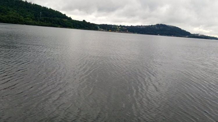
From there I made the crossing to the Cates Park Lighthouse. Below is the view looking across Burrard Inlet to Burnaby.
When I arrived at the lighthouse the tide was high enough to make it around.
After rounding the lighthouse, I passed by two other SUPers heading southwest towards the lighthouse as I started northeast toward the point at Little Cates Park. We exchanged pleasantries and they eyed me up peculiarly, probably wondering why I had my cellphone strapped to my head. I wondered if they were completing the vTNR and travelling in the correct direction. I looked back to see if they had rounded the lighthouse. I couldn’t see them. I check again a little bit later to confirm. Still nothing. They must have continued, perhaps towards the Cates Park Boat Ramp.
As I made my way northward past Little Cates Park I started to question my choice of direction. There wasn’t as much tailwind as I had anticipated. And there was a strong ebbing current. If you look at the graph below you can see that I was heading north at the maximum ebbing current speed. Before departing, I considered the ebbing current, but I didn’t quite take into consideration that it would be at its maximum velocity for my northerly leg. I didn’t feel any wind so I assumed it was at my tail. Which was stronger I wondered?

It felt like slow progress through this section. The water looked stagnate between the southerly wind and the northerly ebbing current. I plodded on, not sure if it was the conditions or my fatigue, or both making my perceived progress prolonged. I made it to Grey Rocks Island and rounded the northwestern corner to meet an easterly wind. I had to pause briefly as I had a momentary lapse of recall regarding whether it was a straight shot to Boulder Island or one more turn around the Hamber Island Lighthouse. It turned out it was the latter. I set my bearing.

Below is the view south out of the arm over the top of the eastern projections of Grey Rocks Island.

I made my final turn at the lighthouse and then entered the last leg back toward my finish line at the Boulder Island dock.
Below is my route recorded with Google Fit.

And my statistics from Google Fit are below.

And here is the link for this week’s vTNR results.
And one last picture looking northwest from the south side of Boulder Island as I head back toward Lowry Waterfront Park.

As I approached the park the same two SUPers that I had encountered near the Cates Park Lighthouse were heading back up the arm. This time around one of them I asked about the camera on my head. Specifically, he asks if I was recording in or out. I replied, “Out”. He then inquired as to watch I was capturing. My slight embarrassment at the time coupled with the fact that they were heading north and not slowing down while I was heading west southwest resulted in a hurried response on my behalf. Just continuous video that I can go back and pull out some still shots from, I replied. I am not sure why I felt strange about my response, as that is in fact what I was doing. I didn’t elaborate that it was part of this hobbyhorse project I had started. Maybe next time I use the inquiry as an opportunity for a shameless plug.
I worked on some pivot turns again in the small bay by Lowry Waterfront Park. A few kayakers passed by heading toward Cates Park. I wondered if they might be completing the vTNR?
This time I wasn’t as lucky as my last turn session. On one of my last turns, I pushed the envelop and tried to get the nose of my board out of the water. It was a little too much, or perhaps just right as I ended up outside of my comfort zone and took a dip. The water was surprisingly warm, though I didn’t stay in for very long to soak it in. I was up quick, back on my board. And then after one last turn to bring my confidence back, it was off to see what the rest of the day would have in store.

One thought on “vTNR#9: ‘Admiral Cates Grey Hamber’”