
Saturday, April 17, 12021 HE
It is week two of the virtual Tuesday Night Race (vTNR) series being put on by Coast Outdoors through Deep Cove Kayak. Here is the general overview of the event.
Last week I ended up doing the first vTNR as a night paddle. This week I was hoping to be more organized and proactive and do an early morning run or at least a daytime paddle.
Here is the link to the course this week on webscorer. And below is an image of the route.

Below is a virtual tour of the racecourse created via Google Earth Studio.
I had ordered a head mount strap to trial for photos and video. The board mount setup that I currently have worked well. But the vantage point for the images is so low that I wanted to test out a different perspective. It is cool to see the water from this perspective but after my whale sighting paddle where I neglected to take a photo from my handheld camera because I had the board-mounted camera, I was keener to trial a new setup. However, at the same time, it was peaceful to just experience the moment and be present rather than feeling the need to reach for a camera. In any case, the head mount seems to be a logical melding of the best of both with the caveat of looking like a total tool with a cellphone strapped to my head.
I did check the weight differences out of curiosity. The Samsung Galaxy S8 is listed as 155 grams and without a case is rated at IP68 with the following qualifying statement, “*Carrying an IP68 dust and water resistance rating. Based on test conditions of submersion in up to 1.5 meters of fresh water for up to 30 minutes” (Samsung). Here is a list of the weights of various GoPro models (and in a slightly more readable format). Many of the GoPro models are waterproof and to various depths. Here is a link to which are and to what depths. Something else to keep in mind is that you may also need a protective casing for shock absorption depending on the environment you are in. When I weighed my Samsung phone with the waterproof case on it came out at 216 grams. It is definitely on the heavier side but I was willing to test it out. Below is the inaugural first wear on the water.
This week’s course started again at Boulder Island in Indian Arm, so like last time I departed from Lowry Waterfront Park. This time it was a bit busier than my evening departure and I ended up parking on the side of the road. I was passed by three paddlers packing up their kit as I set mine up. And down the road, one other paddler was gearing up to head out too.
I had seen an infographic showing a clockwise route, so despite unfavourable wind conditions, I decided to paddle the course clockwise. Damn, you stubbornness gene. One-quarter of the way into the route I was kicking my stubborn self in my mind’s eye. As I struggled upwind I thought to myself, there is a reason that they are Tuesday night races, it is probably that the wind conditions are more favourable then (though it could purely be an after-the-workday convenience of timing thing too). I was paddling midday and I couldn’t shake the idea that the wind was both stronger and possibly in the reverse direction compared to the evening.
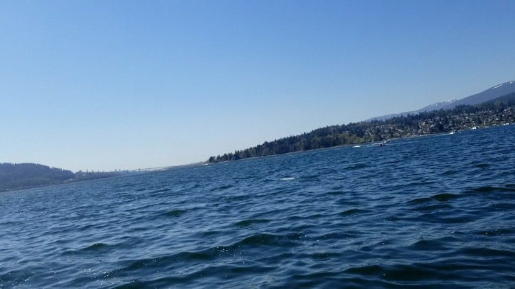
It was a headwind from Boulder Island up to Maple Beach at Gosse Point/Admiralty Point. I assumed that there would be a buoy, piling, or dolphin to do a pivot-turn around and when I arrived there was. The conditions were choppy and with the beachgoer audience, I decided to do a wider step-back pivot turn. I was glad it was a virtual race as I have yet to do a pivot turn in a jockeying situation.

From there I turned into even more headwind and now with the swell coming straight on as well. I was cutting across the mouth of Indian Arm heading westward out of Burrard Inlet. The next corner was the point at Cates Park. This proved to be the hardest section as I was battling the winds and waves coming down Burrard Inlet. I changed up to a choke stroke to shorten my paddle and get lower in the oncoming wind. I spied the piling in the distance and it was head-down paddling.


And below is the non-paddle obstructed view. Though the head-mounted camera has the disadvantage of my angled body position with an unedited photo.
Below is a video clip of the upwind paddle from Admiralty Point towards Cates Park. The exercise breath sigh tells it all, but at least it is gorgeous out!
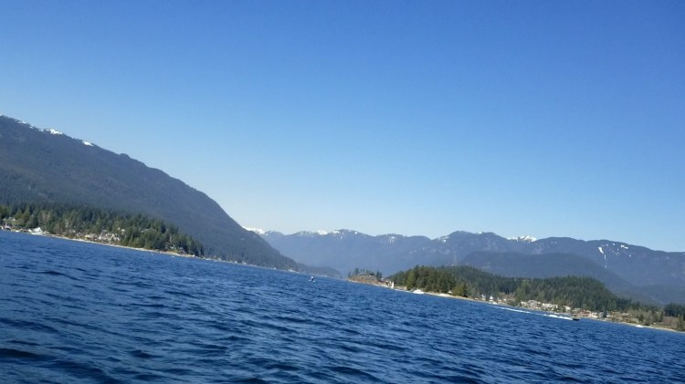
And below is a sailboat taking advantage of the wind a little bit closer to Cates Park. I’m slightly envious at this stage as the wind is only a hindrance for me. Scenic Park is in the left background and you can just make out Iron Workers Memorial Bridge in the distant background.

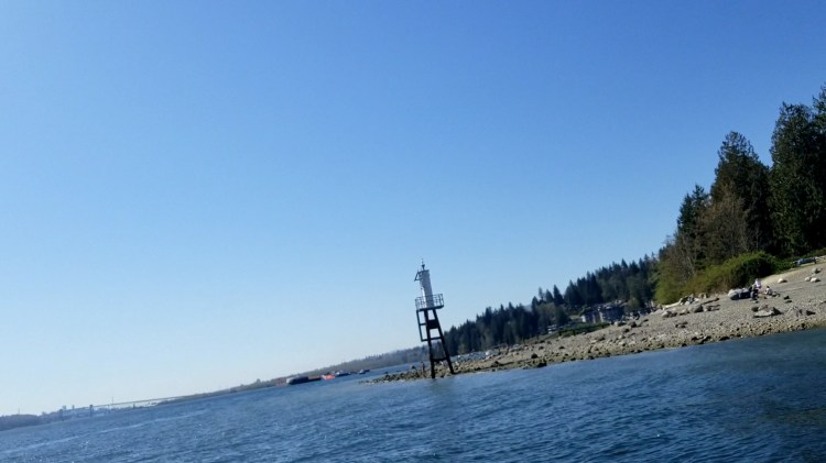
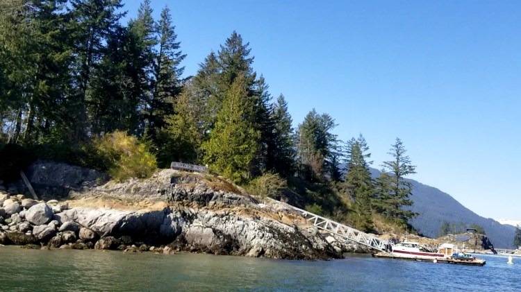
When I arrived at the light station the water levels were too low to turn around it. So, I paddled to parallel with it and then pivoted to start on the third leg of the triangle. I know had a tailwind and a minor cross swell coming from my starboard side.

Cates Park was busy and there were many paddlers out and about. In the distance crossing from the Maple Beach direction was a paddler on a Starboard racing board. He was ripping and I was envious at the route he was taking as the wind and waves were in his favour. I am very keen to try renting a racing/performance board this spring/summer to feel what the difference is from my all-around board.

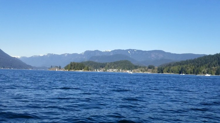
The one upside of my paddle route which I had considered was that the last leg was now with a tailwind. I guess that was the sacrifice/consolation for the hard start. Below is the view down the final leg with Boulder Island in the centre-left.
I paddled to the dock at Boulder Island and then had a brief rest, some water, and a snack. Next midday paddle I think I will bring my camel pack!
I took a leisure paddle back across the fjord to Lowry Waterfront Park. Then it was off to my in-laws’ place for an early weekend birthday dinner for my wife. A lovely end to a lovely day.
Below is my route and here are the results from TNR#2.


9 thoughts on “vTNR#2: Triangulation: Boulder Island, Admiralty Point, and Cates Park”