
Saturday, April 24, 12021 HE
It is week three of the virtual Tuesday Night Race (vTNR) series being put on by Coast Outdoors through Deep Cove Kayak. Here is a general overview of the event.
Check out these posts for the week one (vTNR#1) and week two (vTNR#2) races.
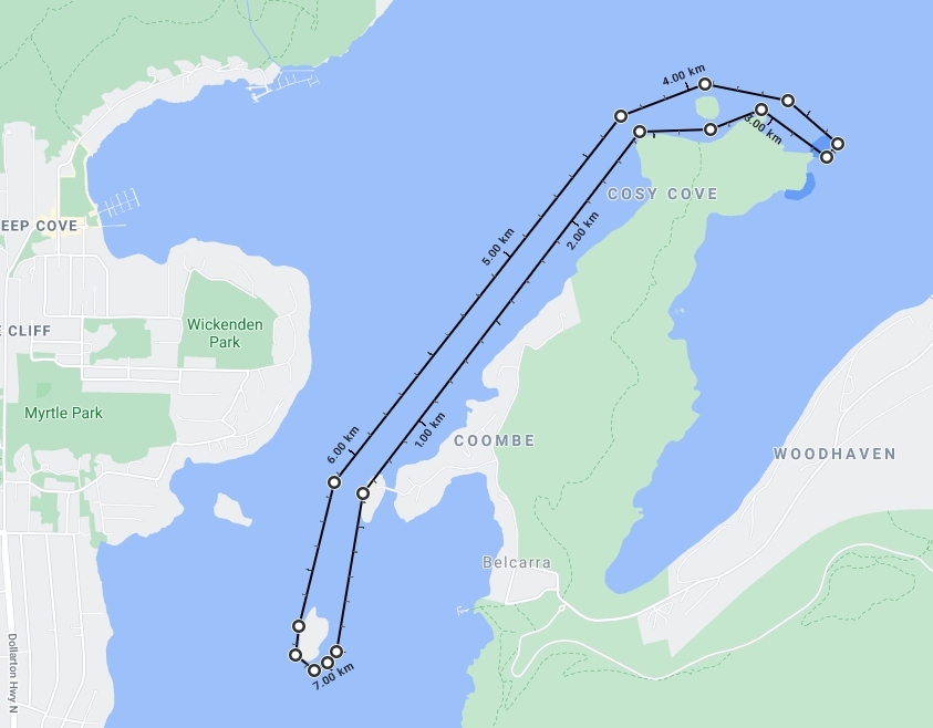
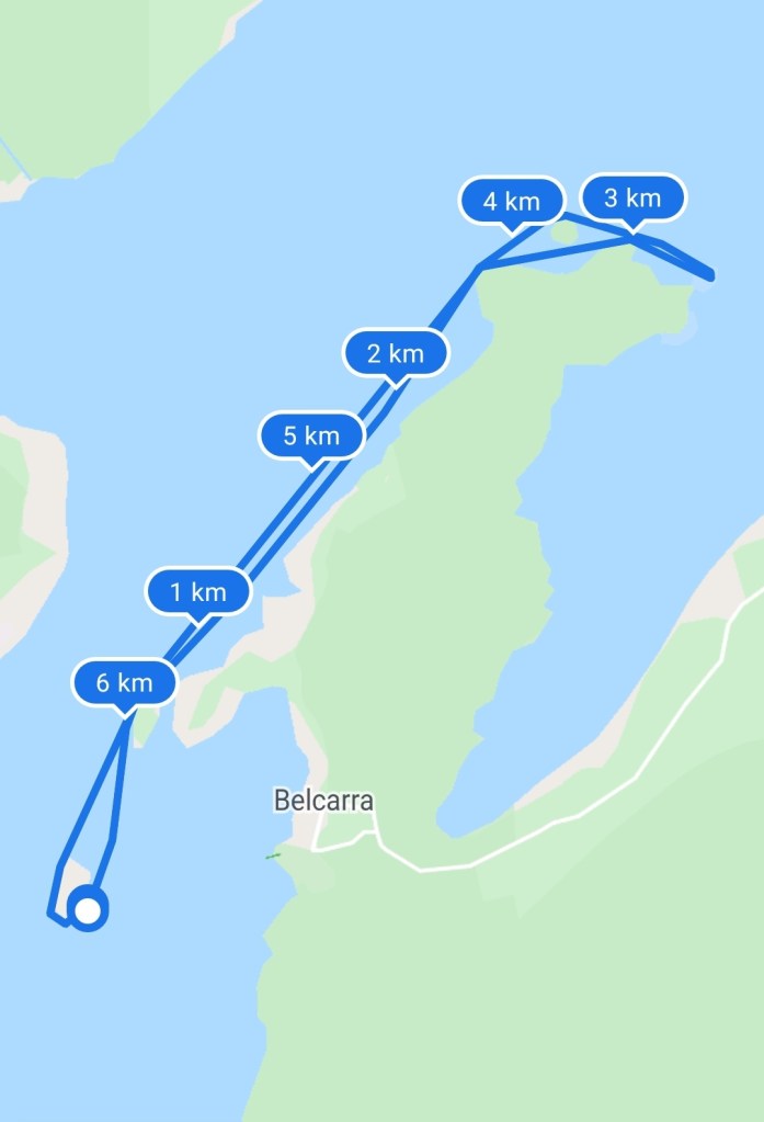
Here is the link to this week’s course on webscorer. And below is the image of the route.
I left again from Lowry Waterfront Park and used the paddle across to Boulder Island as my warm-up. The weather was not as nice as last week’s paddle. And with the threat of rain, I decided to wear my semi-dry suit, even though I was likely to overheat. Better hot than cold was my logic.
Below is a virtual tour of the racecourse created via Google Earth Studio.
I was excited about the course since when I paddled to Jug Island in March I didn’t get out as far around the point as the course required. Luckily I did see the warning on the virtual TNR Facebook site warning about the rocks at low tide around the lighthouse marking the entrance to Bedwell Bay. Below is the tide prediction from My Tide Times Pro. But from the Google Maps‘ satellite images and Google Earth, there was potential for shallows as well as rock exposure.

And unlike last week there wasn’t any real wind to speak of.

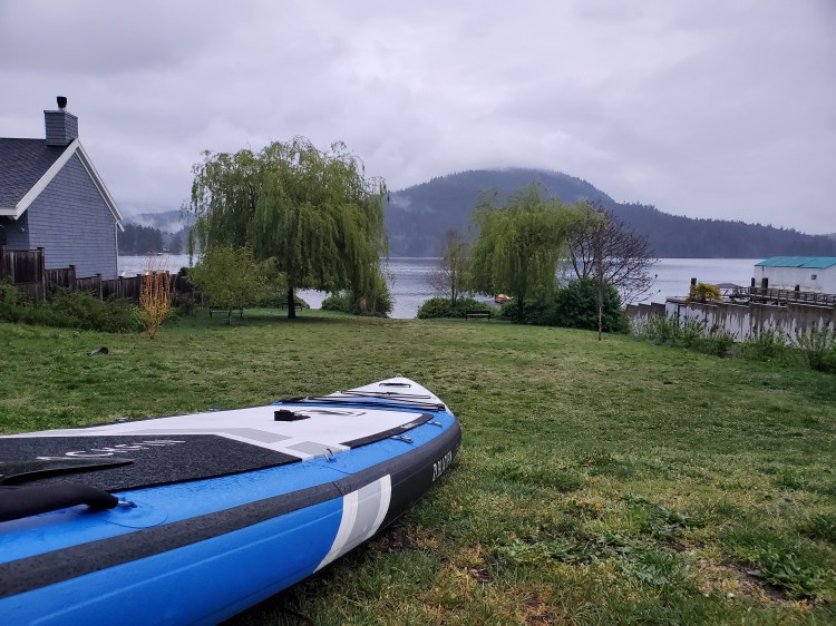
Here was the view from Lowry Waterfront Park as I prepared my kit. No wind, but a little bit of liquid sunshine for the morning.
This time I decided to go with the board mount setup rather than the head mount strap I used last week. Scroll down for the video of a sped-up version of the course. Below is a still shot from the video I captured as I depart from Lowry Park. Boulder Island is to the left of the image.
Below is the start line at the dock on the east side of Boulder Island. Hamber Island is visible just off the corner of the dock and you can see the bridge connecting the island to the mainland.

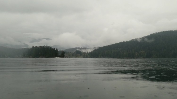
And here is the view a little closer to Hamber Island as I paddle through some fog.

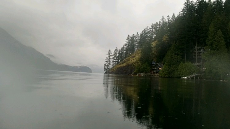
And below is the view as I approach the point just north of Cozy Cove. It was here that my camera timed out as I ran out of storage space. Oops! Because I was almost certain that I had deleted my previous videos and images? I clued into my camera not recording just around the point in the channel between Jug Island and Jug Island Beach. It was here that I was faced with the dilemma of stopping to restart the camera, which at this point I believed had just timed out. Or keep paddling, this was a race after all. Since I was interested in having footage of the lighthouse I decided to stop and fiddle with the camera. My racing speed pride could take the hit. Unfortunately, I was soon to find out that I would not be able to record anymore without a concerted effort to determine where and how I could free up memory. So in the end, not only did my racing pride take the hit but I didn’t have any video or images to show for it.
So my plan to have a full-time-lapse sequence of a trip from start to finish was foiled yet again. Oh well, I guess there is always next week. Here is a video of the footage that did obtain, which was just over a third of the course.
Below is my route recorded on Google Fit‘s activity tracker.
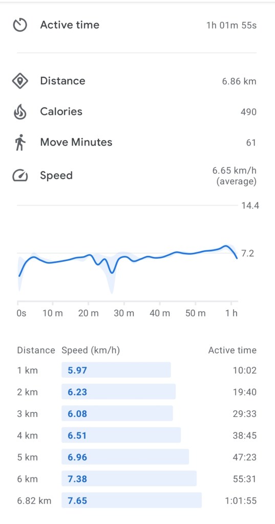
And my statistics from Google Fit.
And last, a link to the race results on webscorer.

8 thoughts on “vTNR#3: Boulder Island to Bedwell Bay”