Saturday, May 13, 12023 Human Era (HE)
- Common Interests, Common People
- Dates, Pace. Wait Race?
- Paddle Plan
- Summer in May: Words on Whether Weather or Weather
- Gorgeous Gorge: Launch Site
- My Kit
- (P)logging
- Privatization Podcasting Parley
- Re(p)logging: Landing In Site
- SUP Stats
- Final Thoughts
Common Interests, Common People
A few years ago while researching for stand up paddleboarding (SUP) destination ideas, I came across the Outdoor Family Blog. It is written by a local Vancouverite who was covering similar content to my blog. Naturally, I scoured his paddle posts for relevant information.
At one point, we seemed to be on a similar circuit and were completing comparable paddles within weeks of one another. It seemed like we would cross paths on the water. Alas, that did not happen. At least not my knowledge. But after some online communication, we decided to try to meet up for a paddle. We floated a few ideas between us, but our schedules initially didn’t coincide.
Eventually, Billy suggested a paddle to Thywates Landing. The name was familiar but I couldn’t call the location to mind. After some quick searching, I realized why it was familiar. It is about halfway up Səl̓ilw̓ət (Indian Arm) and I had come across the name in past paddles through the fjord and on destination ideas on the Deep Cove Kayak Centre website.
It wasn’t on my to-do list of places to paddle, but after Billy suggested it, I was keen. Later, when he forwarded a link to the history of Thywates Landing from The Land Conservancy of British Columbia and a link to his post on his goal to explore all 23 Metro Vancouver Regional Parks I was stoked. Part of my passion for paddleboarding has been how it has helped me to learn about the history of the local lands and waterways and to have goals to explore new and adventurous places. This adventure ticked off both of those boxes, along with the added benefit of sharing the SUP stoke!
Dates, Pace. Wait Race?
We set our sights on May 13 as a tentative date, pending familial approval (mine not his). At some point, I realized that May 13 was also the date of Board the Fjord, one of the big annual paddling races. I had considered participating this year as I have entered the SUP race scene, testing my fitness in some of the Thursday night Jericho Wavechaser paddling race series. I first tested the waters during the pandemic with the convenience of virtual races and then eventually attended a Wavechaser live and direct last summer.
Last year, I missed the Board the Fjord as the race was so early in the season, at least in my mind, that it wasn’t on my radar. This year, given I was on point with the opening of the Wavechaser series, I was generally more aware of race dates. It was on my radar. I have already participated in two of the Jericho Wavechaser races. I found the added level of paddle intensity and competition a fun change and challenge. However, I do still very much enjoy the serenity of sans sprint SUP. So I had to decide, speed or serenity.
I decided to go with the serenity of SUP. Səl̓ilw̓ət is such a special place and I thought a smooth water serene sunup SUP would reflect that better. Plus, Billy and I had been back and forth for a bit without being able to lock down a date, so I thought we might not ever make a paddle happen if not this day. And for sure there was a degree of apprehension with doing my first race en masse, so easier to defer.
Paddle Plan
After locking down managerial approval, I confirmed with Billy that I would be able to join him on his adventure. Despite planning to leave early (i.e., before the business of the fjord boarding), I thought it would be better to avoid Deep Cove. It is a busy spot at the best of times, let alone with the race event coupled with regular weekend traffic. And fresh in my mind was the clusterfuck of construction that is going on in Deep Cove after my recent visit there for Deep Cove Demo Day. We decided to meet and launch from Lowry Waterfront Park.
I put together a paddling itinerary. I find creating them useful for estimating my paddle duration. Plus, it is a great safety practice to leave one with someone in case fit hits the shan, which I always do for extended/non-routine paddles.
SUP FLOAT PLAN: Səl̓ilw̓ət: Lowry Waterfront Park to Thywates Landing
Paddle Plan
DATE: Saturday, May 13, 2023
ROUTE: Lowry Waterfront Park to Thywates Landing (round-trip)
VESSEL: green/blue/white/orange NSP Carolina
•EST. DEP. From Home: 0600
•EST. DEP. From Lowry Waterfront Park: 0645
•EST. ARR. @ Thywates Landing: 0830
•EST. ARR. @ Lowry Waterfront Park: 1045
•EST. ARR. @ Home: 1145
Details:
Estimated Distance
One-Way 9 km
Tides (from WeatherCAN Water Level App)
Deep Cove
•0159 high 4.6 m
•0832 low 2.7 m
•1246 high 3.2 m
•1927 low 1.3 m
Wind
Windy App
•Morning: North-northwest (N, NNW) kt 3 (10 kt wind gusts)
•Afternoon: South-southwest (SWS, SSW) 2-3 kt (10-12 kt wind gusts)
WeatherCAN App
•NW 10 km/h morning; 20 km/h afternoon
Air Temperature
•10-24°C
Water Temperature
•~13°C
Daylight: 0625 – 2001
Nautical Twilight: 0510 – 0551
Civil Twilight: 0551 – 0625
Drive Distance 19 km (one-way)
Drive Time ~25 min
Paddle Distance ~18 km (round-trip)
Paddle Time ~3.5 hrs
Personal Info
TRAVELLER(S): 2 [first & last name]
VEHICLE: [colour][year][make][model][ABC 123]
PHONE: [xxx-xxx-xxxx]
Itemized Itinerary
0600 🚗 ↗️ Home
0625 🚗 ↘️ Lowry Waterfront Park
0645 🏄🏽♂️ ↗️ Lowry Waterfront Park (9 km)
0830 🏄🏽♂️ ↘️ Thywates Landing
0840 🥣 ⏸️ Thywates Landing
0900 🏄🏽♂️ ↗️ Thywates Landing (9 km)
1045 🏄🏽♂️ ↘️ Lowry Waterfront Park
1100 🚗 ↗️ Lowry Waterfront Park
1145 🚗 ↘️ Home
Summer in May: Words on Whether Weather or Weather
Leading into the weekend, the forecast was looking HOT! Especially with respect to seasonal averages. Environment Canada released a special weather statement preceding the weekend’s heatwave warning of high temperatures 10 to 15 degrees Celsius above seasonal averages. Below is an updated version released on Monday, May 15th.
In versus Out
I wondered if the high heat would be enough to drive the typical summer thermals common to the Westcoast coastal fjords? Last year, when circumnavigating Buntzen Lake in April, I experienced fairly strong outflow-esk winds. That is if you consider Buntzen Lake to be a form of coastal fjord. Though, perhaps a better description would be to describe those winds as katabatic. With the hot weather, I wondered if we were likely to encounter inflow winds given the parallel geography but reversed temperature gradient. Check out this previous post on the potential patterns of puff prone to arms of inlets.
Provided the paddle went according to plan, we would be paddling through the slack tide surrounding the low-high tide at around 0832 hours. You can follow the rule of thirds generally, to time tidal travel. The rule estimates the tidal currents to be weakest in the hour preceding and following the high or low tide (~0-50% of the maximum speed), and strongest in the middle hours between tides (~90-100% of the maximum speed). Just keep in mind that this is a general rule and does not always hold true. Especially in some of the narrow passes particular to the Pacific Northwest. All this to say that the winds were our bigger worry on the water, but well within our ways and means.
Supratropical Stream Speculation
I did a previous post on the El Niño Southern Oscillation (ENSO), which has occupied my psyche in recent times with my newfound fascination with weather forecasting. During my research, I came across a fascinating account that attributed the heat dome in S’ólh Téméxw, the hən̓q̓əmin̓əm̓ word for “our land”, (pronounced “Soul Tow-mock”) (aka., British Columbia) over the 12021 HE summer to bending of the polar jet stream. Essentially, the theory is that climate change is warming the globe non-uniformly. Specifically, the polar regions are warming faster than the tropics. The polar jet stream’s speed is powered by the temperature gradient between arctic and tropical regions. The resultant decreased temperature gradient is slowing the polar jet stream, allowing it to bend more. When extreme bends happen, colder arctic air can travel further south, or conversely, warmer tropical air can travel further north (see the video below for visuals and a detailed explanation).
After learning this fascinating fact I have kept track of the jet stream through this interactive model and it has corroborated the theory. Though I have only been confirming forecasts not making them. When cold temperatures through the winter have been forecasted during polar outflows, checking the jet stream map has revealed a downward dip. And this most recent heatwave aligned with an upward arc. All of this makes sense, since I am sure the specialist synoptic chart soothsayers source more sophisticated statistics.
The Boy Returns?
The other compelling climate characteristic is that the current prediction is a shift in the ENSO from La Niña to El Niño. La Niña is the cooler phase of the cycle, consisting of cooler-than-average sea surface temperatures in the tropical Pacific. The Pacific Ocean’s heat capacity is so great, it has the ability to impact global weather patterns. La Niña often means a colder and wetter winter in the Pacific Northwest, which is what we saw through the for the 12021/22 and 12022/23 HE winters.
The last La Niña advisory by the NOAA was issued in March, signalling a transition to the neutral ENSO phase. Already, the sea surface temperatures have warmed and transitioned, but apparently, the atmosphere is a little more like a teenager in its approach to a new day. Slow to rise. El Niño is forecasted to arrive later this year, meaning we are in for a warmer and dryer winter. Typically the trends for the ENSO phase are felt more in the winter, but I am not the only one who has wondered what they mean for whole world weather? Specifically, if La Niña is the colder sister, what happens to global temperatures when the warmer brother arrives.
He Saw, She Saw Seesaw
I can’t help but contemplate if collective climate characteristics have been clamped to cooler confinements. What happens to global temperature trends when the cool sister gives up control to the hot brother? In my mind, I see an oscillating trend within an upward trajectory where we were on the downturn, the low-high in a tidal sense, but are now about to be bumped back up to the high-high. I think we are in for a slightly rude awakening. Judging by the start of the fire season, on time but extreme, we might be rustling in our sleep already. Though it is likely too soon to tell anything for certain, we did see some record temperatures posted on Sunday.

And speaking of the devil, the day after composing this section of this post I came across this headline in the BBC News, “Global warming set to break key 1.5C limit for first time.” The article echoes my sentiments about how for the last three years the La Niña event has dampened the effects of global warming.
Enough weather talk, on to the paddle…
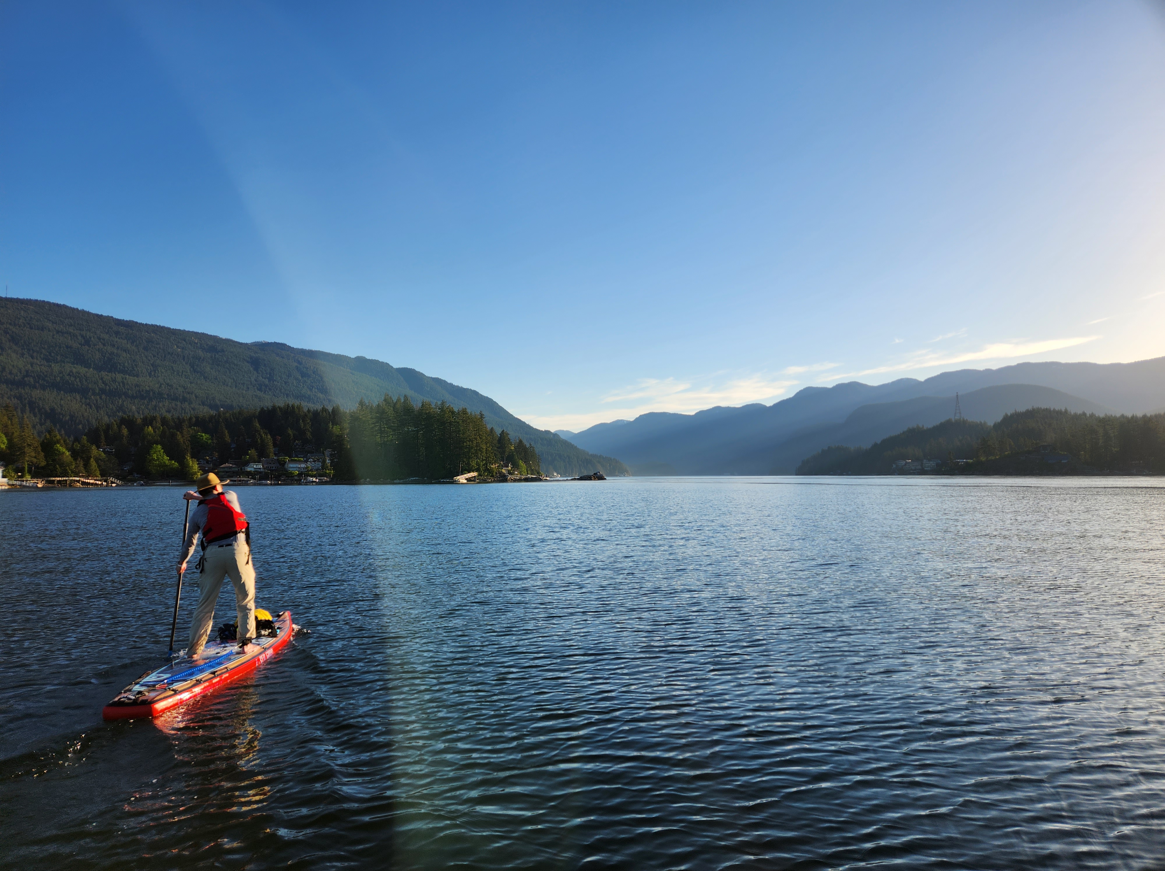
Gorgeous Gorge: Launch Site
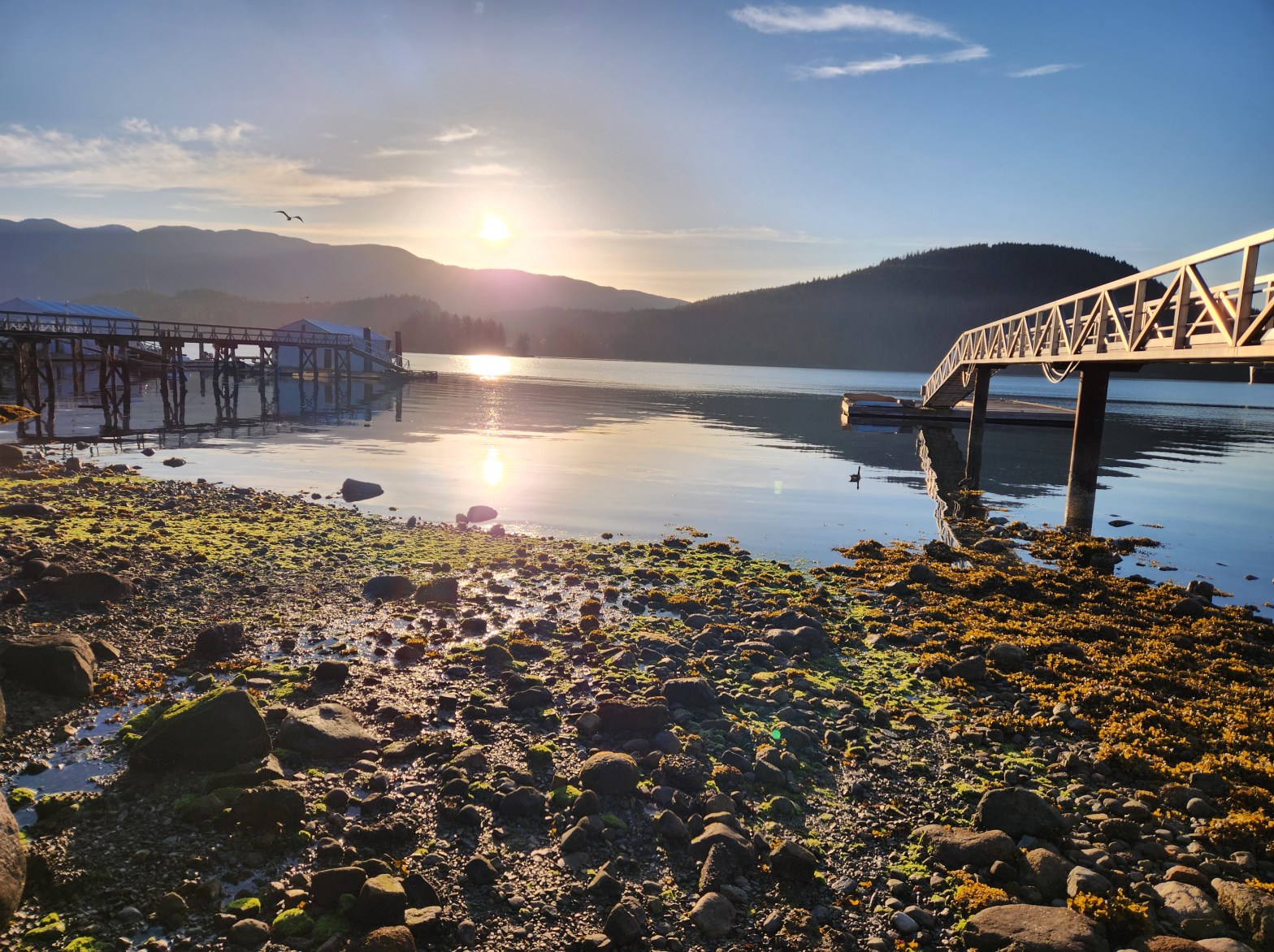
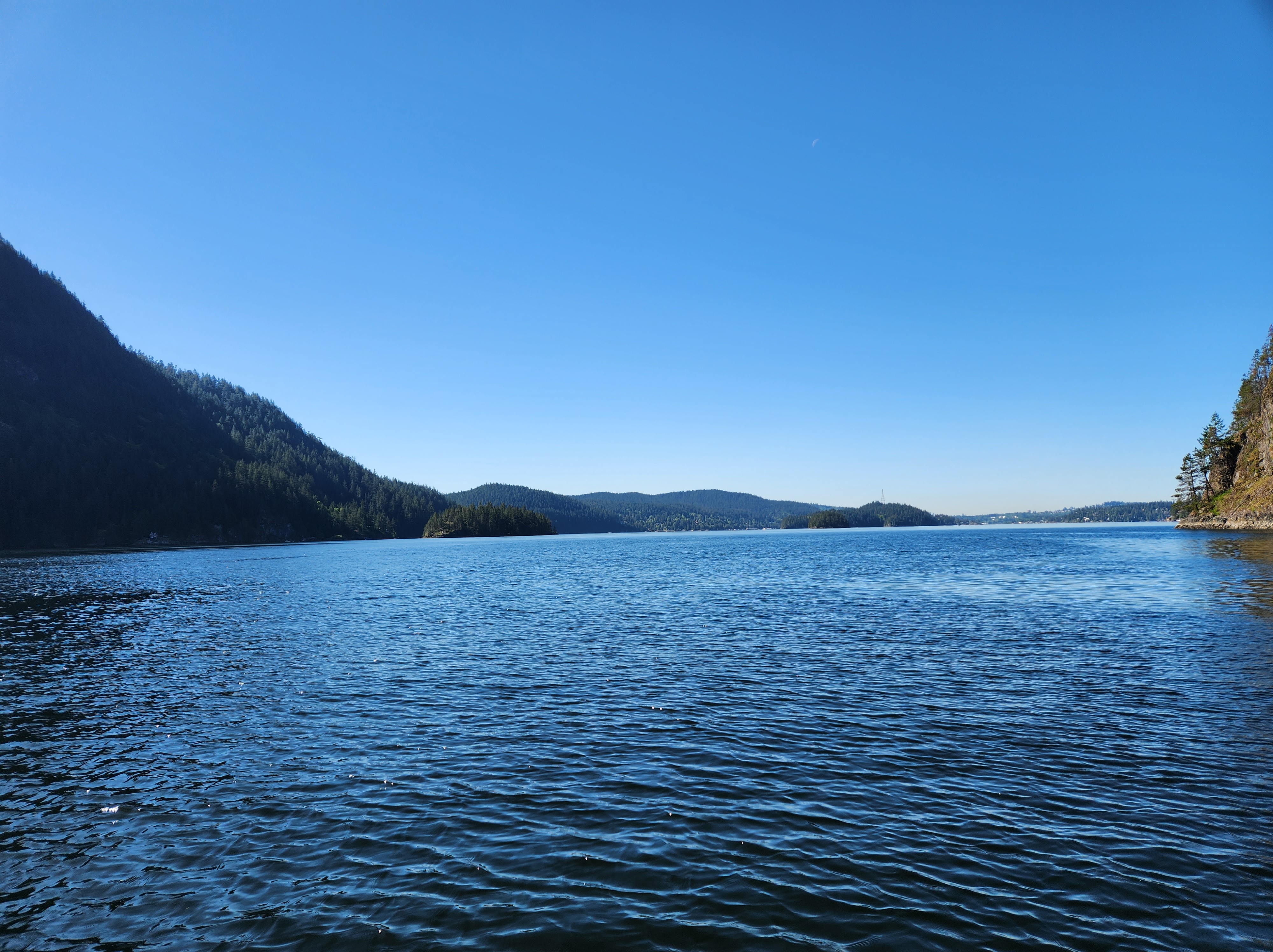
As planned, it was an early start. I arrived at Lowry Waterfront Park a few minutes before 0630 hours. After getting my kit in order, I paused to take in the morning light. With the Sun rising in the east it was shaping up to be a spectacular day of SUP and sunshine. Below is the view from the parking lot looking out over the mouth of Səl̓ilw̓ət (Indian Arm) with Belcarra Bluffs in the background.
Seeing Sea State
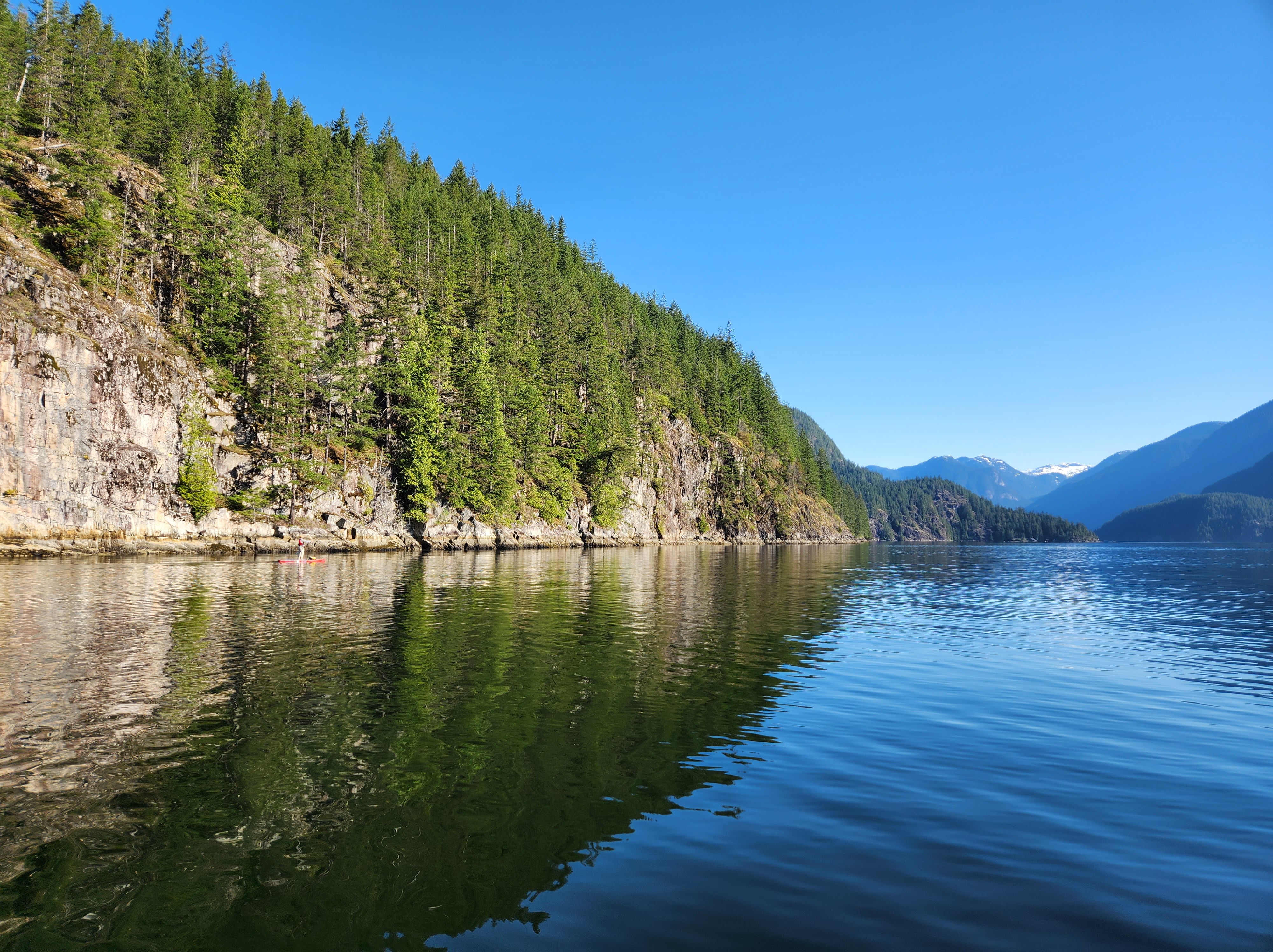
Billy had not arrived yet, so ventured down to the shore to check out the sea state. I have been trying to visualize ocean currents more by watching for the signs of currents and eddies at the surface. Walking down to the shore I realized, for the first time embarrassingly, that there is a path with a staircase at the south end of the park leading down to the water. Thankfully, the mystery path did not lead to the adjacent dock or I would have had some choice words to utter. Previously, I had always taken the rocky staircase at the centre of the park down to the water. The image below is the view out onto the water from the wooden staircase. It was 0630 hours and the tide was just entering its ebbing slack state in advance of the 0827-hour forecasted morning low.

I could see some minor eddie-like currents in the span between me and Boulder Island, but nothing significant.
Back up at the parking lot, Billy had arrived. This was our first meeting. After exchanging pleasantries we made small talk as he prepared his kit. Then we were off, launching around quarter to seven.
My Kit
Clothing
Anticipating the heat, I dressed lightly. Shorts and a T-shirt, along with a brimmed sun hat and sunnies. My sunglasses were attached to a floating strap, just in case.
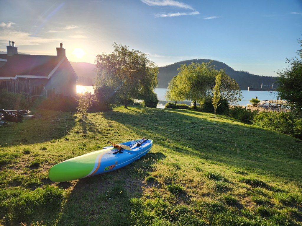
Paddle. Board.
I brought my BlackProject Adjustable Lava paddle. It is much lighter than the stock paddles that came with my inflatable boards. For my board, I went with my NSP Carolina (12020 HE model) as the sleeker (0.65 metre (26-inch) width) speedier shape and longer length would help for efficiency, compared to my wider (0.86 metre, 34-inch), slower, more stable, and sturdier Blackfin Model XL inflatable SUP (12020 HE). Though I did worry about the rocky landing at Thywates.
Accessories
For safety, I wore my Onyx inflatable belt pack PFD and packed my cell phone attached to a floating lanyard, along with electricians and duct tape (for emergency repairs) in a ziplock bag inside a Seal Line Seal Pak® Hip Pack.
Paddling with a partner and anticipating cellular service, I did not bring a satellite communication device. Typically, I have used this only on multiday trips. But, Billy had packed waterproof walkie-talkies that we had in case we needed to communicate with one another over a distance.
I wore my NRS Freestyle Wetshoes, mainly for the launch and landing, and in anticipation of a possible hike (walk?) at Thywates Landing. I paddled with my coiled leash connected to my hip pack belt to keep it out of the water. I packed a 10-litre roll-down dry sac stocked with water and food. My water was in my Grayl Geopress, in case I needed to top up. I had read that they were freshwater sources at Thywates Landing, and with the warm temperatures, I expected a solid freshet flow.
(P)logging
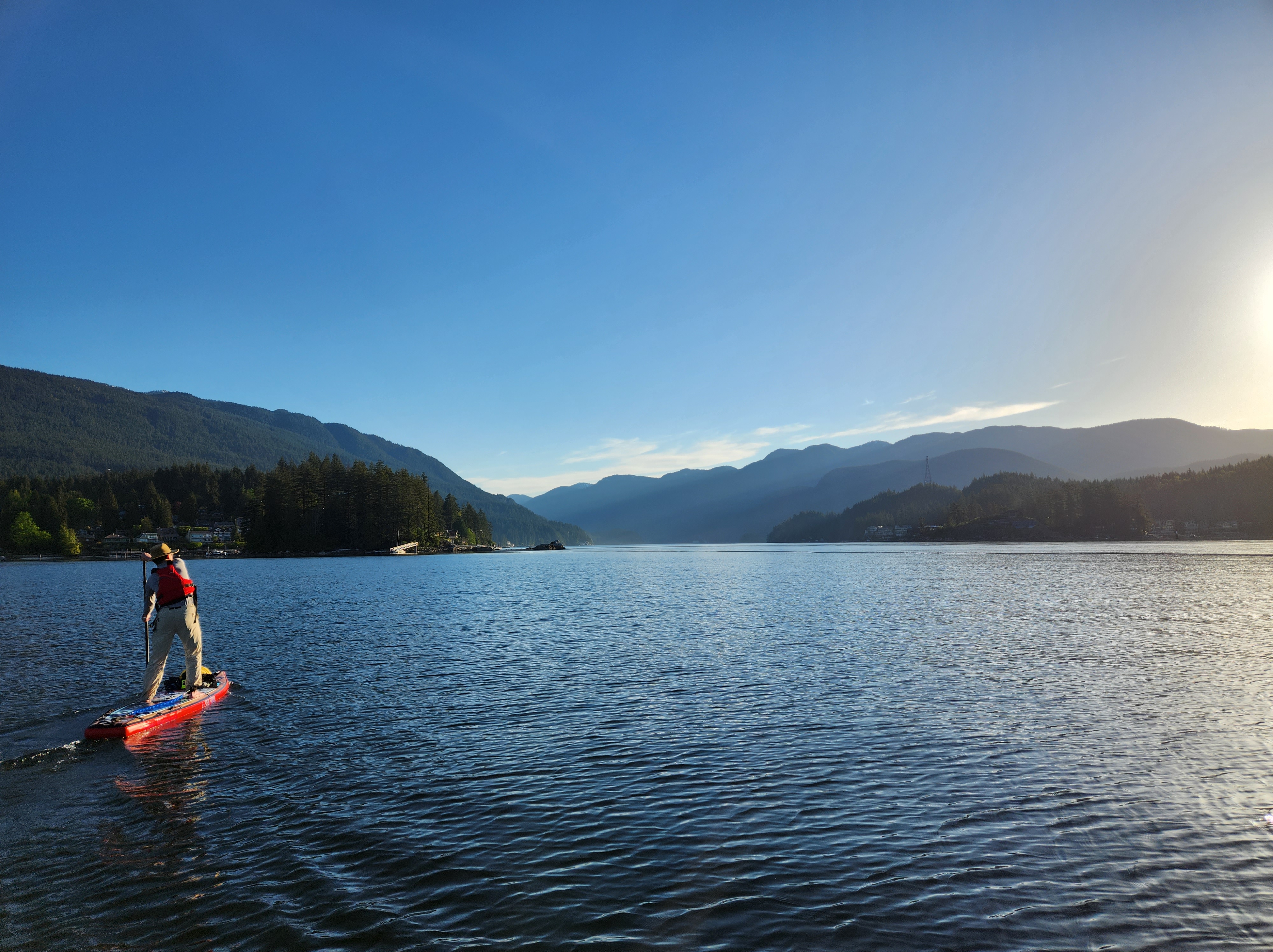
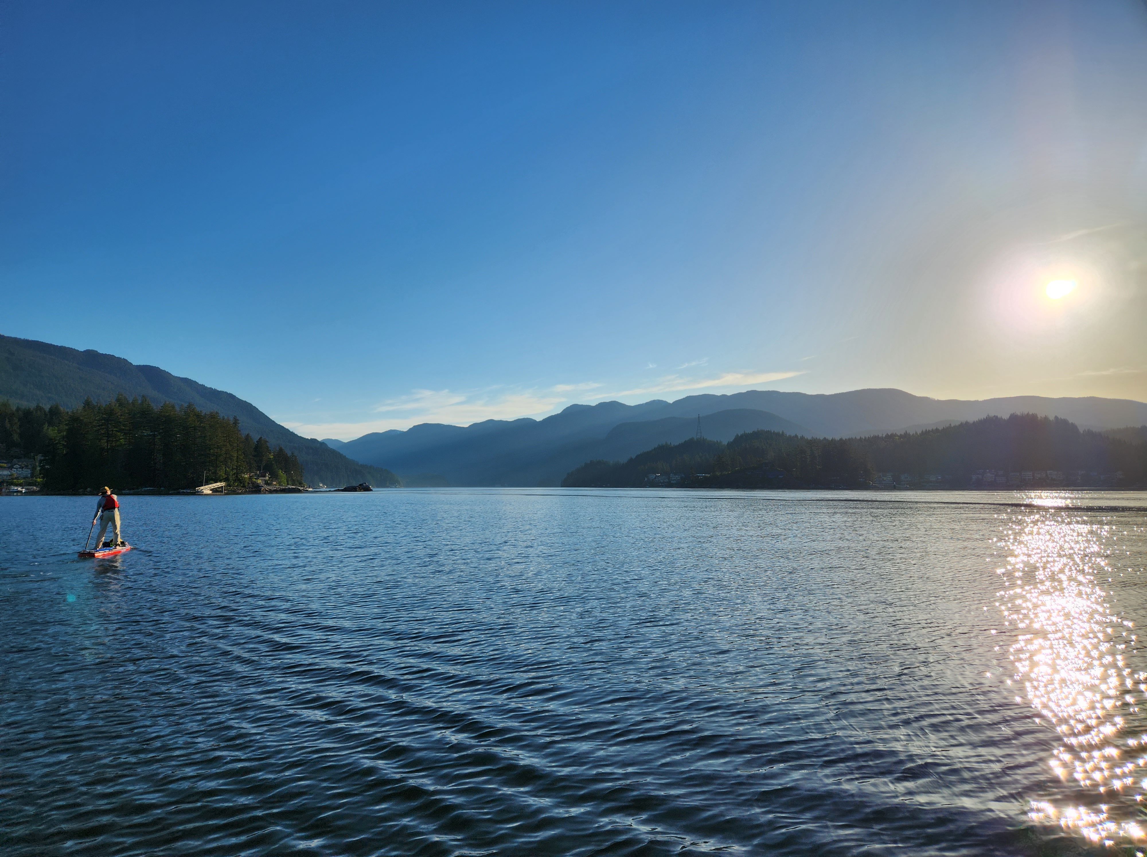
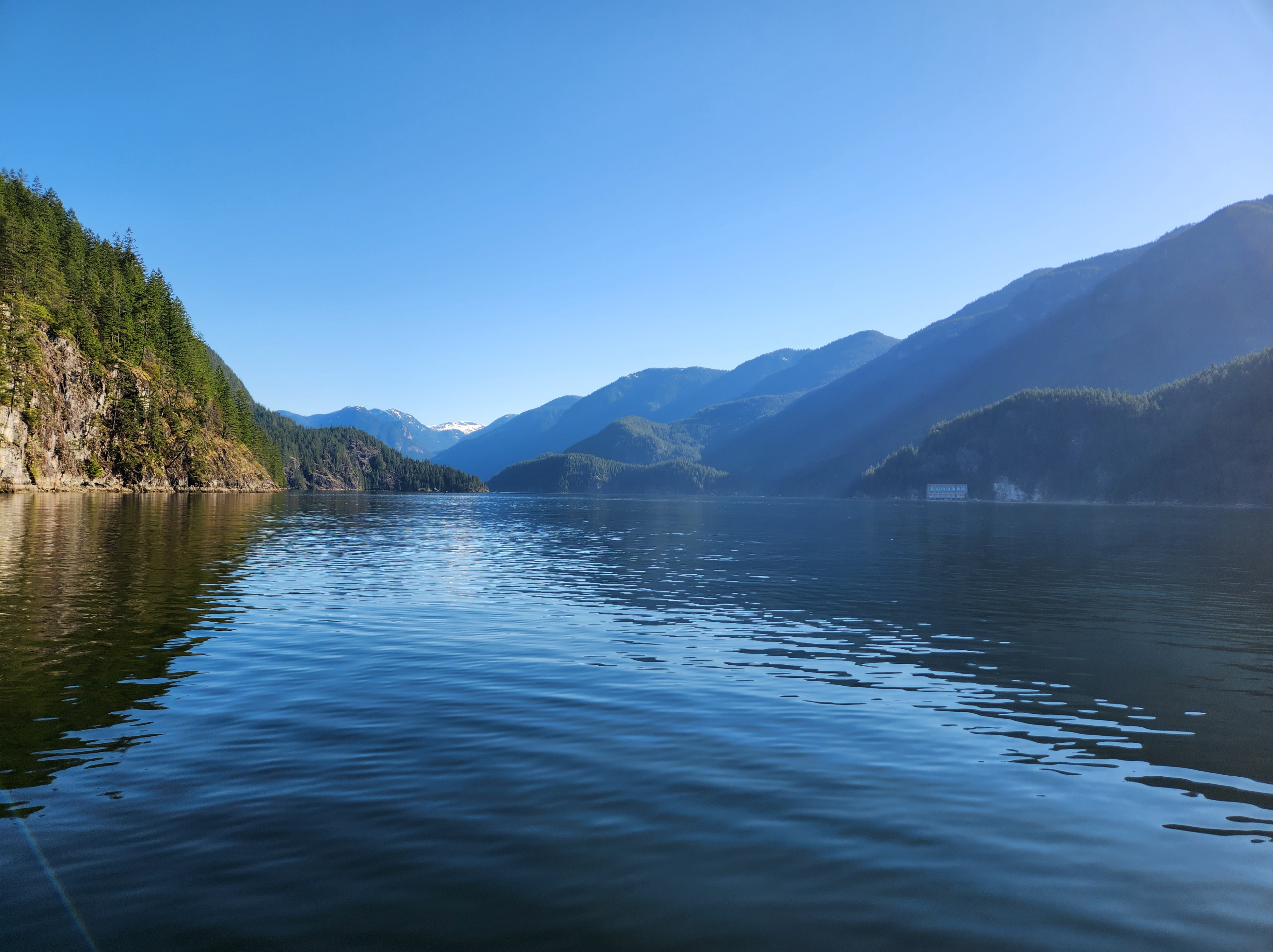
The conditions were idyllic as we paddled northwestward into the gorge of the fjord. There was a slight easterly breeze, that had a hint of southerlyness to it. We made note of the wind direction, with the worry of what that meant for our pending return paddle. Though, upon reflection, my sea state reading skills still need some work as I can see that flatwater should have been foreshadowed further afield from the foreground in the photo below.
Mirror Warning: Objects in the Mirror are Closer Than They Appear
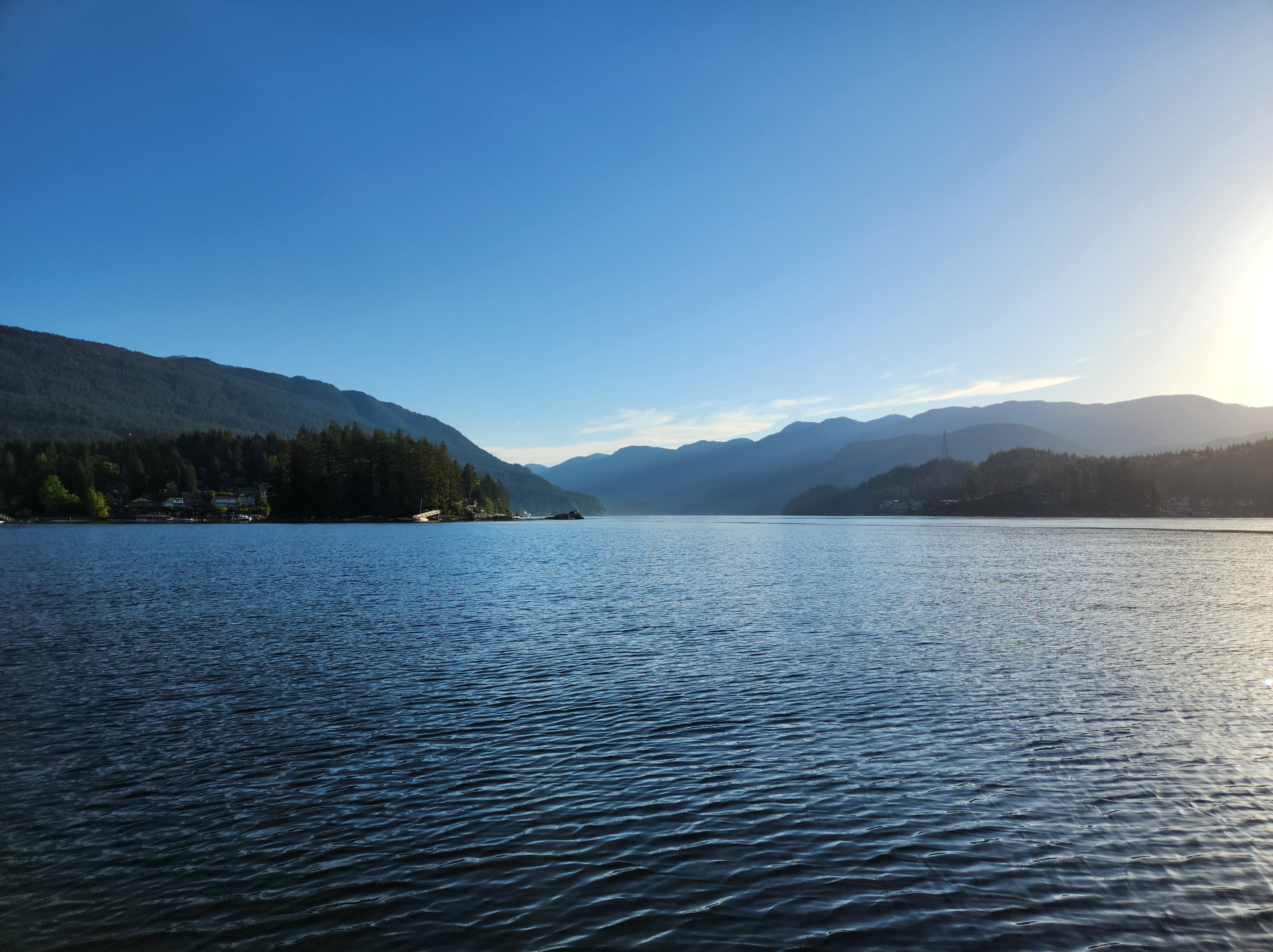
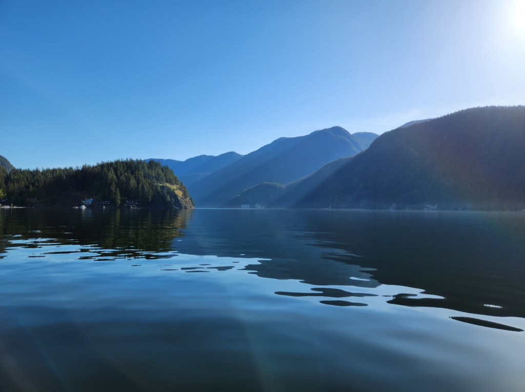
From the get-go, we could see Buntzen Powerhouse #2 in the distance. Over 100 years old now, the second of the two new-age hydroelectric generators was cutting edge at the time its construction was completed in 11914 HE. Ironically, the newer Powerhouse #2 was decommissioned in 11950s HE, but the older Powerhouse #1 still is operational today, and holds the title of the oldest in BC Hydro’s operational system. Powerhouse #2 looked relatively close, but experience told me that looks can be deceiving. On the water, I’ve come to realize that the reverse mirror warning is perhaps needed. Objects on the water are farther than they appear. We knew that Thywates Landing was waiting on the other side of the fjord from the powerhouse, just a few thousand strokes away.
We paddled on, passing the familiar landmarks of Grey Rocks Island, Deep Cove, Jug Island, and Lone Rock Lighthouse, reminders of past paddles in the inlet. The last of which reminded me of my vTNR#8 experience. Lone Rock Lighthouse was the first turn for that week’s virtual race and I happened to cross paths with another paddler out completing the course in the calm morning waters.
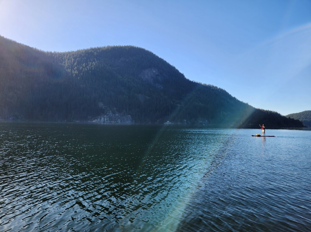
We then made our way past Raccoon Island, observing it only from a distance across the inlet. At this point, we confirmed that the point we suspected to be Thywates Landing from afar was in fact the point at Brighton Beach. At the same time, we were confused about where the Twin Islands were, as we didn’t seem to see them. Eventually, we realized that they were right there in plain sight, but blended into the background of Buntzen Ridge in Belcarra Regional Park between Buntzen Lake and our starboard border of the bight. When the northern end of the north island came into view we spotted the lighthouse confirming our suspicion. In the photo below you can see the point beyond Brighton Beach on the left, Powerhouse #2 in the centre, and the Twin Islands camoflouged on the right.
Beyond the calm waters of the wider section of the arm the winds picked up slightly leaving their characteristic cat paw traces. In hindsight, the increased winds were likely a combination of the geographic constriction and katabatic winds coming down from the cliffsides. The view below is just before rounding the point beyond Brighton Beach.

And the view back toward Billy with the northern Twin Island in the background.
We still had a ways to paddle after passing Brighton Beach. Looks can be deceiving.

A few powerboats passed by, unsettling the smooth surface of the water with their wakes. Eventually, Orlomah Beach and Camp Jubilee came into view. Initially, I was under the impression that Thywates Landing and the associated dock would be right there. But as I surveyed the shoreline, I didn’t see anything that looked like a public lot. All the docks appeared to be private. At the far end of the bay, there was a lone dock, so we started to venture toward it.
Privatization Podcasting Parley
One online account about Thywates Landing highlighted how the locals don’t love liberal landings. The topic of public versus private beachfront access is an interesting one. Many people are unaware that in S’ólh Téméxw (British Columbia) and Canada generally, beachfront access is, in most cases, public. Owners of beachfront property own the land up to the foreshore or high watermark, but they don’t own the land below. That land is public. The exception is older properties, where the property lines can extend all the way to the water’s edge since Shore Road Allowances were modified in the late 119th century HE (19th century CE) for logging transportation purposes.
So, while residents around Thywates Landing are within their rights to complain about visitors traipsing around their properties above the high watermark, legally speaking, landing below the high watermark is within visitors’ rights, though may not be the most considerate thing to do.
The parley over private versus public lands lends to a wider conversation around the role of the state that has been rolling around in my head. It is a long-standing question but was specifically re-sparked recently after listening to a podcast episode by NPR‘s Throughline titled, “Past is Prologue: Talking Taxes.” The episode tackles what exactly constitutes income tax in the USA, which is surprisingly harder to define than one would think. It also discusses the origins of income taxes (in the USA). Perhaps not surprisingly, taxes share their origins with other human advancements that have occurred under the pressure of war. An ugly and uncomfortable truth about war is that it drives innovation.
If the tax chat piques your interest, then check out the ABC‘s Rear Vision episode, “What’s wrong with Australia’s tax system and can we fix it?” for a Commonwealth common wealth perspective. I found the recommendation to move towards a land tax as a revenue stream that can not leave your country, particularly intriguing.
The role war has played in innovation reminds me of the “iPhone” episode from 50 Things That Made the Modern Economy where the degree of both publicly funded and military-based (and thus also publicly funded) technology at the heart of the iconic smartphone is discussed.
Publicly Funded Technology for Privately Sold Technology
Using the iPhone as the exemplar of the smartphone, Tim Harford highlights the economist Mariana Mazzucato‘s finding that of the 12 key technological developments needed for a smartphone, all of them were supported in significant ways by governments. In many cases, this was often directly Uncle Sam and is eerily related to military and war technological research and development. So, while many of us credit the creation of the flagship smartphone in 12007 HE to Steve Jobs and his Silicon Valley superstars, we would do better to acknowledge the role that governments and publicly funded science played. The irony is that the sexy repackaging of publicly funded intellectual capital has been sold back to the citizenry that funded it for corporate capitalistic profits.
The Facade of Free-Market Pharmaceutical Fitness
Bringing this back to the Throughline tax chat, what was surprising to me among many things presented was the income trail on US medical care. I, like many, had come to believe the rhetoric and narrative that the USA has a private healthcare system. But shamefully, I never gave it much thought beyond that. For example, why would corporations go out of their way to expend their resources on their workers? Perhaps in today’s world, with the more established relationship between worker health status and productivity, corporate altruism is not such a fantastical claim. But, in the post-WWII reconstruction and reformation of the modern welfare state, the shift to a privatised corporate healthcare system was a radical move. Similar to smartphone development, from a wider perspective, the modern welfare state can be seen as a war development off-shoot. Check the video below for some of the propaganda at the time to make sure everyday citizens like Donald Duck were keen on paying their taxes.
Corporations did not just provide healthcare plans out of the kindness of their hearts they were incentivized to do so by the federal government. The nuance is that while the US healthcare system is privately administered, it is publicly subsidized.
Government Subsidies
The source and semantics of subsidies reminded me of a conversation with a client about fuel taxes. My contention was that the oil and gas industry in Canada (and globally) has been and still is subsidized. His stance, as far as I could tell, was that the industry is/was not. My confusion regarding his stance comes from the fact that he acknowledged that we pay taxes on fuel, with my mind wondering where do you think that money goes? Our opinions seemed to differ on this point. I think his argument was that since those taxes are not directly earmarked for oil and gas, they are not a subsidy for the petroleum industry. Rather, they are a source of general government revenue. However, that doesn’t jive with my accounting practices where a dollar is a dollar regardless of where it is earned. The fact that the government provides various avenues for the oil and gas industry to reduce their costs (e.g., tax deductions or credits, grants or direct funding, government loans or loan guarantees (aka., public financing), and reduced royalties or royalty credits) to me amounts to a subsidy, regardless of where exactly the dollar came from. The crux of the argument is semantics. Just like the definition of income tax is contentious, so too is the definition of subsidy. Simply, in my view, a concession from the government that lowers your costs amounts to a subsidy. With that definition, it is clear that the oil and gas sector is subsidized.
That is not to say that subsidies are necessarily a bad thing. We can be the beneficiaries of them individually and collectively. I am just saying to call a spade a spade (in the classical pre-Harlem Renaissance sense of the phrase).
New Eyes for American Healthcare Subsidize
The role the US federal government has in indirectly funding Americans’ healthcare was a surprise to me. Prior to listening to the Throughline episode, I would have assured that the American medical system is private. But that doesn’t answer ‘the why’ is it private. It is privatised because businesses have been incentivized by the federal government to provide healthcare to their employees through tax benefits. Subsidies, you might say.
Two problems and one benefit come to mind with this approach. The first problem is that it marginalizes healthcare, restricting access only to those employed in sectors that provide it. In a culture living in the aftermath of centuries of institutional racism, systematic racism runs rampant. It is hardly a coincidence that workers in marginalized communities have marginal access to healthcare through their employment sectors. Non-universal healthcare under the auspices of meritocracy widens the margins of access.
The second problem is that people often fail to see the proverbial hand that feeds them. Since federal funding for healthcare is one step removed, many citizens are unaware of the benefits their tax dollars provide through the federal government. This issue is emphasized in the podcast, not only regarding healthcare but also in relation to all government programs. The podcast highlights the evolving perspectives of Americans, their varying willingness and unwillingness to pay taxes over time based on their perceived benefits.
Lastly, one potential benefit of the system could be increased efficiency, although this remains hypothetical. In practice, Americans pay more per person for their healthcare system compared to other equally developed nations. Moreover, the additional healthcare spending in the USA does not seem to directly translate into improved health outcomes, such as life expectancy. However, it is important to note that measuring health outcomes can be a complex and nuanced endeavor.
Give Government some Glory
Give some credit where credit is due. I grew up hating taxes, consumption/sales as a youth, and income when older. I was very critical of governments for their colonial ties/practices. I still think governments should be critiqued, but I also have come to believe that they do deserve more credit for the things they are doing well. I have come to see taxes as necessary as I gained a greater understanding of the things that they garner. Depending on where you call home, roads, parks, running water, electricity, and medically essential healthcare are all examples of fine subtleties of life that are nice to have. They are a convenience afforded through the modern nation-state, and nothing in life is free. It just so happens that these things are paid for in many nations by taxes. Keep that in mind the next time you are critical of your ruling regime.
Now, back to SUP…
Re(p)logging: Landing In Site
As we approached Orlomah Beach, a powerboat that had passed us earlier was making its way toward the dock at Camp Jubilee. Behind us, further offshore, a couple of other powerboats passed by. Surprisingly, their wakes managed to make it to shore with enough wave power to give me a boost to do some light surfing toward the shallows. I angled myself, favouring the north end of the bay at what I now took to be the forbidden dock at Thywates Landing.
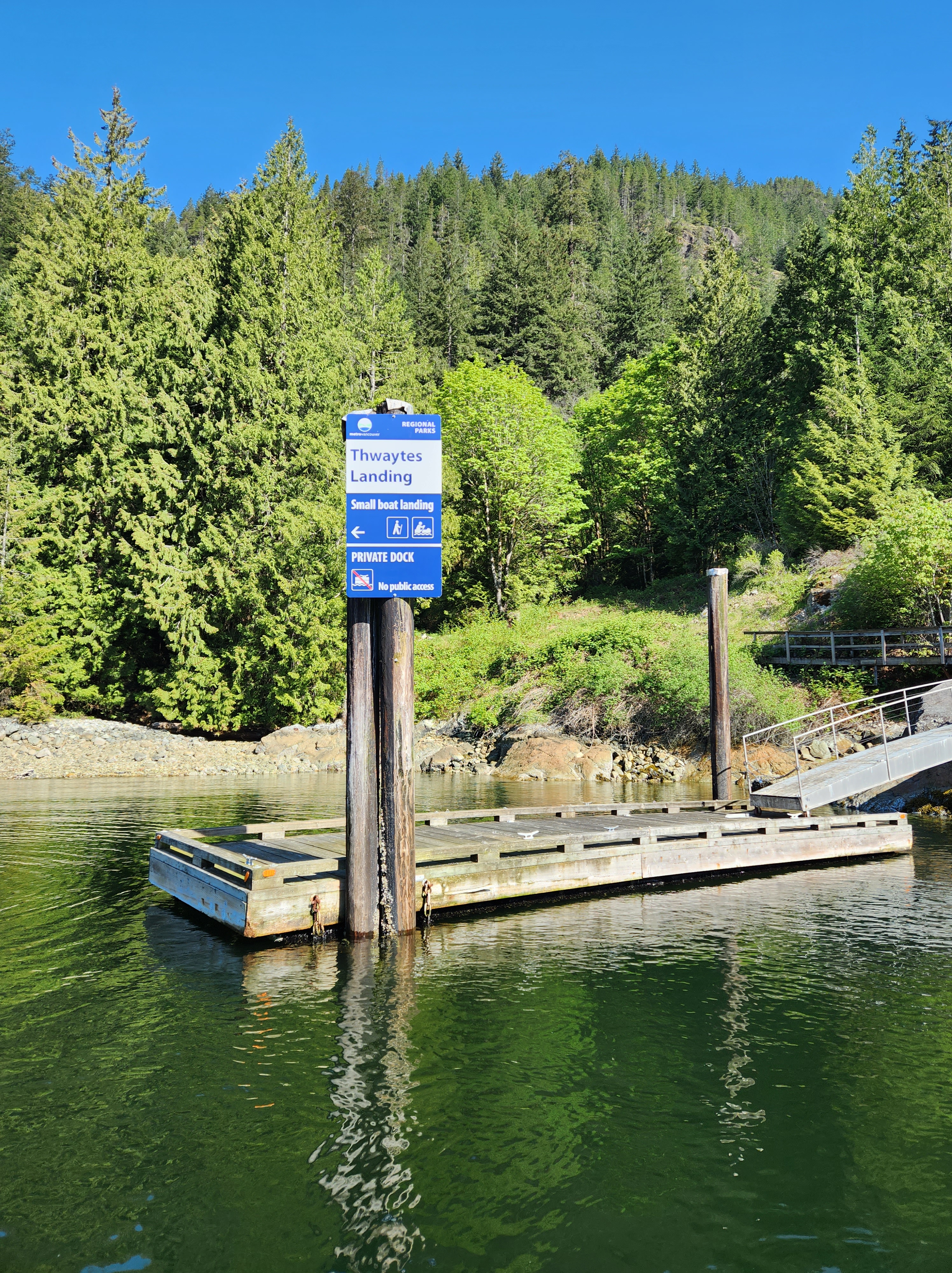
Approaching the dock, I recognized the familiar colours of Metro Vancouver signage, and I assumed we would be able to land at the dock. From a distance, there didn’t appear to be any visible signs of closure. From memory, I had it in my mind that the dock was closed for safety. So I was confused when I saw that the dock looked to be in working order. But my confusion was clarified when the signage came into clear view. It clearly stated that the dock was off-limits and directed visitors toward the rocky beach for landing.

After landing, I found a suitable place to stow my board, away from the barnacles and rocks of the beach. Delicacy is definitely the disadvantage of hardboards for touring in the Pacific Northwest. I always worry about dinging my board up on the rocky shore, so that is definitely one instance where a high-quality inflatable board is superior.

Once onshore we refueled and hydrated, then began to explore. Anticipating stronger afternoon headwinds time was of the essence. We had read that Holmden Falls was only a short walk. We searched for the trailhead, first at the south end of the beach near the mouth of Holmden Creek. No luck, but there was a nice flat grassy area up the shore. It would be suitable for a tent, though camping is not permitted at Thywates Landing. Next, we checked the north end of the beach and came across the signpost slightly up the shore. Holmden Falls was only 120 metres away, so off we went.
The trail to the falls is simple and appears to be seldom travelled. After the short walk, we took in the falls, took a few photos/videos, and wondered where the trailhead to Underhill Peak was? This post gives a good account of how to get to the peak, but we didn’t have the time today for backcountry bushwhacking backpacking.

Back at the beach, I paused for a brief photo out across Səl̓ilw̓ət (Indian Arm) to capture the twin powerhouses. Number one on the left and #2 on the right. Then it was back on board for the ride home.

I made a quick detour to survey the dock and shoreline beyond the bay, while Billy changed into warmer weather gear. A bit further up the arm is Best Point, but that was beyond our reach for today. In the photos below you can see that the path onshore above the dock is blocked off and the signage that directs visitors where to land.

Leaving the bay we passed two qajaqers around Orlomah Beach making their way toward Thywates Landing. Farther out of the bay, we could feel the southerly breeze. Thankfully, the wind was mild but it was present and in front of us. The photo below is the view south down through the narrowing of the arm. The Twin Islands are on the left and in the centre you can see Raccoon Island, Jug Island, and the peninsula where Jug Island Beach is at the tip. The sea state in the foreground reflects the windier conditions, but in the distance, the water looks flatter.

Sure enough, on the other side of the opening, the conditions were flat again with minimal winds. We passed several other qajaqers making their way north. And with more motorboat traffic out and about I decided to try to catch a few wakes. I am not totally sure what the etiquette of the process is, so for my first few attempts, I was well away from the boats. I don’t think there was enough wave power to push me at those distances. But a little while later, in the section just north of Lone Rock Point, I was able to ride some decent bumps. The wakes became surprisingly big and I was able to get a few solid runs. In hindsight, after some internet sleuthing, I suspect the bumps were a byproduct of the bathymetry. The water depth in that section drops to a half or third of the open water depth which would force the wave amplitude up.
I rode three of four nice bumps before deciding to attempt an unsuccessful pivot turn in the waves. My excuse was a mermaid sighting, but the reality was that I just didn’t get low enough to have a chance. The upside was that the water was refreshing, and the summer-like M-ugust weather kept me warm once I was back on board.
We continued on to Deep Cove. As we were crossing the cove, we heard the bullhorn addressing the racers, and a little while later, the first heat signal went off. We decided to float around and watch. At first, the field was crowded by a scattering of recreational paddlers who appeared to be in the lead. They’d had a headstart but weren’t putting in the power strokes to maintain their lead. Soon enough, the first of the high-performance qajaqers overtook them. Then the canoes came out, finally flanked by the SUP races. The fastest of which were already catching the more leisurely racers from the other categories. I managed to spot a few of the Jericho Wavechaser regulars vying for their positions.
While we were viewing the race, the water conditions became a bit more chaotic. Leaving Deep Cove, the waters were wakened with a combination of warmth-generated winds and boat traffic wake waves. The waters were still very manageable, just more lively than the morning.
We made our way back out of the inlet amongst more paddlers venturing out from Deep Cove and up from Cates Park. A few more boats provided wakes and bumps to ride. Nearer to the mouth of the inlet, the winds picked up. There was a section of bigger bumps from a combination of the currents, wind, and boat wakes. I tried to catch a run, but the headwind was too strong to get enough speed.
Then we were back at Lowry Waterfront Park. I did a step-back turn in each direction, part of my SUP sign-off standard. Back in my basketball days, my sign-off routine to finish practice or play was a made three-pointer, jumper, and free-throw. We packed up our kit while discussing future potential paddles and then parted ways.
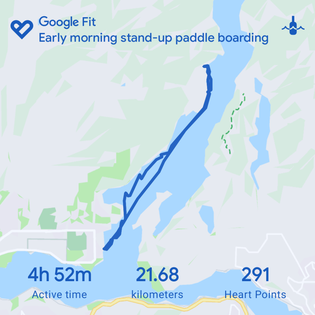
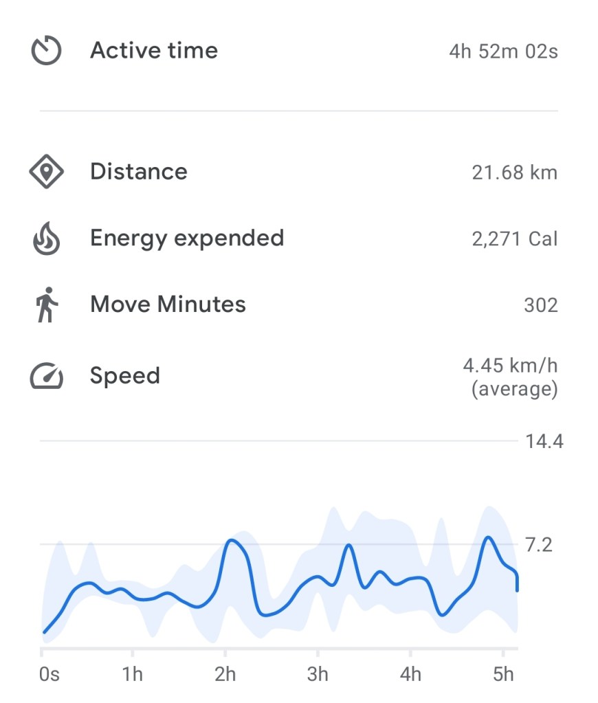
SUP Stats
Final Thoughts
Səl̓ilw̓ət (Indian Arm) is an exceptional place to paddle. With its glacially formed sheer shores, it is an impressive body of water to navigate. Especially, if you travel further north up the inlet to the more secluded areas (which we did not on this trip). However, be cautious that in warmer weather you run the risk of running into southerly inflows for your return. For calmer water, morning paddles are best. Later in the day, the waters are more active with wind in warmer weather and there is ample boat traffic to contend with.
Thywates Landing wasn’t anything special. But it was a fun adventure mainly for the novelty, a Metro Vancouver Regional Park accessible only by boat. Not to mention a storied history. A combination paddle and hike would be a great full-day feat for the adventurous backpacker.
For an early May paddle, we couldn’t have asked for better conditions.
Happy paddling people.

Nicely researched and written as usual 🙂 It was a great pleasure paddling with you. Let’s do it again soon!
LikeLike
Thank you. And ditto to paddle and doing a repeat.
LikeLike